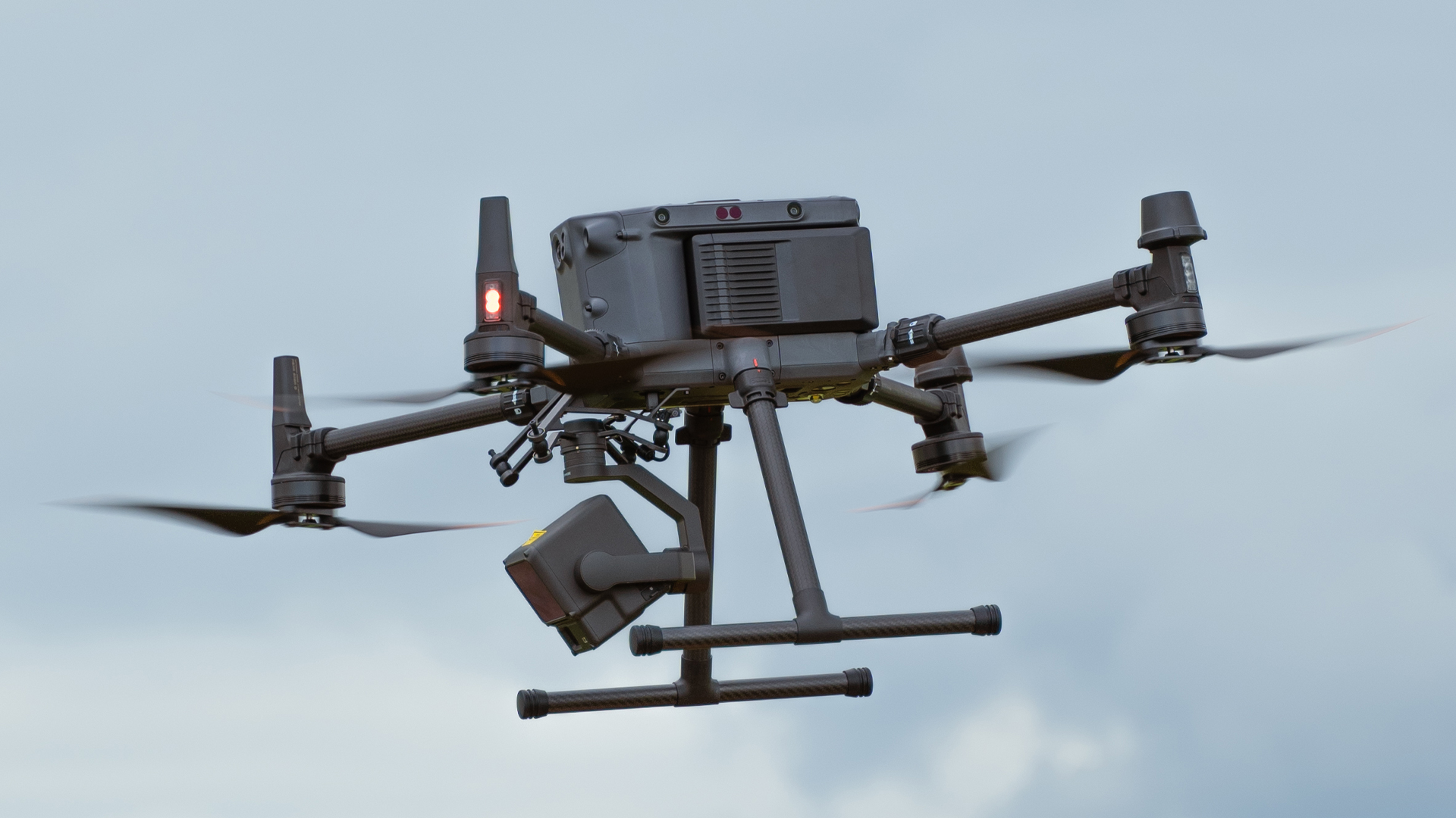
DJI Matrice 350 RTK & Zenmuse L2

TitleThe perfect combination for professional surveying and inspection
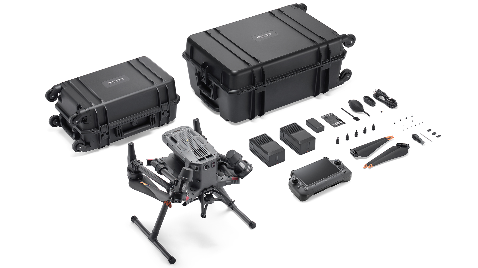
The DJI Matrice 350 RTK in combination with the Zenmuse L2 camera is the ultimate solution for high-precision surveying, mapping and inspection tasks. With advanced RTK technology and a powerful LiDAR camera, this system takes your work processes to a new level.
Discover all the features and find out how this powerful UAV can increase your efficiency.
TitleThe advantages of UAV surveying
UAV surveying offers significant advantages due to its speed, precision and cost efficiency.
UAVs can cover large areas in a short time and deliver highly accurate data thanks to advanced sensors such as LiDAR. Not only do they reduce manpower requirements, they also increase safety by capturing hard-to-reach or dangerous areas without risk.
In addition, drone surveying is environmentally friendly and leaves no ecological footprint. Real-time data transmission enables faster decisions and optimized project planning.
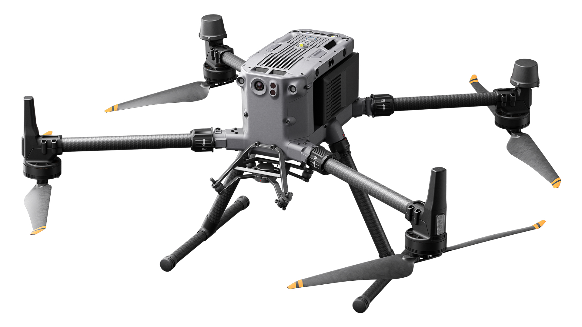
TitleDJI Matrice 350 RTK – Maximum efficiency & precision
The DJI Matrice 350 RTK is an all-round industrial tool designed for demanding tasks.
It offers the perfect balance of stability, portability and cutting-edge technology that you can rely on for every mission.
TitleImportant features of the Matrice 350 RTK
- RTK module for centimetre-precise accuracy: Thanks to the integrated RTK module (Real-Time Kinematic), the Matrice 350 RTK delivers extremely precise positioning data. Ideal for surveying and mapping projects where maximum accuracy is required.
- Maximum flight time of up to 55 minutes: The long flight time allows you to cover large areas in a single flight without frequent interruptions for battery changes.
- Payload capacity of up to 2.7kg: Use the drone with a variety of payloads, including LiDAR systems, cameras and sensors, for different applications.
- Weather and environmental protection class IP55: The Matrice 350 RTK can be used in harsh conditions - from rain to dusty environments.
- OcuSync 3.0 Enterprise: This technology ensures stable, interference-free transmissions over a distance of up to 15 kilometers, allowing you to operate safely even from a distance.
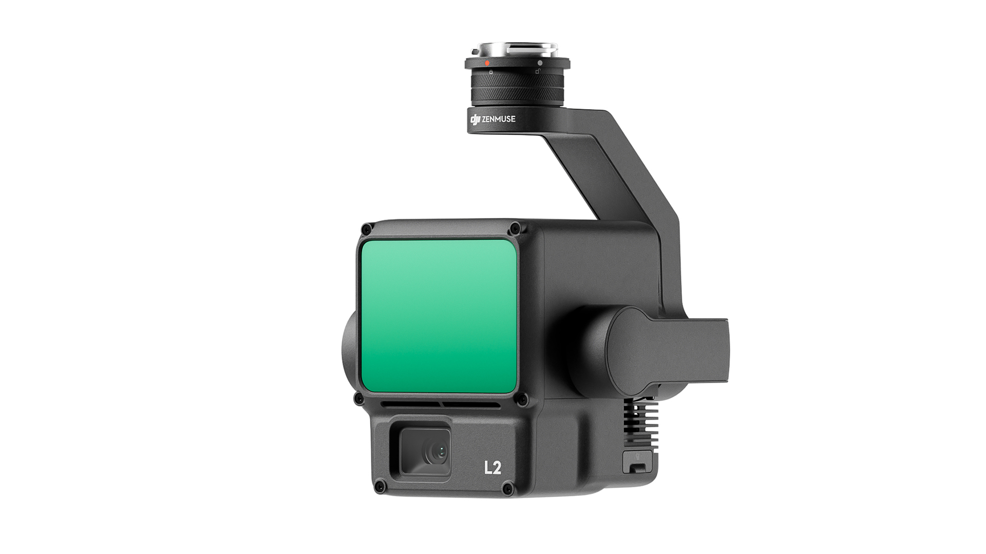
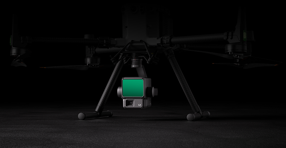
TitleZenmuse L2 – High-End LiDAR for precise 3D data capture
The Zenmuse L2 is a powerful LiDAR system that is perfect for high-precision surveying and modeling.
The combination of LiDAR technology and RGB camera allows you to capture point clouds and visual data simultaneously.
TitleImportant features of the Zenmuse L2
- LiDAR technology for precise point cloud data: The Zenmuse L2 captures detailed point clouds that are perfect for creating 3D models and terrain models – even in dense vegetation.
- Ultra-precise data acquisition: With a measurement accuracy in the millimeter range and a range of up to 450 meters (at 10% reflectivity), the Zenmuse L2 is ideal for large-scale and detailed projects.
- RGB camera for razor-sharp image data: The integrated RGB camera provides high-resolution images that can be seamlessly combined with the Lidar data to create photorealistic 3D models.
- High dot density of up to 240,000 points per second: With such a high dot density, you can capture even the smallest details of your surroundings.
- Multiple reflection detection: The Zenmuse L2 offers high data reliability by detecting and processing multiple reflections – ideal for dense vegetation or complex urban environments.
TitlePerfect combination for your mission
The combination of the DJI Matrice 350 RTK and the Zenmuse L2 enables you to carry out projects faster and more precisely.
From construction surveys and inspection tasks to environmental analysis, this system provides you with comprehensive data in the shortest possible time.
With the powerful LiDAR technology and robust drone, you can tackle even the most complex tasks with ease.
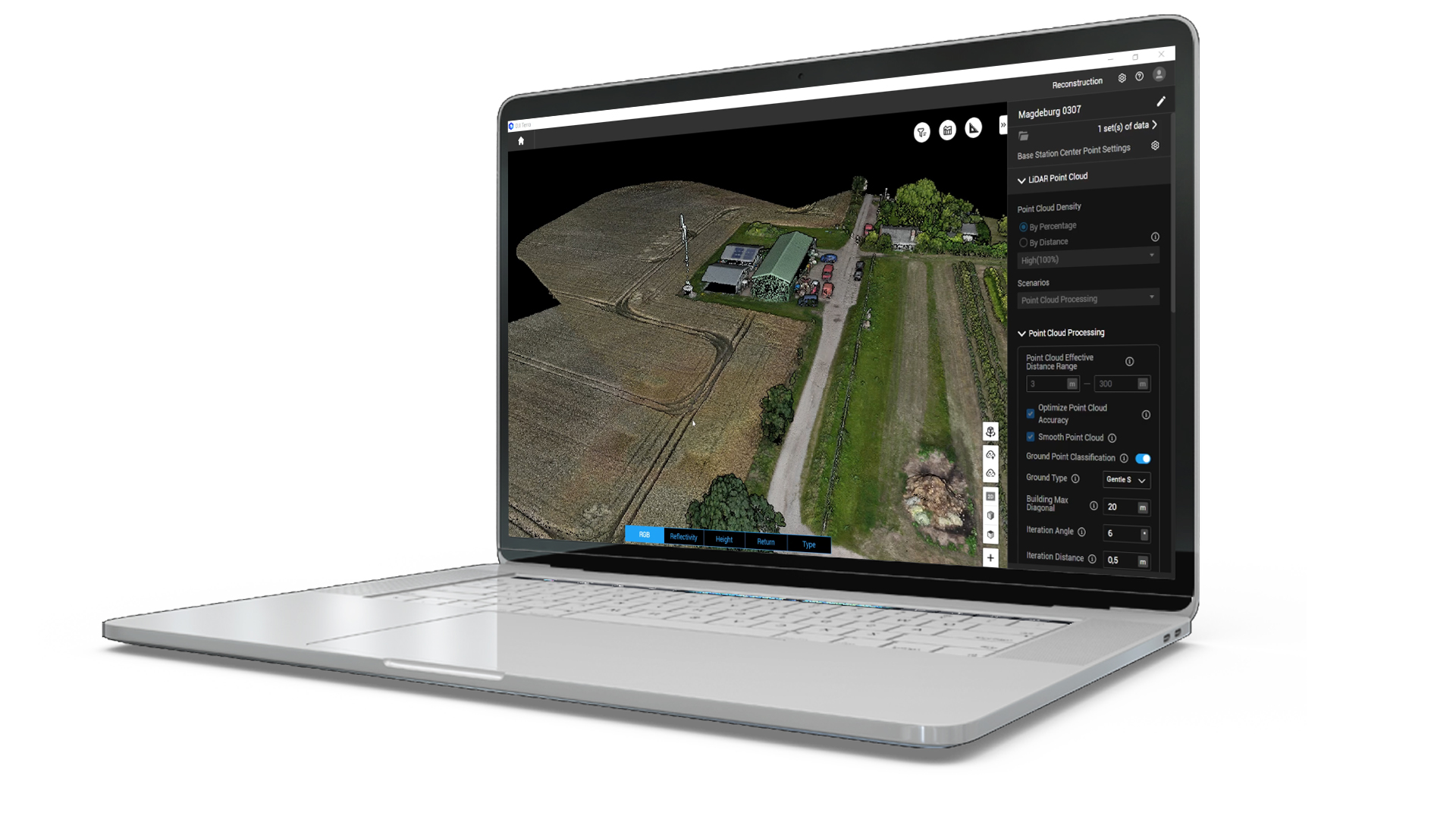
TitleOptimized LiDAR data processing with DJI Terra
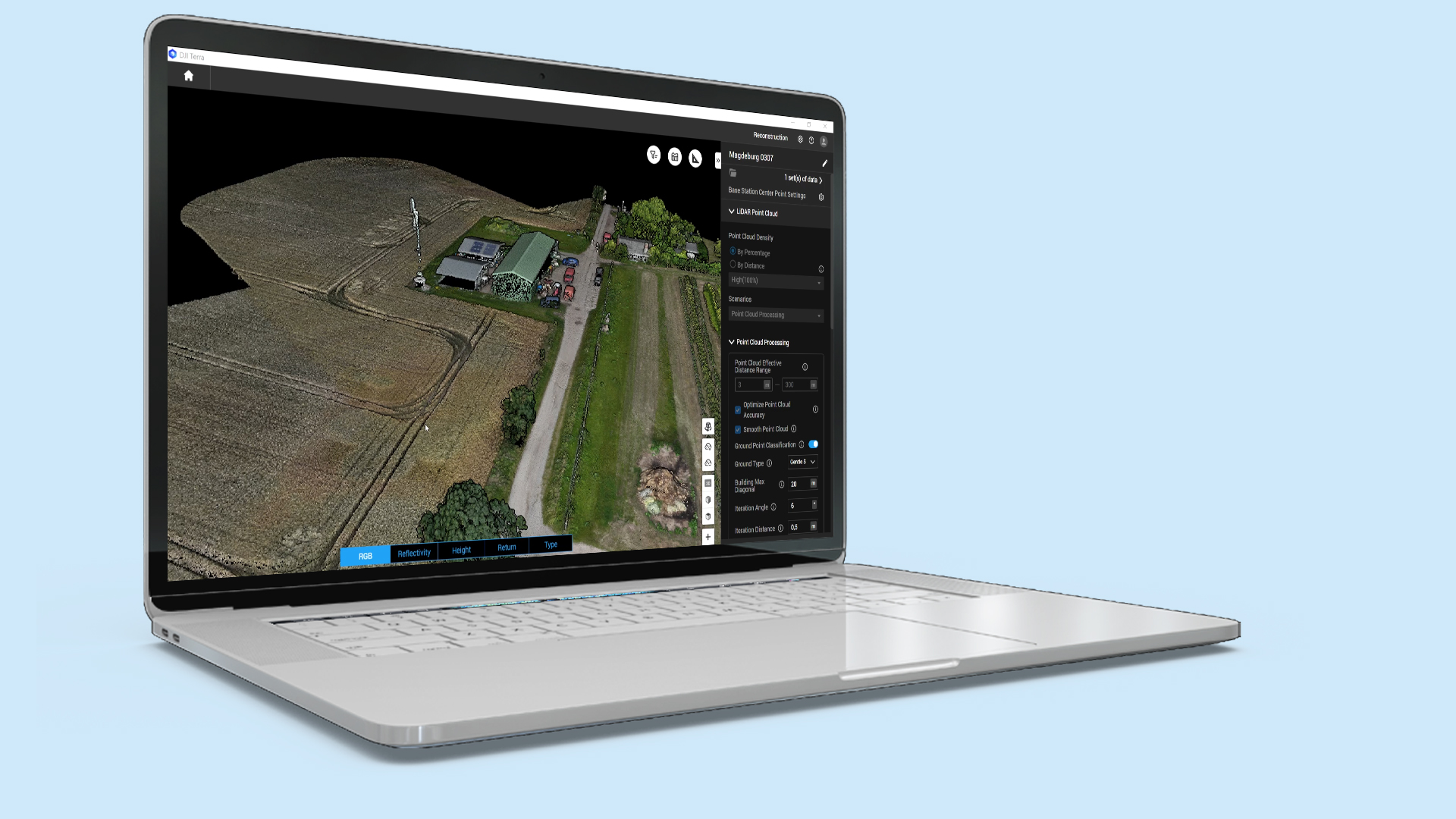
The DJI Zenmuse L2 LiDAR data can be processed easily and efficiently thanks to DJI Terra. After the flight, the collected data is uploaded to the software, where it is automatically recognized and converted into high-resolution 3D models. These models can be examined in detail using DJI Terra's powerful analysis tools.
The finished results can be exported in various formats for further processing in other programs such as CAD software. DJI Terra impresses with its seamless integration, fast processing and flexible export options, making it an indispensable tool for precise LiDAR data processing.
TitleFunctions in DJI Terra
- Data import and processing: Supports the import of LiDAR, photo and video data for processing in various formats.
- 3D modeling: Converts captured data into high-resolution 3D models, including terrain models (DTM) and digital surface models (DSM).
- Point cloud analysis: Captures and processes point cloud data from LiDAR scans to enable detailed analysis and visualization.
- Distance & area measurement: Provides tools to accurately measure distances, areas and volumes within the 3D models.
- Reporting: Generates reports and analyses based on the processed data that can be used for presentations or documentation.
- Export options: Enables the export of processed data in common formats (e.g. .LAS, .OBJ) for further use in other software solutions.
- Real-time preview: Provides a real-time preview during processing to get instant feedback.
- User-friendly interface: Intuitive user interface for easy navigation and operation, even for users without extensive technical knowledge.
- Multiple mission options: Support for various flight missions, including automated route planning for efficient data collection.
- Integration with UAVs: Seamless integration with DJI drones to ensure efficient data collection and processing.

TitlePrecise solutions for your projects: DJI Matrice M350 & Zenmuse L2
The DJI Matrice M350 in combination with the DJI Zenmuse L2 is a powerful solution for professional applications in various industries.
Discover the versatile fields of application in which this advanced UAV system is used and learn how it can optimize your projects!
TitleSurveying & mapping
With the DJI Matrice M350 and the Zenmuse L2, precise 3D models and digital terrain models can be created.
The Zenmuse L2's LiDAR technology enables detailed capture of terrain and vegetation, while the Matrice M350 ensures efficient data capture over large areas.
Ideal for surveyors and geospatial professionals who need accurate data.
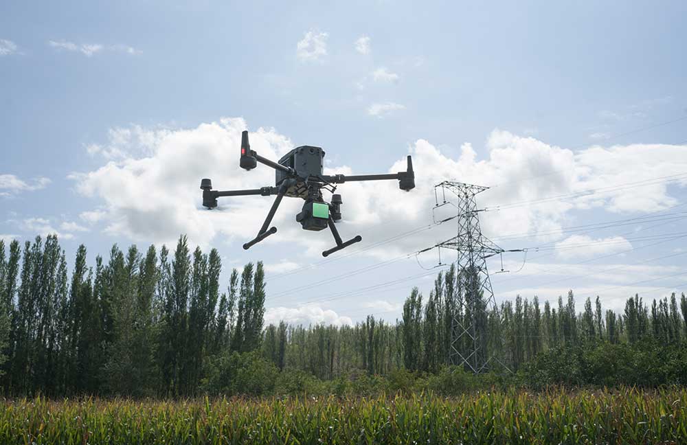
TitleInspection of infrastructure
The combination of Matrice M350 and Zenmuse L2 is ideal for inspecting infrastructure such as bridges, power lines and pipelines.
With high-resolution RGB imagery and accurate LiDAR data, engineers and technicians can quickly identify and assess potential problems, increasing the safety and efficiency of maintenance work.
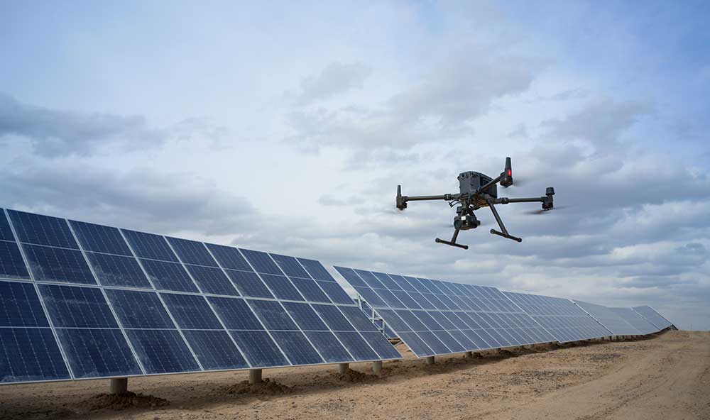
TitleAgriculture & environmental monitoring
Farmers and environmental experts use the DJI Matrice M350 and the Zenmuse L2 to carry out comprehensive analyses of cultivated areas and natural habitats.
With multispectral data, vegetation indices can be created to monitor the health of plants. This enables precise decisions to be made on increasing yields and resource utilization.
TitleDisaster management
The combination of Matrice M350 and Zenmuse L2 is invaluable in disaster management.
The drone can quickly and efficiently scan areas after natural disasters such as earthquakes or floods.
The captured LiDAR and image data support emergency services in analyzing the damage and planning relief measures.
TitleConstruction & urban planning
The Matrice M350 and Zenmuse L2 are ideal tools for contractors and urban planners.
The precise 3D models and point clouds help to plan and visualize construction projects, monitor construction progress and identify potential problems in the design phase.
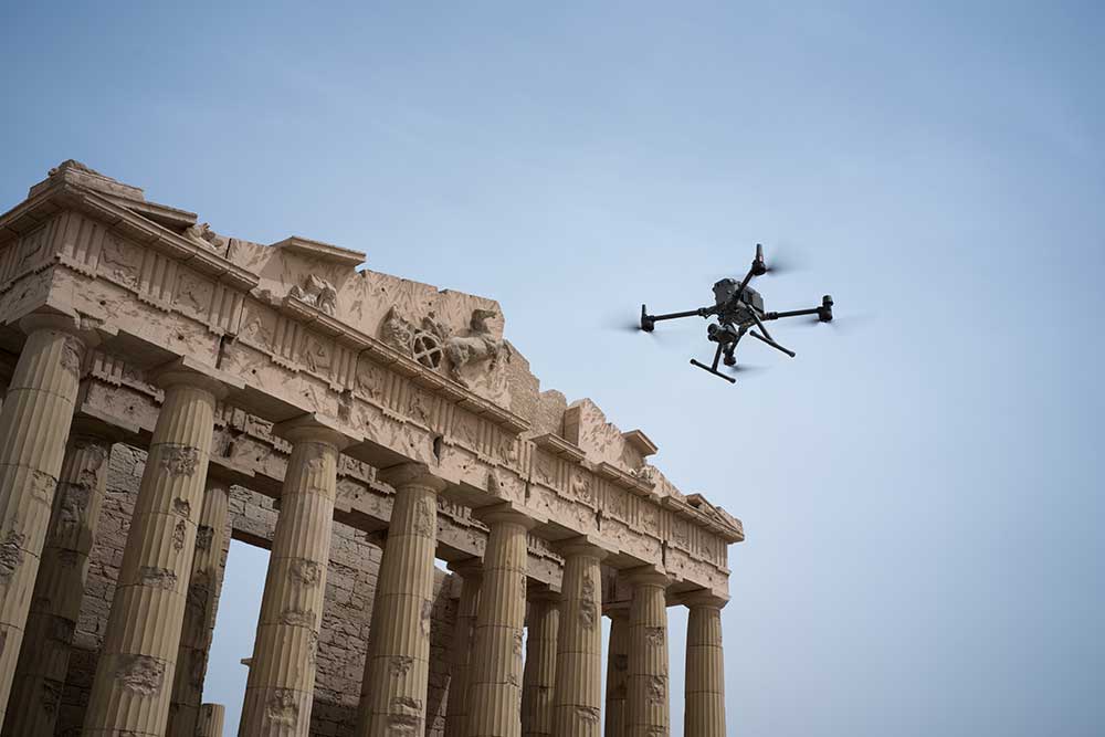
TitleArchaeology & heritage
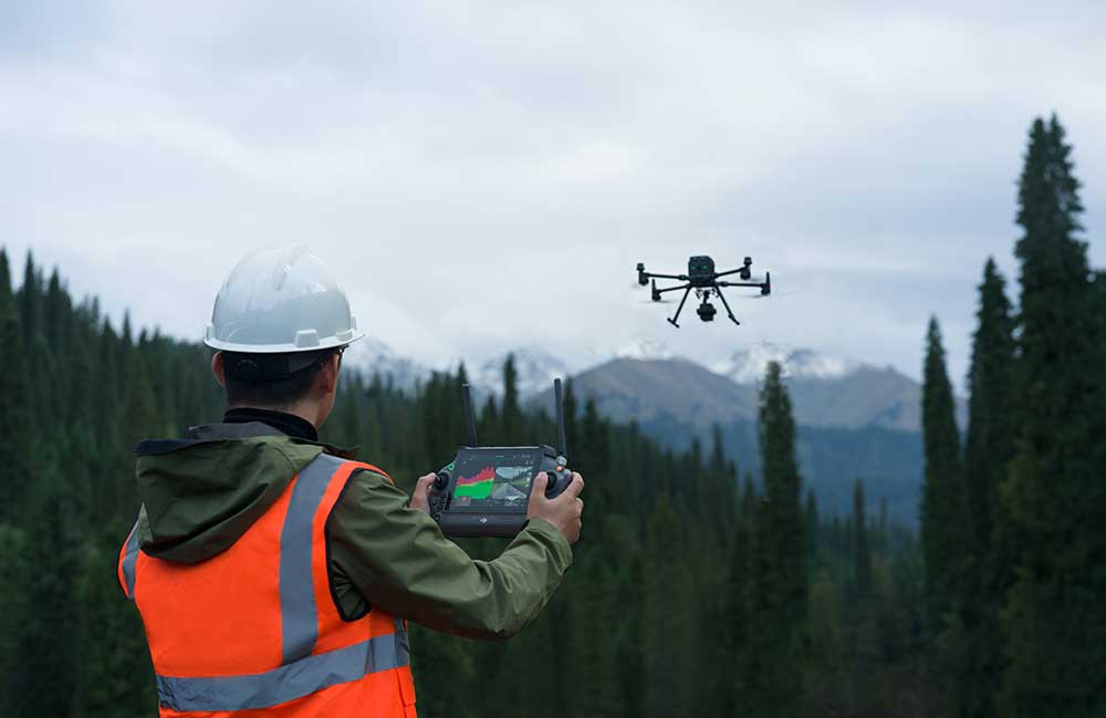
In archaeology, the Zenmuse L2's high-resolution LiDAR data can provide valuable insights into historical sites and landscapes.
The Matrice M350 enables archaeologists to quickly survey large areas and discover hidden structures that are invisible to the naked eye.

TitleDJI Matrice M350
The DJI Matrice M350 is a powerful drone designed for industrial applications and offers a wide range of functions.
Get to know the most important features and functions of the M350 system.
TitleDJI Matrice M350 functions
Robust construction & design
- Modular design: The Matrice 350 has a modular design that allows for easy assembly and disassembly of the components. This facilitates transportation and maintenance.
- Weather resistance: With an IP55 certification, the UAV is suitable for use in harsh weather conditions.
Advanced flight technology
- Intelligent flight control: The M350 uses advanced algorithms for stabilization and control, enabling precise navigation and easy handling.
- Multiple flight modes: The UAV supports different flight modes, including GPS and ATTI mode, to adapt to different mission scenarios.
Powerful drive
- Slow flight time: The Matrice 350 offers a maximum flight time of up to 55 minutes, depending on the payload, which enables efficient data acquisition over large areas.
- High payload capacity: The drone can carry payloads of up to 2.7kg, which enables the use of various sensors and cameras.
Sensors & data capture
- Compatibility with multiple payloads: The M350 can be equipped with a variety of sensors, including cameras, LiDAR systems and multispectral sensors, to meet specific requirements.
- Real-time data transmission: Thanks to OcuSync 3.0 technology, data can be transmitted in real time over distances of up to 15km.
Safety functions
- Dual battery system: The Matrice M350 has a dual battery system that offers greater safety and longer flight times. If one battery fails, the drone can continue to fly safely.
- Return function: In the event of a loss of connection or a low battery charge, the drone automatically activates the return function to return safely to its starting point.
User-friendly control
- DJI Pilot App: The drone is controlled via the DJI Pilot App, which provides a user-friendly interface for planning and executing flights as well as monitoring live data.
- Real-time maps: The app provides real-time maps and telemetry data to enable precise navigation and flight monitoring.
TitleDJI Zenmuse L2 functions
The DJI Zenmuse L2 is a powerful LiDAR system designed for use with DJI drones such as the Matrice M350.
It combines LiDAR and RGB technology to capture precise 3D data and high-resolution images.
Learn about the key features and functions of the Zenmuse L2.
TitleZenmuse L2 functions
LiDAR technology
- Point cloud data capture: The Zenmuse L2 uses liDAR to take pinpoint measurements of the environment. This is done by sending laser beams and measuring the time it takes for the reflected beams to travel back to the sensor.
- High point density: With a capture rate of up to 240,000 points per second, the Zenmuse L2 can generate highly detailed point clouds that can be used for precise 3D modeling and terrain analysis.
RGB-Kamera
- Integrated RGB camera: The Zenmuse L2 is equipped with a 20-megapixel RGB camera that captures high-resolution color images. These images can be used for visual analysis and to create photorealistic 3D models in combination with the Lidar data.
- Multispectral functions: The camera offers the ability to capture multispectral images, which are useful for agricultural applications and environmental analysis.
Automated data capture
- Real-time data processing: The Zenmuse L2 can collect and process data in real time during flight. This enables an immediate preview and review of the collected data.
- Flexible flight missions: The L2 can be used in various flight missions that are planned via the DJI Pilot app. The UAV automatically flies predefined routes and collects data in the process.
Data analysis & processing
- Point cloud creation: After data capture, the LiDAR point clouds can be processed in software such as DJI Terra to create 3D models, terrain models and other analysis.
- Color mapping: The RGB images can be mapped to the LiDAR data to create photorealistic 3D models that represent both the geometric and visual characteristics of the environment.
Ease of use
- Easy mounting: The Zenmuse L2 is designed for easy mounting on DJI UAVs, allowing the user to quickly and easily switch between different sensors.
Integration with DJI software: The L2 is seamlessly integrated into the DJI software environment, allowing for easy data management and processing.
TitleDJI Terra functions
DJI Terra is a comprehensive data processing software solution specifically designed to analyze and evaluate aerial data captured by DJI drones, especially LiDAR and camera systems. The software enables users to create high-precision 3D models, maps and analysis.
Learn about the main features and how DJI Terra works.
TitleOverview of functions
Data import
- Wide range of data formats: DJI Terra supports the import of various data types, including LiDAR data, RGB images and videos. Users can upload data directly from DJI drones or import from storage media.
- Real-time data processing: During data import, the software displays a preview of the available data so that users can quickly check whether the acquisition was successful.
Flight planning
- Intuitive mission planning: The software allows users to plan and configure flight missions to efficiently cover specific areas. Users can set parameters such as flight altitude, overlap and data collection mode.
- Automated flight routes: DJI Terra optimizes routing to ensure that all required areas are covered, increasing the efficiency of data collection.
3D modeling & mapping
- Point cloud processing: The software converts the collected LiDAR data into detailed point clouds. Users can visualize and analyze these point clouds to extract geographic information.
- 3D model generation: DJI Terra creates high-resolution 3D models from the imported data that can be used for both analysis and presentation. These models are particularly useful for surveying and planning applications.
Analysis tools
- Measurement functions: The software offers various analysis tools that allow users to measure distances, areas and volumes directly in the 3D model. This is useful for construction and environmental analysis.
- Reporting: DJI Terra allows the creation of detailed reports based on the collected data. These reports can be used in presentations or for documentation purposes.
Export & integration
- Flexible exports: After processing, the results can be exported in common formats such as .LAS, .OBJ or .GeoTIFF. This enables easy further use in other software solutions, such as GIS and CAD programs.
- Seamless integration: DJI Terra integrates well with other DJI products and services, ensuring a consistent user experience and efficient workflow.
Ease of use
- Intuitive user interface: DJI Terra has a user-friendly interface that allows even less experienced users to use the software effectively. Tutorials and help functions support users in navigating through the various functions.
TitleTechnical data of DJI Matrice 350
Aircraft
| Technical specifications | Values |
|---|---|
| Dimensions (unfolded, propellers excluded) | 810×670×430mm |
| Dimensions (folded, propellers included) | 430×420×430mm |
| Diagonal wheelbase | 895mm |
| Weight (with single, downward-facing gimbal) | Without batteries: Approx. 3.77kg With two TB65 batteries: Approx. 6.47kg |
| Max. payload of the individual gimbal damper | 960g |
| Max take-off weight | 9.2kg |
| Operating frequency | 2.400 to 2.4835 GHz 5.150 to 5.250 GHz (CE: 5.170 to 5.250 GHz) 5.725 to 5.850 GHz |
| Transmission power (EIRP) | 2.400 to 2.4835 GHz: < 33 dBm (FCC) < 20 dBm (CE/SRRC/MIC) 5.150 to 5.250 GHz (CE: 5.170 to 5.250 GHz): < 23 dBm (CE) 5.725 to 5.850 GHz: < 33 dBm (FCC/SRRC) < 14 dBm (CE) |
| Hovering accuracy | Vertical: ±0.1m (Vision System enabled) ±0.5m (GPS enabled)) ±0.1m (RTK enabled) Horizontal: ±0.3m (Vision System enabled) ±1.5m (GPS enabled)) ± 0.1m (RTK enabled) |
| RTK positioning accuracy (RTK FIX) | 1cm + 1ppm (horizontal) 1.5cm + 1ppm (vertical) |
| Max. angular velocity | Pitch: 300°/s Yaw: 100°/s |
| Max. pitch angle | 30° |
| Max. ascent speed | 6 m/s |
| Max. decent speed (vertical) | 5 m/s |
| Max. descent speed (tilt) | 7 m/s |
| Max. speed | 23 m/s |
| Max. flight altitude | 7,000m |
| Wind resistance | 12 m/s |
| Max. flight time | 55 minutes |
| Supported DJI Gimbals | Zenmuse H30, Zenmuse H30T, Zenmuse H20, Zenmuse H20T, Zenmuse H20N, Zenmuse L2, Zenmuse L1, and Zenmuse P1 |
| Third-party payloads | Supports only certified payloads developed on the basis of the DJI Payload SDK. |
| Supported Gimbal Configurations | Single Downward Gimbal, Dual Downward Gimbals, Single Downward + single upward gimbal, Dual Downward + single upward gimbal |
| Environmental Rating | IP55 |
| GNSS | GPS + GLONASS + BeiDou + Galileo |
| Operating temperature | -20 °C to 50 °C (-4° to 122 °F) |
| Class | C3 (EU) |
Video transmission
| Technical specifications | Values |
|---|---|
| Video transmission system | DJI O3 Enterprise transmission |
| Antenna | 4 video transmission antennas, 2T4R |
| Max. transmission distance (un-obstructed, free of interference) | 20km (FCC) 8km (CE/SRRC/MIC) |
| Max. transmission distance (with interferences) | Low Interference and Obstructed by Buildings: approx. 0-0.5km Low Interference and Obstructed by Trees: approx. 0.5-3km Strong Interference and Unobstructed: urban landscape, approx. 1.5-3km Medium Interference and Unobstructed: suburban landscape, approx. 3-9km Low Interference and Unobstructed: suburb/seaside, approx. 9-20km |
Vision system
| Technical specifications | Values |
|---|---|
| Obstacle sensing range | Forward/backward/left/right: 0.7-40m Upward/downward: 0.6–30m |
| FOV | Forward/backward/downward: 65° (horizontal), 50° (vertical) Left/right/upward: 75° (horizontal), 60° (vertical) |
| Operating environment | Surfaces with clear patterns and adequate lighting (> 15 lux) |
Infrared sensing system
| Technical specifications | Values |
|---|---|
| Obstacle sensing range | 0.1-8m |
| FOV | 30° (±15°) |
| Operating environment | Large, diffuse and reflective obstacles (reflectivity >10%) |
Remote controller
| Technical specifications | Values |
|---|---|
| Screen | 7.02-inch LCD touchscreen; resolution: 1,920 × 1,200; max. brightness: 1,200 cd/m² |
| Weight | Approx. 1.25 kg (without WB37 battery) Approx. 1.42 kg (with WB37 battery) |
| GNSS | GPS + Galileo + BeiDou |
| Built-in battery | Type: Li-Ion (6,500 mAh @ 7.2V) Charging type: VBattery station or USB-C fast charger with max. 65 W (max. 20 V). Charging time: 2 hours Chemical system: LiNiCoAlO2 |
| External WB37 Intelligent Battery | Capacity: 4,920 mAh Voltage: 7.6V Type: Li-ion Energy: 37.39Wh Chemical system: LiCoO2 |
| Ingress Protection Rating | IP54 |
| Operating time | Built-in battery: Approx. 3.3 hours Built-in battery + ext. battery: Approx. 6 hours |
| Operating temperature | -20 °C to 50 °C (-4° to 122 °F) |
| Operating frequency | 2.400 to 2.4835 GHz 5.725 to 5.850 GHz |
| Transmission power (EIRP) | 2.400 to 2.4835 GHz: < 33 dBm (FCC) < 20 dBm (CE/SRRC/MIC) 5.725 to 5.850 GHz: < 33 dBm (FCC) < 14 dBm (CE) < 23 dBm (SRRC) |
| Wi-Fi protocol | Wi-Fi 6 |
| Wi-Fi | 2.400 to 2.4835 GHz 5.150 to 5.250 GHz 5.725 to 5.850 GHz |
| Bluetooth protocol | Bluetooth 5.1 |
| Bluetooth operating frequency | 2.400 to 2.4835 GHz |
LED auxiliary light
| Technical specifications | Values |
|---|---|
| Effective lighting distance | 5m |
| Illumination type | 60 Hz, solid glow |
FPV camera
| Technical specifications | Values |
|---|---|
| Resolutions | 1080p |
| FOV | 142° |
| Frame rate | 30fps |
Intelligent flight battery
| Technical specifications | Values |
|---|---|
| Model | TB65 |
| Capacity | 5,880 mAh |
| Voltage | 44.76V |
| Type | Li-ion |
| Energy | 263.2Wh |
| Weight | Approx. 1.35kg |
| Operating temperature | -20 °C to 50 °C (-4° to 122 °F) |
| Ideal storage temperature | 22 °C to 30 °C (71,6 °F to 86 °F) |
| Charging temperature | -20 °C to 40 °C (-4° to 104 °F) |
| Charging time | With a 220V power supply, it takes approximately 60 minutes to fully charge two TB65 Intelligent Flight Batteries and approximately 30 minutes to charge them from 20 % to 90 %. With a 110V power supply, it takes approximately 70 minutes to fully charge two TB65 Intelligent Flight Batteries and approximately 40 minutes to charge them from 20% to 90%. |
DJI battery station
| Technical specifications | Values |
|---|---|
| Dimensions | 580×358×254mm |
| Net weight | Approx. 8.98kg |
| Compatible stored items | 8x TB65 Intelligent Flight Battery 4x WB37 Intelligent Battery |
| Input | 100–120 VAC, 50–60 Hz 220–240 VAC, 50–60 Hz |
| Max. input power | 1.070W |
| Output power | 100–120V, 750W 220–240V, 992W |
| Operating temperature | -20 °C to 40 °C (-4° to 104 °F) |
Note
The terms HDMI, HDMI High-Definition Multimedia Interface, HDMI Trade Dress and the HDMI logos are trademarks or registered trademarks of HDMI Licensing Administrator, Inc.
TitleTechnical data of DJI Zenmuse L2
General
| Technical specifications | Values |
|---|---|
| Product name | Zenmuse L2 |
| Dimensions | 155×128×176mm |
| Weight | 905±5 g |
| Power | 28W (typical) 58W (max.) |
| Environmental protection | IP54 |
| Supported aircraft | Matrice 300 RTK (with DJI RC Plus) Matrice 350 RTK |
| Storage temperature | -20 °C to 60 °C |
| General operating temperature | -20 to 50 °C |
System performance
| Technical specifications | Values |
|---|---|
| Detection range | 450m @ 50% reflectivity, 0 klx 250m @ 10% reflectivity, 100 klx |
| Point cloud range | Single return: 240,000 pts/s Multiple return: 1,200,000 pts/s max. |
| System accuracy | Horizontal: 5cm @ 150m Vertical: 4cm @ 150m |
| Real-time point cloud coloring coding | Reflectivity, Height, Distance, RGB |
Inertial navigation system
| Technical specifications | Values |
|---|---|
| IMU update frequency | 200 Hz |
| Accelerometer range | ±6 g |
| Angular velocity meter range | ±300 dps |
| Yaw accuracy (RMS 1 σ) | Real-time: 0.2°, Post-processing: 0.05° |
| Pitch/Roll accuracy (RMS 1 σ) | Real-time: 0.05°, Post-processing: 0.025° |
| Horizontal positioning accuracy | RTK FIX: 1cm + 1ppm |
| Vertical positioning accuracy | RTK FIX: 1.5cm + 1ppm |
RGB mapping camera
| Technical specifications | Values |
|---|---|
| Sensor | 4/3 CMOS, Effective Pixels: 20 MP |
| Lens | FOV: 84° Format equivalent: 24mm Aperture: f/2.8 to f/11 Focus points: 1m to ∞ (with autofocus) |
| Shutter speed | Mechanical Shutter 2-1/2000 s Electronic Shutter 2-1/8000 s |
| Shutter count | 200000 |
| Photo size | 5280 × 3956 (4:3) |
| Photo modes | Single shot: 20 MP Timed: 20 MP JPEG timed interval: 0.7/1/2/3/5/7/10/15/20/30/60 s RAW/JPEG + RAW timed intervall: 2/3/5/7/10/15/20/30/60 s |
| Video codec and resolution | H.264, H.265 4K: 3,840 × 2,160 @ 30 fps FHD: 1,920 × 1,.080 @ 30 fps |
| ISO | Video: 100-6400 Photo: 100 bis 6400 |
| Video bitrate: | 4K: 85 Mbit/s FHD: 30 Mbit/s |
| Supported file system | exFAT |
| Photo format | JPEG/DNG (RAW) |
| Video format | MP4 (MPEG-4 AVC/H.264 or HEVC/H.265) |
LiDAR
| Technical Specifications | Values |
|---|---|
| Präzision der Entfernungsmessung (Effektivwert 1 σ) | 2cm @ 150m |
| Max. returns supported | 5 |
| Scan modes | Non-repetitive scanning pattern, Repetitive scanning pattern |
| FOV | Repetitive scan: Horizontal 70° | Vertical 3° Non-repetitive scan: Horizontal 70° | Vertical 75° |
| Minimum detection range | 3m |
| Laser beam divergence | Horizontal 0.2 mrad, vertical 0.6 mrad |
| Laser wavelength | 905nm |
| Laser spot size | Horizontal 4cm, vertical 12cm @ 100m (FWHM) |
| Laser pulse emission frequency | 240kHz |
| Laser class | 1 (IEC/EN 60825-1:2014) |
| Accessible Emission Limit (AEL) | 233.59 nJ |
| Reference aperture | Effective aperture: 23.85mm (equivalent to circular) |
| Max. laser pulse emission power within 5 nanoseconds | 46.718W |
Gimbal
| Technische Angaben | Werte |
|---|---|
| Stabilized system | 3-axis (tilt, roll, pan) |
| Angular vibration range | 0.01° |
| Mount | Detachable DJI SKYPORT |
| Mechanical range | Tilt: -143° to +43° Pan: ±105° |
| Controllable range | Tilt: -120° to +30° Pan: ±90° |
| Operating modes | Follow / Free / Re-center |
Data storage
| Technical specifications | Values |
|---|---|
| Raw data storage | Photo/IMU/point cloud/GNSS/calibration files |
| Point cloud data storage | Real-time modeling data storage |
| Supported microSD Cards | microSD: Sequential writing speed 50 MB/s or above and UHS-I Speed Grade 3 rating or above; Max capacity: 256 GB. Use the recommended microSD cards. |
| Recommended microSD cards | Lexar 1066x 64GB U3 A2 V30 microSDXC Lexar 1066x 128GB U3 A2 V30 microSDXC Kingston Canvas Go! Plus 128GB U3 A2 V30 microSDXC Lexar 1066x 256GB U3 A2 V30 microSDXC |
Post-processing
| Technical specifications | Values |
|---|---|
| Software | DJI Terra |
| Data formats | DJI Terra supports exporting point cloud models in the following formats: PNTS/LAS/PLY/PCD/S3MB |
Better advice for users
Are you interested in our offer or would you like to find out more about DJI Matrice 350 RTK? Then give us a call today and arrange a free, non-binding consultation. We will answer all your questions. As both a dealer and a user, we are ideally positioned to support you after your purchase.