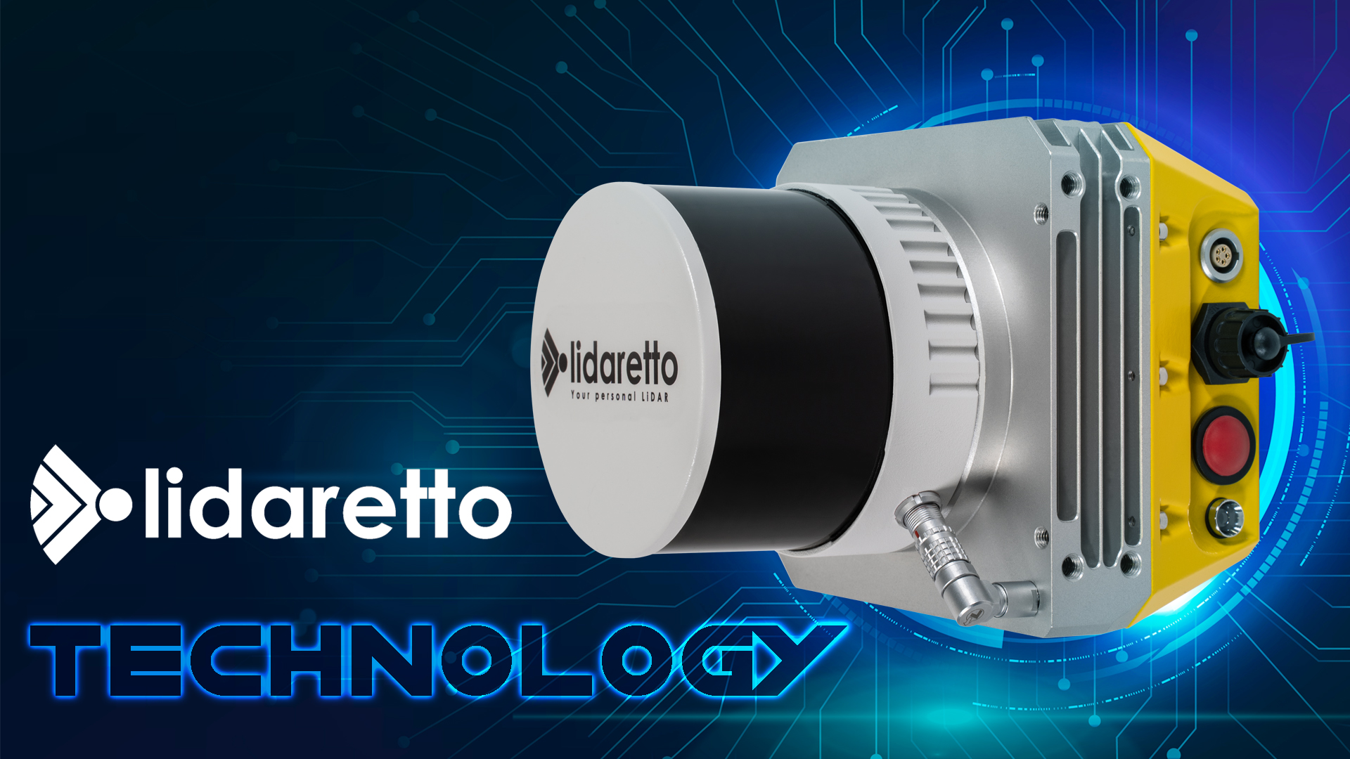
LIDARETTO Mobile Mapping System
TitleMobile mapping with Lidaretto
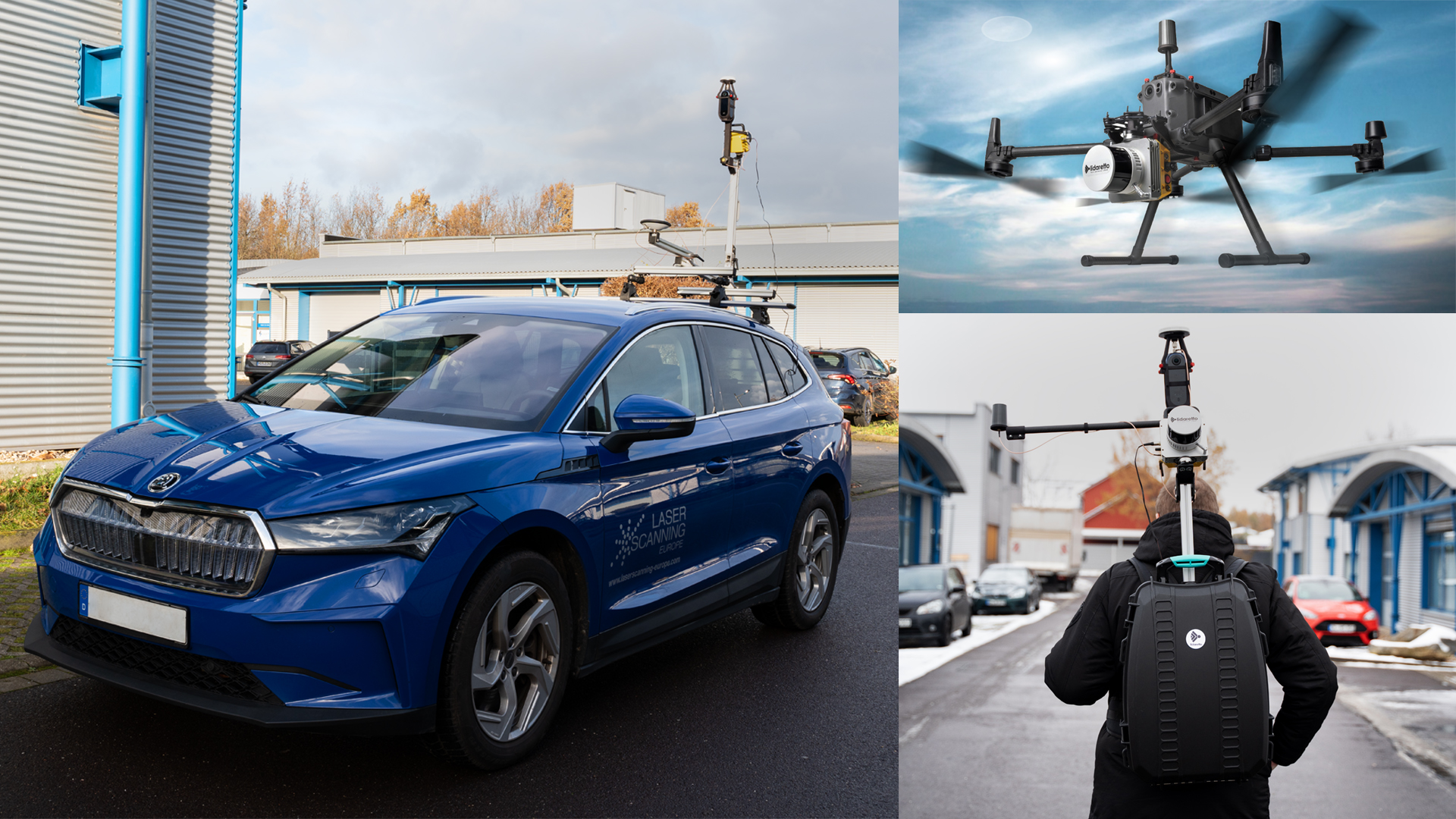
Lidaretto is a state-of-the-art mobile 3D scanning system designed to capture environments. It can be used on various platforms, including UAVs (Unmanned Aerial Vehicles), vehicles and as a portable solution. By integrating proven high-end technologies from Velodyne and Hesai Lidar sensors, Lidaretto generates precise point clouds that can be used for a variety of professional applications.
TitleLIDARETTO - ONE laser for different platforms
The Lidaretto system is characterised by its versatility, as it can be installed on different carrier platforms. This makes it suitable for a wide range of applications:
- Vehicles: Cars, boats and trains
- Aerial vehicles: Drones
- Portable solutions: As a backpack system
This flexibility allows Lidaretto to be used in a variety of applications, from urban surveying to infrastructure inspection.
TitleBackpack application
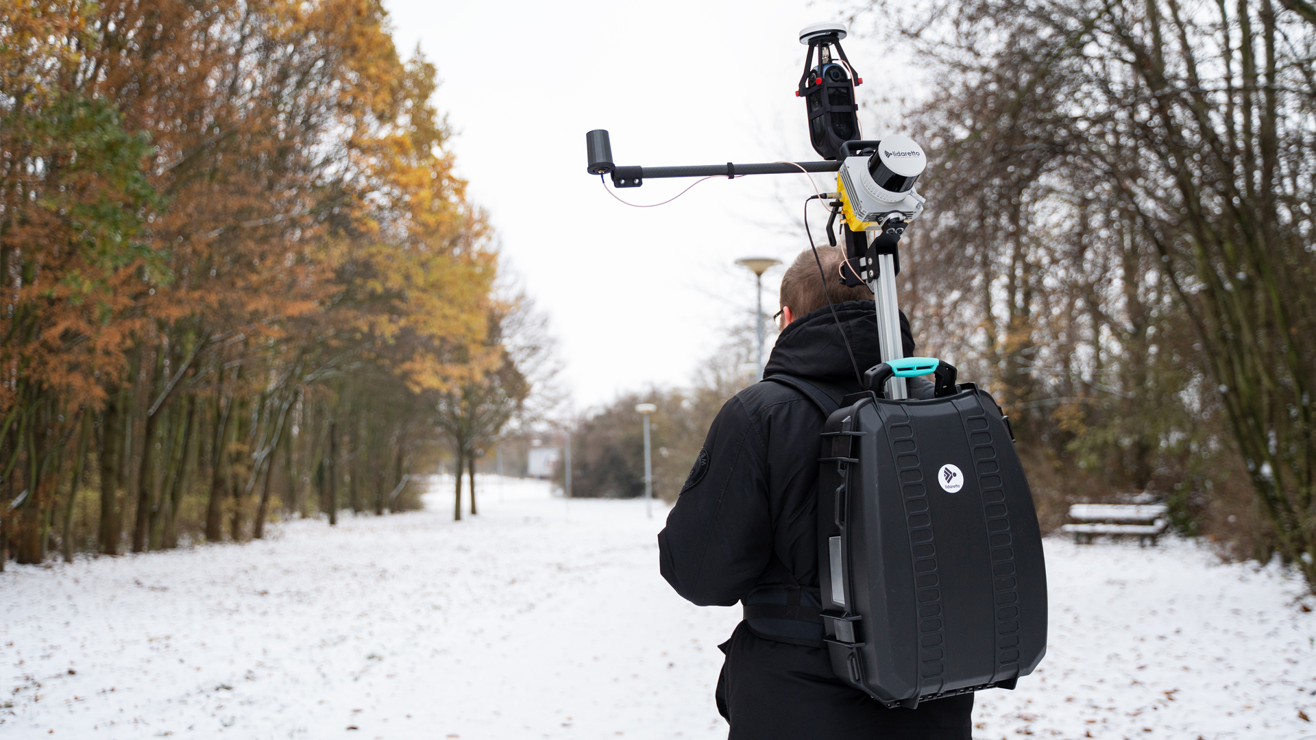
The Lidaretto system can be conveniently used with a backpack solution, allowing both small and large areas to be covered efficiently. This method also makes it possible to cover areas that are difficult or impossible to access with vehicles. This solution is ideal for:
- Mapping of city centres
- Mapping of railways
- Modelling of ski slopes
- Utility companies
- Architecture
- Property mapping
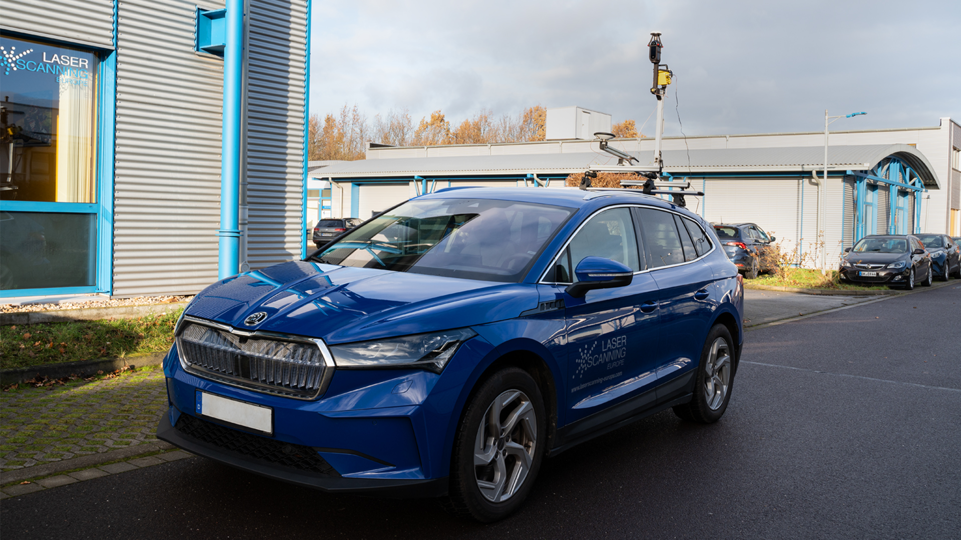
TitleWith the car
The installation of the Lidaretto system on a car enables large areas to be efficiently captured and analysed. This method offers fast and comprehensive data acquisition, ideal for:
- Mapping of roads
- Mapping of construction sites
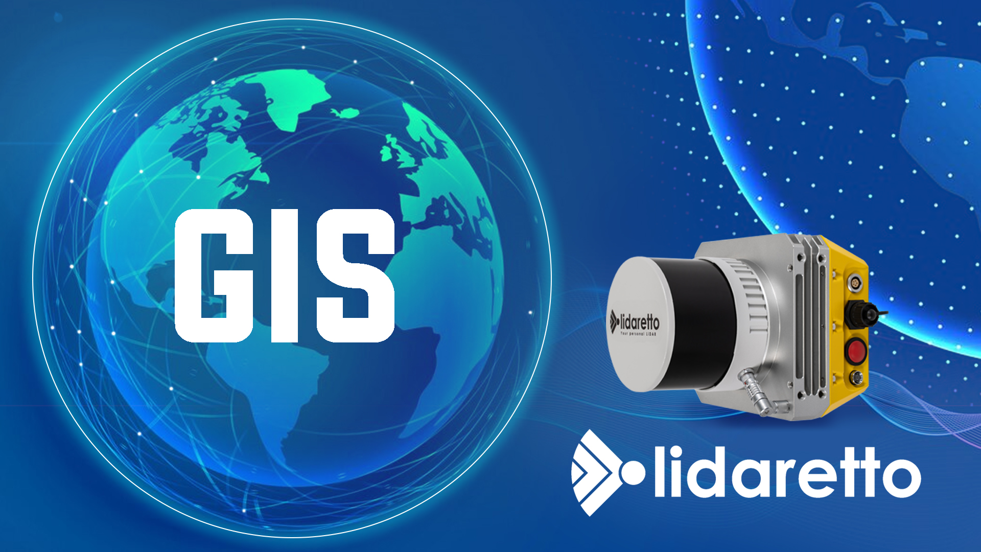
- GIS data acquisition
- City administration
- Road construction
- Virtual surveying
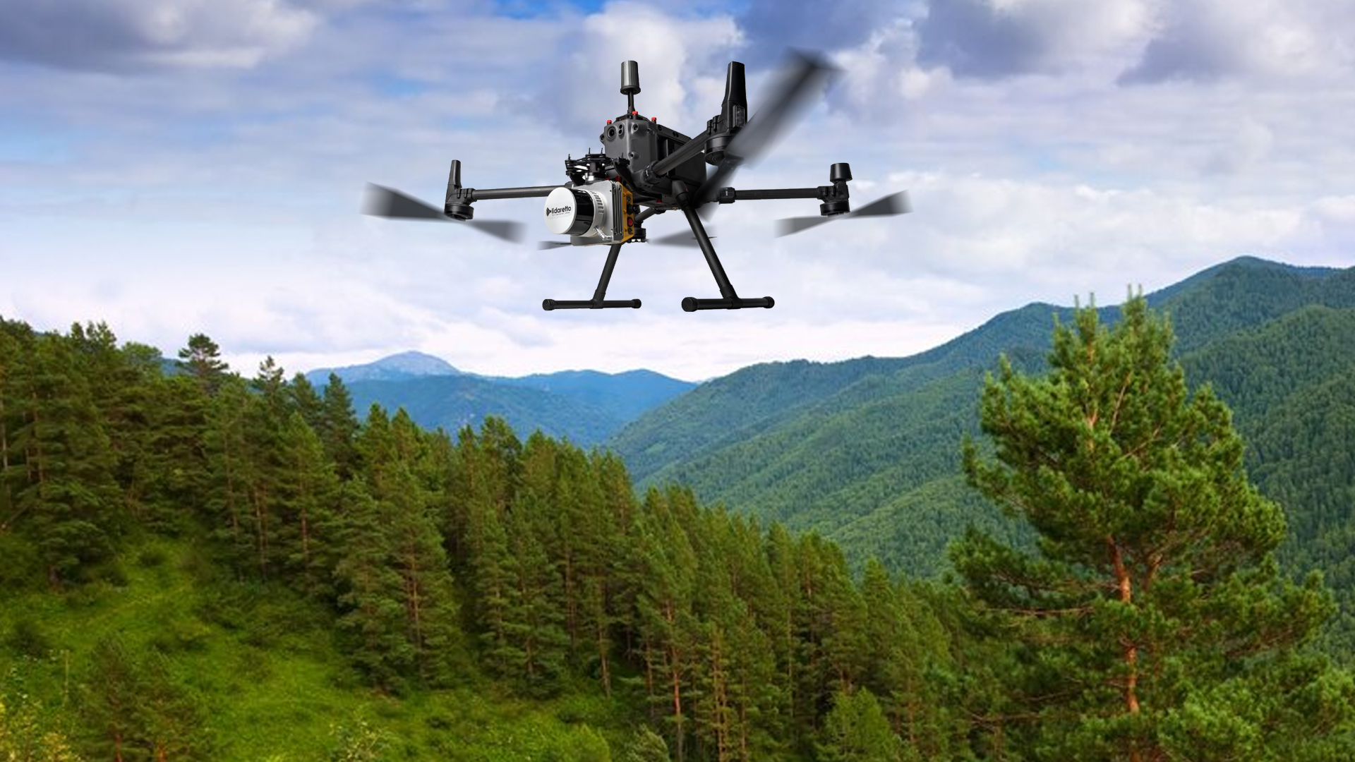
TitleWith UAV
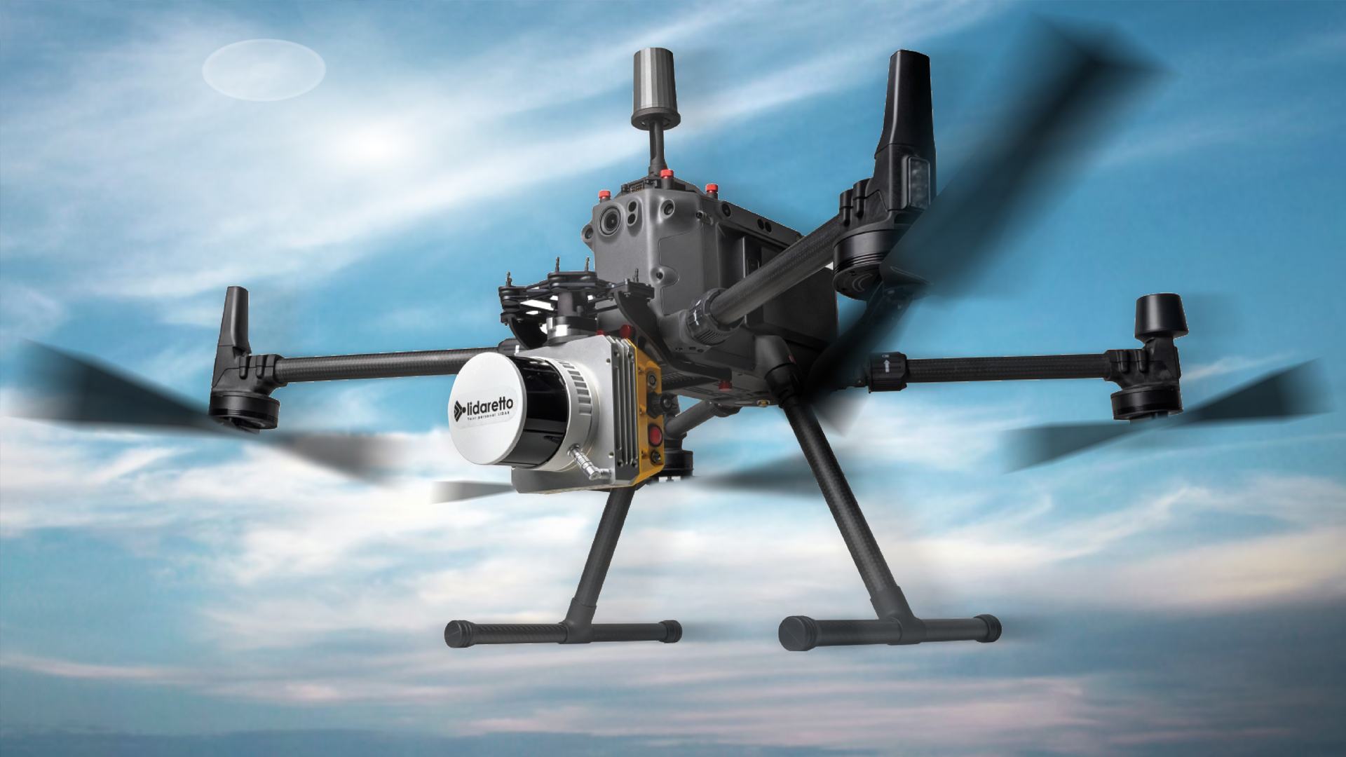
The Lidaretto system can be used effectively with a drone, allowing hard-to-reach and extensive areas to be captured precisely. This application enables the fast and detailed creation of 3D models and maps from the air. Ideally suited for:
- Mapping the topography
- Power lines
- Mining
- Agriculture
- Forestry
- Archaeology
- Environment
TitleTechnology of LIDARETTO
The centrepiece of the Lidaretto system is the tracking unit, which can be combined with various laser sensors and cameras. Here are some of the technological highlights:
- IMU and GPS: A NovAtel IMU (Inertial Measurement Unit) is used in combination with high-quality GPS antennas to accurately determine the flight path.
- LiDAR sensors: Currently, mainly Hesai sensors are used, which are known for their excellent price-performance ratio. The high-performance Teledyne CL-360 laser can also be integrated for special requirements.
- Camera sensors: Various models can be installed depending on the application in order to optimise data acquisition.
The Lidaretto system is suitable for mapping in the accuracy range of GIS systems as well as for applications requiring surveying accuracy. It is user-friendly and has its own processing software, which enables the data to be analysed quickly and efficiently in post-processing.

TitleFields of application for the LIDARETTO mobile mapping system
The LIDARETTO Mobile mapping system is a versatile 3D scanning system used for capturing and analysing environmental data. Thanks to its ability to be installed on different carrier platforms, it offers a wide range of applications in various industries. Lidaretto enables precise virtual surveying by being used as a mobile system on cars, boats, trains, drones, helicopters or even as a portable backpack system. This facilitates data collection in hard-to-reach or expansive areas and provides high-quality 3D point clouds for various applications.
TitleInspection of power transmission lines
The system is used for the inspection and maintenance of power transmission lines. Lidaretto enables the collection of detailed data on the condition of the lines and thus supports preventive maintenance measures and the early detection of problems.
TitleConstruction
In the construction industry, Lidaretto plays a crucial role in the 3D mapping of construction sites. It enables the precise calculation of volumes, surfaces and topographies, which is essential for planning and monitoring the progress of work. As a result, construction projects can be carried out more efficiently and cost-effectively.
TitleRoad & railway construction
Lidaretto is used in road and railway construction to record precise data for the construction and maintenance of transport routes. This includes the capturing of surface profiles, the monitoring of infrastructure projects and the documentation of construction progress.
TitleAgriculture
In agriculture, Lidaretto helps to create elevation maps of agricultural land. These maps support precision agriculture by providing detailed information on soil conditions and topography, which can be used to optimise cultivation and irrigation strategies.
TitleForestry
In forestry, Lidaretto is used to measure the vertical structure of tree crowns. This enables a detailed analysis of the condition of the forest, supports forest management and contributes to sustainable forestry.
TitleRemote sensing & surface information
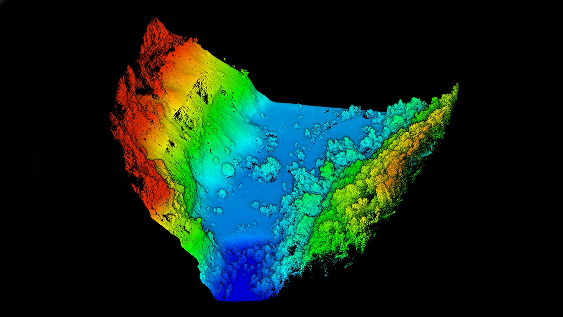
The system enables remote sensing and capturing of detailed surface information. This data is crucial for analysing landforms, monitoring erosion processes and planning protective measures in endangered areas.
TitleGIS data acquisition
Lidaretto supports GIS data collection by providing accurate and detailed geodata. This data is used for the planning, design and maintenance of infrastructure and contributes to the improvement of urban and rural development.

TitleHow LIDARETTO works
The "Lidaretto" mobile mapping system is a LiDAR-based measurement system that is used to capture and measure environments. It combines several technologies and components to capture precise three-dimensional data of its surroundings.
TitleMain components of the Lidaretto system
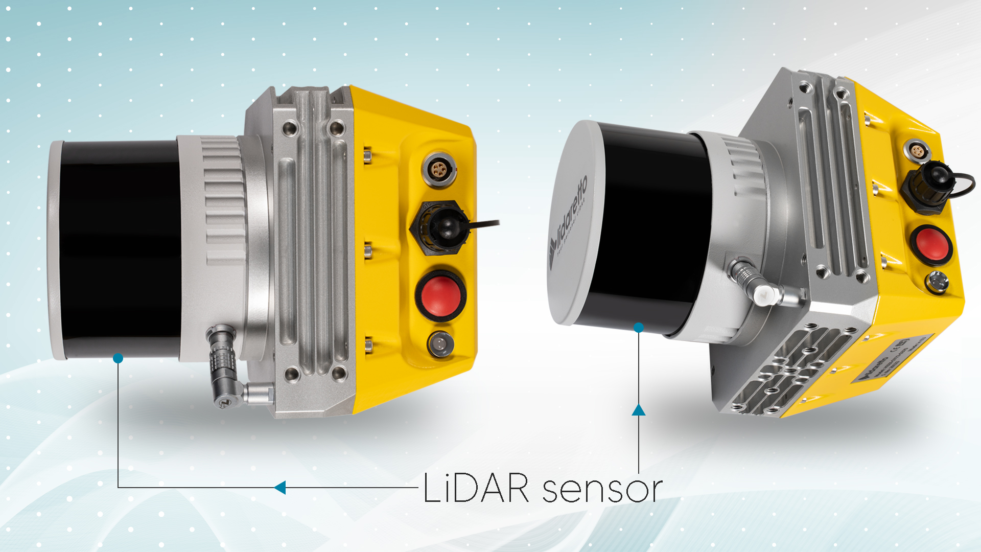
LiDAR sensors
These sensors emit laser beams and measure the time it takes for the laser to reflect off an object and return to the sensor. The distance to the object can be calculated using this time-of-flight measurement.
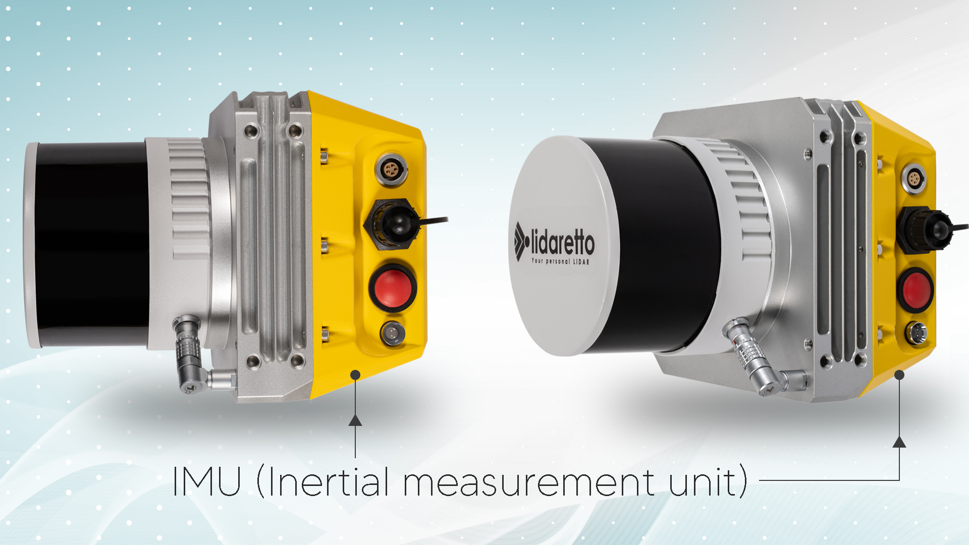
Inertial measuring unit (IMU)
An IMU contains accelerometers and gyroscopes that measure the movements and orientation of the system in real time. This data is important for determining the exact position and orientation of the LiDAR sensor.
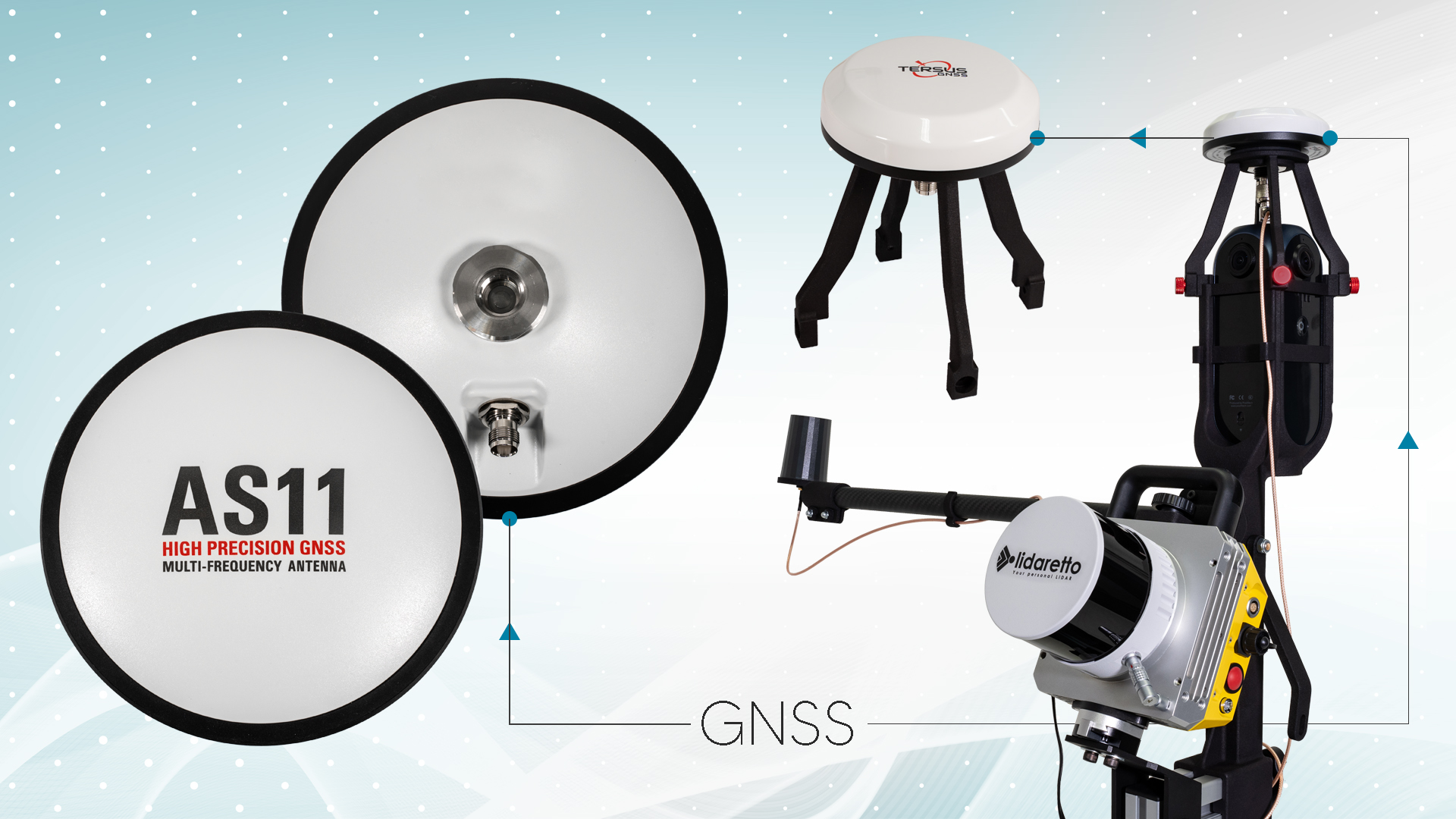
GNSS receiver
GNSS (Global Navigation Satellite System) receivers use satellite signals to determine the exact geographical position of the system. This allows the collected LiDAR data to be anchored in a global coordinate system.
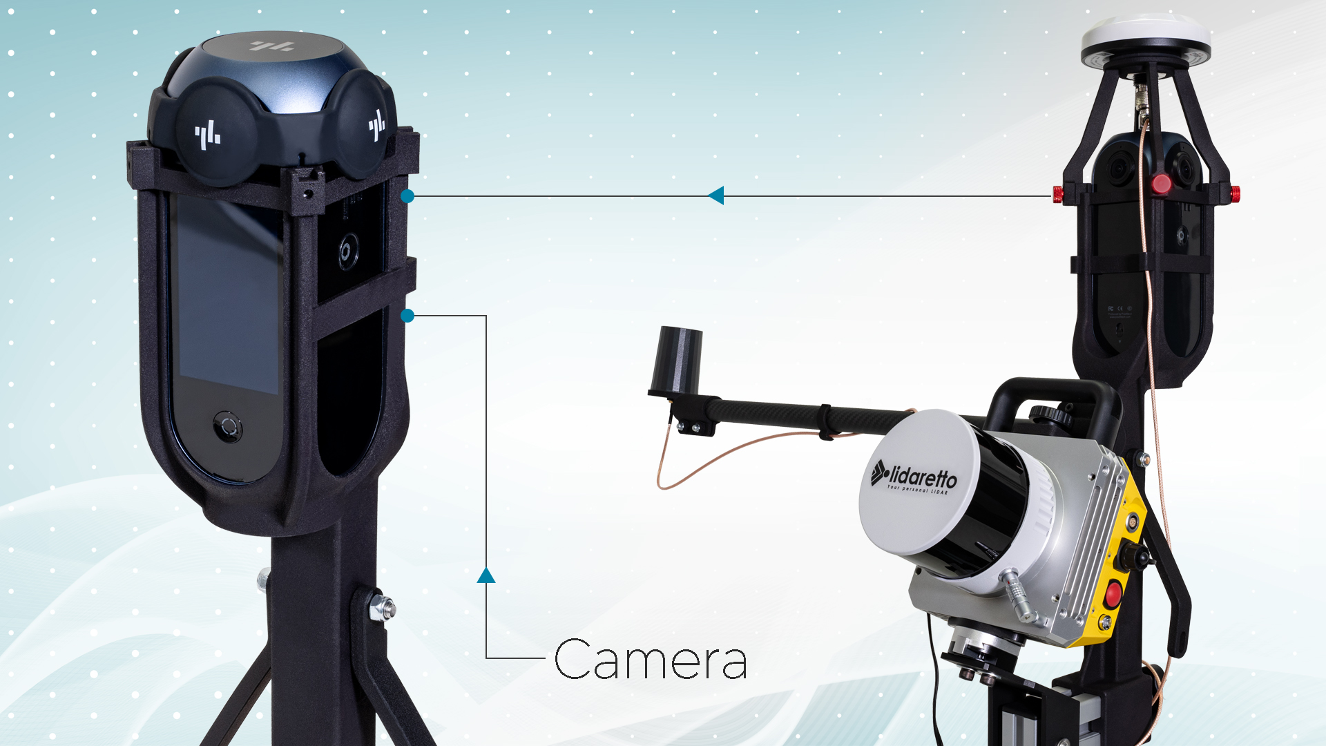
Cameras
Often, high-resolution cameras are also integrated into the system to capture visual information that can be used together with the LiDAR data to create detailed 3D models and maps.
The system is very flexible and allows the use of different cameras that are suitable for a lidar and 3D scanning system. For example, a Ladybug camera can also be used together with this system.
TitleFunctionality of the Lidaretto system
Data acquisition
The Lidaretto system can be mounted on the car, on the drone or used with the backpack. As the vehicle, drone or backpack wearer moves through the environment with the Lidaretto system installed, the LiDAR sensors continuously emit laser beams and receive the reflected signals. This generates point clouds that show the distances to various objects in the environment.
Data fusion
The IMU and GNSS receivers provide position and movement data, which is used together with the LiDAR data to determine the exact position of each detected point. This is necessary in order to position the point clouds precisely in space.
Data processing
The raw data from LiDAR, IMU and GNSS is processed in real time or after data acquisition. Errors are corrected and the data is converted into a standardised coordinate system.
Data analysis & utilisation
The processed point clouds can then be further analysed and used to create 3D models, maps, surveys and other geospatial applications. Object detection and classification algorithms are also often used to further process the data.
TitleLIDARETTO Spezifikationen
LIDAR
- Laser: Class 1 – Eye-safe
- Channels: 16 / 32
- Range: 100m / 120m / 200m
- Accuracy: +/- 3cm (typical)
- Number of returns: Max. 2
- Water resistance: IP67
Physical parameters
- Dimensions: 125mm x 125mm x 150mm
- Weight: <1.5kg
- Power consumption: 15 W stabil, 24 W Spitze
- Operating temperature: 0°C to 50°C
- Protection against water and dust
Camera system
- Number of cameras: 1
- Horizontal field of view: 360°
- Vertical field of view: 360°
Positioning
- GNSS receiver: Novatel OEM7, 555 channels, SPAN enabled, dual GNSS (optional)
- GNSS signals: GPS + GLONASS L1/L2, upgradable to GALILIEO and BEIDOU
- GNSS accuracy: PP 1-2cm
- IMU accuracy: PP Heading/Pitch/Roll – 0.038/0.008/0.008
Better advice as a user
If you are interested in our offer or would like to learn more about the Lidaretto mobile mapping system, then call us today and arrange a free and non-binding consultation appointment for you. We will answer all your questions. As a dealer and at the same time a user, we are well positioned to assist you even after the purchase.