Benaco
Title3D tour creation made easy
Digital 3D tours are a fascinating way to explore and experience objects and entire places digitally – almost as if you were there yourself. With just a few intuitive clicks, you can navigate through the desired object or building. The possible applications for 3D tours are very diverse. Entire locations can be captured within a very short time and can be experienced digitally a short time later. No special technical equipment such as VR glasses is required. You can simply view the 3D tour in your web browser and share it with friends and colleagues!
TitleWorkflow for 3D tours
The creation of digital 3D tours is fascinatingly simple. Thanks to the wide range of possible applications, almost any wish can be fulfilled.
First, the desired object or location is digitally captured, either with terrestrial or mobile laser scanners. The object is captured from different angles in order to obtain a complete image.
The data is then combined into a digital twin and may already be colored, depending on the scanner and settings. The combination with panoramic images creates a highly accurate and realistic picture of reality.
One of our exciting projects together with Benaco is a digital stadium tour of the MDCC Arena in Magdeburg. This article is a good example of what the project process and workflow looks like in such an application.
TitleRequired equipment & software
Different devices are used depending on the application and the location or object to be surveyed. Of course, the size and scope of the object to be realized plays an important role. Various 3D scanners can be used to create a 3D tour. Terrestrial scanners, mobile systems or even UAV solutions are conceivable. In the example project mentioned above, the capture of the MDCC Arena Magdeburg to create a digital stadium tour with 3D mesh, a large range was of course an advantage. The following were used in this project:
- FARO Focus laser scanner (FARO Focus S 70 & Focus S 150)
- Panoramic camera Ricoh Theta Z1
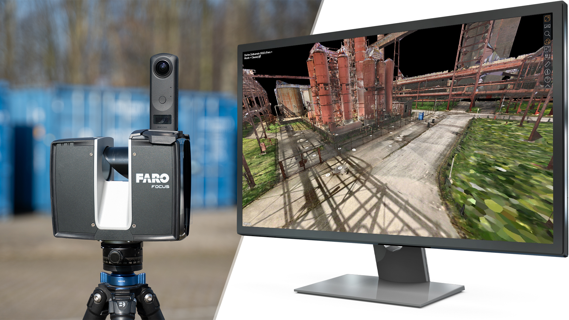
The terrestrial 3D laser scanners used were particularly suitable for this due to their large scanning range, speed and very high accuracy. The Ricoh Theta Z 3D panoramic camera was used to capture the images simultaneously. The camera significantly speeds up the time it takes to capture the image data and, thanks to the outstanding image quality, the results are fantastic. Watch the video to find out what the 3D panorama camera can do and how it speeds up your workflow.
The entire scan data was processed using the FARO Scene software after it was captured. The individually captured point clouds of the many different locations could thus be quickly and easily output and forwarded to our partner Benaco. The final creation of the digital 3D tour was implemented with the Benaco software. The laser scan data was processed with the camera data to create an impressive 3D mesh.
TitleWhat options does Benaco offer?
Benaco can be used to process all common color point clouds and panoramic photos – you decide which hardware you want to use for recording. For realistic and accurate 3D models, the use of stationary (terrestrial) laser scanners is recommended. Benaco supports most laser scanner manufacturers such as Leica, FARO and Z+F. The Benaco software can automatically align additional panoramic photos with colored laser scanning data via photogrammetry. This saves you time by reducing the amount of laser scanning data required. By adding high-quality panoramic images, you achieve maximum photo detail. Benaco supports all panoramic cameras, such as the "Ricoh Theta" series, as well as stitched DSLR photos.
TitleBenaco tour features
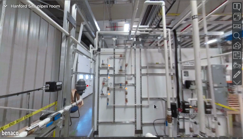
- Info points
Add text and media to 3D environments.
Image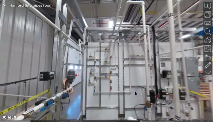
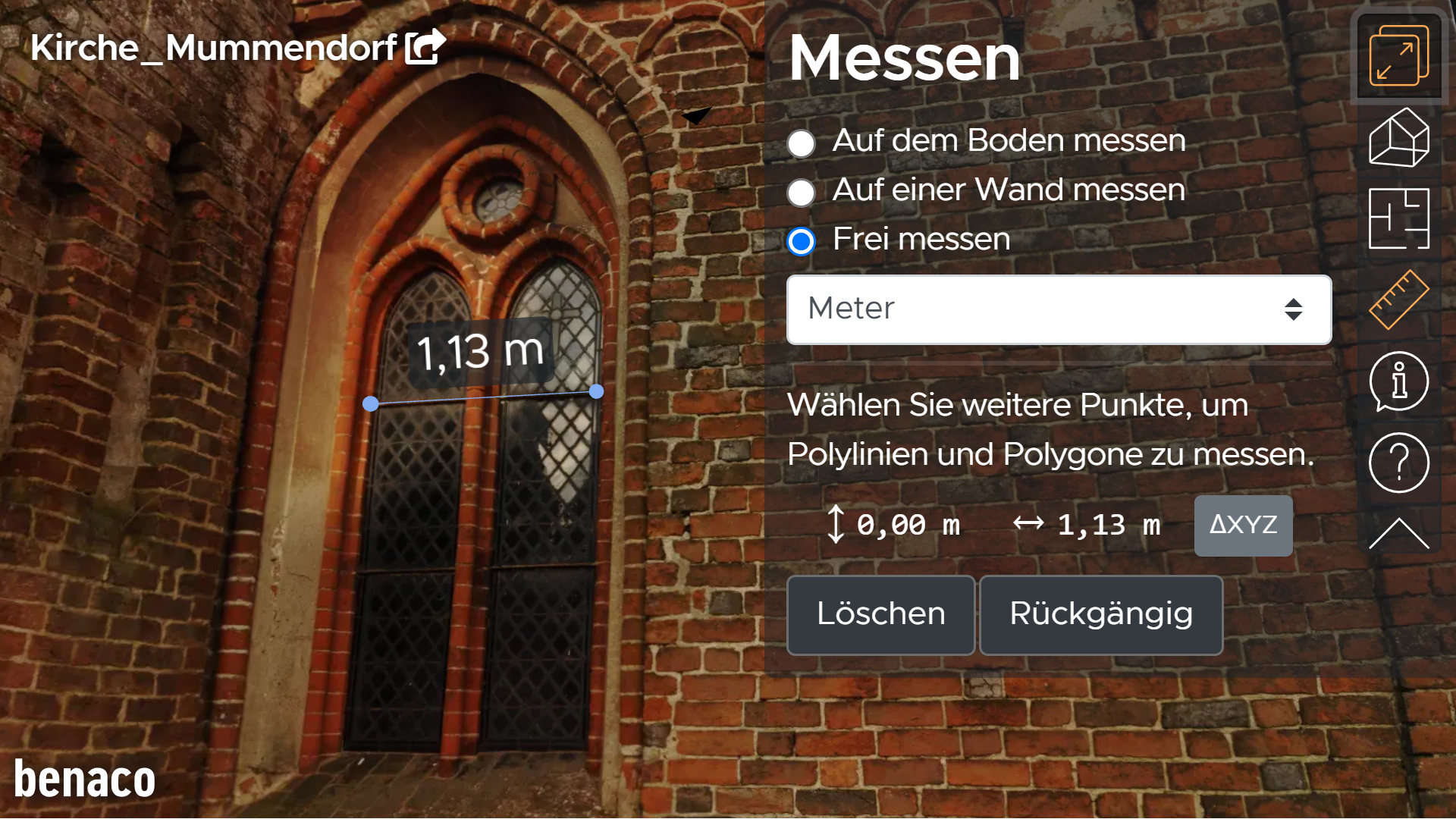
- Measure
Take surface measurements directly in the 3D tour.
Image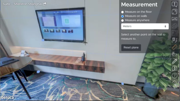

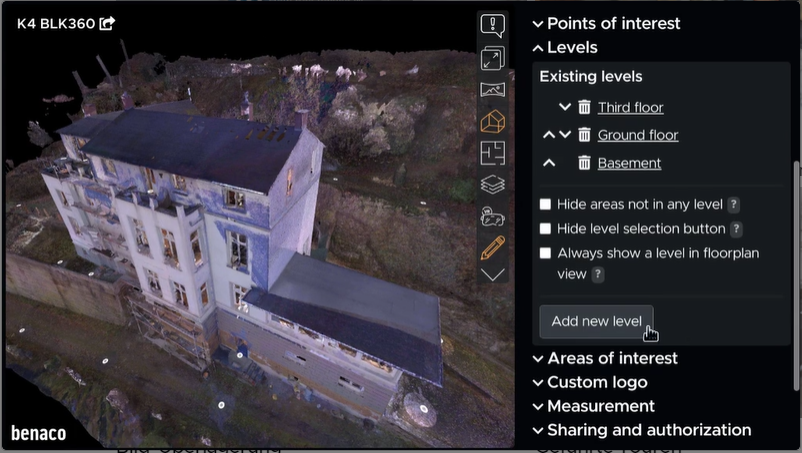
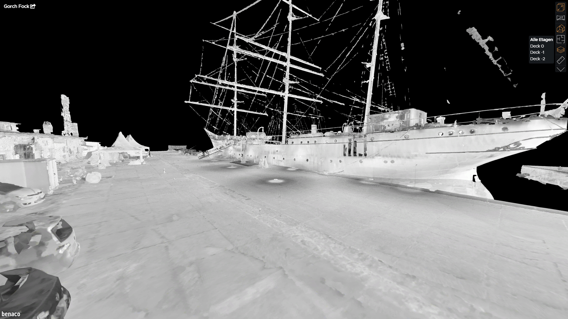
- Floors
It is easy to separate areas vertically.
Image
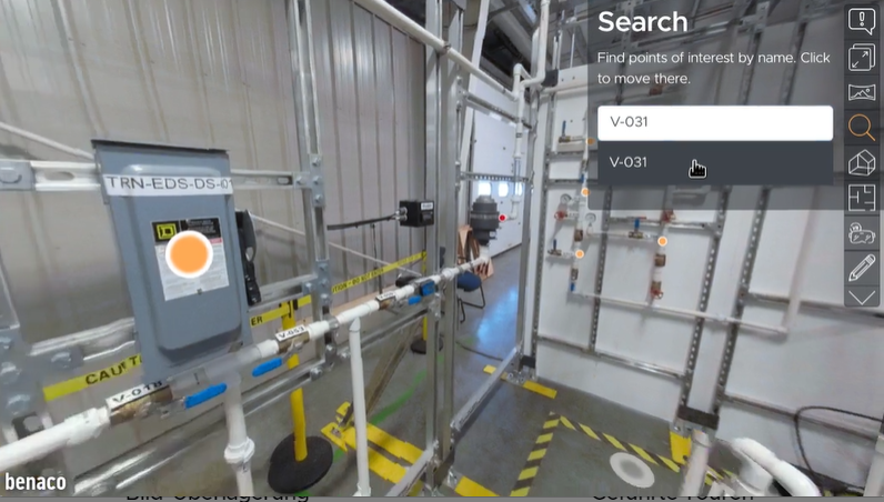
- Search
Jump quickly to relevant positions in the 3D tour.
Image
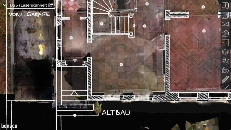
- Image overlay
Add floor plans, drawings or satellite images.
Image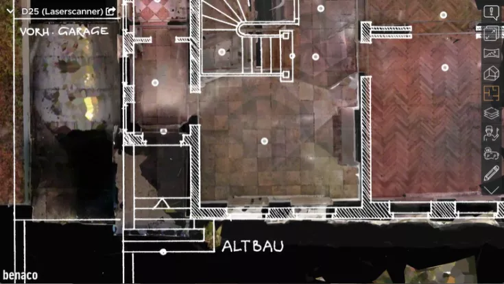
- Guided tours
You can record & play back motion sequences.
- White labeling
Use your company logo in the 3D tours.
- Embed
Embed 3D tours on your website or in applications.
- VR
Explore environments on all devices that support WebXR.
- Decide what is to be shown
Simply show or hide photos in the tour.
- Support for all devices
3D tours can be used on all devices: Smartphones, tablets, computers.
- Access control
Share your tours with others or grant access authorizations via Microsoft single sign-on or password.
TitleData protection for 3D tours
You have full control over the data and decide on the hosting of the data. Benaco offers various options to suit your individual requirements:
Your content and 3D tours can be hosted on benaco.com. By locking the region in a desired region, e.g. EU or Germany, you decide where your data is hosted. Your 3D tour can also be downloaded as an online bundle. This gives you full control over your data or allows you to integrate it into offline applications. Another option is to order a private single-tenant deployment of the Benaco platform. In this case, the data is stored on your servers or optionally on a server that is set up just for your organization. If you have special data protection requirements, an individual solution can be found for you together with Benaco.

TitleVirtual tours with 3D scans or panoramic images
Laser scanner
Various devices can be used for data acquisition with a laser scanner, such as terrestrial laser scanners (FARO, Z+F, Leica, ...) or mobile scanners, but UAV applications are also possible.
Panoramic cameras
Benaco supports all common panoramic cameras when capturing images for a realistic display. For example, if you want to connect a PanoCam to your terrestrial FARO scanner, all you need is an adapter and a Rico Theta Z1.

TitleWhat are digital 3D tours suitable for?
The range of applications for digital 3D tours is extremely diverse. Almost all conceivable places and objects can be transformed into a 3D tour. Possible areas of application are
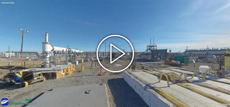
- Industrial sites / construction
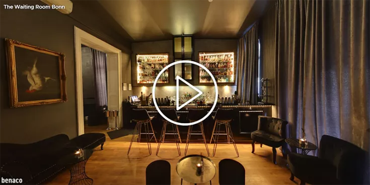
- Real estate / hotels / stores
- Historical places
- Green spaces & parks
- Aircraft hangars
- Soccer stadiums
- Churches
- Event venues
- Public spaces
TitleWhat are the advantages of virtual 3D tours?
Thanks to digital 3D tours, costly visits can be reduced. The same applies to dangerous or difficult-to-access environments. In the construction industry, construction progress can be documented and tracked remotely. Digital catalogs can be linked to the real world – for example, you can immediately find all the locations where a specific object is installed. Realistic safety instructions can be implemented with digitally guided tours. The 3D tours also make it easier for all "non-specialists" to work with point cloud data. No special software is required for viewing, as the 3D tours can be displayed with a browser on almost all end devices.
Better advice for users
Are you interested in our offer or would you like to find out more about Benaco software? Then give us a call today and arrange a free, non-binding consultation. We will answer all your questions. As both a dealer and a user, we are ideally positioned to support you after your purchase.