Veesus Arena4D

TitleVeesus - THE! Software for your point cloud visualization
3D scan data, or point cloud data, is often extremely extensive and complex. This makes it difficult to store, display and work with huge point clouds.
From the outset, Veesus has set itself the goal of overcoming these challenges when using point cloud data. The company offers products that are technologically up to date, constantly evolving and available to every user.
Veesus' software makes it possible to capture, share, edit and present data. Thanks to the use of a highly efficient file format, many common obstacles to the use of point clouds can be overcome.
TitleWhy choose Veesus?
- Unlimited data streaming
The entire software is powered by the XStreamEngine, which allows you to easily view and work with point clouds of any size – even when streaming via ZAPPCHA. - Powerful tools
Even on standard computer hardware, Veesus software can easily edit, convert, annotate and create complex animations on point cloud data, so you can do your job to a high standard and get professional results time after time. - Simple subscription
Depending on your needs, you can purchase an annual license or a lifetime single-user license. - Professional support
As a sales partner, we at Laserscanning Europe GmbH are on hand to help all customers if they have any problems or questions about Veesus software products. - End-to-end point cloud workflows
Veesus software allows you to capture, view, edit, combine, mark, present and share. Wherever you are and whatever devices you use, Veesus allows you to maximize your point cloud resources. - Save, manage and share via the cloud
Thanks to the ZAPPCHA Cloud, all Veesus software can stream point cloud data from the cloud on demand and without loss of quality.
TitlePoint cloud visualization in Veesus Arena4D
Veesus Arena4D Data Studio software is designed for the visualization, use and animation of large-volume point clouds and GIS data.
Thanks to the powerful point cloud engine, you can quickly load point clouds from different systems and manufacturers into Arena4D Data Studio to edit, analyze, register, generate video flights or use the point cloud information for reverse engineering. Even huge point cloud datasets are no challenge for the visualization software.
The Arena4D software is easy and intuitive to use, so even inexperienced users can quickly add context to their 3D data. For example, panoramic images, documents, photos or sound can be added to the lidar data. There is also the fourth dimension of “time”, which you can use to present your data analytically or narratively.
TitleWhat features does Arena4D Data Studio offer?
- Support for numerous scanners
- Numerous functions for examining, editing and using complex point clouds (e.g. select, show/hide, copy, delete, filter, colorize, measure, annotate, export, create 3D models, generate video flight and much more)
- Powerful point cloud engine
- Immediate point cloud registration
- Rendering of billions of points
- Building information management
- Cloud-2-Cloud registration
- Protection of sensitive data (Protected data cannot be edited or exported | You can set a time limit for using data | Protected data is provided with a PIN code)
- Use of large-volume point clouds on mobile devices
- View the point cloud in the Local Viewer or Global Viewer
- HD video generation in real time
- Documentation in PowerPoint or PDF format with one click
- Live rendering of data from GPS tracking devices or network cameras
- Simple sharing of views via a network using a web interface
- Definition of time parameters for the data
- Add context to LIDAR data (e.g. still images, panoramic images, annotations, 3D models, CAD models, GPS tracks, CSV files)
- Presentation of the data via the free “View only” mode for opening and viewing (no license is required for this)
TitleAnimate point clouds with Veesus Arena4D
The Animation for Arena4D module allows you to create extraordinary video flights through your point cloud. Whether you want to create a simple flight through the point cloud or an object and/or an area of your point cloud in a complex animation, with Arena4D you can set the scene for your point cloud.
Arena4D gives you free choice when creating animations. You can create an animation with unlimited frames, define different camera locations as well as Bézier curves and durations. It is also up to you whether you animate the entire point cloud, only a part of it or only specific properties.
You can also add objects that can be controlled at any or defined times.
TitleEasily edit point clouds in Arena4D
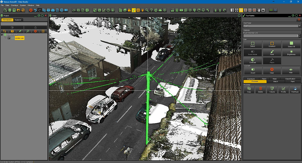
The powerful Cloud Editing for Arena4D module allows you to edit, fix and refine huge point clouds.
- Various selection tools – 3D brush, polyline, rectangle, layer, select all and invert selection
- Editing tools – Copy, paste, delete, hide
- Color points – Color, intensity, brightness and contrast
- Create additional points – Close holes in your point cloud
- Compare points – Compare and select points of a specific color and/or intensity
- Surface Profiler – Detect deviations in a selected plane
- Volume – Calculate the volume of the selected points
- PointFuse – Create a mesh of selected points and export to FBX, OBJ and DXF
- LAS Classification – Classify your point cloud data to create up to 256 layers within one file
TitlePanoramic images in Veesus Arena4D
With the Panorama for Arena4D module, you can integrate the images captured by your scanner or panoramic camera into a project.
- Scan images – Panoramic images from the laser scanner
- Context view – Most laser scanners capture panoramas to colorize the point clouds. Add the image separately to your point cloud and view it from different viewpoints.
- Measurements – If you have a georeferenced or correctly positioned panorama, you can take measurements in the image.
- Comments – Comment on georeferenced or correctly positioned panoramas.
- Visualization – The panoramic images help to identify objects in a point cloud.
- Full HDR – View the panoramas alone or in conjunction with a point cloud in high-resolution HDR quality.
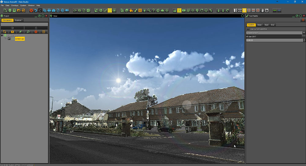
TitleUse GIS data in Arena4D Data Studio

The Geospatial for Arena4D module provides you with a GIS user interface that allows you to provide and display accurate spatial data.
- Coordinate system – Select a coordinate system and all georeferenced data will be positioned at the correct location on the globe.
- Mapping – Use the open source mapping or connect to your own map database.
- Satellite images – Use free low-resolution satellite data or add your own images.
- Sunlight – Change the position of the sun depending on the time of year, time of day and location.
- Terrain – Use the free Digital Terrain Elevation Model (D-TED) or connect to your own terrain database.
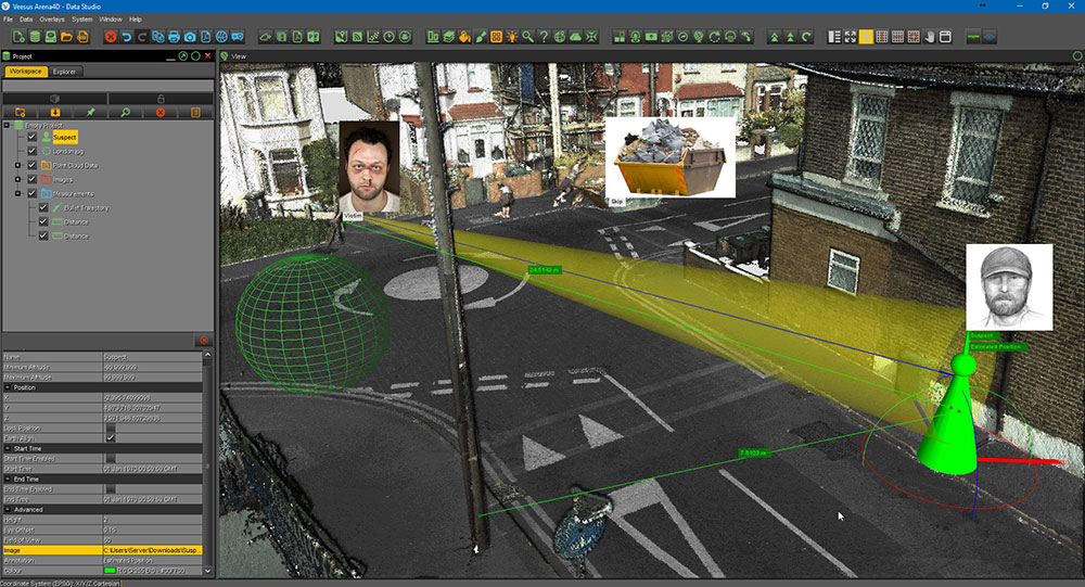
TitleForensic analyses with Veesus Arena4D
The Forensics for Arena4D module allows you to create, present and deploy complete forensic scenes.
The functionalities include, among others:
- Advanced data objects – Add almost any data object to a point cloud. This gives you a better overview of all relevant evidence.
- Sphere trajectory – Scan trajectories for shot trajectory calculation.
- CSV import – Add GPS data.
- Viewpoint – View the crime scene from multiple angles.
- View window – Define a fixed point, such as a window, and view the point from different locations.
- Actor – Define the height and viewing angle of the possible perpetrator; view the crime scene from their perspective.
- Various share functions – For example, create a PowerPoint presentation or a PDF and share it with your customers. Or create an orthographic photo in the desired resolution. There are even more possibilities.
TitleOpportunities in virtual reality
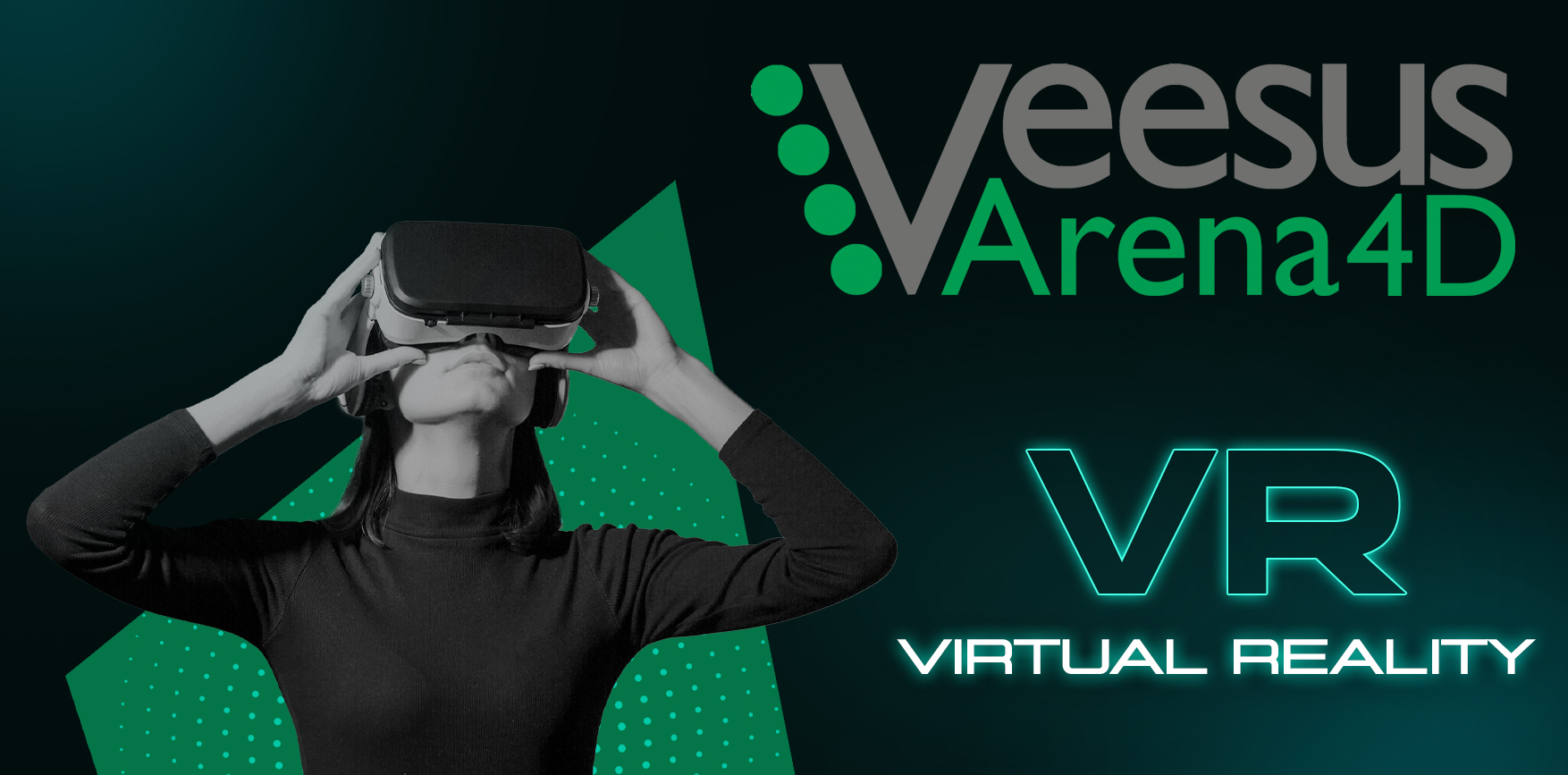
The Virtual Reality for Arena4D module takes the visualization of your point cloud data and other data to a new level.
With a combination of headset and game controller, you can move freely and virtually through the point cloud without any restrictions. The integration of Oculus Rift, HTC Vive and Power Wall / Cave Projector shows that it is important for the industry of the future to view point clouds in virtual reality.
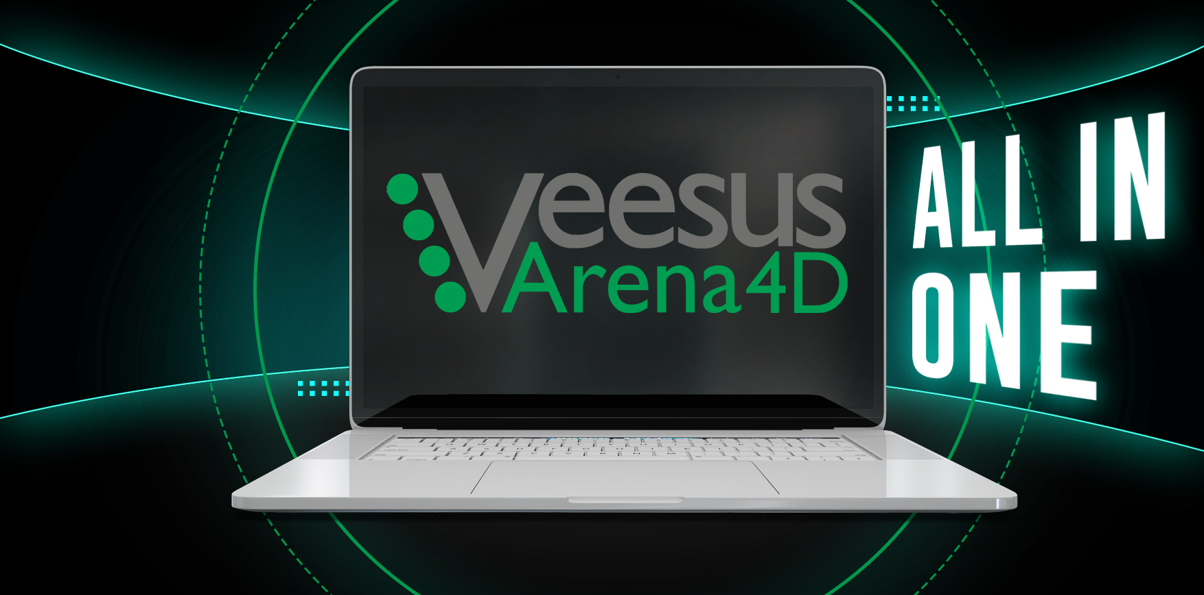
TitleAll in one software
Veesus has expanded its offering and packed the various plug-ins (e.g. for Rhino, SolidWorks and Revit) all into one complete package in their software. In addition, users gain access to the ZAPPCHA Cloud, which brings all services and data together in one central location. This bundled software solution simplifies the workflow and provides users with a comprehensive platform for their projects.
TitleAll in one complete package
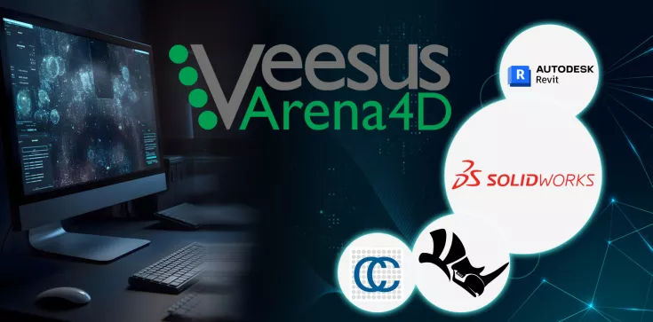
With the purchase of Arena4D software, you receive all available Veesus plug-ins.
View, explore and edit huge amounts of point cloud data natively in the CAD application of your choice. The current plug-ins are available for Rhino, SolidWorks, Revit and CloudCompare.
TitleArena4D Point Clouds for Rhino
Arena4D Point Clouds for Rhino is the plug-in for the CAD software Rhino. With the help of plug-ins, you can easily load your large-volume point cloud into the Rhino interface and edit it with the help of powerful point cloud editing tools (e.g. cutting, smoothing, lighting, cropping, enlarging, adjusting color values).
TitleArena4D Point Clouds for Revit
Thanks to the plug-in, Autodesk Revit users can work with the revolutionary VPC files from Veesus natively in Autodesk Revit. The plug-in enables the smooth import of VPC data directly into Revit's BIM plans.
TitleArena4D Point Clouds for Solidworks
Arena4D Point Clouds for SolidWorks is the powerful plug-in for loading and editing huge point cloud data in SolidWorks.
TitleArena4D Point Clouds for CloudCompare
Arena4D Point Clouds for CloudCompare allows you to open, view and save Veesus VPC files in CloudCompare.
It also connects to the Zappcha cloud ecosystem, allowing you to stream data from the cloud to CloudCompare. This also allows you to import Lidar scans taken with iPhone and iPad from our app directly into CloudCompare without the need for conversion.
TitleVeesus VFX & Voxel update
Thanks to the new VFX function, you can make your point cloud animations even more impressive. All powerful effects are integrated directly into Arena4D, which means that no additional software is required.
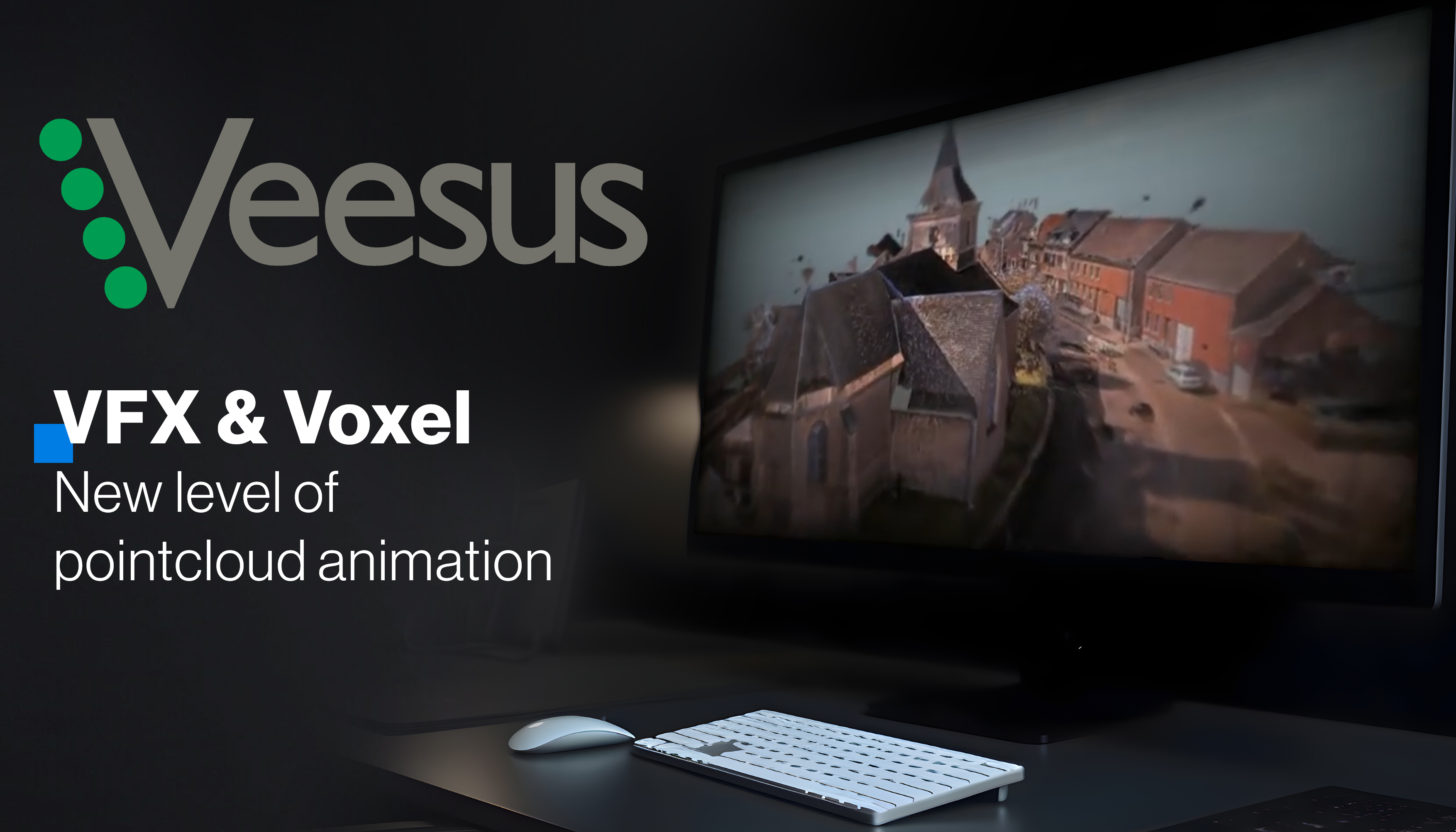
TitleImpressive animations
With the VFX function, you can create impressive animations and bring special features into focus.
Spotlight – This effect allows you to select specific points in your animation that are in focus while the rest of the area appears blurred. This makes it possible to draw full attention to the highlighted point.
Vignette – You can use the vignette to highlight the center of the image. The edges of the image are slightly darkened, which automatically directs the focus to the center of the image.
Motion blur – The motion blur gives your shots more dynamism. A slight blur in the direction of movement gives fast movements in the video a more dynamic look.
TitleExciting gaming experiences thanks to voxel update
Veesus' Voxel update is a groundbreaking advancement for anyone looking to take their gaming experience to the next level.
Simply capture your environment with a LiDAR-enabled iOS device. You can then upload the data to the ZAPPCHA software and export it as a voxel model.
You can import the data into many popular 3D games and platforms, such as
- Minecraft
- Roblox
- Unity
- Unreal Engine
- and more…
Thanks to the update, you can incorporate your real environment into your game world to create an immersive and exciting experience like never before.
TitleAnimated Gaussian Splats in Arena4D
Gaussian splats can be impressively animated in Arena4D!
In this video, we show what is possible with the point cloud visualization software and how the Gaussian splats, which are generated by the XGRIDS scanner for example, can be imported and animated in Arena4D.
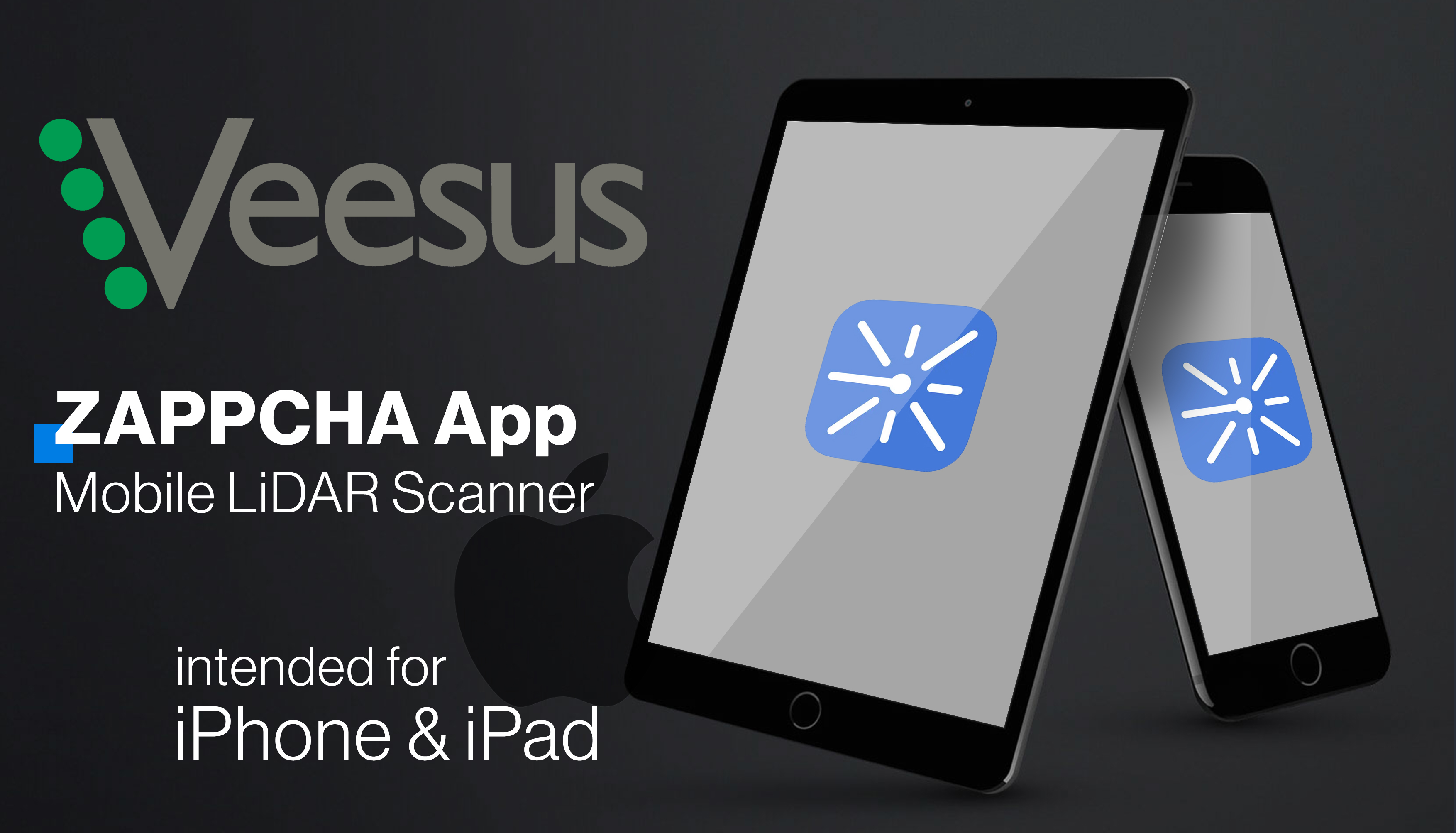
TitleVeesus ZAPPCHA
In the past, capturing point cloud data was only possible with highly specialized devices or complex photogrammetric processing methods. But thanks to the ZAPPCHA app, owners of Apple iDevices can now capture point clouds using the built-in LiDAR.
The ZAPPCHA app is based on the same technology as the desktop software and allows users to visualize unlimited point clouds either from the local drive or from the ZAPPCHA cloud.
3D scanning is no longer reserved for LiDAR-enabled iPhones. ZAPPCHA now enables ANY iPad and iPhone to become a mobile scanning device.
The ZAPPCHA app is available for download in the App Store.
TitleZAPPCHA - Functions & features
Capture
Effortless continuous capture of millions of points.
Unlimited
Easily view and navigate any point cloud of any size.
Easy to use
Intuitive user interface – makes data capture simple.
Freely available software
Download completely FREE from the AppStore.
Share
Upload to the ZAPPCHA Cloud for easy sharing and streaming.
Fast processing
Instantly filters data for the best results.

TitleHardware Compatibility
In order to use Veesus optimally and utilize its full performance spectrum, it is important that your computer is designed for the software. To ensure that Veesus runs properly on your computer, please check the hardware requirements listed below.
System requirements
- Windows, Mac OSX or Linux
- CPU: 2.0 Ghz Dual Core RAM, 2048 MB
- GPU: 1024 Mb, OpenGL 2.0 HDD, 100 MB
- 64 bit operating system
- Java 7 (or better)
Compatible hardware
| Compatible Virtual Reality devices | Compatible virtual reality control units | Compatible scanners |
|---|---|---|
|
|
|

TitleSoftware Compatibility
Veesus Arena4D supports various point cloud formats and is compatible with several CAD programs.
TitleShare point clouds from Arena4D with Veesus ZAPPCHA
ZAPPCHA makes it easier than ever to create, use and share point cloud data.
ZAPPCHA is available as a free app that allows users of LiDAR-enabled Apple devices to generate 3D scans.
On the other hand, there is the ZAPPCHA Cloud, which makes it extremely easy to save and share scan data. Thanks to the ZAPPCHA Cloud, you can transfer point cloud data anywhere in the world without any loss of quality - even with large point clouds.
The Zappcha Cloud is included in all Veesus subscriptions.
TitleSupported file formats
| Compatible point cloud formats | Compatible CAD software |
|---|---|
|
|

TitleArena4D applications
The ability to combine many different types of data in one software makes Arena4D Data Studio particularly suitable for investigations and planning in the following areas:
- Surveying
- Forensics
- Construction planning
- Visualization
- Security planning
- Geodata management
- Data processing
Better advice for users
Are you interested in our offer or would you like to find out more about Veesus software? Then give us a call today and arrange a free, non-binding consultation. We will answer all your questions. As both a dealer and a user, we are ideally positioned to support you after your purchase.