Trimble & DotProduct Scanning Kit

TitleTrimble DA2 Catalyst & DotProduct - Precision & efficiency in surveying technology
The Trimble DA2 Catalyst combined with DotProduct software provides a powerful solution for 3D data capture, processing and integration.
This combination enables the use of high-precision GNSS positioning for 3D data capture, which is particularly beneficial for applications in construction surveying, mapping and infrastructure inspection.
TitleInnovative surveying: Trimble DA2 Catalyst & DotProduct in use
With the increasing complexity of modern infrastructures and the growing need for precise surveying technology, innovative solutions have been developed to meet these requirements. Two outstanding tools in this area are the Trimble DA2 Catalyst, a high-precision GNSS receiver, and the DotProduct software, which specializes in the acquisition of 3D data. In combination, they enable the precise location of structures and their three-dimensional mapping, which is of great value for numerous applications, particularly in surveying, construction and infrastructure maintenance.
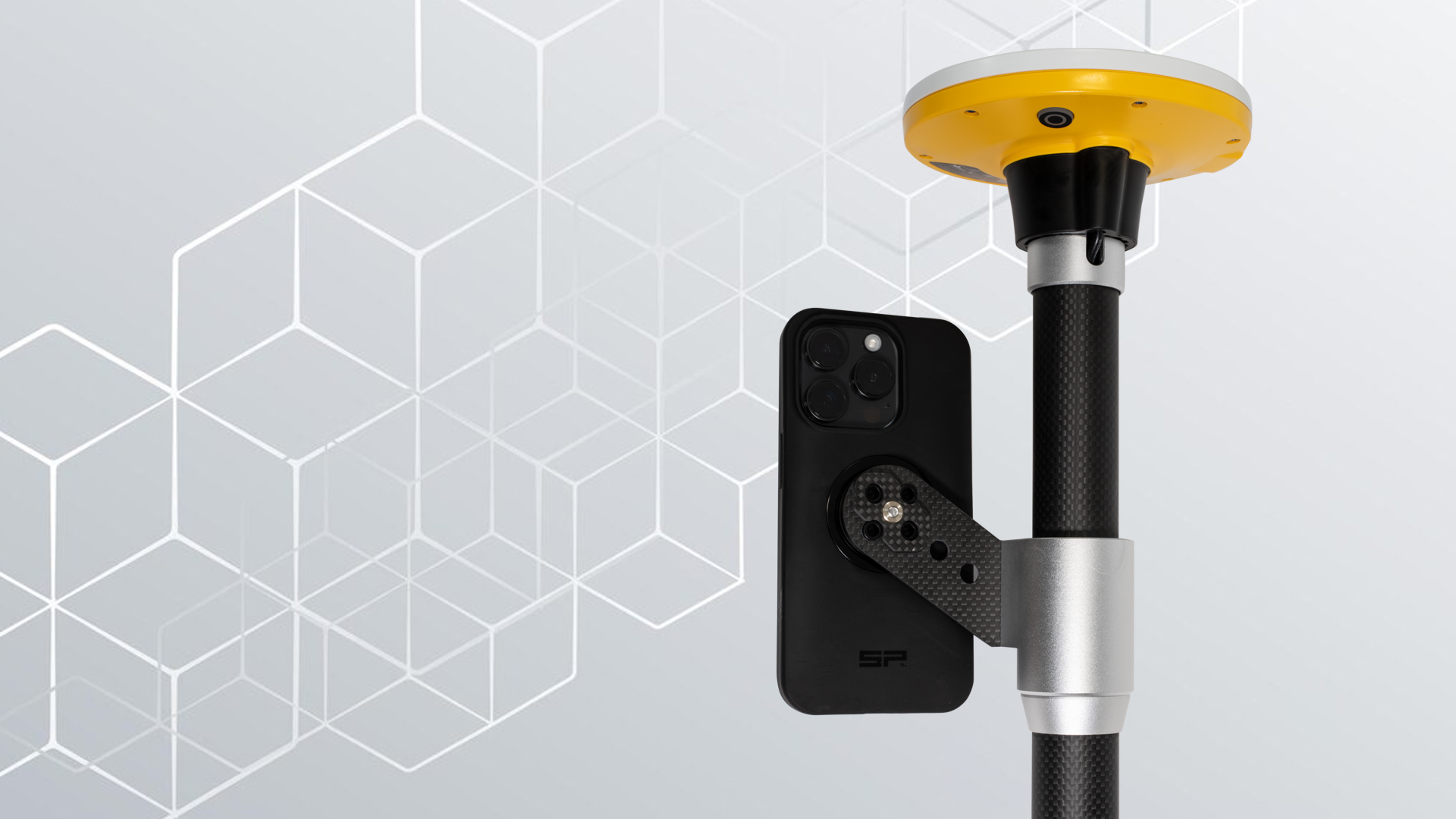
TitleTrimble DA2 Catalyst
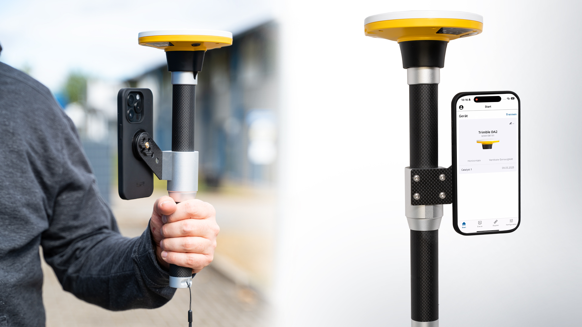
The Trimble DA2 Catalyst is a mobile GNSS receiver that delivers highly accurate positioning data. This solution is particularly flexible as it can be used in conjunction with smartphones or tablets and provides centimeter-accurate results through RTK (Real-Time Kinematic) correction data. The DA2 Catalyst uses a variety of satellite systems, including GPS, GLONASS, Galileo and BeiDou, to ensure high positioning accuracy.
The core function of the DA2 Catalyst is to provide accurate geo-coordinates, which are essential for surveying in construction, agriculture and infrastructure management. The Trimble Catalyst mobile application facilitates the collection of real-time GNSS data without the need for extensive equipment. This revolutionizes traditional surveying technology by making it not only accurate, but also accessible and easy to use.
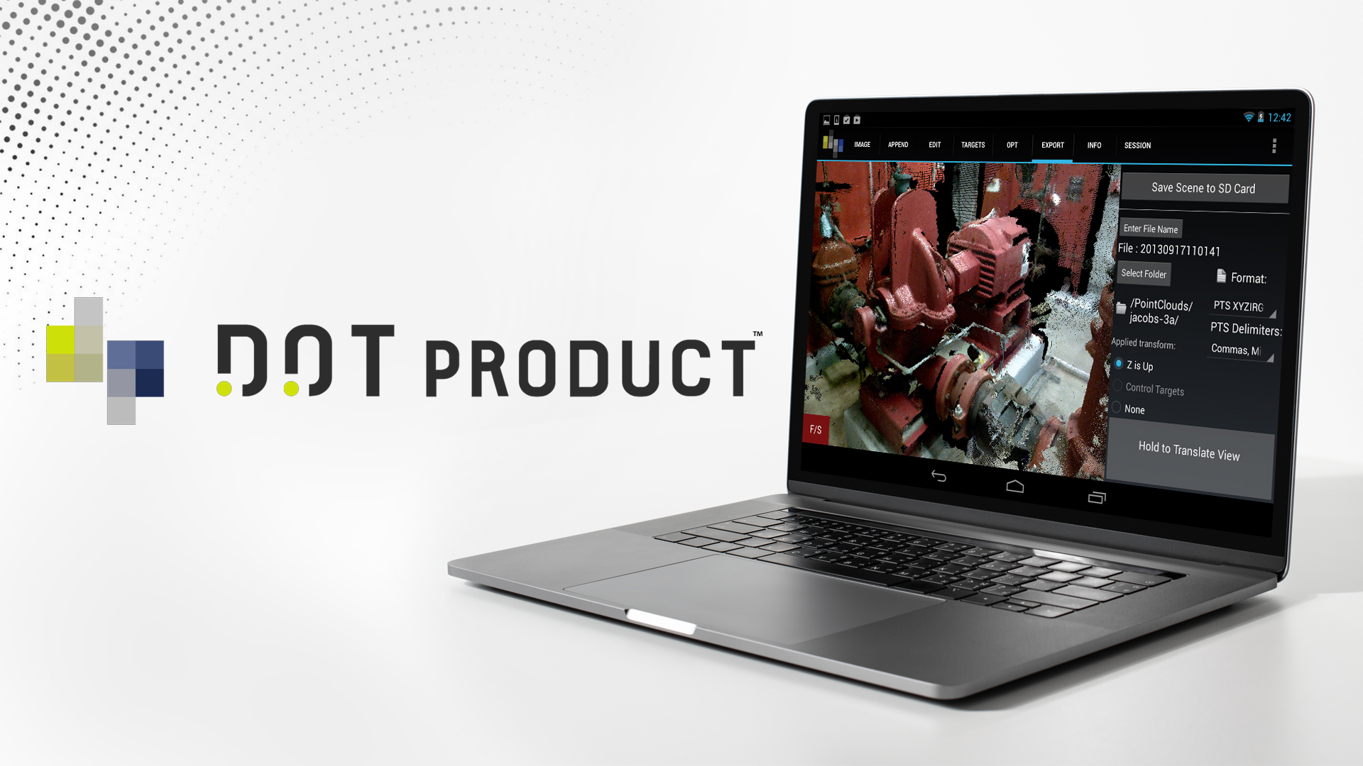
TitleDotProduct's Dot3D
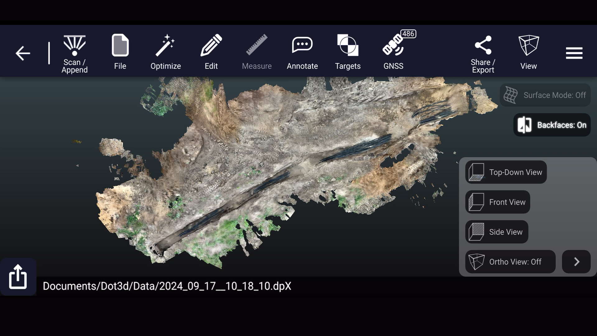
The DotProduct software Dot3D enables the creation of 3D point clouds using 3D cameras such as Intel RealSense or other depth sensors. A point cloud consists of thousands of measurement points that represent the surfaces of objects or structures in space. This data is particularly valuable for creating three-dimensional models that represent real environments and structures in detail.
The real-time processing of the captured point clouds makes DotProduct an efficient tool for professionals who need to capture 3D data quickly and accurately. The data obtained can be easily integrated into various software solutions for surveying, construction planning and inspection, which simplifies the use and visualization of the data.
TitleCombination of Trimble DA2 Catalyst & DotProduct
The combination of the Trimble DA2 Catalyst with the DotProduct software offers numerous advantages for surveying and infrastructure management. Together, they not only enable the precise location of structures, but also the creation of realistic 3D models.
In the video, we present the scanning kit and explain how it works.

TitleVersatile application options
The Trimble DA2 Catalyst combined with DotProduct software provides a powerful solution for 3D data acquisition, processing and integration.
This combination enables the use of high-precision GNSS positioning for 3D data acquisition, which is particularly beneficial for applications in construction surveying, mapping and infrastructure inspection.
TitleIntegration von Trimble DA2 Catalyst & DotProduct
The Trimble DA2 Catalyst is a GNSS receiver that provides centimeter-accurate positioning data. In combination with DotProduct, the DA2 is used to supplement GNSS data for the 3D point clouds and integrate highly accurate geo-positions into the acquisition.
DotProduct provides software for capturing 3D data through the use of mobile devices (such as tablets) with integrated or connected 3D cameras. This technology creates point clouds that capture complex structures and environments in a detailed 3D representation.
The combination of these technologies is useful because it enriches 3D data with high-precision GNSS coordinates. This makes it possible not only to capture the geometry of an object or environment, but also to determine its exact position in a geodetic system.
This integration is particularly suitable for a wide range of applications in surveying and construction.
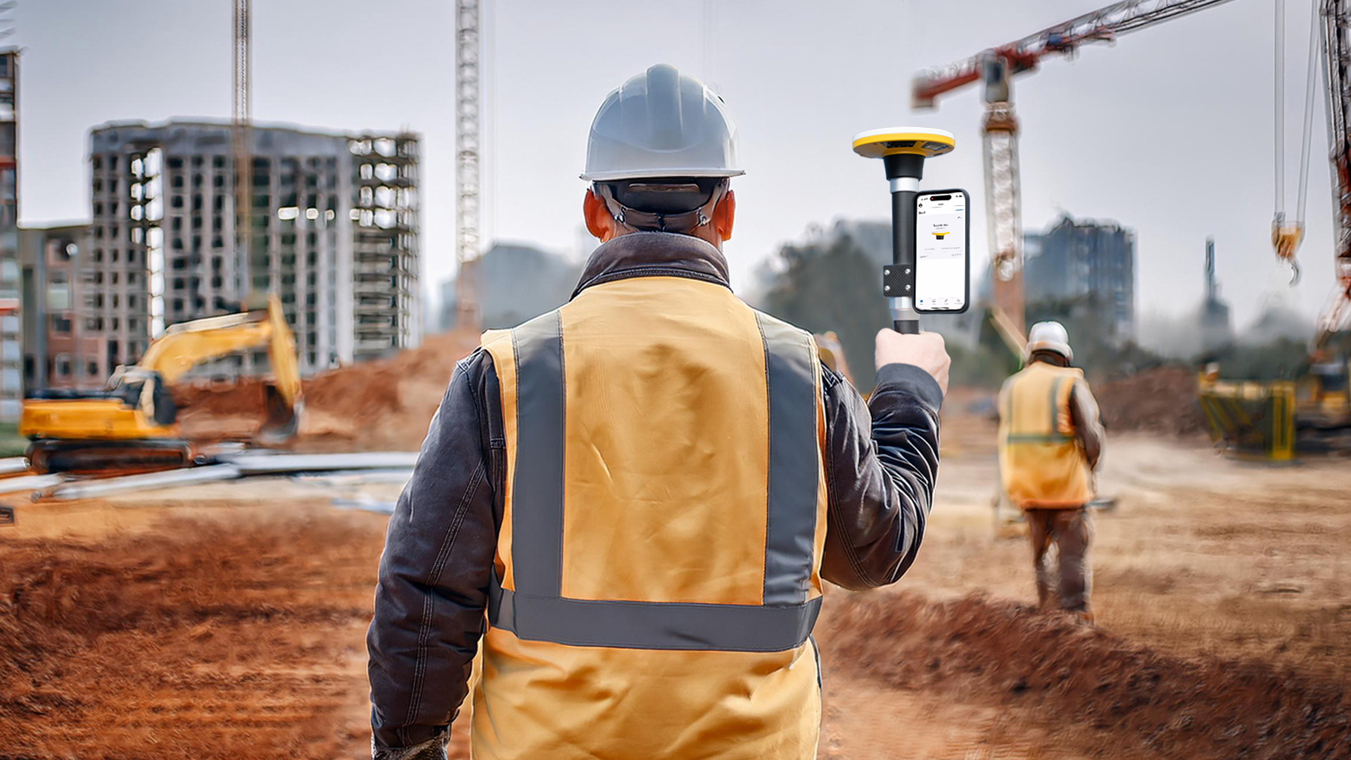
TitleCivil engineering & construction site surveying
Trimble DA2 provides precise positioning data for point clouds created by the DotProduct software. This enables accurate placement of the 3D models in a geodetic coordinate system.
The combination enables site managers and engineers to track progress on construction sites by capturing 3D data in real time and matching it to accurate global coordinates.
Precise GNSS positioning allows building locations, construction details and planned stakeouts to be compared directly with the captured 3D data.
TitleAs-built survey & inspections
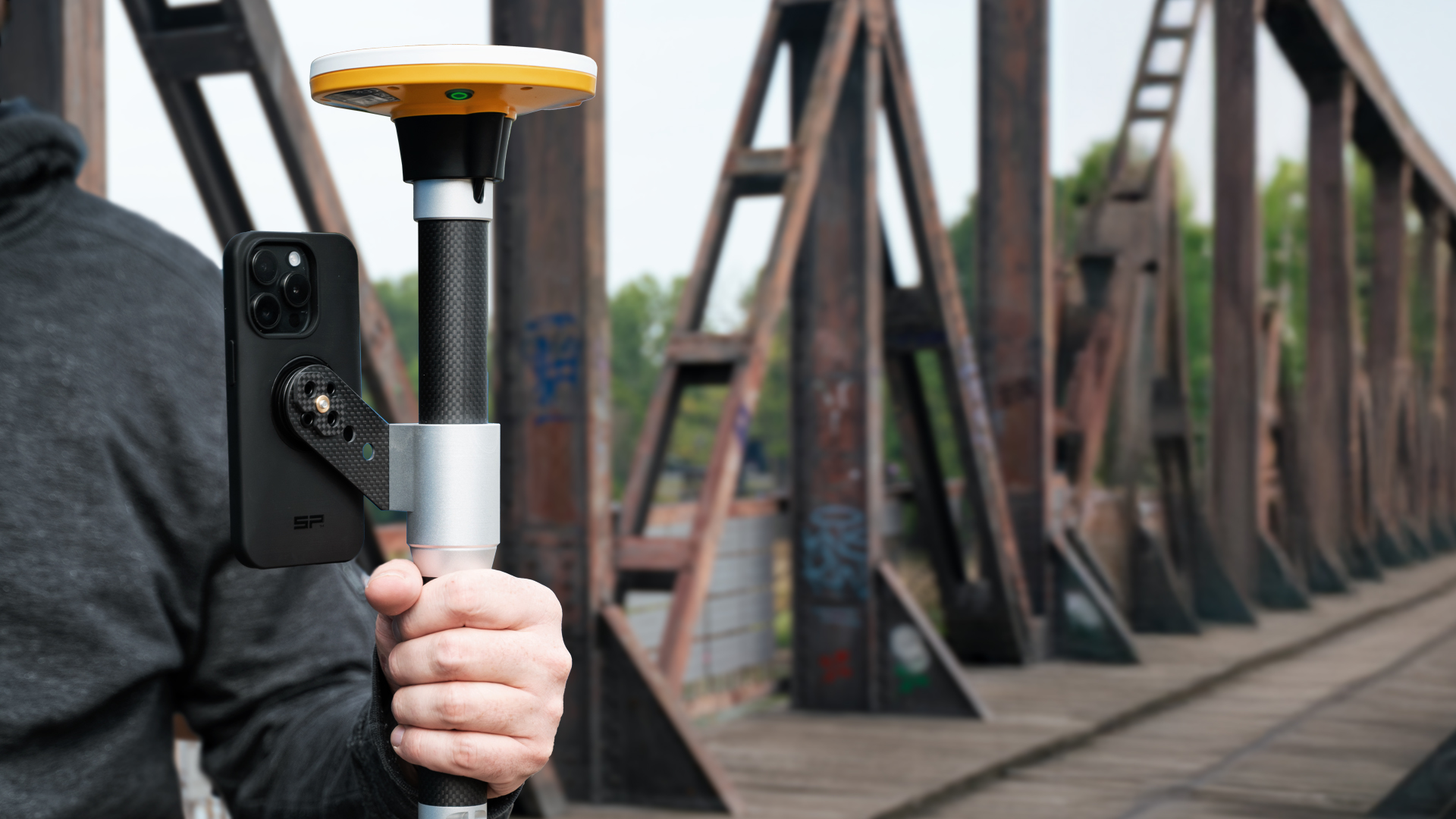
In infrastructure monitoring, such as bridges, roads or utility lines, survey teams can use the DotProduct software to create detailed 3D images and supplement them with the exact geographic coordinates of the Trimble DA2 Catalyst.
This provides a precise, true-to-life basis for as-built surveys, inspections and planning, making it easier to detect deviations or damage.
TitleMapping & GIS
In geospatial data processing, the combination of Trimble DA2 Catalyst and DotProduct can be used to create 3D mapping of complex terrain and structures.
The point clouds generated by DotProduct can contain centimeter-accurate GNSS data, allowing them to be integrated directly into geographic information systems (GIS). This enables more efficient analysis and decision-making in areas such as urban planning or environmental monitoring.
TitleAs-built documentation
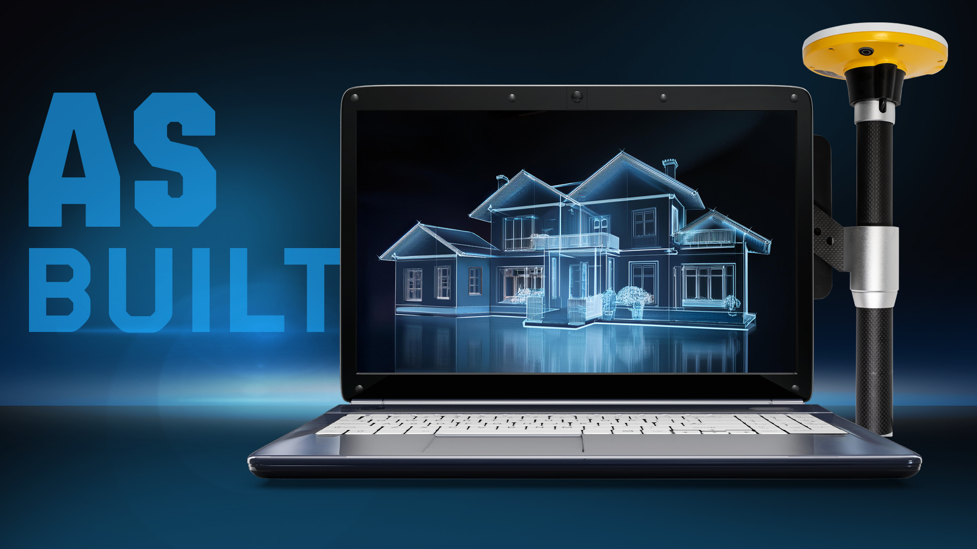
Architects and engineers can use the Trimble DA2 Catalyst with DotProduct to create accurate 3D scans of existing structures. This data is often used for as-built documentation to verify that the structure was built according to the construction plans.
Linking the 3D point clouds to exact geographic coordinates makes it easy to integrate this data into CAD software or other planning tools.
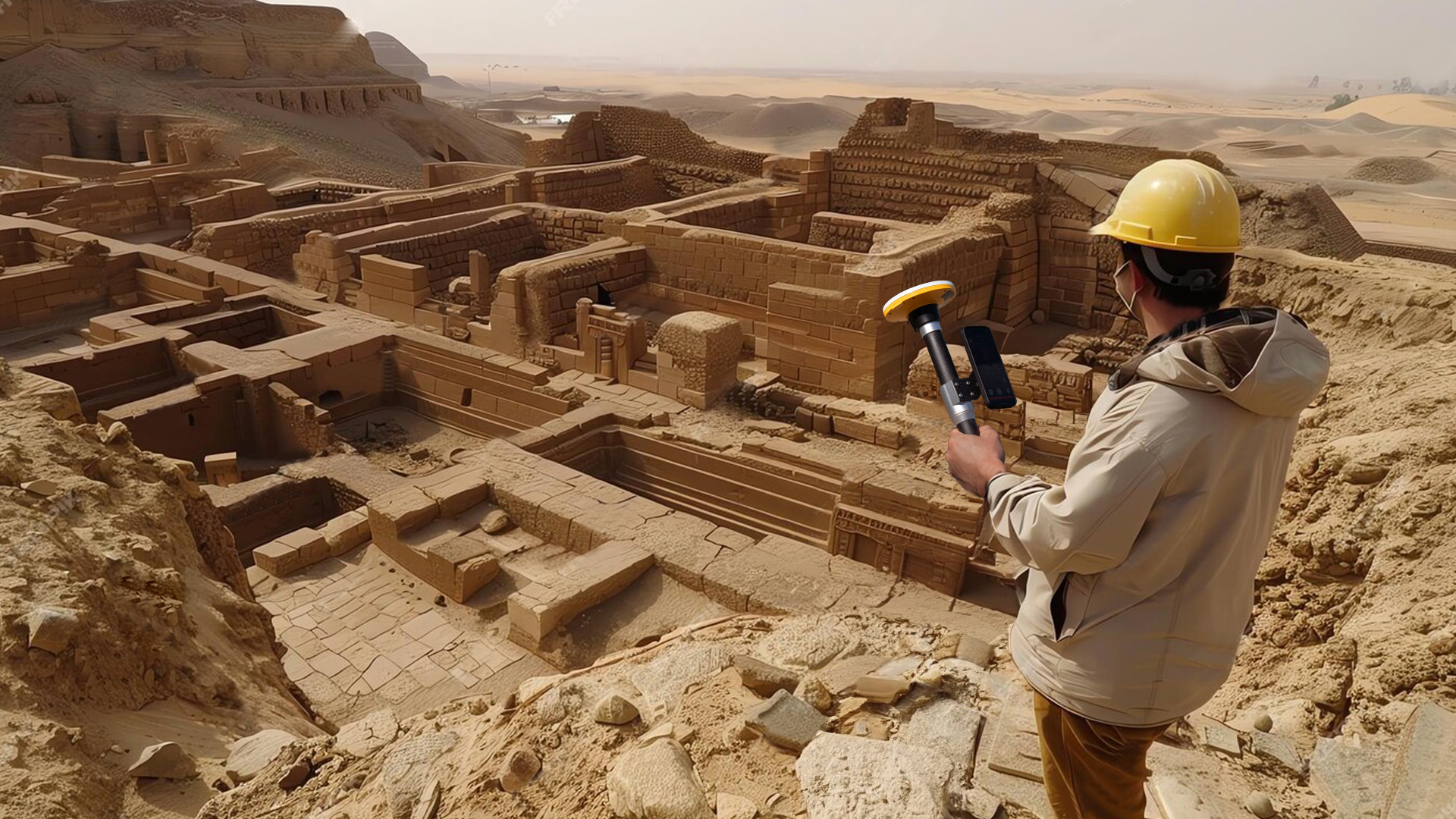
TitleArchaeology & cultural heritage management
In archaeology, the Trimble DA2 Catalyst is used to accurately map and document archaeological sites. With its help, archaeologists can determine the exact location of finds, excavations and historical structures. This is crucial for the documentation and protection of cultural heritage sites, as accurate geographical data can be collected on the location and condition of these sites.
Furthermore, the application with DotProduct helps to design color 3D models for virtual tours and presentations.
TitleEnergy & utility companies
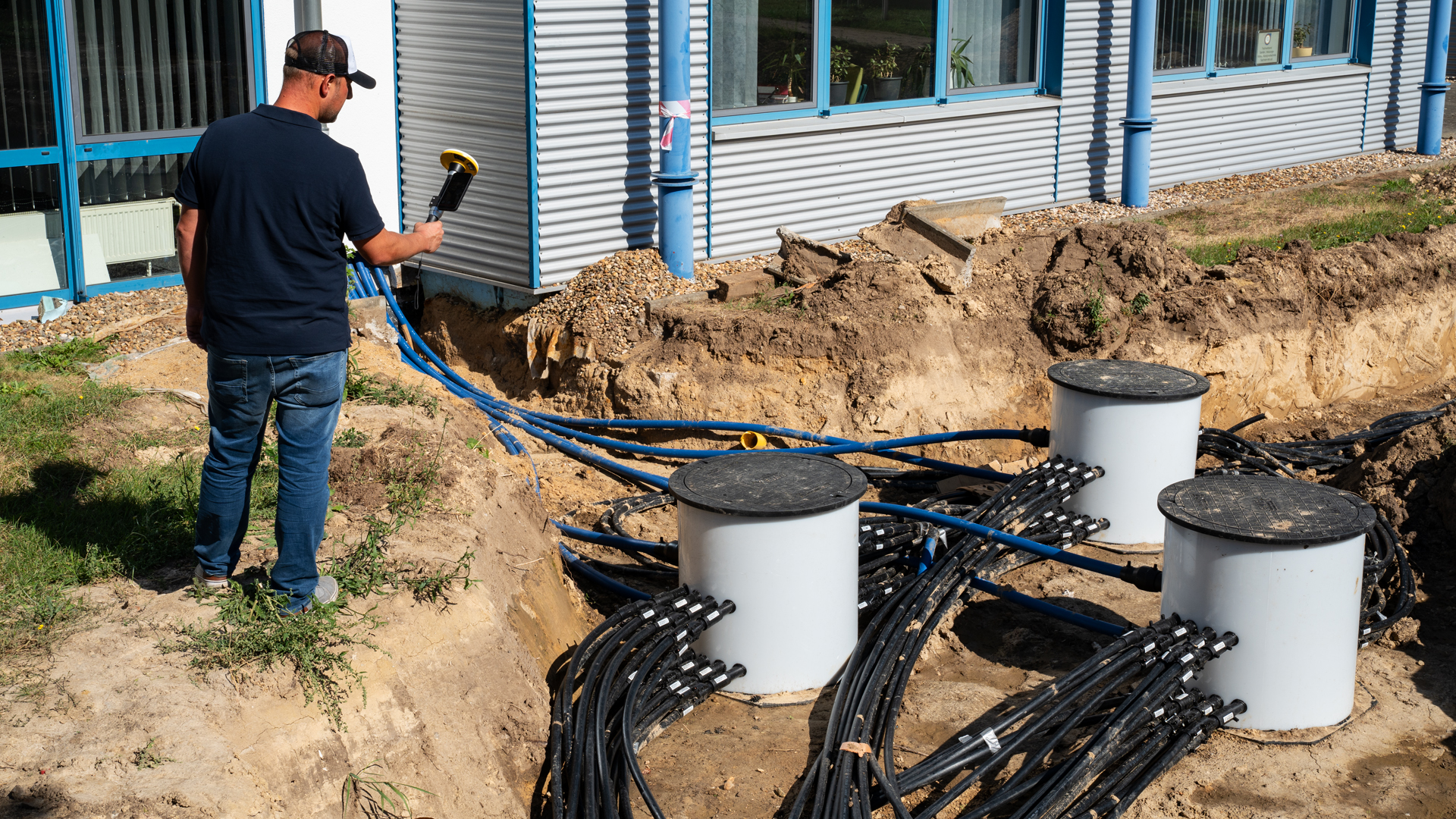
Utilities such as electricity, gas and water companies use DA2 Catalyst to monitor and manage their infrastructure. The location of pipes, cables and other underground structures can be carried out efficiently using DA2 Catalyst. This helps to prevent damage during construction work and optimize infrastructure maintenance.
When locating underground infrastructure, the captured data can be created with DotProduct 3D point clouds to provide a true-to-life visualization of the structures, which can then be integrated into planning software or GIS systems.

TitleAdvanced surveying technology
The integration of modern technologies into surveying and infrastructure management has made rapid progress in recent years.
One particularly powerful combination is the Trimble DA2 Catalyst, a high-precision GNSS receiver, and DotProduct software, a tool for capturing 3D data.
These two technologies work together to create accurate positioning data and three-dimensional images of structures.
TitleHow the Trimble DA2 Catalyst works
The Trimble DA2 Catalyst is a compact, portable GNSS receiver that can be connected to modern mobile devices such as smartphones and tablets. Its core function is to provide highly accurate GNSS positioning data that can be delivered with sub-meter to centimeter accuracy. This accuracy is achieved through the use of RTK (Real-Time Kinematic) correction data and access to various satellite navigation systems such as GPS, GLONASS, Galileo and BeiDou. The DA2 Catalyst processes the received GNSS signals to match them with correction data to precisely determine the user's position in a geodetic coordinate system.
The main advantage of the Trimble DA2 Catalyst is its flexibility and ease of use. Users can pair the device with a mobile device and the Trimble Catalyst app to capture GNSS data in real time.
TitleHow DotProduct works
The DotProduct software is a powerful solution for capturing 3D data in the form of point clouds. Point clouds consist of a large number of measuring points that digitally map the surface of objects or structures. These points contain information about the coordinates in a three-dimensional space and form a basis for the creation of 3D models.
Captured scan data is processed in real time with DotProduct and displayed on the mobile device. Point clouds can be exported and integrated into various planning software or geographic information systems (GIS). This allows real physical environments to be captured precisely and quickly.
TitleCombination of Trimble DA2 Catalyst & DotProduct
The combination of high-precision GNSS data from the Trimble DA2 Catalyst with 3D data from DotProduct offers numerous advantages for professionals in various industries.
This combination makes it possible to display three-dimensional point clouds precisely georeferenced in a global coordinate system.
TitleAdvantages of this combination
- Precise localization of structures
By integrating GNSS data into DotProduct's point clouds, captured 3D models can be linked to their geographical location down to the centimeter. This is particularly valuable for utility companies that need to map underground infrastructure such as pipes and cables. With this technology, companies can ensure that all captured structures are accurately represented on maps and in GIS systems. This contributes significantly to damage prevention during construction work, as the exact location of the infrastructure is known and accidental damage can be avoided.
- Increased efficiency in maintenance & inspection
The combination of centimeter-accurate GNSS data and detailed 3D point clouds greatly facilitates the planning and execution of maintenance and inspection work. Companies can capture precise inspection data that visualizes the condition of infrastructure such as pipelines, power cables or bridges. Georeferencing this data enables targeted and efficient maintenance, as technicians know exactly where problem areas are and what measures need to be taken. This reduces the time required for inspections while minimizing the risk of breakdowns.
- Real-time data collection & mobility
A key advantage of these technologies is their mobility and the ability to capture data in real time.Both systems – the Trimble DA2 Catalyst and DotProduct – can be used with a mobile device, allowing for flexible and location-independent use.This is particularly important in areas such as construction, where survey teams need to respond quickly and efficiently.In addition, site managers and engineers can review the data directly on site and make decisions in real time, significantly increasing project speed.
TitlePositive integration of DotProduct in Trimble DA2 Catalyst
The integration of DotProduct into the Trimble DA2 Catalyst system proves to be particularly beneficial as both technologies work seamlessly together. The high-precision GNSS data from DA2 Catalyst complements DotProduct's 3D point clouds by adding a geo-referenced dimension to them. As a result, the point clouds are not only used as isolated 3D representations, but can be placed in geodetic systems, which significantly expands their applicability.
Another advantage is the user-friendliness of both systems. Trimble Catalyst's mobile application and DotProduct's real-time processing make it easy to capture accurate data on site without the need for extensive post-processing. This saves time and reduces the complexity of capturing and managing geospatial data.
In addition, the collected data can be easily integrated into other planning and analysis platforms. DotProduct's point clouds can be easily imported into CAD software, GIS systems or Building Information Modeling (BIM), making the planning and management of construction and infrastructure projects much easier.
TitleSpecifications
GNSS performance
| Position accuracy | Height accuracy | Positioning rate | |
|---|---|---|---|
| SBAS | 0.6m (std. dev.) | 1.2m (std. dev.) | - |
| Code-differential DGPS position accuracy | 0.3m + 1ppm (std. dev.) | 0.6m + 1ppm (std. dev.) | - |
| Single baseline (<30km) RTK | 10mm + 0.5ppm (std. dev.) | 20mm + 0.5ppm (std. dev.) | - |
| Netzwork RTK | 10mm + 0.5ppm (std. dev.) | 20mm + 0.5ppm (std. dev.) | - |
| Trimble RTX (via Trimble Corrections ub) | 2cm (std. dev.) | 5cm (std. dev.) | 1 Hz, 5 Hz, 10 Hz |
Static GNSS surveying
Static and short-term static (Fast Static)
Position: 3mm + 0.5ppm RMS
Height: 5mm + 0.5ppm RMS
Post-processing kinematics centimeter/decimeter configurations
Horizontal accuracy: 10mm + 1ppm RMS
Vertical accuracy: 20mm + 1ppm RMS
Signal tracking
- Trimble ProPoint GNSS positioning technology for increased accuracy and productivity in challenging GNSS conditions
- GPS: L1C/A, L2C, L5
- GLONASS L1C/A, L2C/A
- SBAS: L1C/A, L2C, L5
- Galileo: E1, E5A
- BeiDou: B1l,B1C, B2A
- QZSS: L1C/A, L2C, L5
- NacIC (IRNSS): L5
- Digital channels: All supported signals in the field of view, software-controlled
| Mechanical data and communications | |
|---|---|
| Mechanical data | |
| Dimensions (diameter x height) | 128x55mm |
| Weight | 330g |
| IP class | IP65 (dustproof, rainproof) |
| Drop, shock & vibration | Withstands tipping from a height of 2m. Withstands a free fall from a height of 1.2m onto concrete. Withstands vibrations & mechanical shocks (MIL-STD-810G test method) |
| Supported platforms | |
| Android | Android 5.0 (Pie) and higher |
| iOS | iOS 13.0 and higher |
| Communications/Connections | |
| Bluetooth | 4.2 |
| Apple | Certification: “Made for iOS” |
| Connections | USB-A (power only) |
| Data protocols | NTRIP, VRS, RTCM 3.2 MSM, CMRx, DCOL |
| Position output | NMEA (LLH), DCOL; Android location detection, Apple location detection, Android location detection extras |
| Battery and power supply (external USB battery pack required) | |
| External power supply input | USB-A (5V, 1A) |
| Power consumption | 2.0 to 2.5W |
| Environmental conditions | |
| Ambient temperature during operation | -20°C to +60°C |
| Storage temperature | -40°C to +70°C |
| Operating humidity | 95% relative humidity, non-condensing |
| Operating altitude | Tested up to 9000m |
Better advice for users
Are you interested in our offer or would you like to find out more about The Trimvble & DotProduct scanning kit? Then give us a call today and arrange a free, non-binding consultation. We will answer all your questions. As both a dealer and a user, we are ideally positioned to support you after your purchase.