Laser Scanning & Modeling in Construction & Architecture

TitlePrecision & efficiency: 3D scanning in architecture & construction
Modern 3D scanning technology is revolutionizing architecture and the construction industry. Laser scanners can be used to digitally capture buildings, structures and construction sites with millimetre precision – ideal for as-built surveys, BIM models and building documentation.
Thanks to fast and high-precision data capture, architects, engineers and construction companies can create exact 3D models of existing structures. This enables more efficient planning, reduces sources of error and simplifies renovation and conversion projects.
Whether new construction, renovation or monument protection – 3D scanning optimizes planning, visualization and construction processes. The use of state-of-the-art laser scanners makes construction projects more efficient, safer and more economical.
TitleFunctions of laser scanning in architecture & construction
1. Surveying & inventory
2. Construction planning & design
3. Supervision of construction projects
4. Safety & risk analysis
5. Land surveying & infrastructure projects
6. Renovation & refurbishment
7. Creation of documentation
8. Visualisation & simulation
TitleLaser scanner for as-built surveys
Digital data as the key to precise planning.
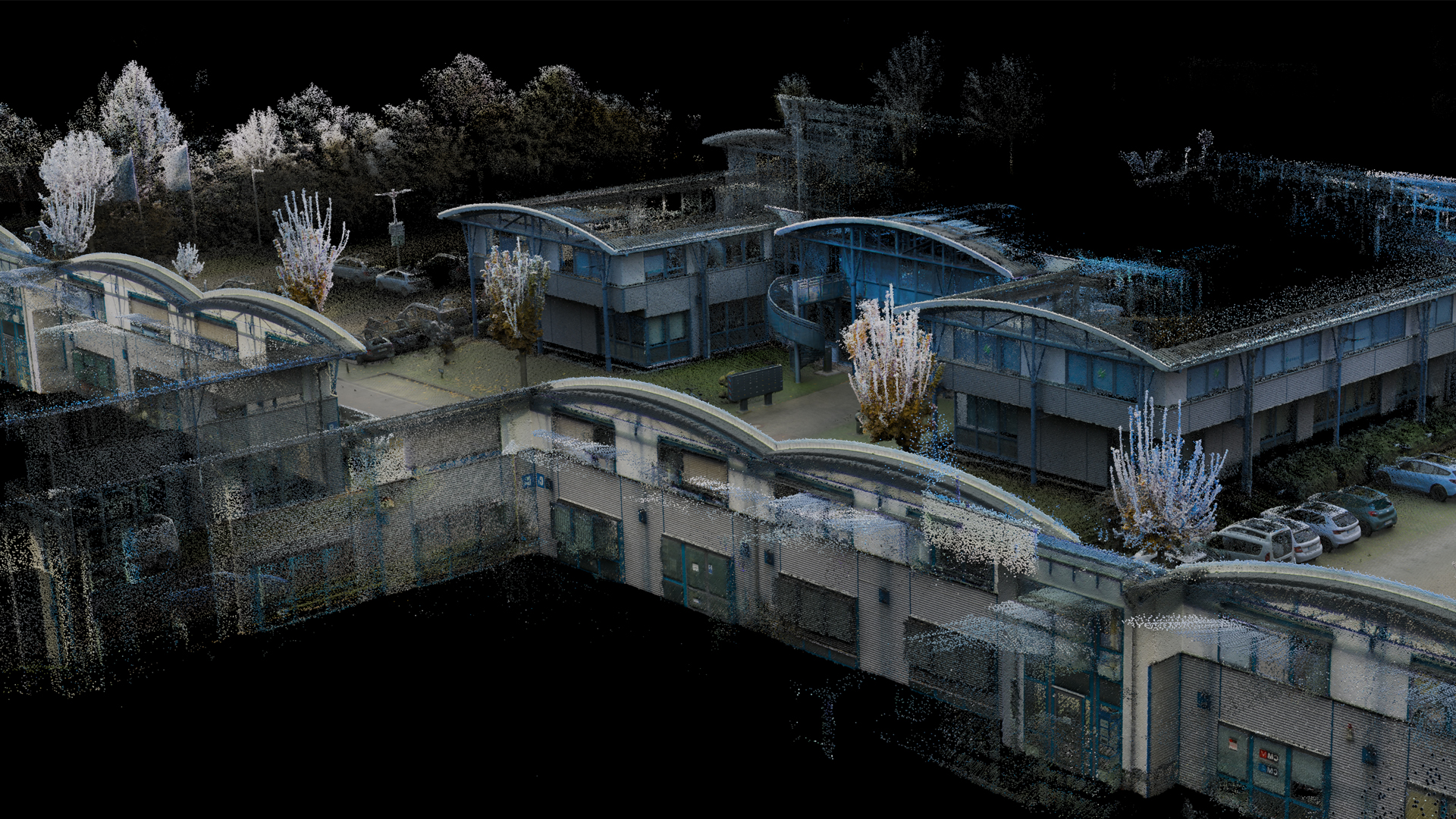
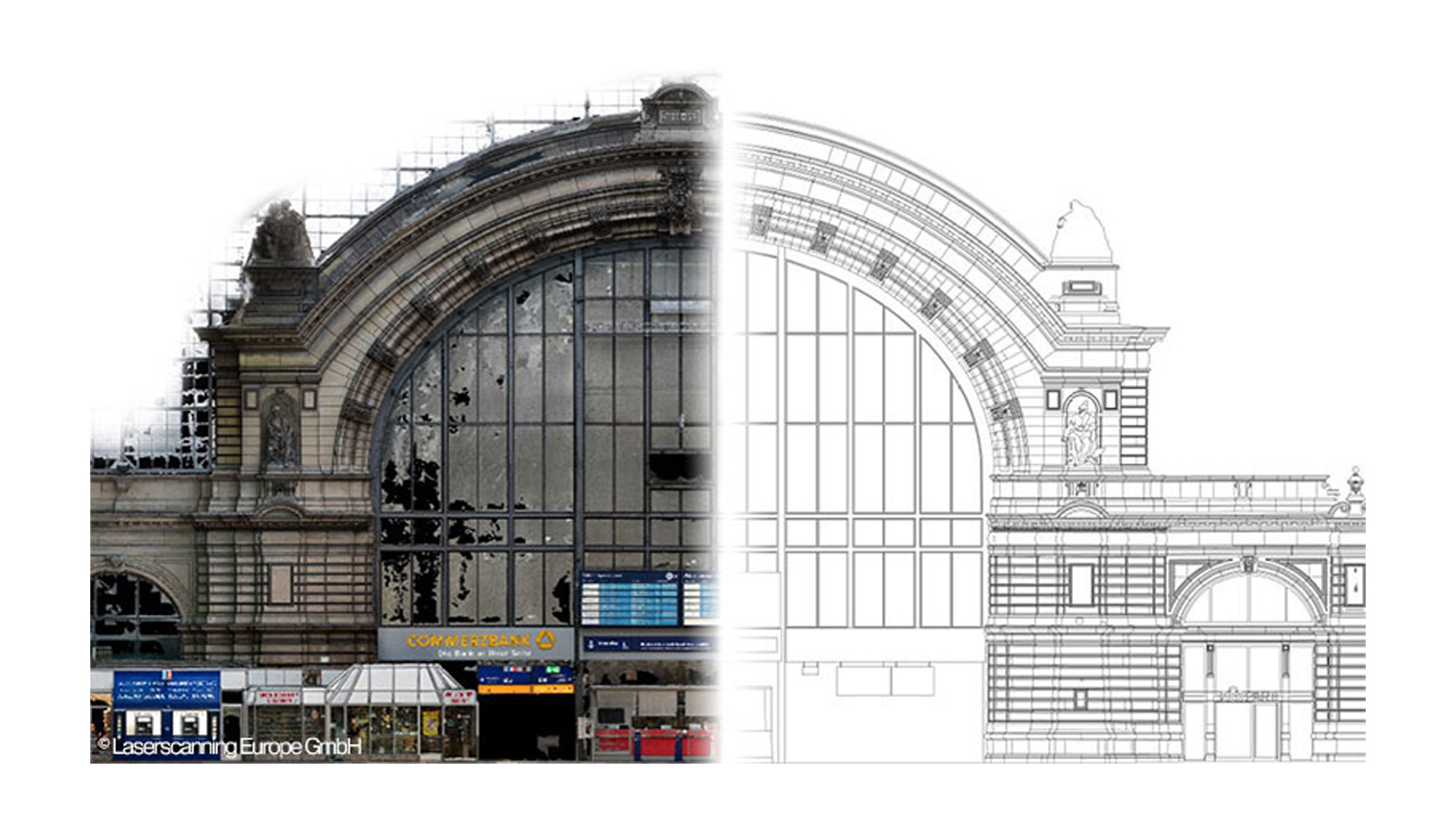
As-built surveys are a central component of many construction projects, especially for conversions, renovations or new builds. Laser scanners make it possible to capture existing buildings, structures or terrain with millimeter precision. The three-dimensional recording creates so-called point clouds, which serve as the basis for detailed analyses and planning.
In addition to as-built surveys, laser scanners are also used in
- Monument preservation: For surveying historical buildings and detailed documentation of complicated structures and ornamentation.
- Planning and design: Integration of laser scanning data in building information modelling (BIM), as well as support for architects when planning new buildings in existing environments.
- Quality control: Checking whether buildings comply with plans and specifications.
- Urban planning: To create 3D city models, analyse urban infrastructure and simulate construction projects.

TitleBuilding in existing structures
Innovative capturing. Efficient planning. Sustainable implementation.
Construction in existing buildings is a frequent area of application for laser scanning. Existing buildings often lack complete and up-to-date plans, and regular geometries are not available.
Laser scanners offer an ideal solution here, as they enable the building structure to be digitally captured with millimeter precision. Areas that are particularly difficult to access, such as roof structures, can be scanned from a distance.
Compared to conventional measuring methods, laser scanning is a much more efficient and accurate alternative that saves time and resources.
TitleSurveying methods in 3D scanning: Which technology is right for your construction project?
Different 3D scanning technologies are used depending on the project requirements and environment. Choosing the right method is crucial for the accuracy, speed and efficiency of data capture. Here is an overview of the most important methods:
TitleDifferent methods for data collection
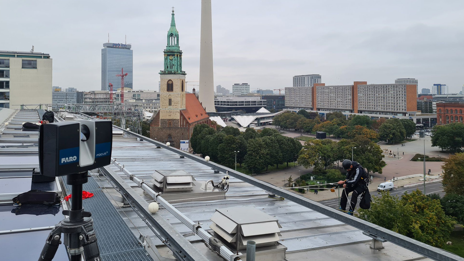
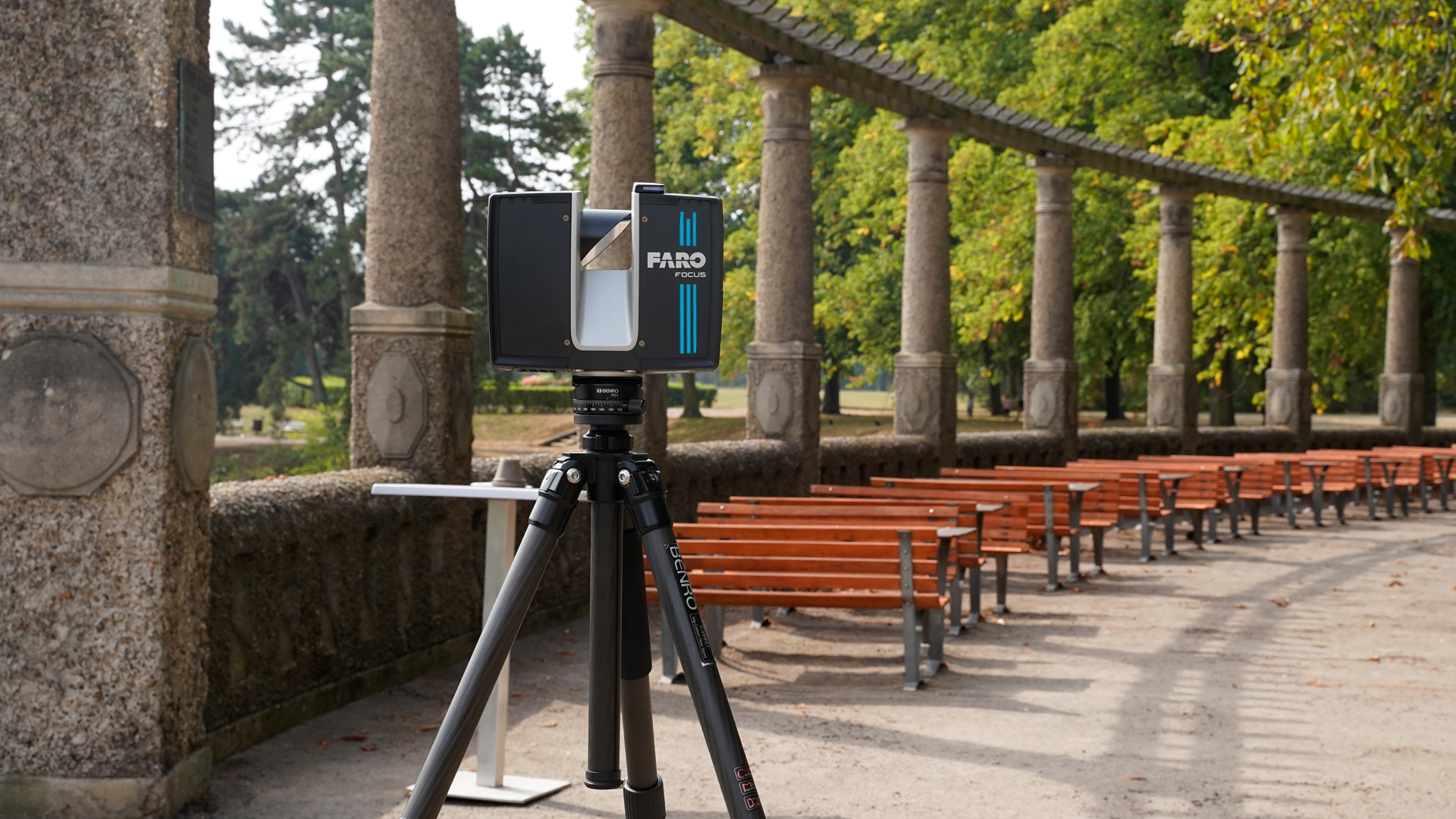
Terrestrial laser scanner – Precise & detailed as-built surveys
Terrestrial laser scanners (TLS) such as the FARO Focus are used in stationary applications and capture objects with maximum precision. They are particularly suitable for detailed images of facades, interiors and complex buildings. Their high accuracy makes them ideal for projects where the smallest details need to be captured.
Advantages:
- Very high accuracy in the millimeter range
- Highly detailed capture of complex geometries
- Ideal for indoor & outdoor areas

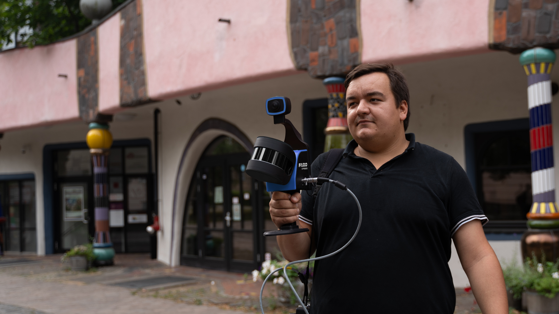
Mobile laser scanner – Fast & flexible surveying
Mobile scanners such as the FARO Orbis or the XGRIDS scanner can be used flexibly and offer the possibility of capturing large areas in a short time. They are ideal for dynamic applications and are ideal for surveying large areas or indoor spaces where mobility is required.
Advantages:
- Fast data capture in real time
- Flexible and mobile use
- Easy operation, no complex installation
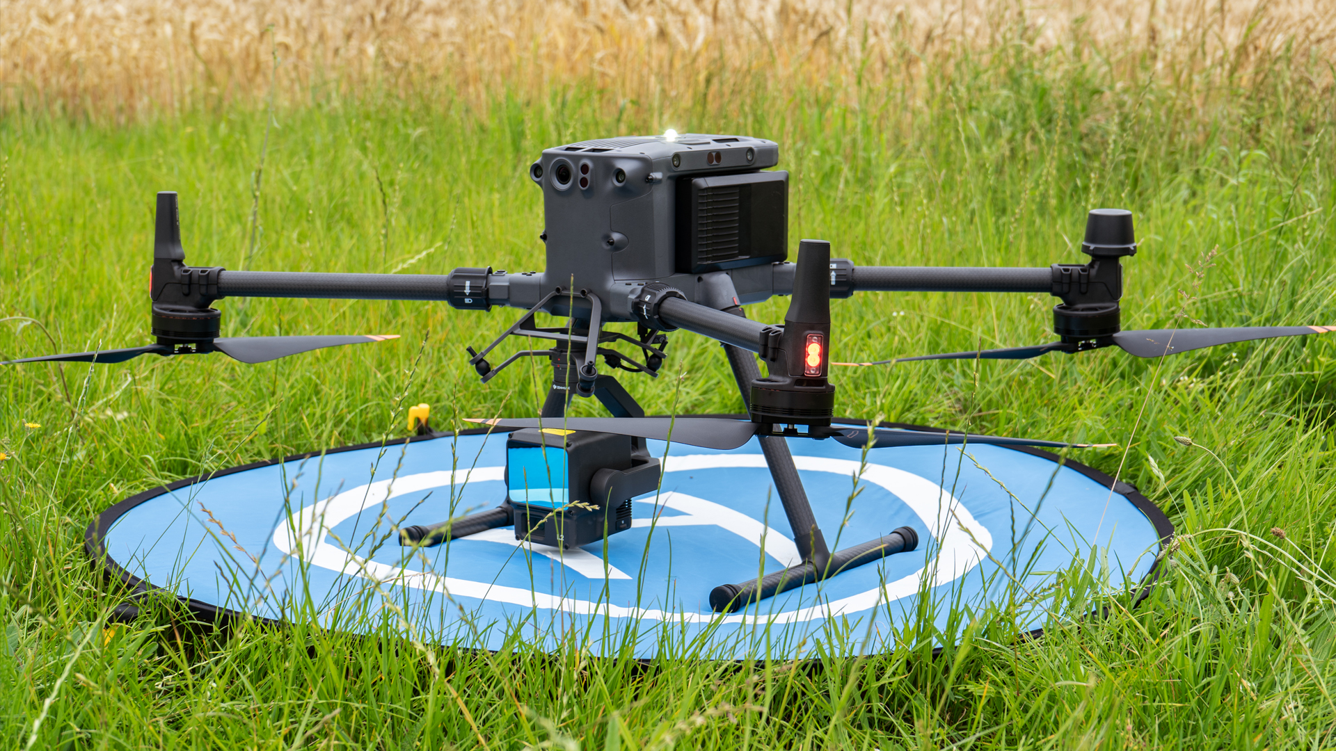
UAV-based scanners and photogrammetry – the perfect solution for large areas
The use of UAVs, for example with DJI technology, combined with photogrammetry, makes it possible to capture areas that are difficult to access, such as roofs or high facades. This method is particularly efficient for large and complex buildings. UAV-based scans can also be used in rough terrain and deliver impressive results.
Advantages:
- Fast surface surveying from the air
- Particularly suitable for inaccessible areas
- High efficiency in as-built documentation
TitleHow are point clouds generated?
The point cloud is at the heart of laser scanning. The scanner measures millions of points in a space and saves their exact position in a 3D coordinate system. The point cloud thus consists of millions of individual measuring points that precisely represent the surface of an object or building.
This data forms the basis for ...
- 3D models
- BIM models (Building Information Modelling)
- 2D plans such as floor plans, sections or façade plans.
Due to the high density of the point clouds, even the smallest details can be depicted. In addition, deformations, deformations or flatness of a building can be precisely analyzed.
TitleCapture & edit scan data
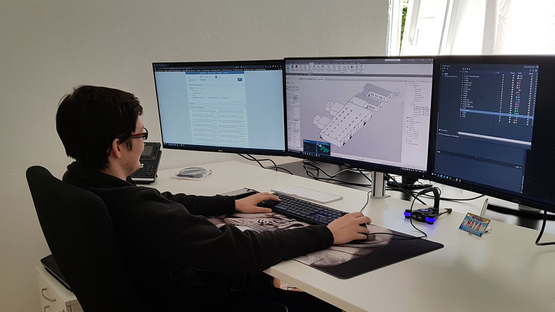
Processing the scan data is an essential step in order to benefit from the information collected. With the help of modern software, the point clouds are...
- cleaned up and optimized,
- converted into various formats,
- prepared for specific areas of application.
The data can be further processed with special software solutions to create a complete 3D model. Typical file formats are e.g:
- E57, LAS, XYZ → Exchange formats for point clouds
- OBJ, STL, FBX → 3D model formats for CAD software
- RCP, RCS (Autodesk ReCap) → Compatibility with BIM software
Further processing of the data creates precise digital models that can be used for further planning, simulation and analysis.
TitlePoint cloud - and what next?
A point cloud is the first step in the digital capture of a building or an environment. But what happens afterwards? Based on the 3D scan data, a wide range of results and further processing can be derived that are crucial for architecture, construction and engineering projects.
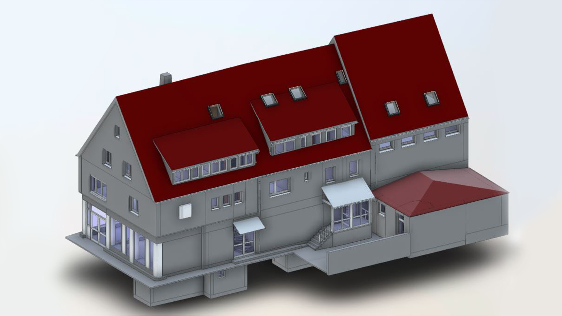
3D models of buildings & structures
3D models offer a realistic representation of buildings. They are ideal for visualisations, planning or the virtual inspection of a building. Architects and engineers benefit from the ability to view the building precisely in all dimensions.
BIM models
Building Information Modelling (BIM) uses laser scanning data to create intelligent digital twins of buildings. These models not only contain geometric information, but also specific data on materials, construction elements and functions. BIM models are a central building block for modern construction project management.
Areas of application:
- Creation of a digital twin for planning & simulation
- Collision checking & early error detection
- Optimized construction processes through digital collaboration
2D plans
Floor plans, longitudinal and cross-sections as well as façade plans are created on the basis of the scan data. These plans are precise and contain all the relevant information required for construction projects.
Areas of application:
- Creation of exact as-built plans of buildings
- Derivation of 2D views & sections for construction planning
- Optimization of conversions & renovations
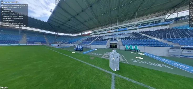
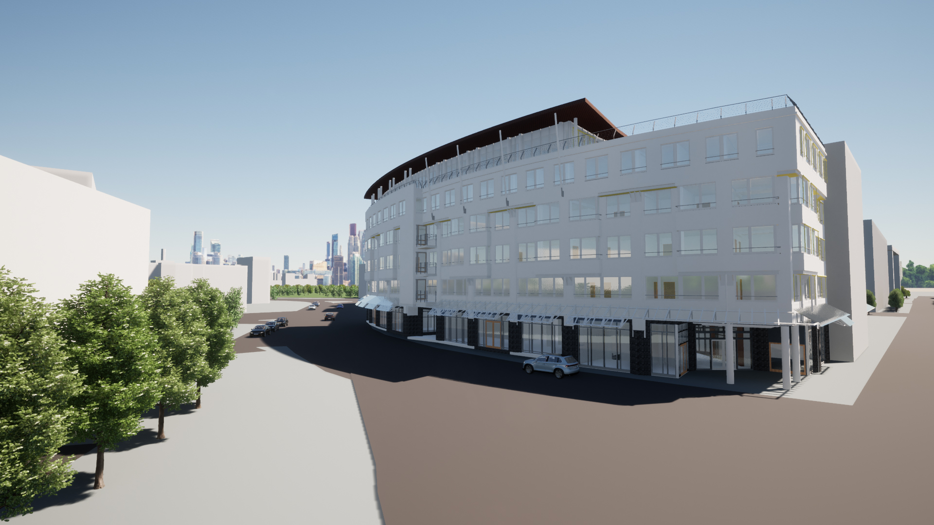
3D visualization & Virtual Reality
Realistic 3D visualizations (e.g. video animations, 3D tours) or walk-in VR models can be created based on point clouds. This enables better planning & presentation of construction projects.
Impressive 3D models & renderings offer a unique opportunity to make architectural projects tangible.
Areas of application:
- Virtual site inspection & presentation for customers
- Architectural visualization for rendering & animation
- Support for heritage protection & urban planning
Structural monitoring & deformation analysis
By comparing point clouds from different points in time, deformations and damage to structures can be detected. The precise condition analysis enables early maintenance.
Areas of application:
- Inspection of settlements & cracks in buildings
- Documentation of construction progress & quality control
- Analysis of bridges, tunnels & high-rise buildings

TitleLet us support you!
Laser scanning offers a wide range of benefits for the construction and architecture industries. From millimetre-precise capture and the creation of detailed models to the analysis of deformations - the technology increases the efficiency and accuracy of modern construction projects.
Do you need help with your projects? We will be happy to help you.
We offer the following services, among others:
- Data capture using a 3D laser scanner
- Analysis of the scan data (point clouds)
- 3D models of buildings and structures
- BIM models of buildings
- 2D plans (floor plans, longitudinal sections, cross-sections, elevations, façade plans)
- Determination of flatness or deformations as well as deformations
- Various training courses on laser scanners and software