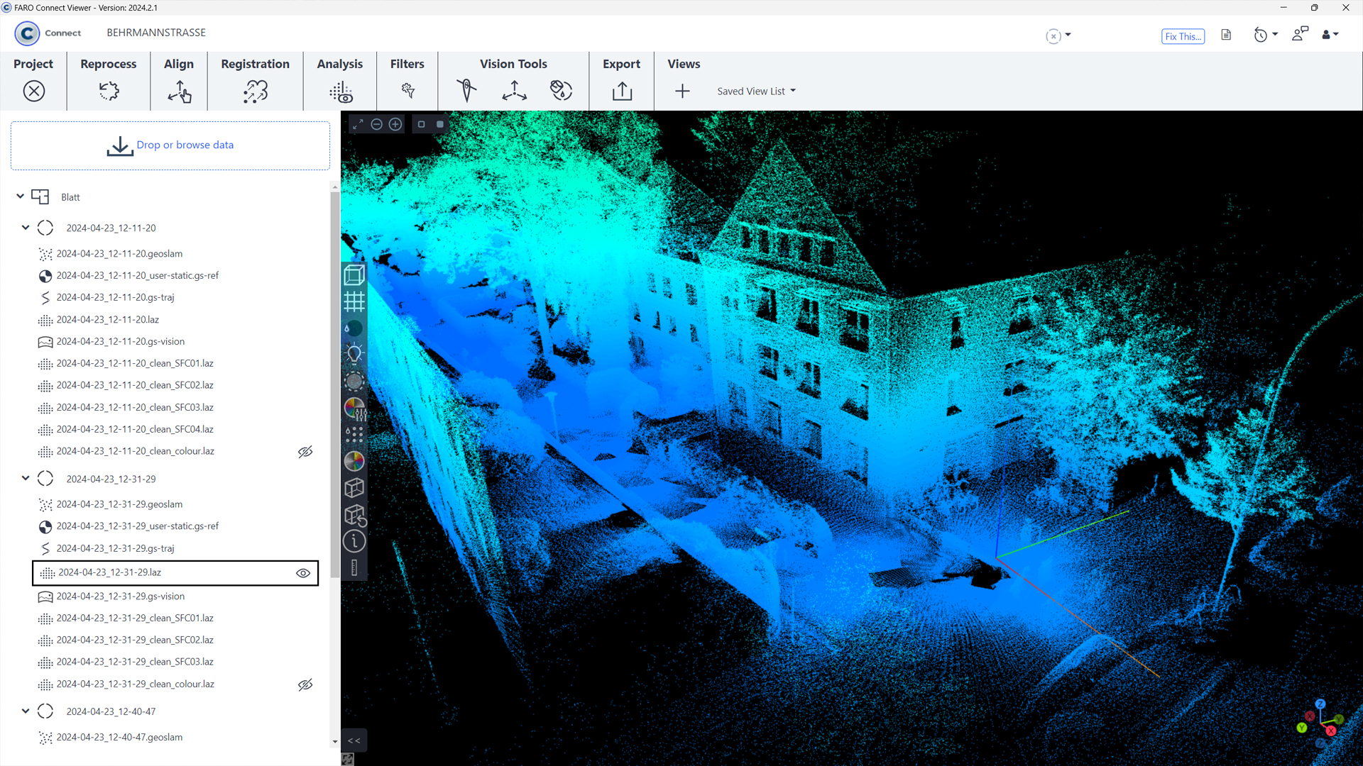
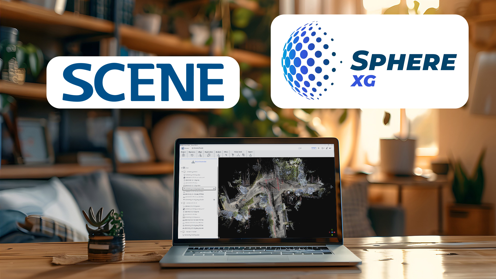
FARO Connect

TitleComprehensive processing software for the FARO Orbis
Do you own a FARO Orbis and want to process the data from the hybrid scanner in the best possible way? FARO Connect allows you to extensively process and analyze the 3D point clouds and image data you have captured and then view or export them on the FARO Sphere XG cloud platform.
In addition, the automated workflow saves you a lot of time when processing the scan data, which of course also reduces the cost factor. To further optimize your FARO Orbis data, there are a number of automatic filters for outliers, noise, thinning and more that you can use to clean up your point cloud.
TitleFeatures of the desktop solution FARO Connect!
Data processing and property
FARO Connect enables up to 50% faster local data processing without compromising on data quality. Users retain full control over their data and can process it as often as needed. Alternatively, point cloud data can be easily uploaded to the Sphere XG Reality Capture solution to improve collaboration with other stakeholders. Flexible processing and storage without third-party involvement promotes more secure and transparent collaboration.
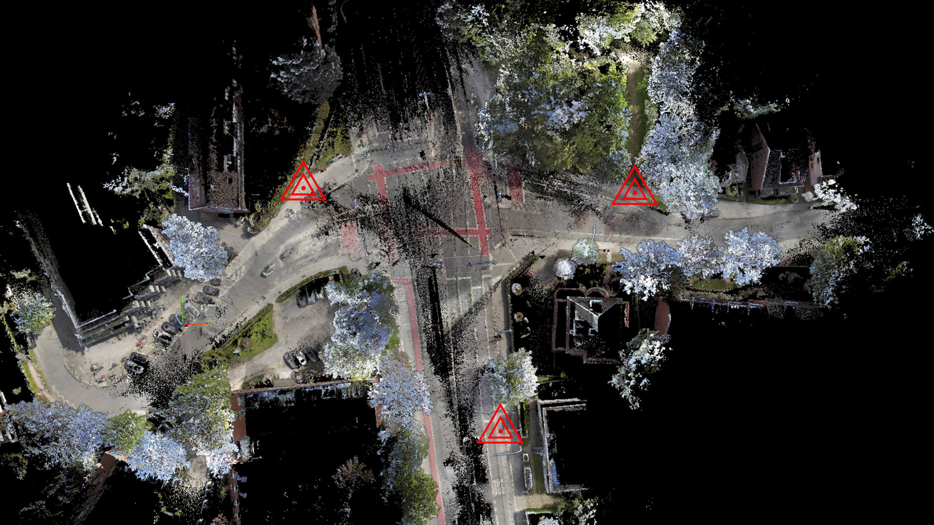
Automatic georeferencing
Use reflection targets or control points to georeference 3D point cloud data in FARO Connect. The software automatically recognises these targets and uses their positions to locate the point cloud in real space. Alternatively, you can briefly point the scanner at a known control point, whose information is then saved in the 3D point cloud.
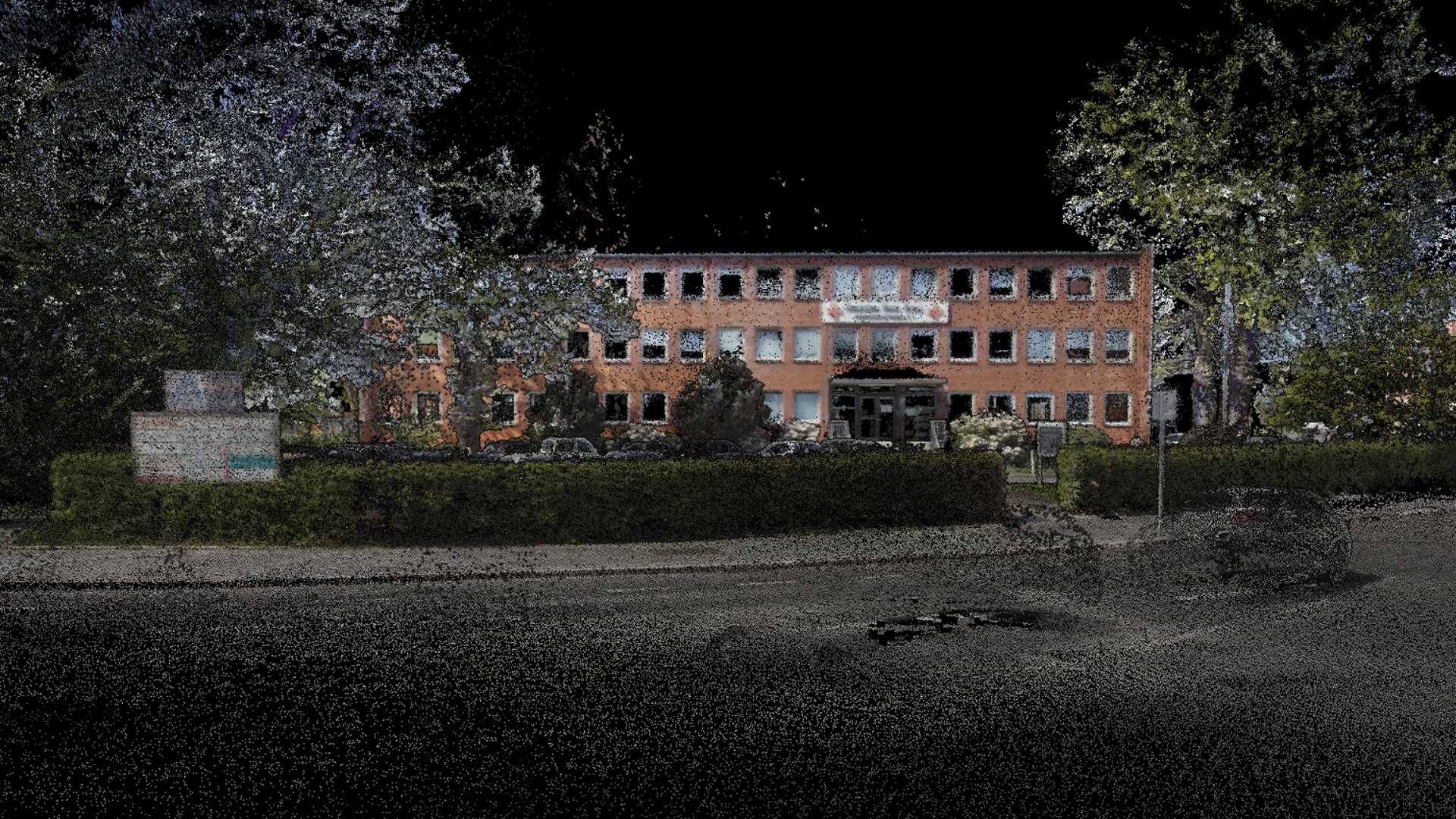
Automatic colorization of point clouds
Use the FARO Orbis integrated camera to capture panoramic images and colorize your 3D point cloud data in FARO Connect RGB. In a single automated workflow, Connect processes your data, creates panoramic images, positions them over your point cloud and colorizes the data set.
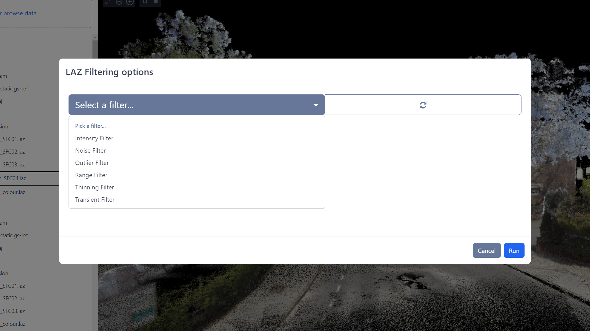
Automatic data filtering
FARO Connect offers a range of automatic filtering tools to help you get the best results from your point cloud data. These include filtering out outliers, reducing surface noise and removing transient points to improve data output. The filter tools are integrated into Connect and can be automatically applied to any data set.
TitleTools & workflows
SLAM process
The SLAM workflow allows you to fine-tune processing parameters for demanding capturing conditions. After the initial processing with standard parameters, you can use this workflow to adjust the settings and run SLAM again if the result was not satisfactory.
Alignment
The alignment workflow enables the alignment of multiple point clouds by providing various tools for manual selection and alignment of common user-selected points between scans. A fine alignment procedure is also available and requires that all required scans are accurately aligned at the start of the procedure.
Analysis
There are three analysis workflows for the project dataset, depending on the desired output results:
Detection of changes:
Compares point clouds from scans of the same location at different points in time to highlight differences. Objects or surfaces in the output are colored to visualize the detected changes.Floor slices:
Creates a scaled PNG image of a slice through the point cloud at a specified height above the ground.Static Scans with Flash:
Analyzes Orbis scans and automatically creates static scans at the locations where the scan person stopped. These scans are enriched with flash and color data.Registration
Five registration workflows allow you to easily align two data sets:
Reflective Target Alignment, Reflective Target Georeferencing & Stop and Go Alignment:
Utilize a rigid transformation to align the point cloud to the control points of the reference scan.Stop and Go georeferencing workflow:
Can use a rigid or non-rigid transformation by reprocessing the original data with the SLAM algorithm to match the trajectory to the control points.Filters
Once you have processed the data and confirmed the output, you can apply additional filters to further reduce and cleanse the data. The following workflows are available for this purpose:
Noise:
Removes protruding data points on flat surfaces, ideal for environments with such features as walls.Outliers:
Removes outliers that can be caused by various factors such as rain or dust.Area:
Removes less dense and inaccurate points furthest from the scanner based on their distance from the trajectoryThinning:
Reduces point density uniformly to reduce the thickness of scanned surfaces based on a user-defined grid method.Temporary:
Identifies temporary points created by movement of people or vehicles during detection.Vision tools
You can use the image processing tools to further optimize imported scans:
Stitch Vision Images:
Generates panoramic images from the scan images and creates a timing file to calculate the camera positions.Calculate Vision Camera Positions:
Calculates the exact camera position and orientation for aligning images and point cloud data.Colorize Cloud Using Vision:
Extracts color information from the images and adds it to the point cloud data to create a colorized .laz file with RGB information.Export
Users can export project artifacts in various formats to import them into other applications such as FARO SCENE:
Point clouds:
Exported in .laz format, compatible with .e57, .las, .laz, .ply or .txt.Control points / reference points:
Can be exported as .txt.Static scans:
Exported as .e57 structure, suitable for import and analysis in FARO SCENE.
TitleFurther processing with FARO Sphere XG
FARO Sphere XG is a cloud-based digital reality platform that provides users with a centralized, collaborative experience for all of the company's 3D reality capture and modeling applications. In conjunction with FARO Connect, scan data can be processed with a series of automated workflows and filters and then uploaded to the cloud.
TitleSystem requirements
Minimum requirements
Processor: Intel i7 7th generation or AMD Ryzen 7 (1700X)
Operating system: Windows 10 (32 & 64 bit)
RAM: 64 GB
Storage capacity: 512 GB SSD (100 GB free)
Graphics card: Integrated graphics card
Recommended
Processor: Intel i9 12th generation or AMD Ryzen 9 (3900X/5900X)
Operating system: Windows 10 (32 & 64 bit)
RAM: 128 GB
Storage capacity: 1 TB NVMe M.2 (100 GB free)
Graphics card: NVIDIA RTX 3060 or better
TitleScanner Compatibility
- FARO Orbis
- ZEB Horizon
- ZEB Horizon RT
- ZEB Vision
- ZEB GO
- ZEB REVO
- ZEB REVO RT
TitleCompatible formats for FARO Connect
FARO Connect offers you the option of importing a wide variety of file systems, processing them further and uploading them to FARO Sphere XG, for example.
TitleImport formats
Type of data | File format |
Raw scan data: Processed scan data: Meta data: Parameters: Calibration: | .bag, .geoslam .laz, .json, .ymal .json .yaml .yaml |
TitleExport formats
Type | File format |
Displayable output files: Point cloud export: | .laz, .gs-traj, .gs-vision and other files with a .gs file extension .e57, .laz, .las, .ply, .txt |
TitleMore software solutions
Would you like to register your processed data or share it with your employees? FARO also offers a solution for this. After you have processed your scan data with filters in FARO Connect, you can then transfer and register it in FARO Scene. For collaboration or presentation with clients and colleagues, you can upload your projects to the FARO Sphere XG cloud solution and access them from anywhere.
TitleWhere is FARO Connect used?
Thanks to the versatile automatic workflow, filters and tools, FARO Connect can be used in many industries. The software covers the following areas of application:
- 3D inspection
- Construction and architecture
- Construction progress monitoring
- As-built documentation
- Digital planning
- Crime scene documentation
TitleAnalyze FARO Orbis scan data in FARO Connect!
In this video we present a special area of application: scanning in snow. Of course, this is no problem for the FARO Orbis. Eric Bergholz, CEO of Laserscanning Europe GmbH, went out into the cold and scanned a bridge with the FARO Orbis. The scanner's flash function proved to be extremely helpful. The captured data was then analyzed in detail using the FARO Connect software and PointCab.
Better advice as a user
Are you interested in our offer or would you like to find out more about the FARO Connect software? Then give us a call today and arrange a free, no-obligation consultation. We will answer all your questions. As both a dealer and a user, we are ideally positioned to support you even after your purchase.