Base and Rover GNSS systems

TitleBase & Rover systems - What you need to know
GNSS (Global Navigation Satellite System) systems play a central role in the field of precise surveying and positioning. In particular, the combination of Base and Rover units is widely used for projects in surveying, agriculture and construction.
We explain what is behind Base and Rover systems, how they work and what possible applications there are.
We also present the GNSS devices from Emlid, which offer a powerful and cost-effective solution for these applications.
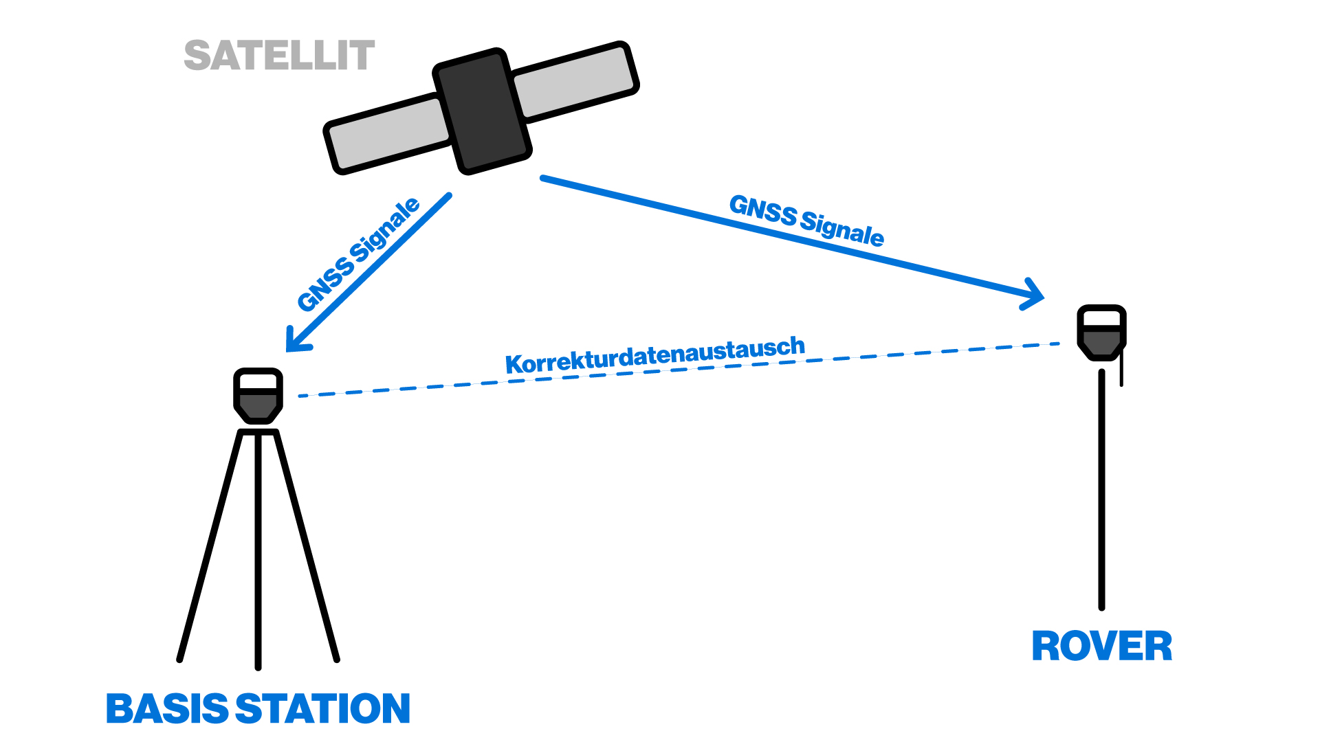
TitleHow does a Base Rover system work?
A Base-Rover system works according to the principle of differential GNSS (DGNSS) or RTK (Real-Time Kinematic) measurement. The Rover's position data is improved by corrections that are determined by the Base and sent to the Rover.
The Base receives the signals from satellites, calculates its own position and detects inaccuracies caused by atmospheric interference or signal delays. These errors are passed on to the rover, which adjusts its position accordingly.
TitleCompatible devices for Base and Rover
| Base | Rover | |
|---|---|---|
Pair of devices for Base-Rover combination | Reach RS2 Reach RS2+ Reach RS3 | Reach RS2 Reach RS2 Reach RS2 |
TitleFields of application
- Agriculture (precision farming)
GNSS Base-Rover systems play a key role in precision farming. They enable the precise measurement of fields, the optimization of sowing and harvesting processes and the control of agricultural machinery. In combination with drones and GNSS-controlled tractors, yields can be increased and resources used efficiently. - Construction & surveying
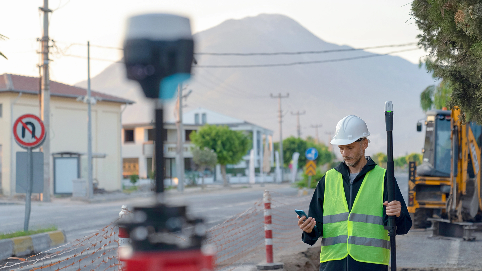
When constructing infrastructure projects such as roads, buildings or bridges, surveying with millimeter precision is required. Base Rover systems ensure that the position of structures and machines is precisely determined in order to avoid deviations. - Geodesy & mapping
Geodesists and mapmakers use Base Rover systems to create precise topographical maps and capture terrain profiles. The data is used in GIS systems to create land use plans or monitor natural resources. - Forestry & environmental monitoring
In forestry, Base Rover systems can be used to accurately measure forests, inventory trees and monitor forest growth. They are also useful in environmental monitoring, e.g. for detecting soil erosion or flood plains.
TitleWe rely on Emlid GNSS solutions
Emlid's GNSS devices, such as the Emlid Reach RS3 and Emlid Reach RX, offer a reliable and precise solution for base rover applications. They support RTK surveying and provide real-time correction data. With their user-friendly interface and flexible usability, they are ideal for surveying projects in the areas mentioned above. The Emlid Reach RS3 offers centimeter-level RTK accuracy and is rugged enough for use in harsh environments, while the Emlid Reach RX is a lightweight, mobile alternative.
Emlid devices not only offer excellent performance, but also an attractive price/performance ratio, making them the first choice for small and medium-sized companies in particular.
Better advice for users
Are you interested in our offer or would you like to find out more about Emlid GNSS products? Then give us a call today and arrange a free, non-binding consultation. We will answer all your questions. As both a dealer and a user, we are ideally positioned to support you after your purchase.