3D Laser Scanning in Forestry

TitleInnovation for forest monitoring & nature conservation
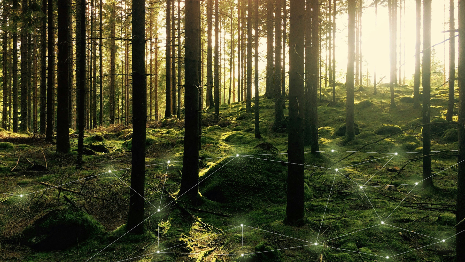
Forestry is going digital - and for good reason. Technologies such as 3D scanning and LiDAR forest mapping are revolutionizing the way forests are measured and sustainably managed. Precise point cloud analyses can be used to capture vegetation structures in detail and create digital 3D models. This not only saves time, but also enables data-based decision-making for sustainable forest management. Find out how you can take your forestry project to the next level by using modern scanning technologies.
TitleHow does modern laser scanning support the monitoring of forests and nature?
Capturing forest structure
Laser scanning makes it possible to capture the forest structure in detail, from the treetops to the ground. It provides information on the height distribution of trees, the density of the forest stand and the layer structure, which is difficult to capture using conventional methods. This data is particularly valuable for monitoring biodiversity, analyzing forest soils and assessing how healthy the forest is.
Detection of changes
Repeated scanning over a longer period of time can detect changes in the forest structure, such as damage caused by storms, pests or fires. The advantage: laser scanning provides extremely precise data that enables rapid reforestation or protective measures to be taken.
Water balance and soil quality
In addition to analyzing vegetation, laser scanning can also provide important information on the water balance and soil quality. This data is crucial for monitoring the condition of forests with regard to climate change and assessing whether forest areas are under drought stress.

Monitoring protected areas
National parks and protected areas benefit in particular from laser scanning. This technology can not only be used to capture vegetation data, but also to monitor human impact on sensitive areas. Forestry administrations can, for example, detect illegal logging or unauthorized interventions in nature reserves at an early stage.
TitleHow does laser scanning work in forests?
Laser scanning, especially in combination with UAVs and mobile mapping technologies, offers a precise and comprehensive method for recording and analyzing forest areas. In addition, modern GPS surveying is used for more precise mapping of forest and woodland areas.
These innovative approaches support foresters, scientists and conservationists in making informed decisions and reacting to changes in nature at an early stage.
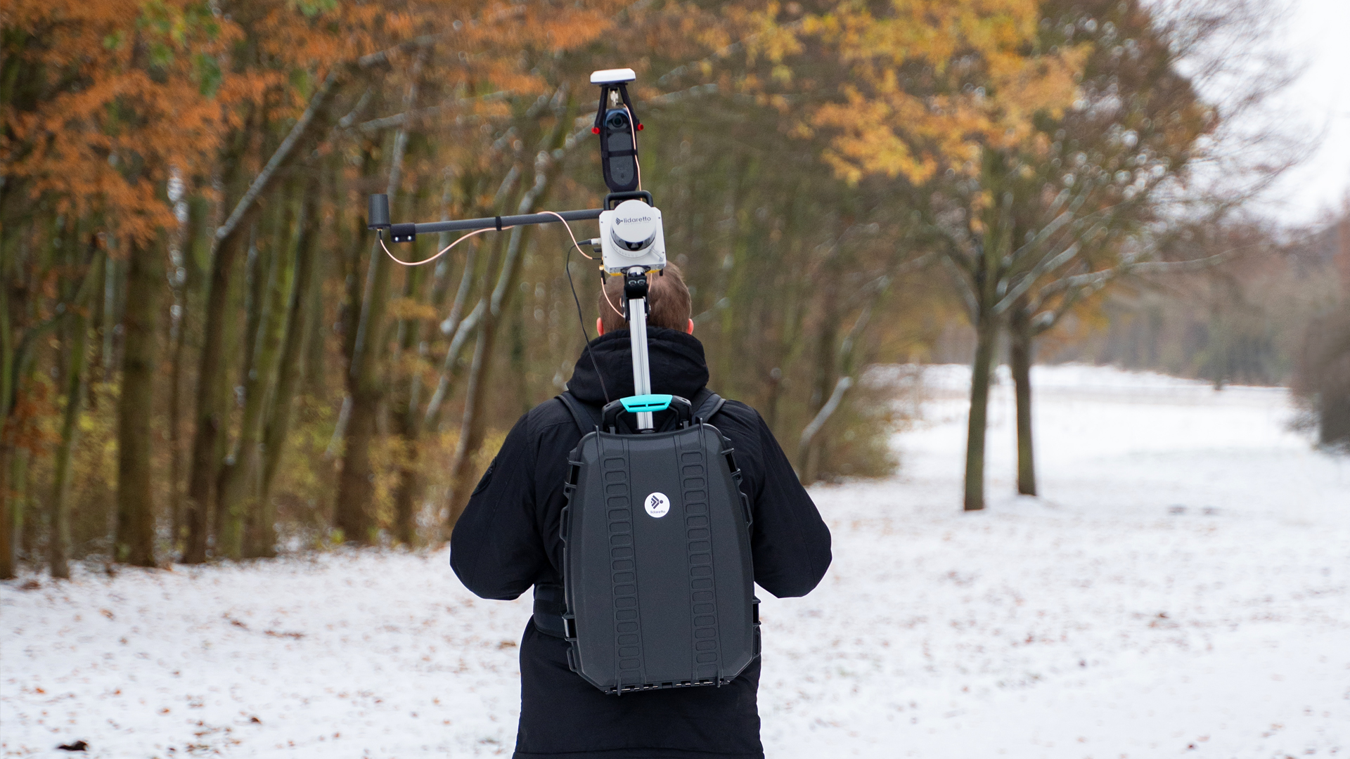
TitleMobile Mapping in forests
This method relies on laser scanners installed on mobile platforms such as vehicles or even pedestrians.
Mobile mapping systems enable large forest areas to be surveyed quickly and flexibly, even in regions that are difficult to access.
They provide high-precision geodata and are often used in combination with GNSS (Global Navigation Satellite System) systems to determine the exact location of the scanned points.
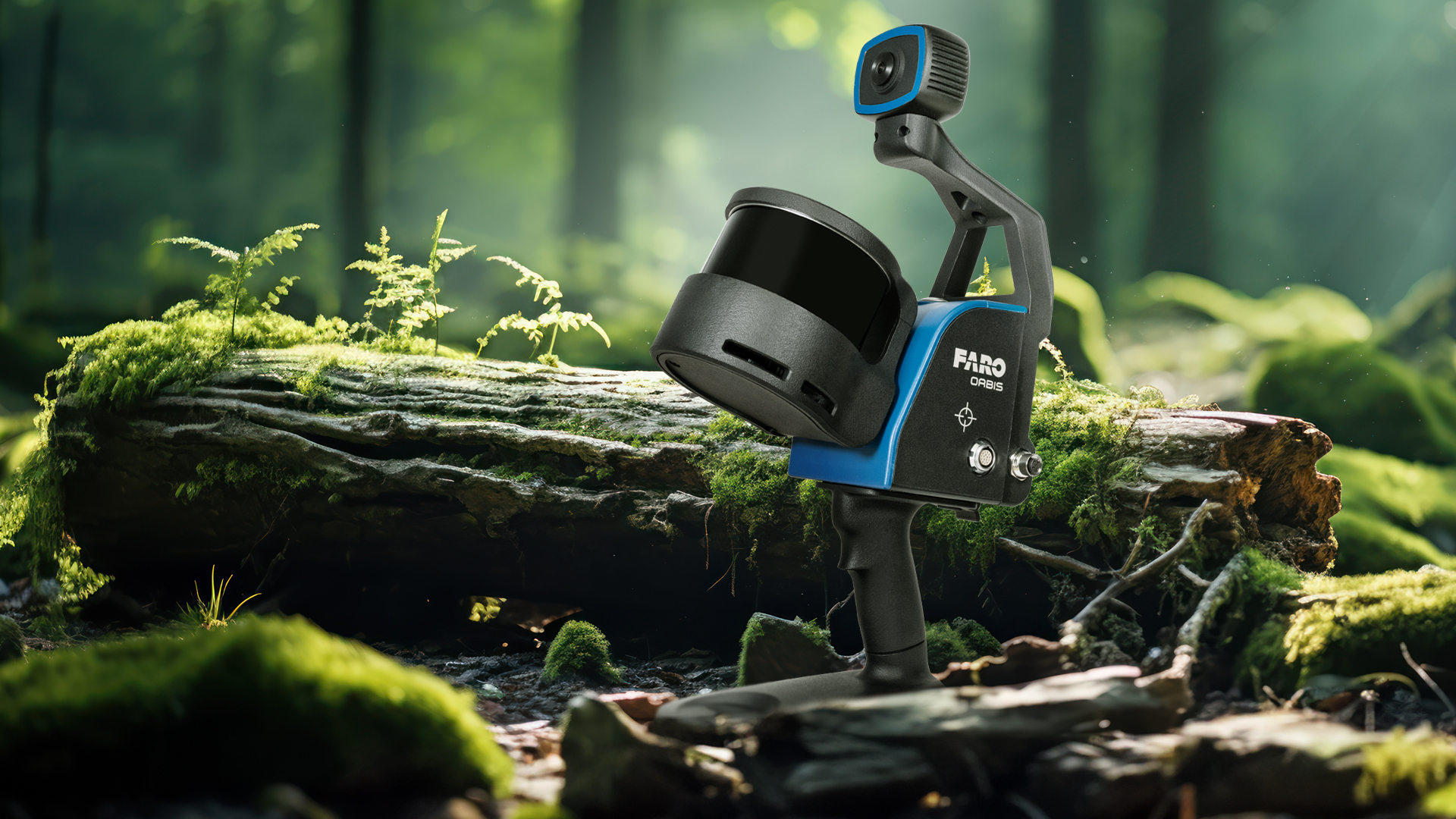
TitleDocumentation with mobile laser scanners
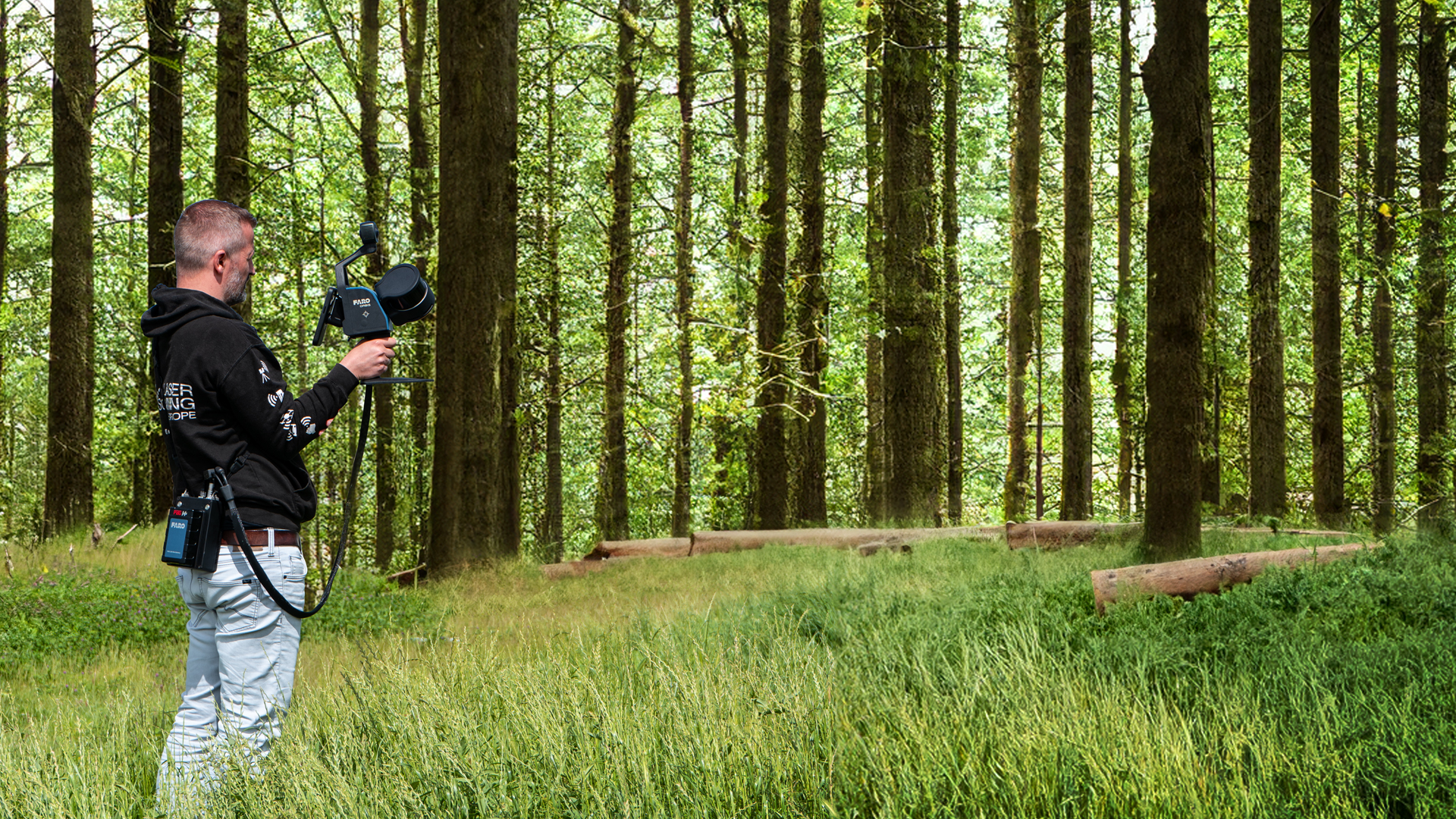
Mobile laser scanners can be used to precisely capture the forest structure in 3D and document the tree and plant population of a forest.
These scanners emit laser pulses that hit tree trunks, leaves and other objects and are reflected back. By analyzing the time of flight of the returning signal, the distance to the objects can be determined. This allows data on tree height, crown density and biomass to be captured.
The advantage of mobile laser scanners is that they can be used flexibly and enable fast and detailed images to be taken even in rough terrain.
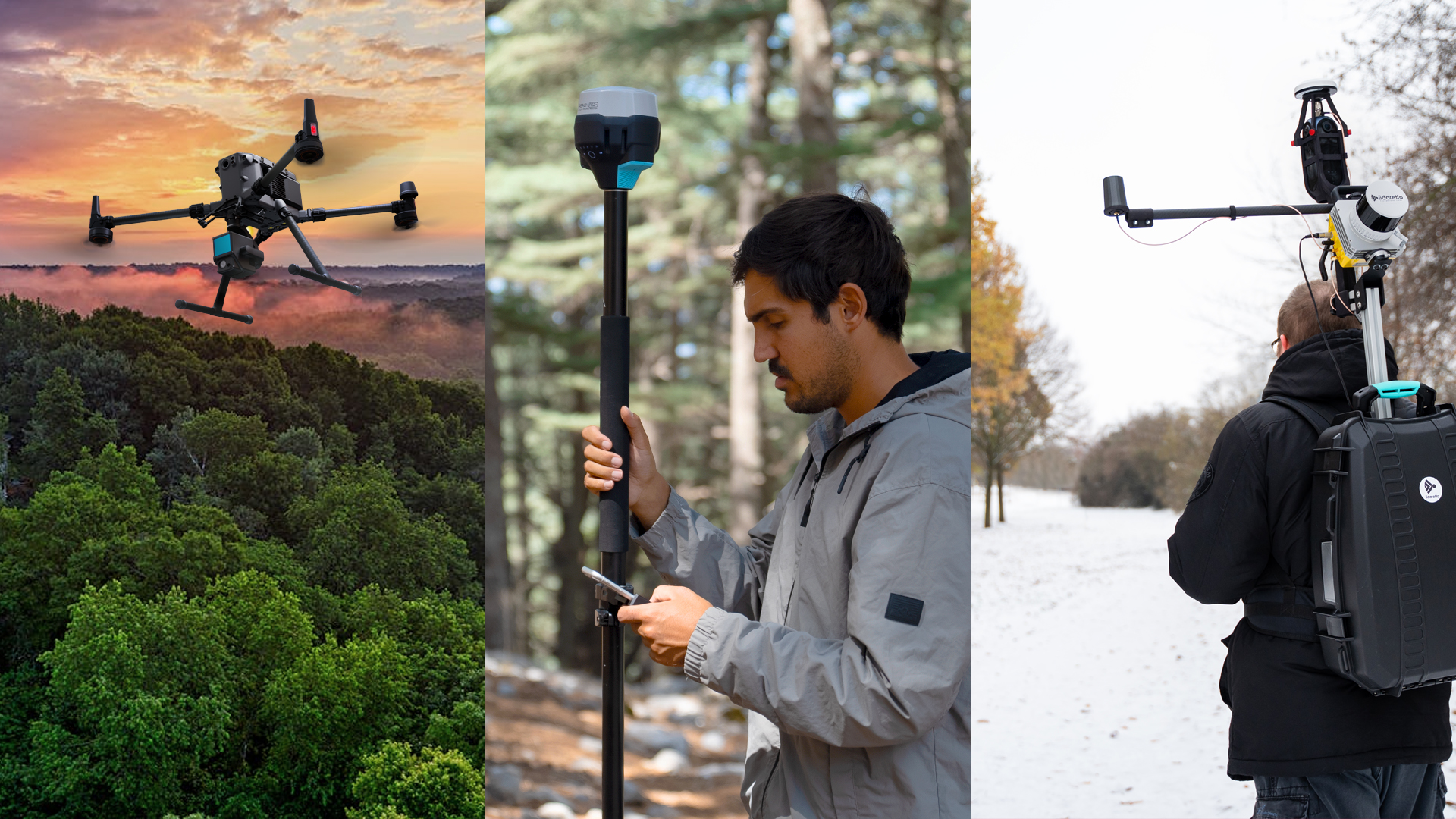
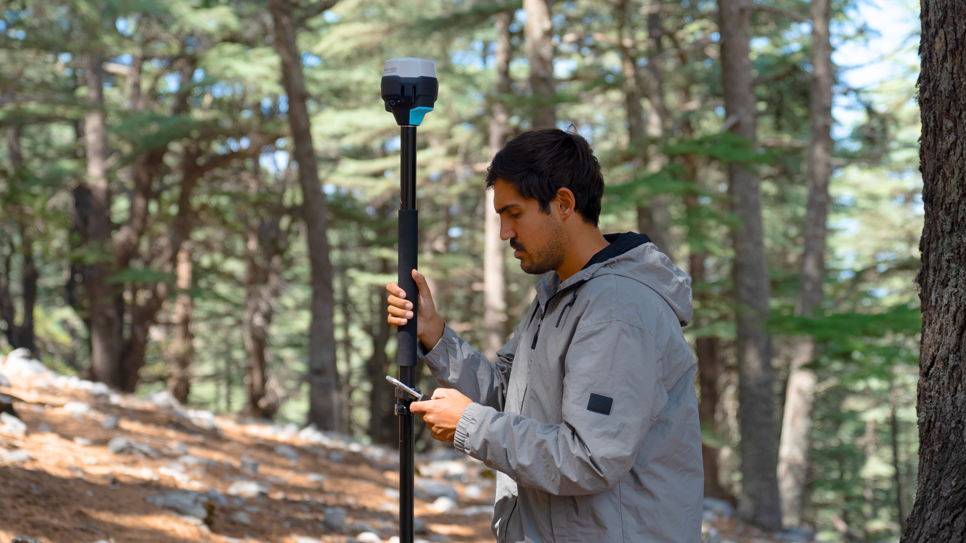
TitleMapping with GNSS & GPS
Mapping forest and woodland areas using GPS-supported devices and methods enables precise capture of terrain and inventory data. GPS receivers that use satellite signals can be used to determine exact positions, for example to map the boundaries of plots or specific tree locations. This data is often integrated into geographic information systems (GIS) to create comprehensive maps and analysis.
This technology allows foresters and scientists to efficiently monitor large areas, capture forest stands and document changes over time, supporting sustainable forest management and conservation.
TitleMapping from the air using UAV

The use of UAVs is revolutionizing forest monitoring and management. Equipped with LiDAR (Light Detection and Ranging) technology, UAVs fly over the forest area and capture a detailed 3D map of the vegetation from a bird's eye view.
The advantage of UAVs is that they can reach areas that are difficult or dangerous to access and cover large areas in a short space of time. Especially in combination with other sensors, such as multispectral cameras or thermal imaging sensors, UAVs provide valuable additional information on the condition of forests.
TitleDigital forest mapping in 3D - Advantages & added value
Advantages of laser scanning in forestry
Precision & efficiency
Compared to conventional methods, laser scanning is faster, more accurate and less labor-intensive. Complex forest structures that are difficult to capture with the naked eye or by manual measurements can be captured in the shortest possible time. Even forest areas that are difficult to access can be completely mapped using LiDAR technology.
Sustainability
Continuous monitoring means that measures can be introduced at an early stage to protect and maintain the forest. This helps to preserve biodiversity and forest health in the long term.
Cost efficiency
Although UAVs and laser scanner systems can be costly to purchase initially, they save resources in the long term by providing more accurate data and enabling more effective planning. Damage caused by pests, extreme weather conditions or human intervention can be detected and treated more quickly.
Added value of digital forestry
Sustainable forest management through data-based planning
Precise digital 3D data can be used to make well-founded decisions, for example on tree felling, stand maintenance or the preservation of protected forests. This not only optimizes forest management economically, but also ecologically.
Early detection of pest infestation and damage
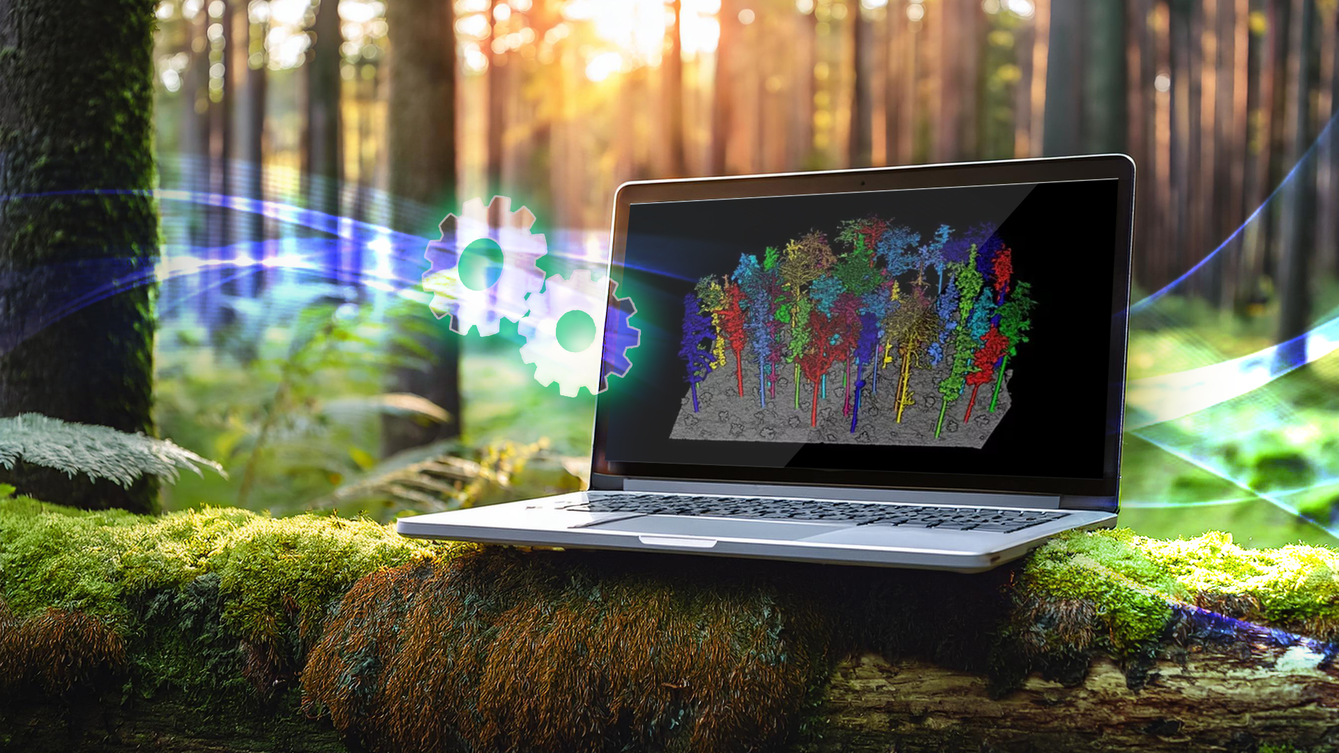
Detailed point clouds and digital models make it possible to detect deviations in the tree population at an early stage. Changes in tree heights or density can be an indication of pest infestation, disease or storm damage. With this information, faster and more targeted action is possible.
Documentation of vegetation changes
Long-term vegetation analyses are easy to carry out with 3D scans. Regular measurements make it possible to precisely track changes in the forest stand and document development processes. This creates transparency and serves as a valuable basis for scientific analysis or official verification.
TitleSoftware solutions for forestry
Specialized software solutions are available to process and edit measured data from the forest and woodland sector. These enable the precise processing of GPS-based point measurements to create detailed mapping as well as the processing of 3D point clouds, for example from LiDAR scans.
While the EMLID Flow app is used to measure areas and create maps, programs such as LiDAR360 are used to analyze and process complex point cloud data in order to precisely record and analyze forest structures and stand densities.
TitleLiDAR360
LiDAR360 is a software suite that specializes in the processing and analysis of LiDAR data.
It offers a wide range of functions for analyzing point clouds that are very useful in many industries, including forestry.

TitleLiDAR360: Functions for forestry
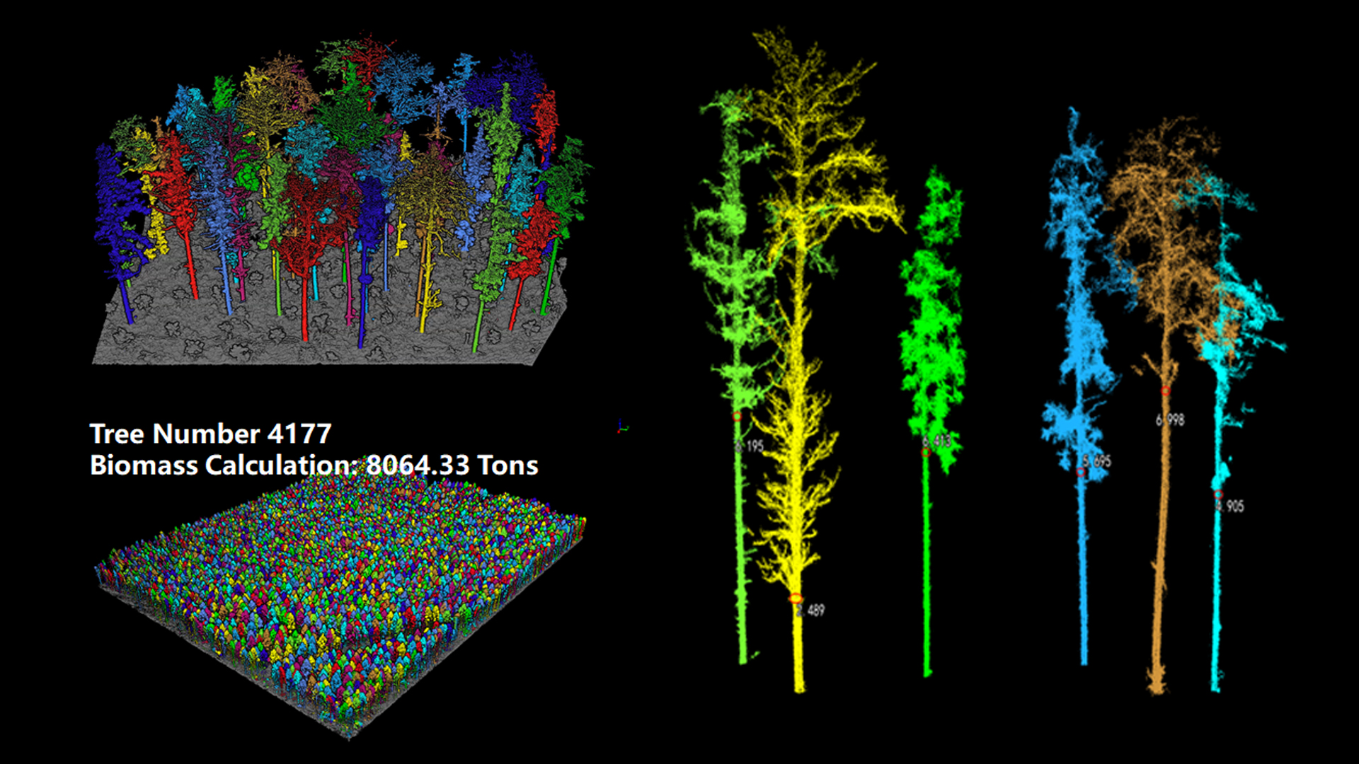
Tree height & crown analysis: LiDAR360 offers specialized tools for the analysis of tree heights and crown diameters. This is particularly important for forest stand analysis and the calculation of biomass or carbon stocks.
Density analysis & inventory: With LiDAR360 you can calculate tree densities and analyze forest structures. This includes the creation of terrain models, tree segmentation and the differentiation between vegetation and soil.
Layer structure analysis: The software allows you to analyze the vertical stratification of a forest (overstory, interstory, shrub layer). This allows ecosystem functions and biodiversity to be better investigated.
Forest inventory: LiDAR360 provides tools for the automatic detection and classification of trees in a forest, based on the point cloud data. It helps in the creation of forest inventories and the calculation of forestry parameters such as volume, height and canopy area.
Terrain models (DTM/DSM): The software can generate digital terrain models (DTM) and digital surface models (DSM) from point clouds, which is important for analyzing the topography of the forest area.
TitleEMLID Flow - Areas of application in forestry
Emlid Flow is designed to capture precise GNSS data for various types of surveying and mapping.
In forestry, the software can be used ...
- for mapping forest areas,
- for area analysis,
- for the creation of trail networks and
- to support data capture for GIS systems.
Mapping of forest areas
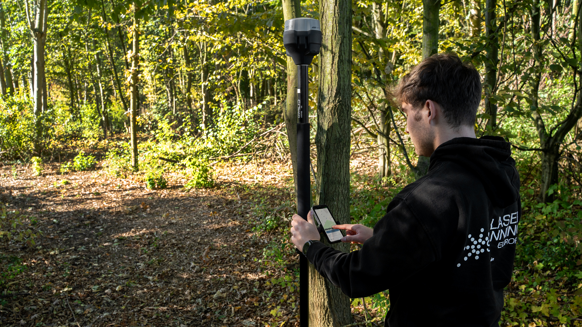
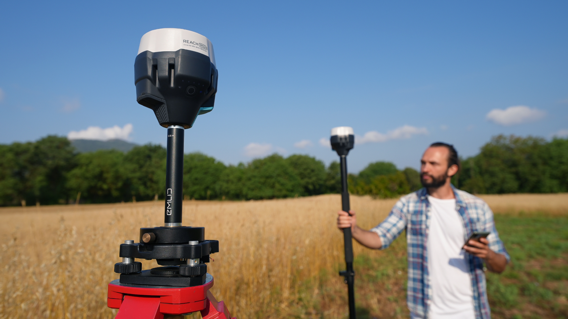
Emlid Flow enables the precise mapping of areas by using highly accurate GNSS data. Using GNSS receivers such as the Emlid Reach RS2 or RS3, foresters and forest engineers can accurately measure and map geographic features and parcels of land. This is particularly useful for mapping forest boundaries, trails, wetlands and other geographical features.
Area measurement & area analysis
The software offers functions for precise area measurement, which can be crucial in forestry to measure forest plots, clearings, afforestation areas or deforestation areas. This is useful for
- the management of forest areas
- the analysis of tree density
- the planning of reforestation measures
- the determination of wood stocks on specific areas
Point measurement for tree locations or forest structure
Emlid Flow can be used to accurately map individual trees or groups of trees using point data. This is useful for
- the creation of tree maps
- tracking tree species and locations
- the management of protection trees or valuable tree species
- the planning of harvesting or maintenance measures
Support for data capture for GIS systems
Emlid Flow generates survey data that can be easily exported to geographic information systems (GIS). This data can be used in conjunction with other data such as 3D scans, satellite imagery or LiDAR data to obtain a complete picture of a forest area.
TitleSpecial functions of EMLID Flow in forestry
Mobile data collection: Emlid Flow can be used on mobile devices to collect data directly in the field. This flexibility makes it easy to collect precise geographic data even in remote forest areas.
Precise GNSS surveys: When combined with Emlid's GNSS receivers (such as the Reach RS2 or Reach RS3), Emlid Flow enables measurements with centimeter accuracy. This is particularly useful when precise forest boundaries or small area sections need to be mapped.
Offline availability: In remote forest areas without cellular coverage, the software can also be used offline to continue collecting and storing accurate GNSS data. The data can be synchronized and analyzed later.
Simple user interface: Emlid Flow offers an intuitive user interface that makes it easy to use even for people with limited technical experience in GNSS surveying. This makes it a practical solution for foresters and forest workers.
Data exchange & export: The captured data can be easily exported in various formats (e.g. CSV, DXF, shapefiles) for further use in other software solutions such as GIS systems (ArcGIS, QGIS) or CAD applications. This integration makes it possible to use Emlid Flow as a supplement to LiDAR or 3D scan data.

TitleEMLID Flow compared to LiDAR processing tools
Compared to specialized LiDAR software solutions such as LiDAR360, Emlid Flow is more of a surveying and mapping tool than a software for processing large point clouds. It is excellent for capturing the exact geographic coordinates of an area, but does not offer sophisticated functions for analyzing vegetation structures or processing 3D point clouds, as would be the case in forest inventory or stand analysis.
However, Emlid Flow can be used very well in combination with other tools such as LiDAR360 by providing precise geographic reference data for the forest area. For example, GNSS data from Emlid Flow could be used to more accurately georeference point clouds recorded with LiDAR. This would improve the positioning accuracy of 3D scans in large forest areas.