3D Laser Scanning for Damage Assessment & Analysis after Disasters

TitleHow do 3D laser scanners help with disaster damage?
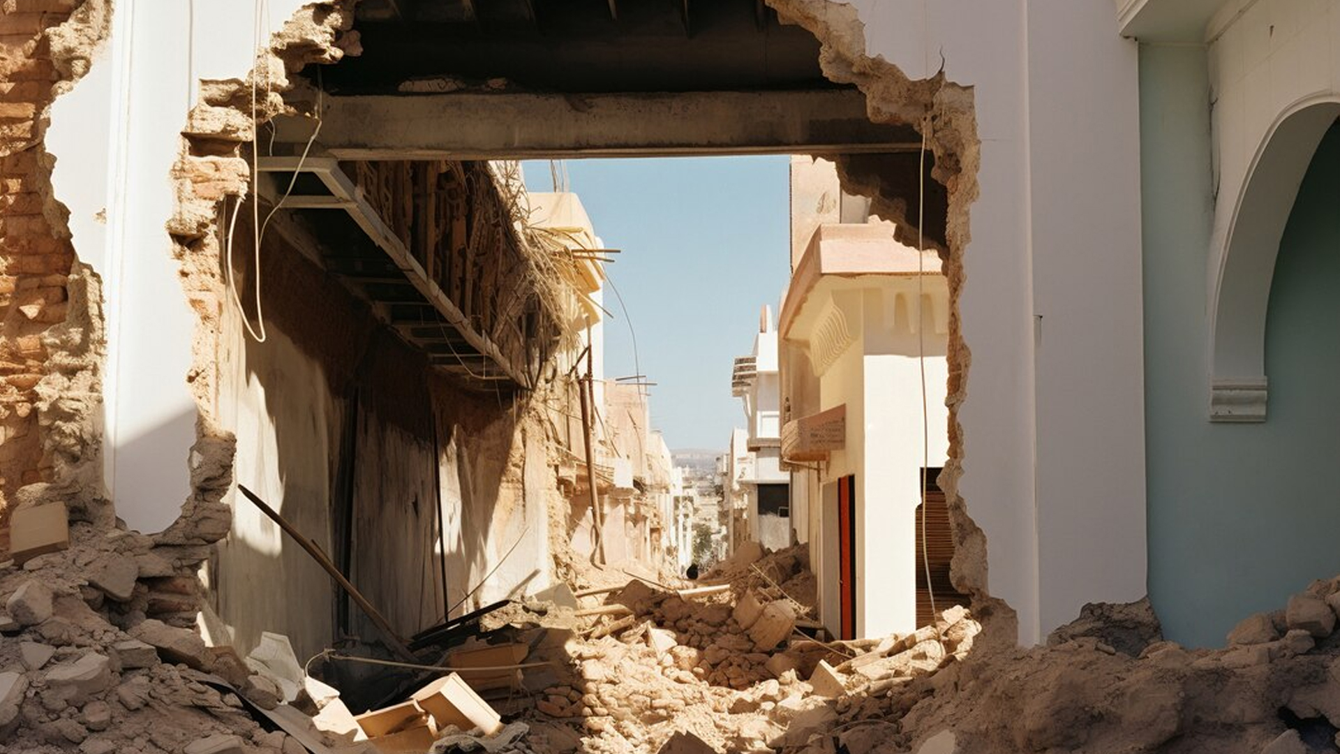
After natural disasters, accidents or other crisis situations, quick and precise damage assessment is crucial. One of the most innovative methods for documenting and assessing damage is 3D laser scanning. This technology enables precise, fast and detailed mapping of affected areas to provide rescue workers, engineers and authorities with valuable information for damage analysis and remediation planning. The data obtained also provides valuable information for insurance companies, experts and aid organizations.
TitleHow 3D laser scanning works in damage assessment
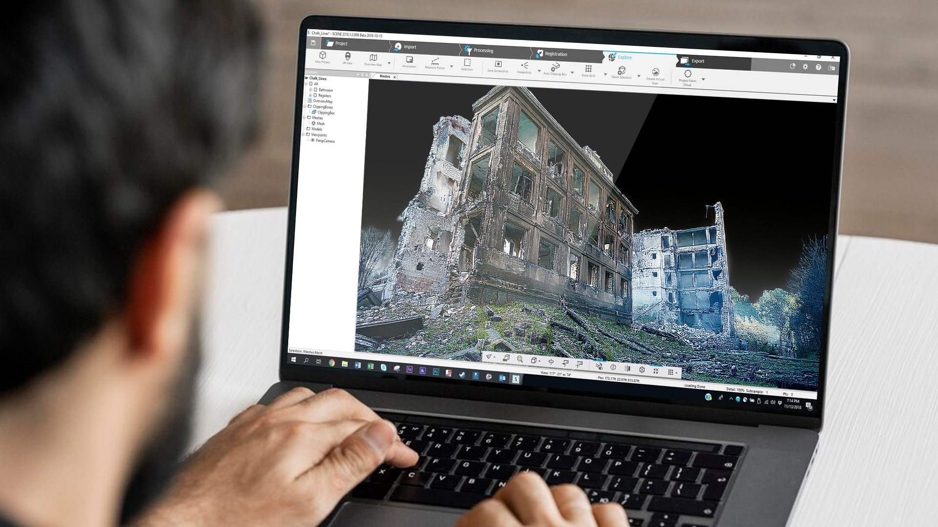
3D laser scanning enables disaster damage to be captured in detail in the shortest possible time. The technology is based on the emission of laser pulses that are reflected by surfaces. The scanner calculates precise distances from the travel time of the returning laser beam and thus creates a three-dimensional point cloud of the scanned area.
This point cloud depicts even complex structures with millimeter precision and enables a comprehensive analysis of the damage. The data can be further processed in order to:
- Create digital 3D models of destroyed buildings or infrastructure.
- Precisely document deformations and damage.
- Compare damage with previous scans and identify changes.
TitleDifferent scenarios in which 3D laser scanning helps
Natural disasters (earthquakes, floods, storms, landslides)
Natural disasters can cause extensive damage to infrastructure, buildings and the environment. 3D laser scanning makes this possible:
- Capture damage: Buildings, roads and bridges can be surveyed with high precision to document damage patterns.
- Rapid assessment: Rescue teams can use the captured data to identify critical areas and coordinate efficient relief measures.
- Before/after comparison: If laser scans were already available before the disaster, damage can be precisely quantified in order to clarify reconstruction and insurance issues.
In one of our assignments, we surveyed a railroad bridge after a ship collision in collaboration with the surveying office Winkler. In the video, we show how laser scanners are used in such a case and are helpful for the restoration.
Accidents involving ships (e.g. collisions with bridges or quay walls)
Shipping accidents, especially collisions with bridges or port infrastructure, require a detailed investigation:
- Accident analysis: 3D scans capture the damage to the bridge, the ship and the surrounding area, thus helping to reconstruct the course of the accident.
- Structural safety assessment: Authorities can use the scans to determine whether a bridge can continue to be used or needs to be closed.
- Repair planning: 3D models provide precise data for engineers to plan necessary repairs or conversions.
Bridge collapses
Bridge collapses are dramatic events, and modern measuring devices such as terrestrial 3D laser scanners are used to investigate them:
- Digital reconstruction: A laser scan of the collapsed structure helps to analyze the collapse mechanism.
- Preservation of evidence: High-resolution 3D models provide investigating authorities and insurance companies with a reliable database.
- Planning of new buildings: The captured data can be used as a basis for the new construction or reinforcement of existing bridge sections.
A well-known example of a bridge collapse is the fall of the Carola Bridge in Dresden in 2024. In the video, we explain the background to this event and show how we used the Polaris scanner to collect detailed data on the bridge in order to precisely analyze its condition.
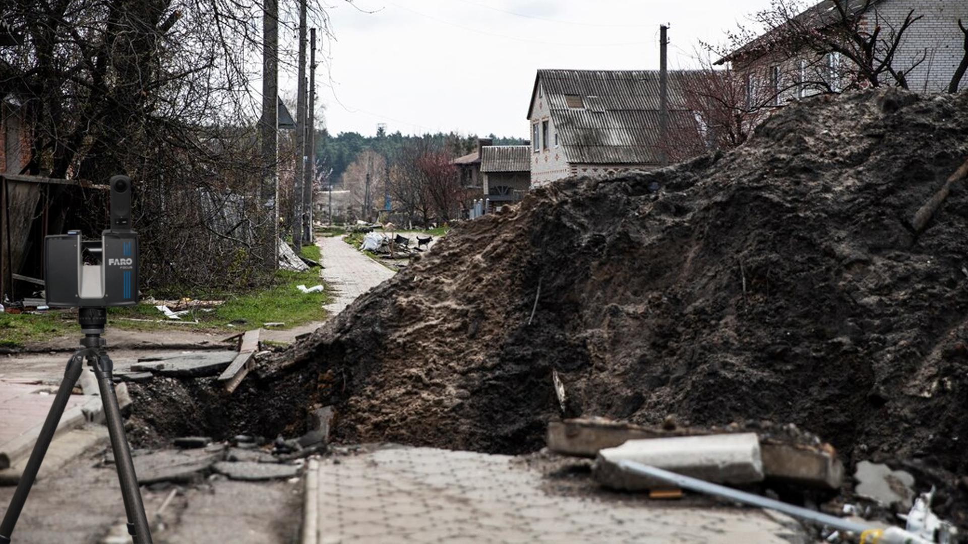
Damaged infrastructure due to natural disasters or extreme weather events
Extreme weather such as hurricanes or floods can severely damage infrastructure. Drone images provide comprehensive information about the extent of the damage.
- Rapid damage assessment: Roads, railroad lines and buildings can be scanned and checked for stability in the shortest possible time.
- Identification of danger zones: Unstable buildings or landslides can be identified at an early stage to avoid further hazards.
- Optimization of repairs: 3D data enables efficient planning of repair measures.
TitleEfficient damage analysis: Processing & analysis of 3D scan data
Processing the collected data
The point clouds captured with 3D laser scanners provide millions of measurement points. This raw data must be processed in order to generate structured models that can be used for various applications. These include
- Digital 3D models: Generating realistic representations of the affected areas.
- Georeferencing: Combining the scans with exact GPS coordinates.
Analysis of the scans
After data preparation, the 3D models are analyzed in order to:
- Identify areas of damage: Automatic algorithms can identify damaged structures.
- Carry out comparisons with previous scans: Changes are visualized to determine the extent of damage.
- Create reports for insurance companies and authorities: The accurate data helps with claims settlement.
TitleStructured data, clear results - How to use scan data
The scanned data of buildings and infrastructure can be used in a variety of ways:
- Engineering & construction planning: Basis for renovation and reconstruction work.
- Simulations & risk analyses: Investigation of which parts of a structure are unstable.
- Training & research: Use of the models for training courses or scientific studies.
TitleEfficient damage analysis with 3D laser scanning: Focus on safety and planning
3D laser scanning is an indispensable tool for documenting and analyzing disaster damage. The technology enables the fast, precise and reliable capture of destroyed or damaged structures. It supports rescue teams, engineers, insurance companies and authorities in making informed decisions and taking efficient measures for damage management and reconstruction. In a world where natural disasters and accidents are becoming more frequent, the use of 3D technologies for damage assessment will continue to grow in importance.