Safety Management & Hazard Prevention with 3D Scanning

TitleDetecting safety risks with 3D laser scanning
In an increasingly complex and interconnected world, the efficient management of safety risks is becoming ever more important. Public safety authorities and emergency services are increasingly relying on advanced technologies to identify and overcome challenges at an early stage. Whether public safety, disaster control, terrorism defense or evacuation planning - modern technologies are indispensable for providing precise data, making well-founded decisions and optimizing operations.
One of these key technologies is 3D laser scanning. This precise and innovative method allows buildings and areas to be captured in full detail, enabling effective planning and analysis.
Title3D laser scanning in police work
3D laser scanning has been used in the field of public safety since the 2000s. The first pilot projects and investments were made as part of police work, particularly by special units such as the state criminal investigation departments. The fields of application were initially limited to crime scene documentation and crime scene measurement. In recent years, however, the use of laser scanners in the field of public safety has expanded considerably. More and more security authorities are relying on this technology, and larger-scale procurements are also on the increase.
The main areas of application include
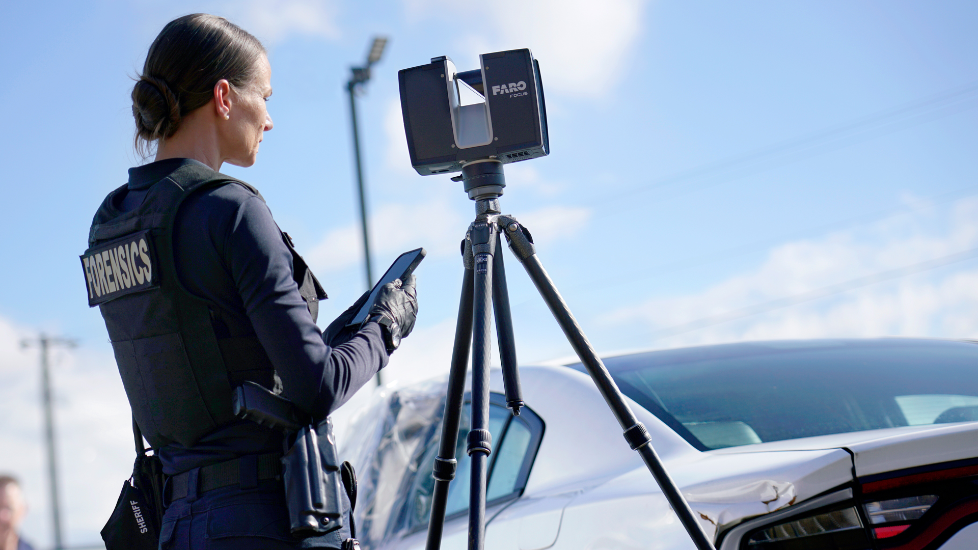
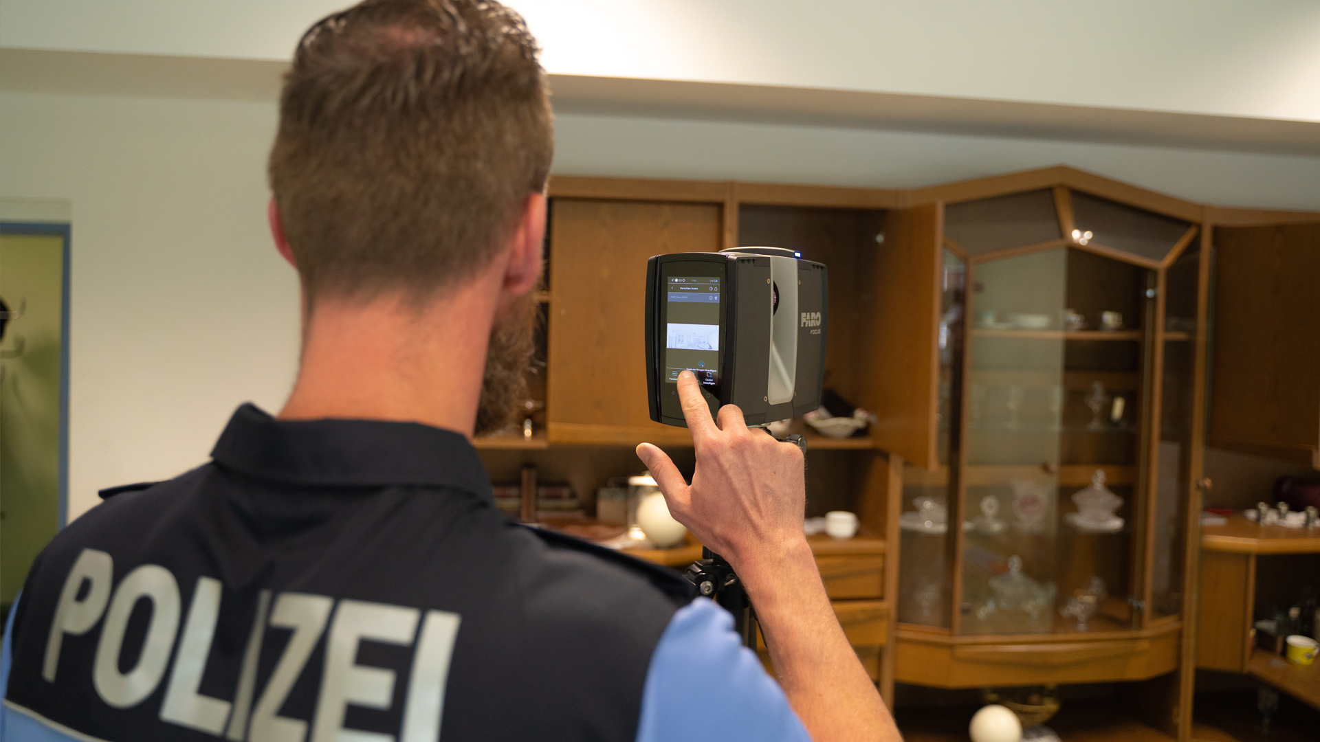
- Documentation of serious traffic accidents: In Germany, precise surveying of accident locations is one of the primary applications.
- Crime scene analysis of violent crimes: This remains a specialized application, primarily carried out by criminal investigation units. Accurate recording of the crime scene can provide crucial information for solving a crime.
TitleTechnologies for public safety
Various technologies are used in the field of safety and security to enable authorities to deal with dangerous situations more quickly and efficiently. These technologies include
- Terrestrial laser scanners: Stationary systems for detailed capture of crime or accident scenes as well as buildings and safety-critical areas.
- Mobile laser scanners: Flexible devices that can be used to quickly scan larger areas.
- Photogrammetry: A method based on capturing images and creating 3D models from them.
- Handheld 3D scanners: Portable devices, ideal for small areas, for example in the documentation of crime or accident scenes.
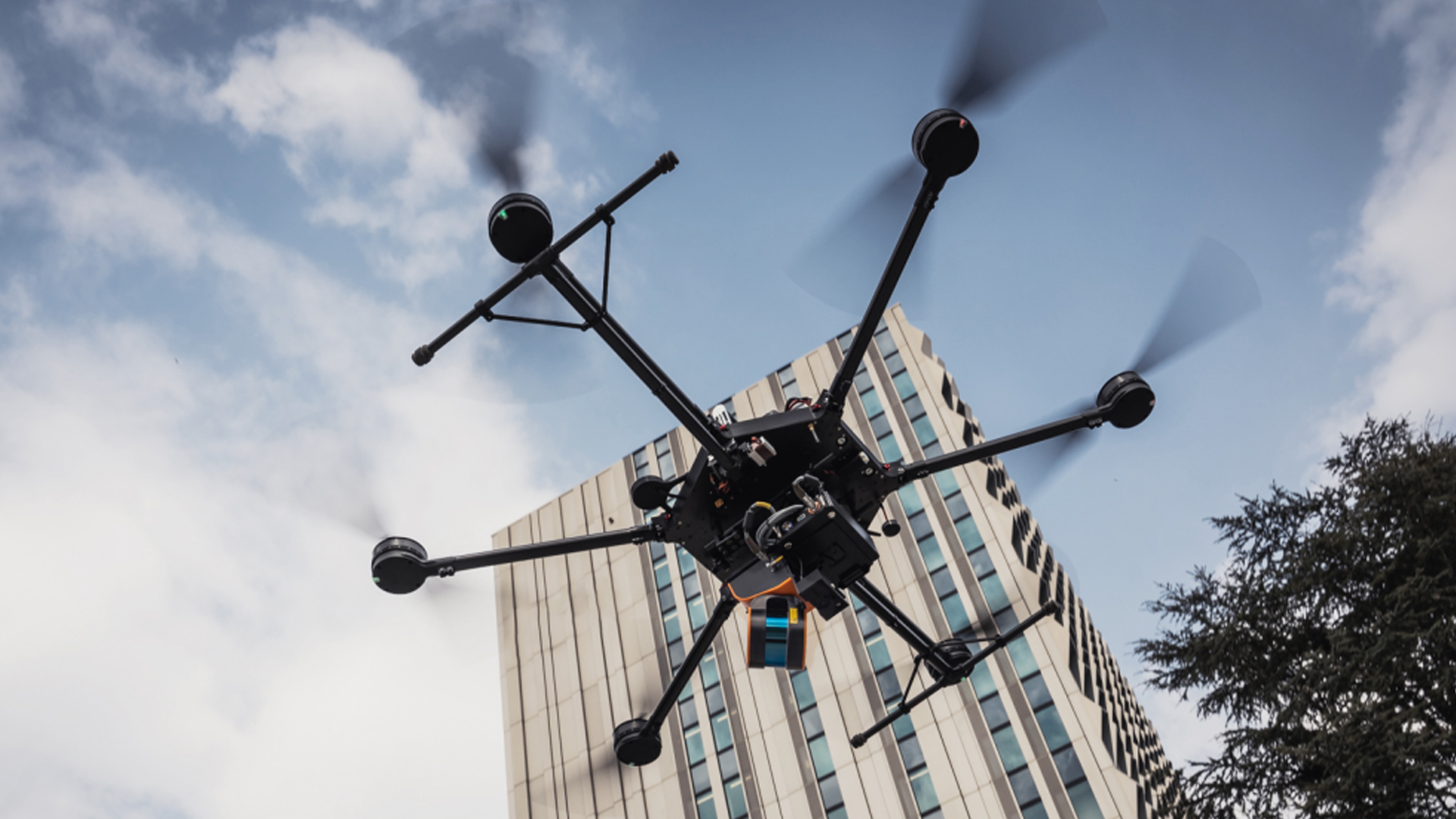
- UAV-supported systems (photogrammetry/laser): Drone-based scanners for aerial capture, ideal for rough terrain or large areas.
- GPS systems: For precise location determination and integration of scan data into georeferenced maps.
TitleUse of 3D laser scanners in various safety agencies
In addition to the police and criminal investigation departments, other authorities and organizations also use laser scanners for hazard prevention and operational planning. These include
- Federal police: When securing borders and investigating criminal offenses.
- German Armed Forces: For tactical deployment planning and for mapping areas during military operations.
- Civil protection and disaster control: To document disaster areas or to support evacuation planning.
- Counter-terrorism facilities: For early identification of sources of danger and for planning measures to avert danger.
TitleTechnologies and their application in public safety
3D laser scanners
- Crime scene and accident measurement: Documentation and surveying of accident or crime scenes with millimeter precision. The detailed 3D models enable precise reconstruction and preservation of evidence.
- Analysis of critical infrastructures: From bridges to buildings – identify weak points to minimize risks.
- Security training: Realistic 3D environment models to simulate operational scenarios, for example for terrorist attacks or large-scale evacuations.
UAV
- Disaster control: UAVs capture flooded or destroyed areas quickly and efficiently from the air in order to coordinate rescue operations.
- Counter-terrorism: Aerial images of risk areas provide valuable information for operational planning.
- Evacuation planning: Fast aerial images and topographical data help to plan evacuation routes and identify obstacles.
Mobile laser scanners
- Dynamic data capture: Efficient recording of data in motion, for example for streets, tunnels or interior spaces.
- Flexibility in use: Perfect for areas that are difficult to access or extensive, where terrestrial scanners reach their limits.
- Real-time data: Fast availability of captured data for immediate analysis and decision-making.
Photogrammetric systems
- Visual documentation: Create precise 3D models from high-resolution images, ideal for crime scene analysis or damage assessment.
- Large area mapping: Fast and cost-effective coverage of extensive areas such as disaster zones or evacuation routes.
TitleSuccess stories from practice
Large-scale operation after natural disaster:
Faster operational planning and more efficient coordination thanks to UAV data, photogrammetric models and 3D models.
Safety planning for major events:
Simulation and analysis of visitor flows using 3D scans to minimize hazards.
Crime scene reconstruction:
Tamper-proof 3D data as a basis for court evidence.
Evacuation exercises:
Realistic tests with 3D visualizations, GPS-based maps and real-time data from mobile scanners.
TitleBenefits for public safety
Public safety
Protect the population and infrastructure with precise risk analyses and preventive measures. Measurement technologies support the identification and elimination of potential hazards, such as structural weaknesses or inadequate evacuation plans.
Disaster prevention
Time is a decisive factor in the event of a disaster. With 3D laser scanners, UAVs and photogrammetric systems, emergency services can quickly assess and analyze the situation and make decisions. 3D models of flooded areas or collapsed buildings facilitate the coordination of rescue operations.
Emergency management
Thanks to GPS-supported planning and visualization, emergencies can be managed in a more structured way. Resources are distributed efficiently, danger spots are precisely localized and response times are minimized.
Counter-terrorism
3D scan data, aerial images and real-time information from mobile laser scanners support the planning of secure entrances, the analysis of danger points and the simulation of attack scenarios. Thanks to the accurate data, emergency services can react more effectively.
Safety & evacuation planning
Precise 3D data, photogrammetric models and mobile scan data can be used to optimize evacuation routes and ensure that they work under realistic conditions. Visual simulations help to identify and adapt weak points in advance.
TitleLaser scanners in the training of security and rescue forces
In the training of security or rescue forces, the laser scanner is used to digitize crime scenes or facilities as part of the forensic investigation. This data can then be used for digital training. VR technologies can also be used for this purpose.
Laserscanning Europe GmbH is happy to support you in the selection and use of suitable technologies and also offers the opportunity to take advantage of appropriate training and hardware solutions in the form of rental options.