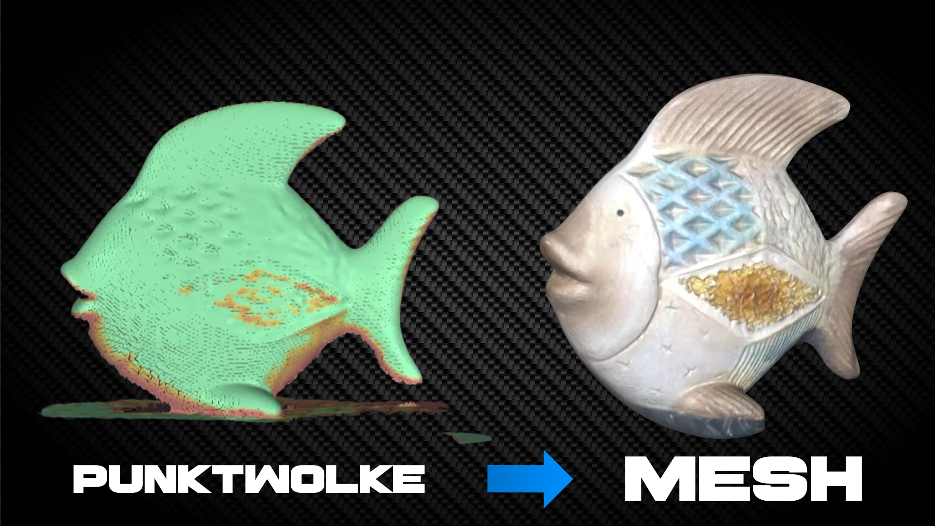
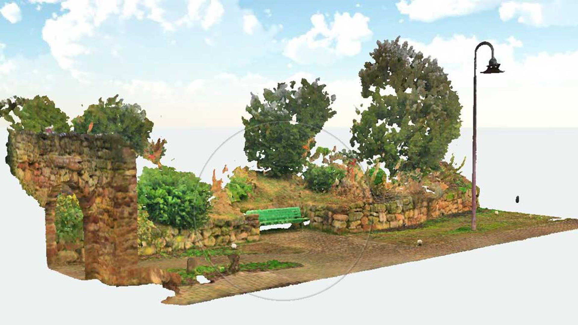
Mesh created from point cloud - Polygon model from laser scan

TitleFrom scan to point cloud - Precise capture in 3D
When objects or environments are scanned, they are captured point by point by the laser scanner. The laser scans provide digital three-dimensional information about the scanned area. If the laser scans are successfully processed and registered, the scan data, i.e. the point cloud, is available for further work.
TitleHow does a 3D scan become a polygon model?
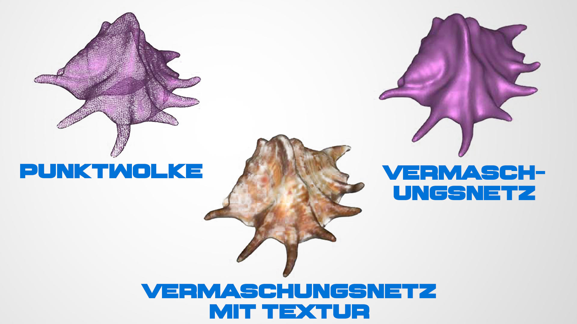
For some applications, working with point clouds is unsuitable and a meshed network (a so-called mesh) is created based on the scan data.
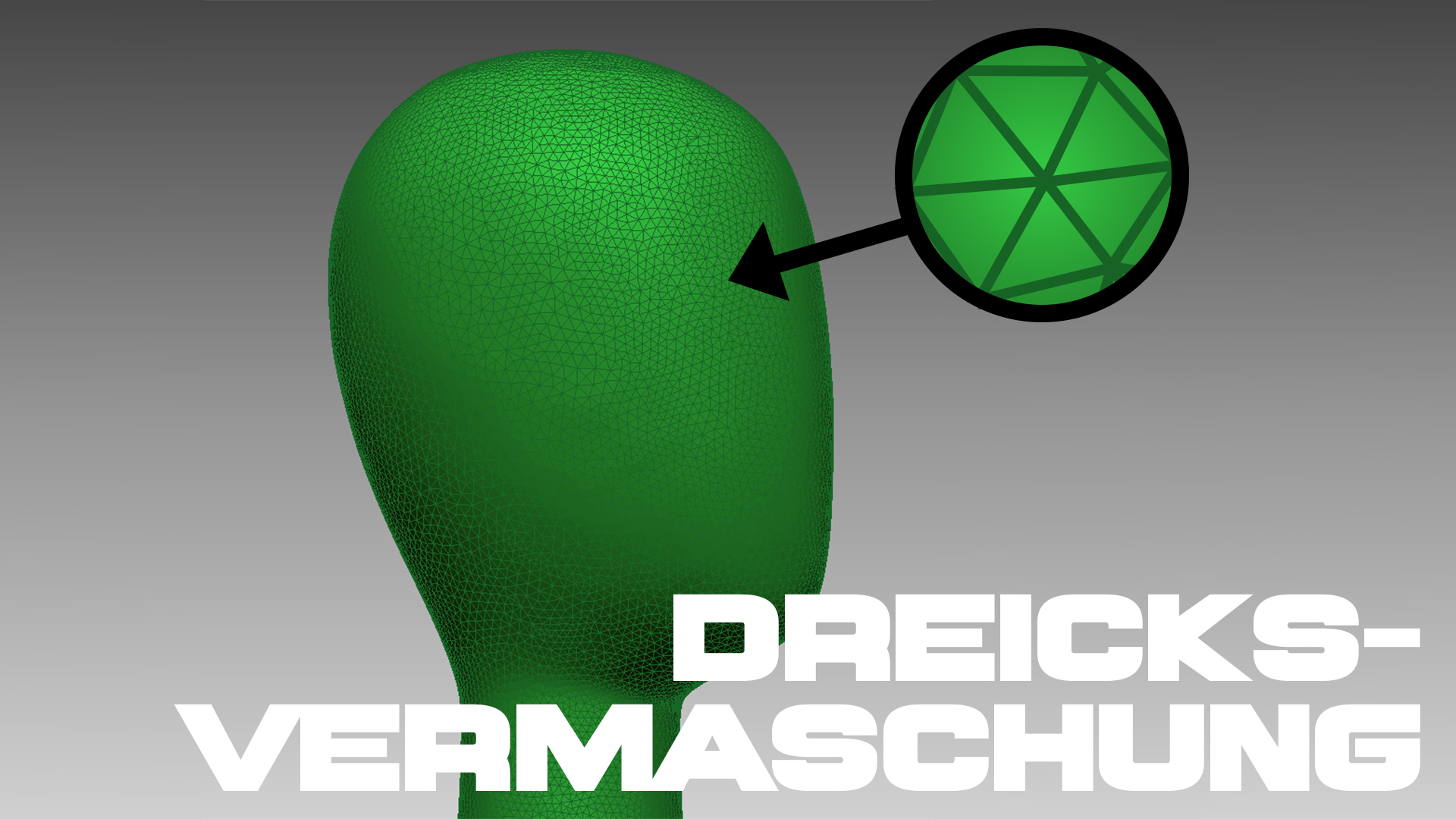
A meshed network is a three-dimensional wireframe model in which neighboring scan points are connected in such a way that triangular surfaces are created. The corner points of these surfaces correspond to the points of the point cloud. This representation in the form of numerous triangular meshes is referred to as a polygon model.
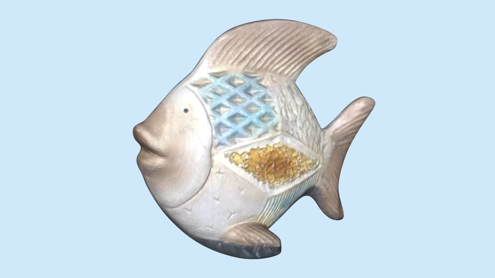
The meshed surfaces are created with or without texture using color information from scans or panoramic images. The latter variant enables photorealistic mesh models.
TitleWhat is the purpose of creating a mesh?
Meshing is necessary to carry out certain processes or calculations. The range of applications is broad. For some applications, a mesh is more suitable than a point cloud.
The great advantage of meshes is that they are flat and can be textured. Accordingly, advertising or application videos can be provided with realistic objects in the form of meshes. This creates a realistic impression of the measurement objects or locations.
A mesh also offers the advantage of normal information: the polygonal surfaces are provided with normal vectors, making volume calculations possible. Closed meshes can be analyzed directly in terms of surface area and volume. In addition, volumes above and below predefined surfaces can be calculated.
The modeling of free forms such as rocks or sculptures is very complex and time-consuming to implement. Meshing is also used here. The point cloud depicts the geometry of these free forms in great detail; the geometries are preserved and displayed in CAD models with the help of the polygon mesh.
When surveying terrain surfaces, it is also helpful to mesh the measurement points. The coarser meshing type, i.e. contours are not reproduced naturally, describes the surface contours and is used for further evaluation procedures. We speak of a digital surface model or digital terrain model.
TitleHow do I create a mesh from a point cloud?
Most software for analyzing point clouds offers the option of meshing. Basic settings for mesh creation are requested.
One of the most important points is the size of the individual polygon areas. In some software solutions, the size can be set via the number of triangles or via the maximum edge length of the triangles.
Depending on the setting, the amount of data, but also the level of detail, is increased or reduced.
Size of the triangle mesh
For large-volume applications (e.g. digital terrain model (DTM)) with a lower accuracy requirement, triangle edge lengths of centimetres to meters are sufficient. The areas between the edges and corner points are generalized to the best fit. A high level of detail is important for small-volume applications (e.g. component measurement). Sharp edges and fine contours in particular should remain visible as such. Accordingly, a very small edge length of millimeters down to the deep submillimeter range is essential. The consequence of this is that the number of triangles and therefore the amount of data in the mesh increases.
Use of meshes for 3D printing
Current meshing solutions offer the option of preparing the mesh for 3D printing. This involves using algorithms that fill holes and can therefore create a closed polygon mesh.
Coloring of meshes
As point clouds are often passed on as a colored data set, these colorations can be transferred to the mesh.
The coloring is based on the RGB values of the point cloud. Each polygon surface is assigned a color value (vertex colors).
Another option is texture mapping. This involves taking information from photos and adapting it to the mesh. This process is more time-consuming, but offers a more realistic representation.
TitleConclusion
Mesh models can therefore be created in many different ways.
Our experts have many years of experience in various application areas. Let us advise you now!