3D Laser Scanning in Fire Inspection

TitlePrecise forensics & investigation of fire scenes
Laser scanning is a key tool in modern fire investigation. This cutting-edge technology allows investigators to precisely document and analyse complex scenarios and draw conclusions about the causes and progression of fires.
Using laser scanners, a fire scene is captured in 3D with millimetre precision. This produces detailed point clouds that serve as the basis for further investigations. The three-dimensional representation makes it possible to comprehensively analyse the distribution of damage patterns, potential ignition sources and the spread of the fire.
TitleHow do laser scanners work in fire investigation?
Laser scanners emit laser pulses that are reflected by surfaces. The time taken by the laser beam to travel back and forth is measured and converted into distance data. This creates a high-resolution point cloud that depicts the fire scene in detail.
The following methods are frequently used in fire forensics:
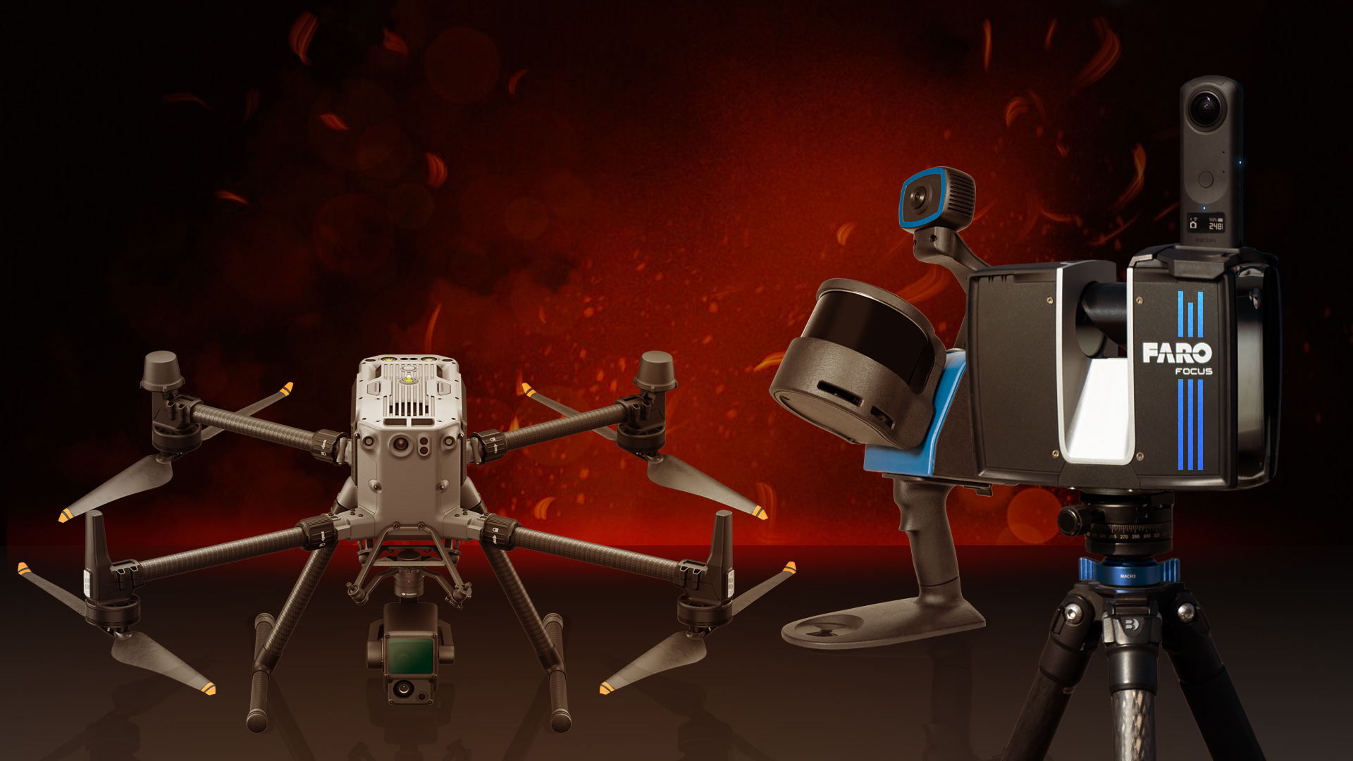
- Terrestrial laser scanning: Stationary scanners capture the surroundings from a fixed position and provide extremely precise data.
- Handheld 3D scanners: Handheld devices are ideal for areas that are difficult to access.
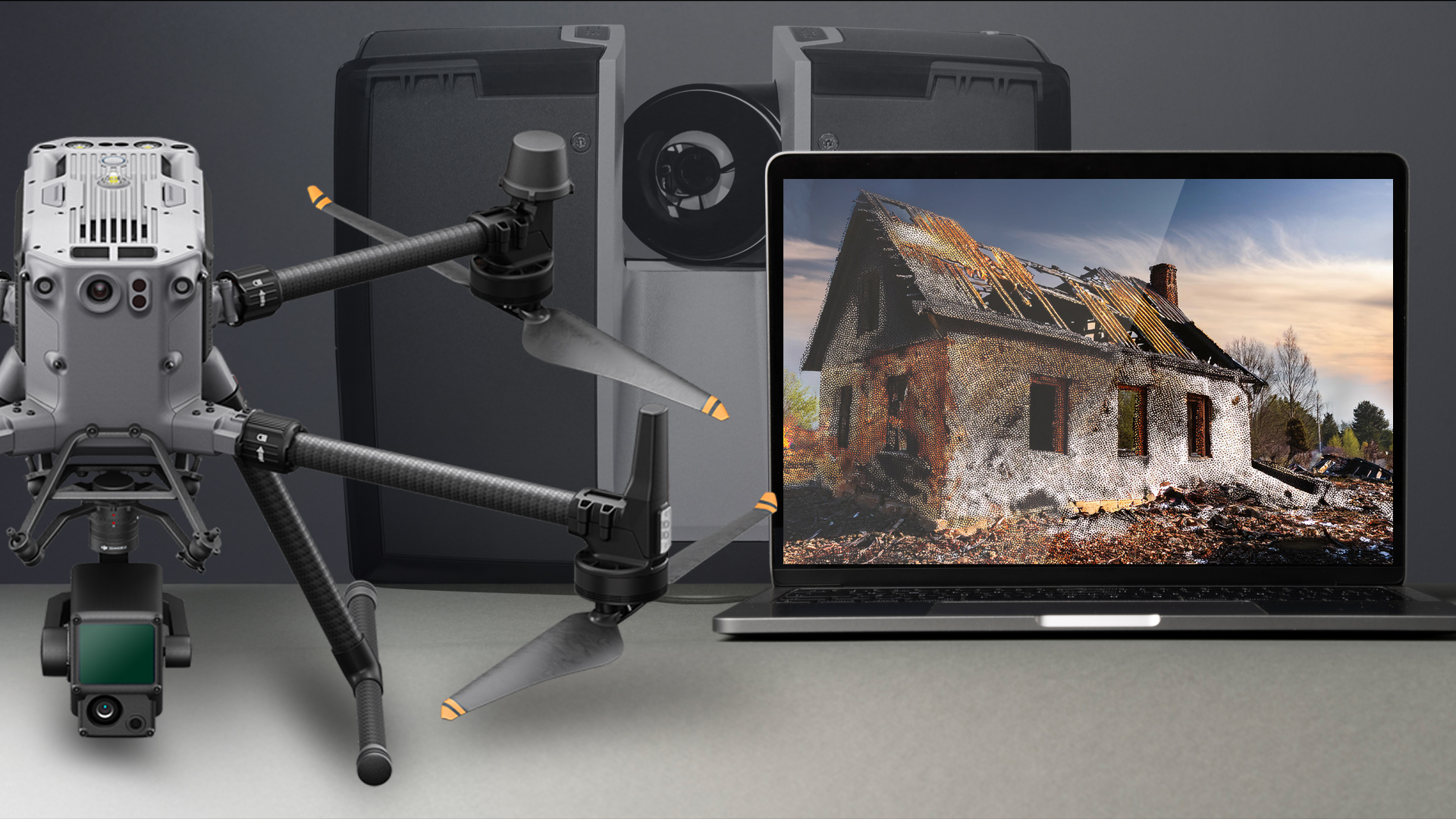
- UAV: UAVs scan large building structures or outdoor areas and provide overview images from the air.
- Photogrammetry: The combination of laser scanning with photogrammetric methods enables even more detailed visualisation.
TitleAdvantages of 3D laser scanning in fire inspection
Fast & non-contact detection
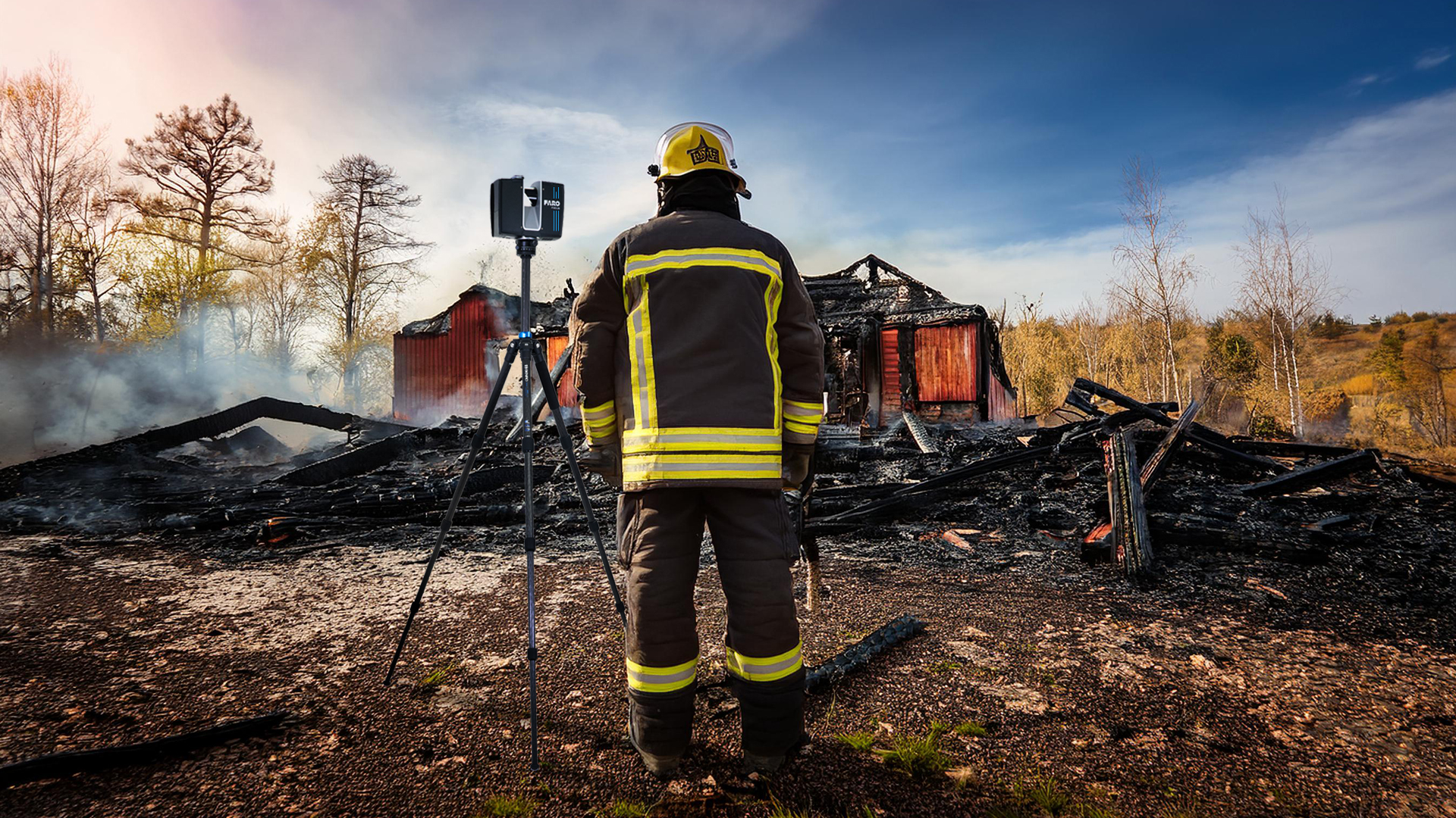
Laser scanners enable precise capture of fire scenes and building structures in the shortest possible time – without physical contact or interfering with the investigation work.
High-resolution 3D documentation
The detailed capture of the surroundings creates realistic 3D models that can be used for analyses, simulations and subsequent assessment.
Improved fire cause analysis
Precise measurement data helps experts and investigators to reconstruct the course of the fire and precisely identify possible causes.
Support for insurance companies & experts
Insurance companies benefit from objective 3D data that enables a clear assessment of the damage. This reduces disputes and facilitates the settlement of claims.
Optimization of fire protection measures
The captured data can be integrated into fire simulations to improve evacuation plans and identify potential danger spots at an early stage.
Before & after comparison for refurbishments
By comparing with old scan data, damage can be documented in detail and precise refurbishment plans can be drawn up.
TitleProcedure for the forensic investigation of a fire scene
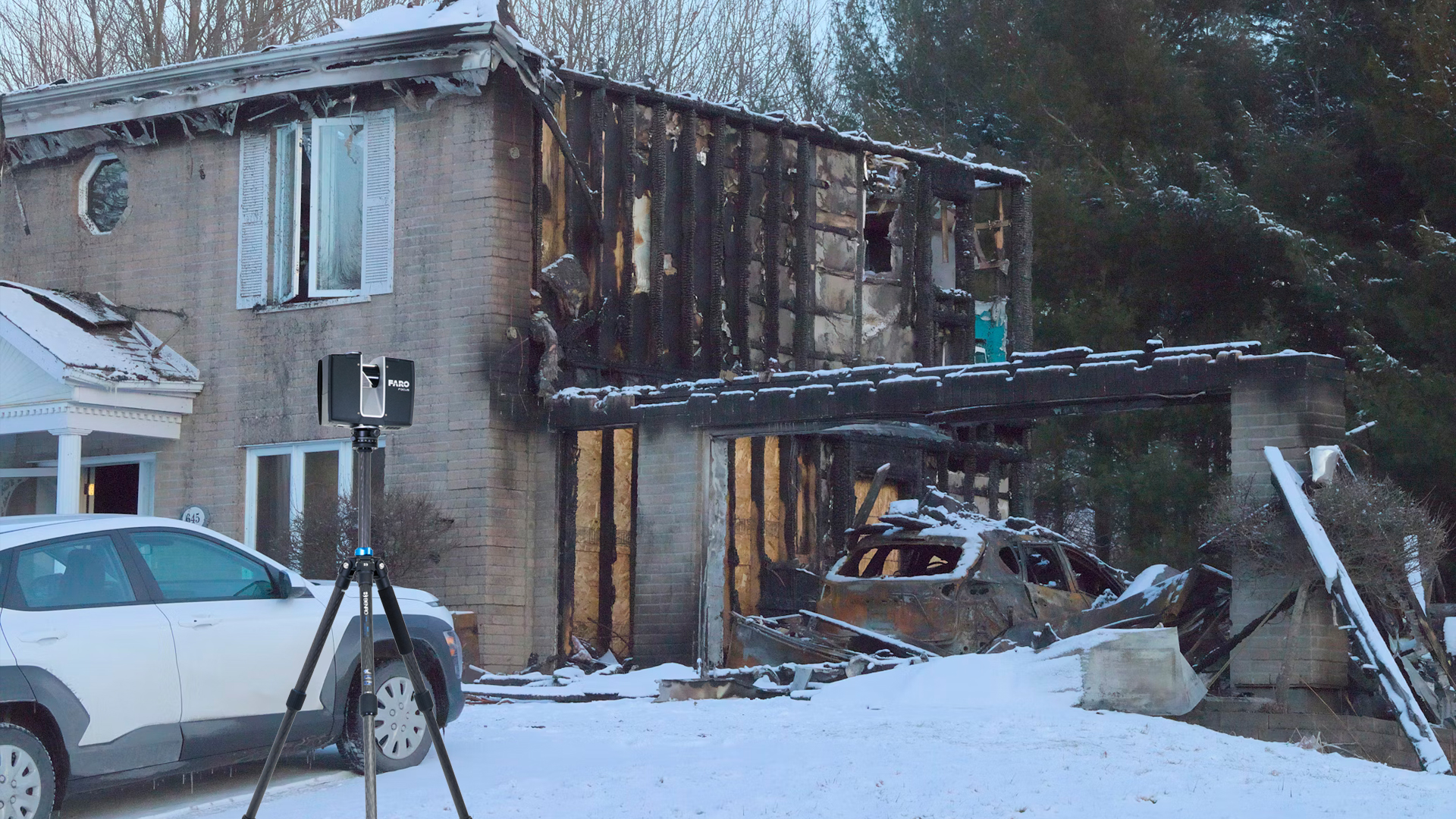
1. Securing the scene of the fire: Once the fire has been extinguished, the scene of the fire is secured to prevent any change in the evidence.
2. Capturing using a laser scanner: The fire scene is scanned from various perspectives to create a complete 3D visualisation.
3. Analysis of the point clouds: the data obtained is analysed to identify damage patterns and ignition sources.
4. Creation of models: Models are generated from the point cloud to visualise the course and spread of the fire.
5. Combination of data sources: Point clouds from different types of scanning (e.g. terrestrial scanners and UAV) can be combined to enable comprehensive analysis.
TitleStatements on fire progression & causes
Laser scanners provide important data that investigators can use to reconstruct the dynamics of a fire. Among other things, this technology enables
- Identification of the source of the fire: Precise localisation of the ignition source.
- Analysing the spread: Documenting the progression of flames, heat and smoke.
- Evaluation of damage patterns: Recognition of specific indicators such as traces of melting or soot distribution.
TitleIntegration in legal proceedings
The results of laser scanning can be used as evidence in court proceedings. 3D models and point clouds provide a visual and objective basis for reproducing the course of the fire. They are used to:
- Support expert reports.
- Create simulations of fire progressions.
- Provide precise evidence for legal disputes.
TitleCombination of data sets for accurate assessments
Fire locations can be recorded using several different laser scanners. Point clouds from different sources, such as terrestrial scanners and UAV, can be merged in the subsequent data analysis. This creates a complete and more precise image of the fire scene.
This combination of point clouds:
- increases the accuracy of the results.
- enables areas that are difficult to access to be analysed.
- provides a comprehensive overview of large areas.
TitleInvestigations 2.0: Laser scanning in fire forensics
Laser scanning is revolutionising fire investigation and forensics. Using the latest technology, investigators can not only precisely reconstruct the cause and course of a fire, but also provide evidence that can be used in court. Whether terrestrial scanners, UAVs or handheld scanners - the integration of these systems ensures comprehensive documentation and analysis, which is indispensable for modern fire investigation.
In the video, we present an exciting instalment of our measurement bus series. Eric Bergholz, CEO of Laserscanning Europe, was on site at the IASFM conference in San Diego and provides insights into the forensic work involved in investigating fire incidents using the latest laser scanner technology. This video is only available in German language.
Do you have questions about laser scanning in the field of fire investigation?