Laser Scanning in Gardening & Landscape Construction

TitlePrecise surveying in gardening and landscaping with laser scanners
In gardening and landscaping, the precise planning and implementation of projects is crucial for a perfect result. Whether designing parks, gardens or planning outdoor facilities, modern laser scanners offer an ideal solution for accurately capturing the conditions on site. Mobile scanners and terrestrial laser scanners enable fast and accurate data capture, which is essential for the precise planning, design and documentation of landscape projects.
TitleApplication of 3D scanning in gardening & horticulture
The use of 3D scanning and laser scanning opens up a wide range of applications in gardening and landscaping. The precise capture of terrain and as-built data forms the basis for efficient planning, creative design and sustainable implementation.
Surveying & documentation
3D scanners can be used to document existing garden and landscape areas in great detail. Point clouds provide exact data on height profiles, vegetation and existing structures. This ensures a reliable as-built survey.
Planning & visualization
Thanks to digital 3D models, landscape projects can be precisely planned and visualized. Terrain adjustments, pathways and planting concepts can be realistically displayed and easily adapted.
Quantity surveying & material planning
The precise measurement of areas and volumes enables exact quantities to be determined. This allows the material requirements for earthmoving, paths, flower beds and other elements to be calculated precisely, which saves costs and makes efficient use of resources.
Terrain analysis & height measurement
Unevenness and height differences are a particular challenge in landscaping. With laser scanning, you receive precise terrain data that enables the optimal adaptation of paths, terraces and planting areas.
Construction progress monitoring
During the implementation of landscape projects, 3D scanning offers reliable construction progress monitoring. Deviations from the plan can be detected and corrected at an early stage, saving time and costs.
Sustainable care & maintenance of green spaces
Digital capturing also offers advantages after a project has been completed: Regular documentation with 3D scanners helps to monitor the condition of green spaces and identify maintenance requirements at an early stage.
The versatile use of 3D scanning and laser scanning makes gardening and landscaping more efficient, precise and sustainable. From planning to maintenance, you can use digital technologies to implement high-quality and creative landscape projects.
TitleAdvantages of laser scanning in gardening & landscaping
The implementation of laser scanners has taken surveying in gardening and landscaping to a new level. The advantages include:
- High accuracy: Laser scanners provide measurement results that are accurate to the millimeter, creating the basis for precise planning and implementation.
- Time saving: The use of laser scanners allows large areas to be surveyed in a short space of time, which speeds up the work process considerably.
- Detailed images: The three-dimensional point clouds generated by laser scanners capture even the smallest details of the terrain surface.
- Efficient documentation: The digital data makes it easier to track the progress of the project and enables precise documentation of the existing structures.
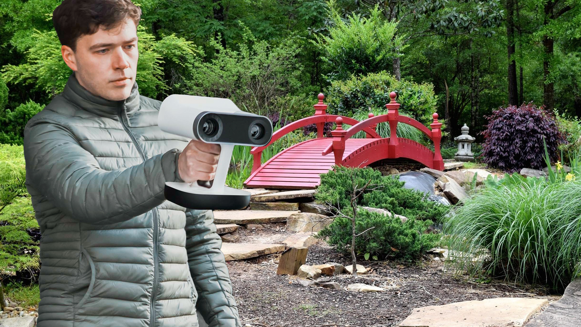
TitleHandheld scanner: Precise detection in a small space
Handheld scanners are ideal for use in areas where flexibility is required. These compact devices enable quick and precise detection of small areas or areas that are difficult to access, such as densely overgrown gardens or areas around complex buildings.
Areas of application for hand-held scanners:
- Capturing small garden areas
- Capturing individual objects such as statues or walls
- Measurement of irregular surfaces and natural stone walls
Thanks to their mobility and ease of use, hand-held scanners are perfect for detail-oriented tasks where precision is required.
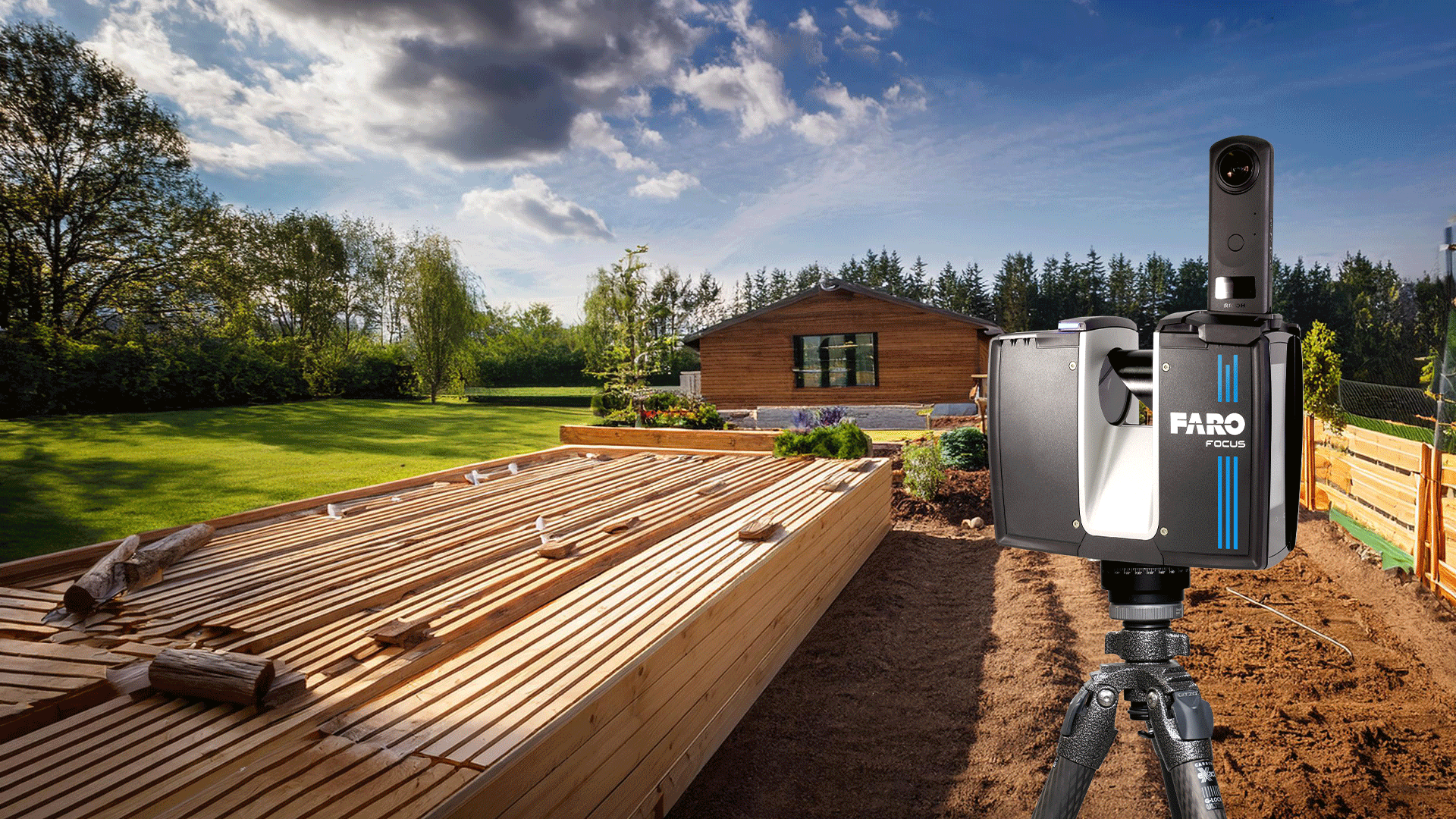
TitleMobile laser scanners: Flexibility over large areas

Mobile laser scanners offer the possibility of efficiently surveying larger areas. They are often mounted on vehicles or UAVs and are particularly suitable for large areas such as parks, gardens or outdoor facilities. Mobile laser scanners allow you to walk around an area on foot while digitally capturing the surroundings.
Advantages of mobile scanners:
- Capture large areas in the shortest possible time
- Possibility to collect data from the air by mounting on UAVs
- Combined capture of terrain profiles and vegetation
Mobile scanners are ideal for quickly obtaining a comprehensive overview of a site and at the same time accurately mapping the topography. Mobile scanners prove to be indispensable, especially for large projects where different types of terrain need to be taken into account.
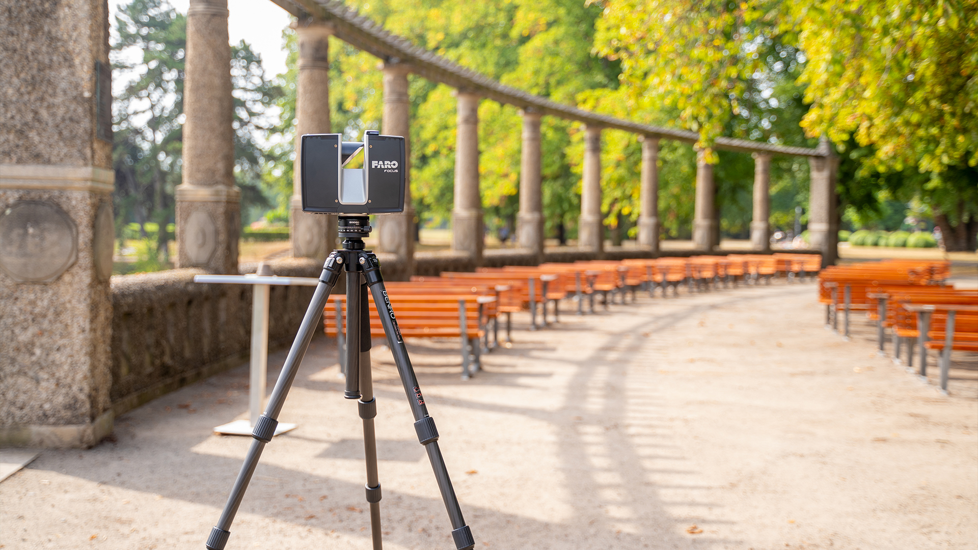
TitleTerrestrial laser scanners: Precise surveying of large areas & complex structures
Terrestrial laser scanners are used in static applications and are particularly suitable for complex structures or large construction projects. These scanners offer extremely high accuracy and capture detailed point clouds that enable a comprehensive analysis of the terrain surface.
Typical areas of application for terrestrial scanners:
- Surveying large garden areas with height differences
- Capturing buildings and structures in parks
- Taking stock of historical gardens
Terrestrial laser scanners are ideal when it comes to obtaining a precise and complete record of the terrain and buildings, which serves as the basis for further planning.
TitleLaser scanners as the key to efficiency in gardening & landscaping
Why is laser scanning useful in horticulture?
The use of 3D laser scanners not only makes gardening and landscaping work more precise, but also more efficient. The versatile application possibilities of the various scanner technologies offer the right solution for every project size and type.
Whether planning new facilities, surveying complex structures or documenting existing data – laser scanners are an indispensable tool for modern landscape architects and construction companies.