Teledyne Optech Polaris
TitleThe laser scanner for a variety of applications
Teledyne Optech's POLARIS 3D laser scanner is the optimal choice for long range, super-fast data capture, high accuracy and resolution. The long-range scanner works with the pulse method, which allows fast detection of objects with a long range.
TitleThe POLARIS series: laser scanners for different ranges and applications
The POLARIS series is available in three models. These are based on each other, i.e. the higher the model, the more detection rates (laser clock frequency) the scanner has for different ranges.
- Polaris HD is ideal for short-range applications up to a range of 250m (500 kHz).
- Polaris ER has two detection rates (500 kHz, 200 kHz) and has a range of up to 750m.
- Polaris LR is the highest configuration level and the perfect scanner for all applications. It has three detection rates (500 kHz, 200 kHz, 50 kHz) and a range of up to 2,000m.

TitleApplication areas of Teledyne Optech Polaris
The different mounting options and ranges of the Polaris open up new and interesting applications in many areas. Whether on a tripod, vehicle or other mobile platform, the Polaris is versatile.
The areas of application include
- Mining
- Heritage
- Transportation
- Engineering
- Construction
- Forensics
- Forestry
- Research
TitlePolaris as a mobile mapping system
Road areas or larger neighborhoods can be easily recorded thanks to the scanner's fast data acquisition. However, additional equipment is required to install Polaris on a vehicle. The scan data can form the basis for design measures, traffic simulations, animations, 3D city models, etc.
Polaris Stop&Go workflow
The Polaris Stop&Go workflow greatly accelerates large-scale data collection. By mounting the sensor on a vehicle and controlling it remotely using the ATLAScan Control module, the user can quickly stop, survey, and move to the next survey area. Whether using the Polaris on a tripod, installed on the roof the car, or lifted up to 6 meters high, the Stop&Go methodology lets you execute multiple surveys in rapid succession to cover wide areas from multiple perspectives.
TitleTeledyne Optech Polaris in mining
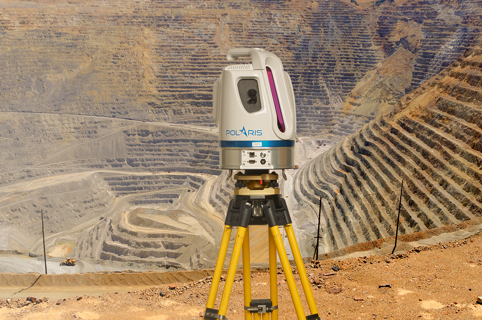
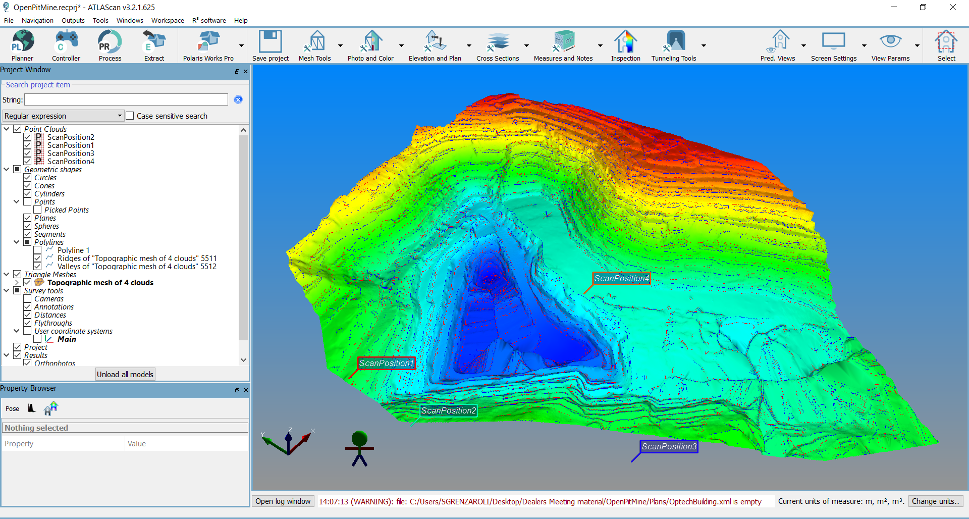
Due to the long range of the Polaris, the detection of mining pits is no problem. The scan data is used, for example, to define height layers, digital terrain models (DTM) and further planning in the mine.
ATLAScan monitoring solution
The optional ATLAScan Monitoring Solution is a complete solution for continuous, real-time monitoring of mines, landslides, glaciers and any other deforming surface of critical importance. This web-based application remotely controls the Polaris, schedules its continuous operation, and processes and compares the data in real time.
The user can define multiple change thresholds for the data, each with their own alarm level, so that ATLAScan triggers the appropriate alarm if the data crosses a threshold.
TitleTeledyne Optech Polaris for firlm & gaming animations
One of the uses of the Polaris is to bring a real environment into the digital world. Among other things, parts of the city of Dubrovnik in Croatia were scanned with the Teledyne Optech Polaris to create a real-life backdrop for the hit series Game of Thrones.
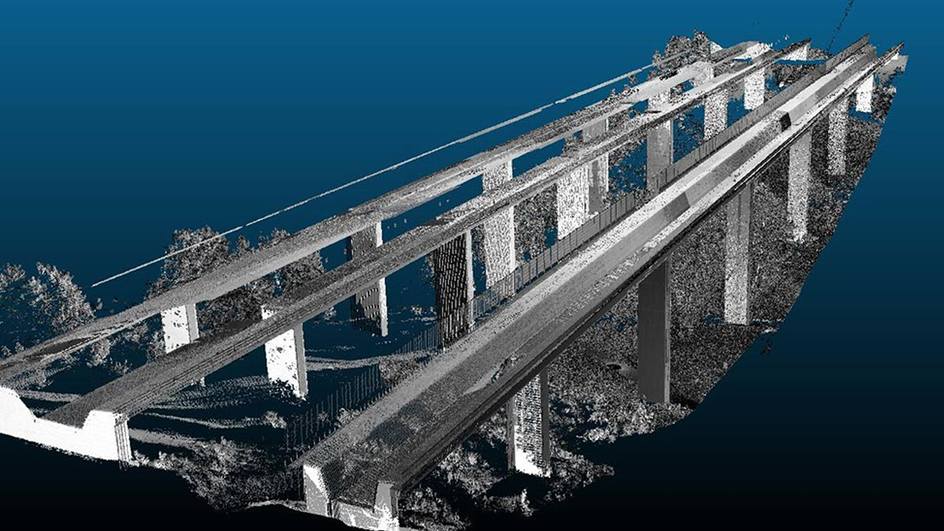
TitlePolaris in Construction
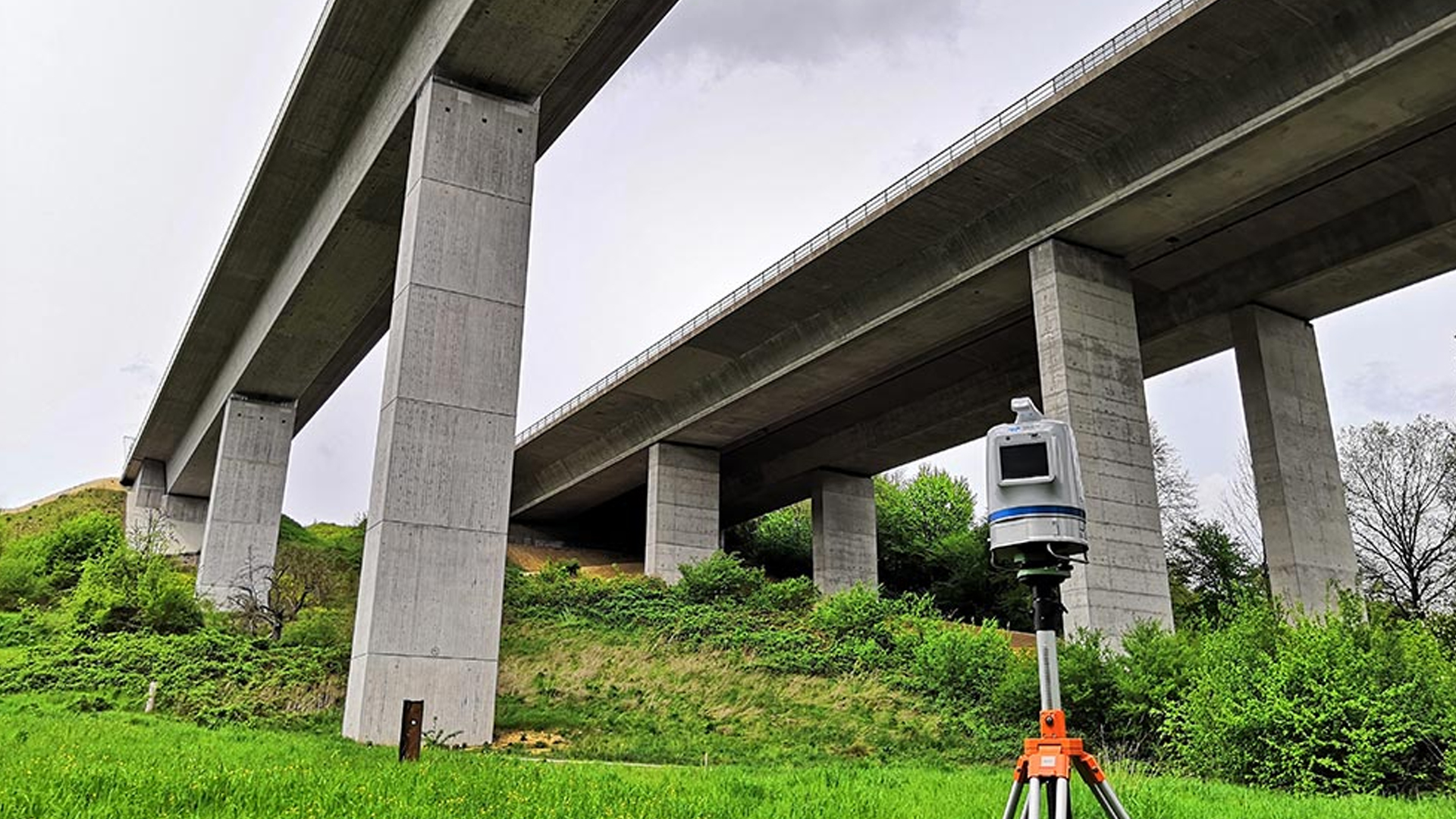
Whether the application is as-built surveys, continual structural monitoring, or inspection of existing structures, the Polaris delivers highly accurate geo-referenced 3D data in a package so simple that any operator can handle the collection regardless of training or skill level.
To save time and money, powerful planning tools let surveyors and engineers arrange the survey parameters and positions without leaving the office, while field crew execute the plans with the press of a single button. Even levelling and positioning can be done completely hands-off thanks to Polaris' integrated tilt compensator, optical plummet, compass, and GNSS antenna. Combined with an excellent data acquisition rate, this makes it easy for operators doing asbuilt surveys to take multiple collections from different positions, capturing every nook and cranny of complex structures.
Despite this simple workflow, the Polaris still has the accuracy and angular resolution to create engineering-grade models colorized by its integrated camera, or detect sub-centimeter movement or deformation in buildings, bridges and other structures.
These are only a few of the potential uses for this flexible sensor. With its 1.5 to 1600m range envelope, the Polaris can do both short-range indoor surveys and long-range collections of inaccessible or hazardous targets. An open API enables surveyors to customize the Polaris and integrate it with third-party sensors to suit their unique application, including infrared cameras, inertial navigation systems, or even sonar.

TitleHow the Teledyne Optech Polaris 3D laser scanner works
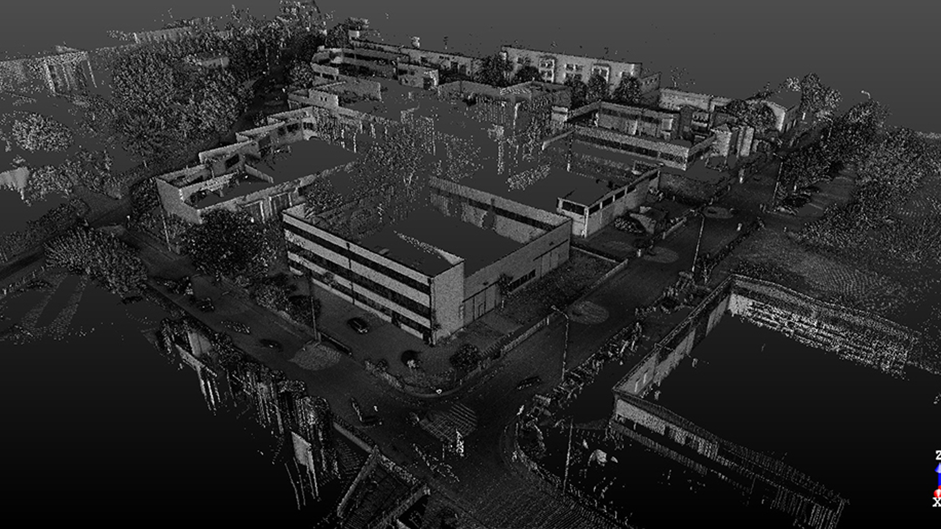
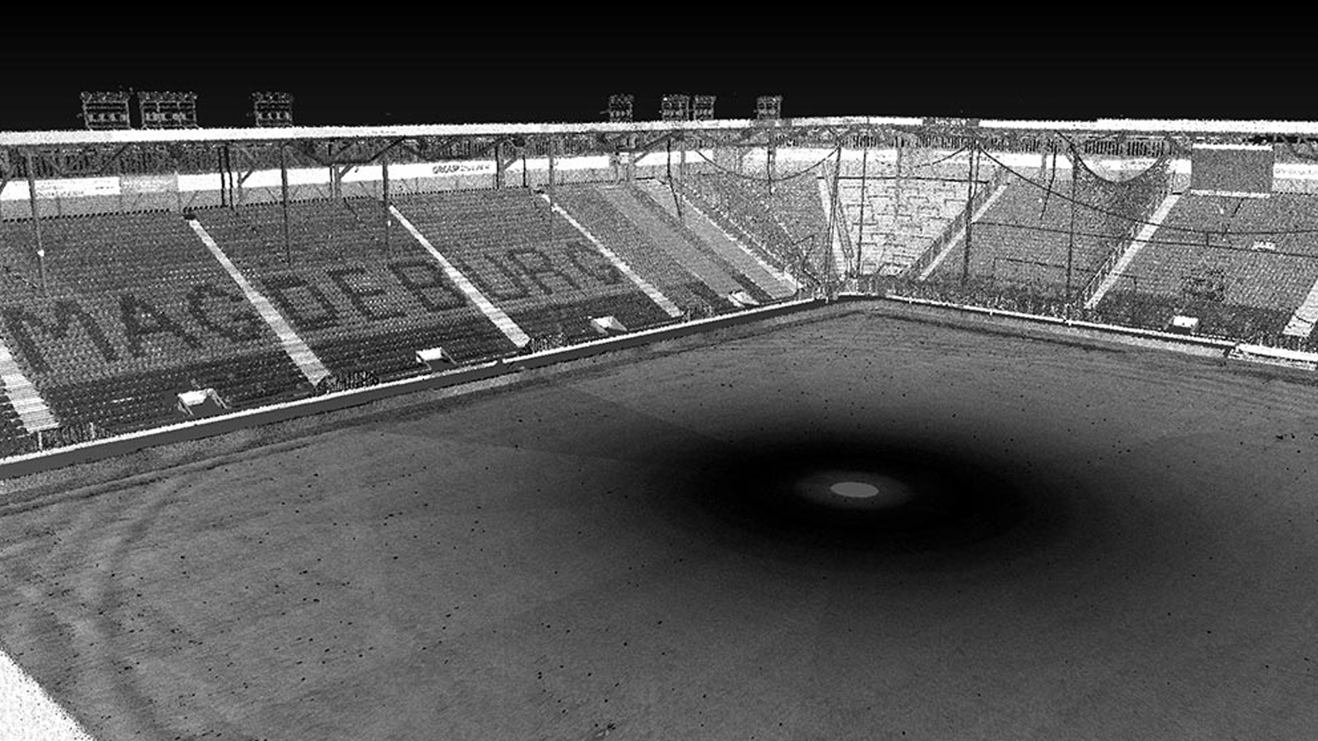
The Polaris laser scanner works with an active sensor, i.e. the scanner generates its own beam in the infrared range. This light is reflected by objects and then picked up and processed by the scanner. By rotating around its own axis, the entire environment is captured.
TitleHow does the Polaris wotk?
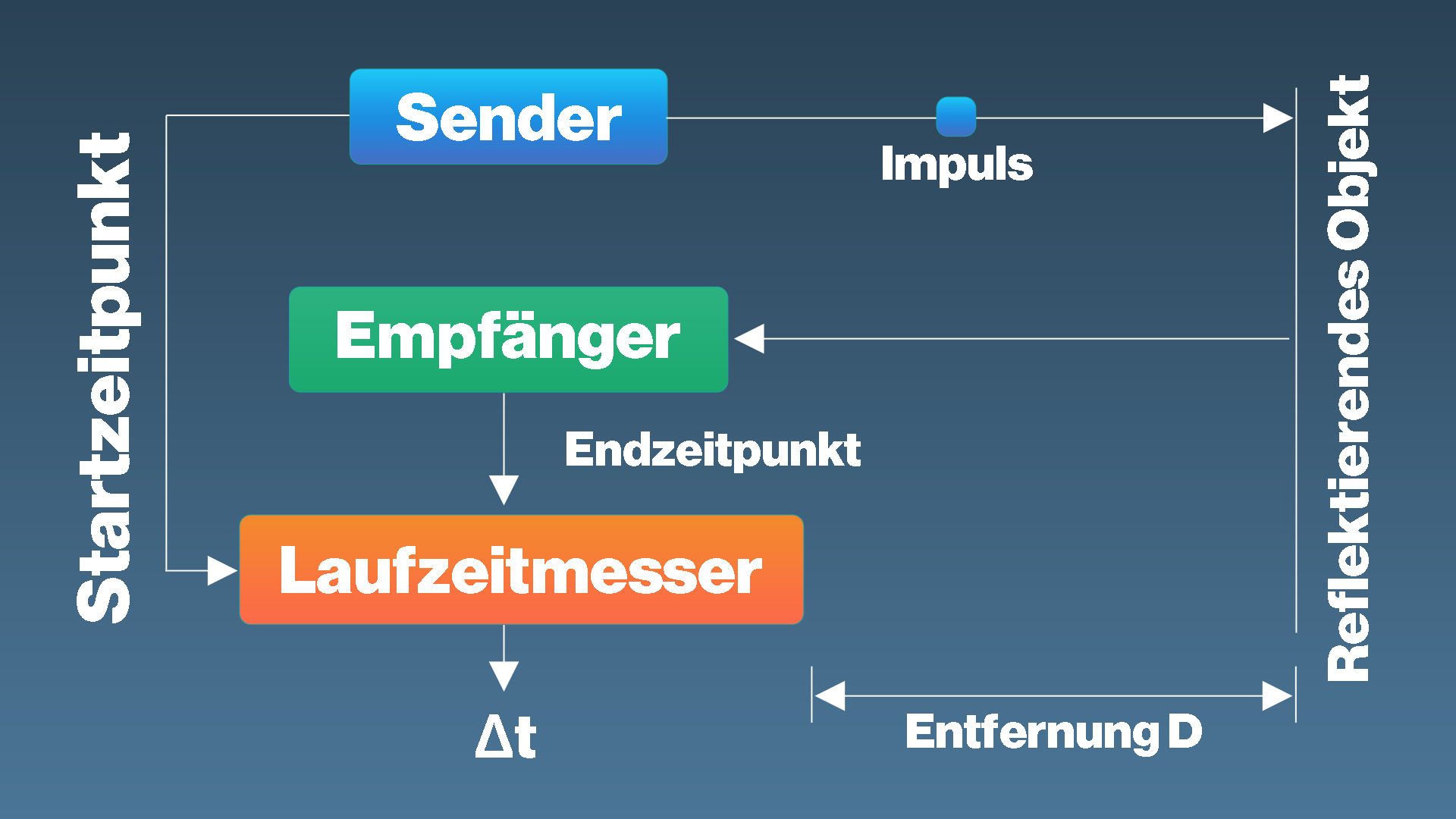
The Time of Flight (TOF) method is used as the measuring method.
In the (TOF) method, light pulses are modeled on a carrier wave; the time between transmission and reception by the device is measured. The distance to the scanner can then be determined from the transit time.
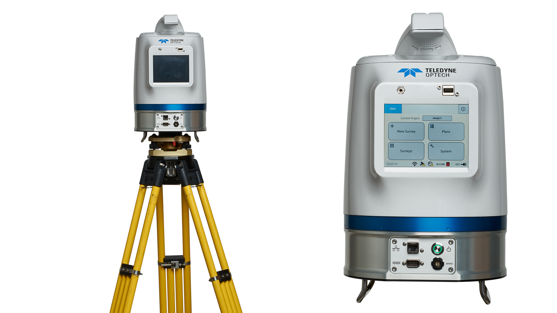
TitleThings to know about the 3D laser scanner
The Polaris scanner can be operated directly via the touchscreen or alternatively via a connected computer. Control via a computer only works with the licensed ATLAScan software.
TitlePlan at the office – Scan automatically in the field
Preparation at the office
ATLAScan’s Plan module allows the user (usually an experienced surveyor) to plan a 3D scanning survey that a less-experienced operator can automatically execute in the field. Using a background map of the area, the planner defines the scanning positions and georeferencing targets either manually or by loading a list of existing points, and sets all of the survey parameters to be used at each location (georeferencing method and targets, Polaris range mode, resolution, FOV, and more). The whole plan is saved and then uploaded to the Polaris for execution.
Automatic execution in the field
In the field, the surveying workflow is highly automated. Once the Polaris is in position, the operator can execute the plan. The Polaris uses information from its internal sensors (GNSS and compass) to guide and assist the operator, setting the scanning locations, options and parameters for the survey as planned at the office, ensuring that the survey will be properly performed. However, if circumstances in the field require a change of plan, the operator still has the flexibility to deviate from the planned settings as needed.
TitleProcess of scanning
The surroundings are scanned 360° horizontally and a maximum of 120° vertically. The scanning range (field of view = FOV) can be variably adjusted in the horizontal and vertical field of view, or alternatively object-specific.
If several scan positions are required, there are two registration options:
- Targets-based registration, i.e. for the alignment of the scans, the ATLAScan software uses targets as linking points between the scans. Polaris can recognize the targets automatically.
- ICP (Iterative Closest Point) registration is a registration without target marks and requires a large overlap area between the scans.
The scan data is analyzed exclusively using the ATLAScan software.
Laser | |
|---|---|
| Range measurement principle | Pulsed |
| Wavelength | 1550nm |
| Laser class | 1 |
| Sample collection rate | Up to 2 MHz |
| Intensity recording | 12 bits |
| Minimum range | 1.5m |
Scanning characteristics | |
|---|---|
| Max. vertical/horizontal FOV | 120° (-45° to +75°)/360° |
| Min. angular step size (horizontal) | 20 μrad |
| Min. angular step size (vertical) | 12 μrad |
Power | |
|---|---|
| Battery | Internal or external |
| Battery power | 2.5 hours |
| Power supply input voltage | 9-32 V DC |
| Power consumption | 60 W |
Physical characteristics | |
|---|---|
| Height | 323mm |
| Width (diameter) | 217mm |
| Total weight | 11.2kg |
Scanning resolution | |
|---|---|
| Angular measurement resolution | up to 12 μrad |
| Max. sample density (point to point spacing) | 2mm @ 100m |
Operation characteristics | |
|---|---|
| Operating temperature | min. -20 °C |
| Operating temperature | max. 50 °C |
| Humidity | 95% |
| On-board display | Yes |
| IP class | IP64 |
Accuracy | |
|---|---|
| Range accuracy (1 sigma) | 5mm @ 100m |
| Precision, single shot | 4mm @ 100m |
System peripherals | |
|---|---|
| Internal cameras | Yes |
| Export format of internal camera | JPEG |
| External camera | Yes (optional) |
| Export format of ext. camera | JPEG, NEF |
| User interface | Integrated touchscreen, tablet, PC |
| Additional sensors | Inclinometer, L1 GNSS, compass |
| Registration method | L1 GNSS, backsighting, targets |
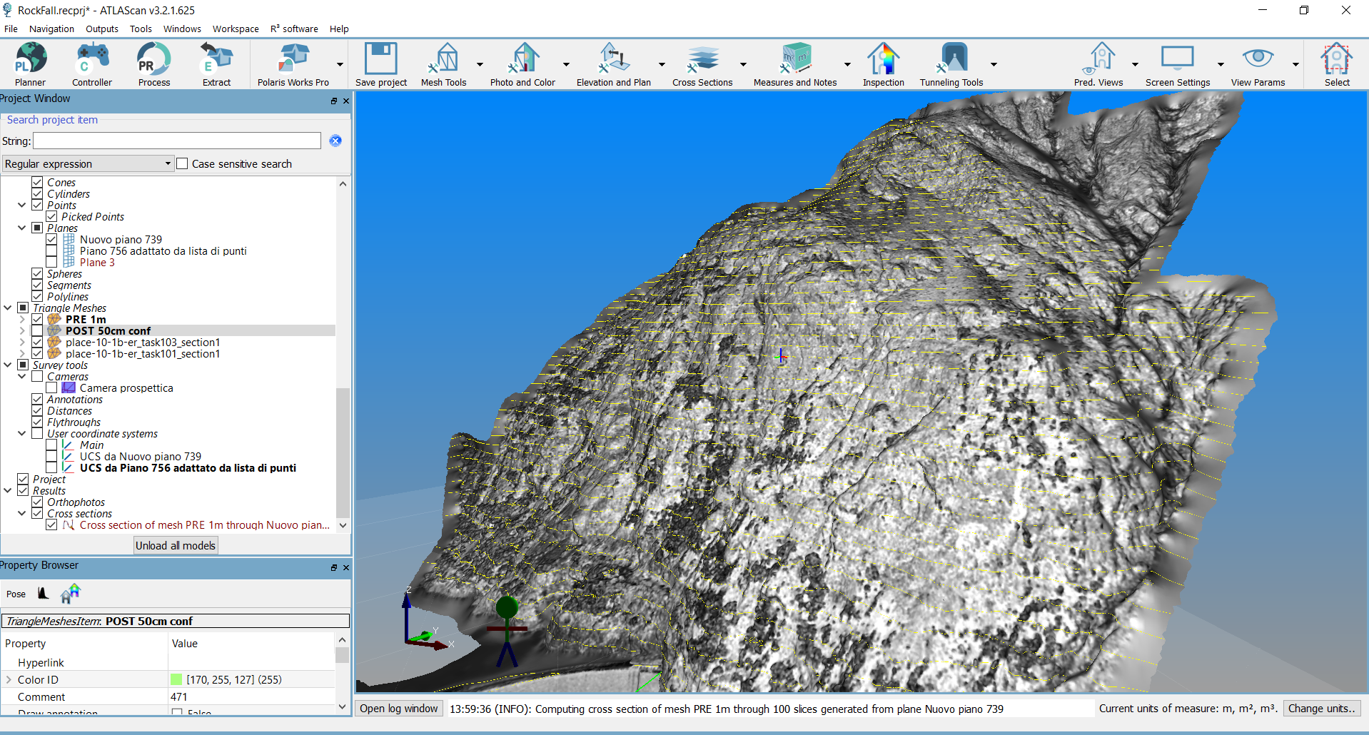
TitleAbout ATLAScan
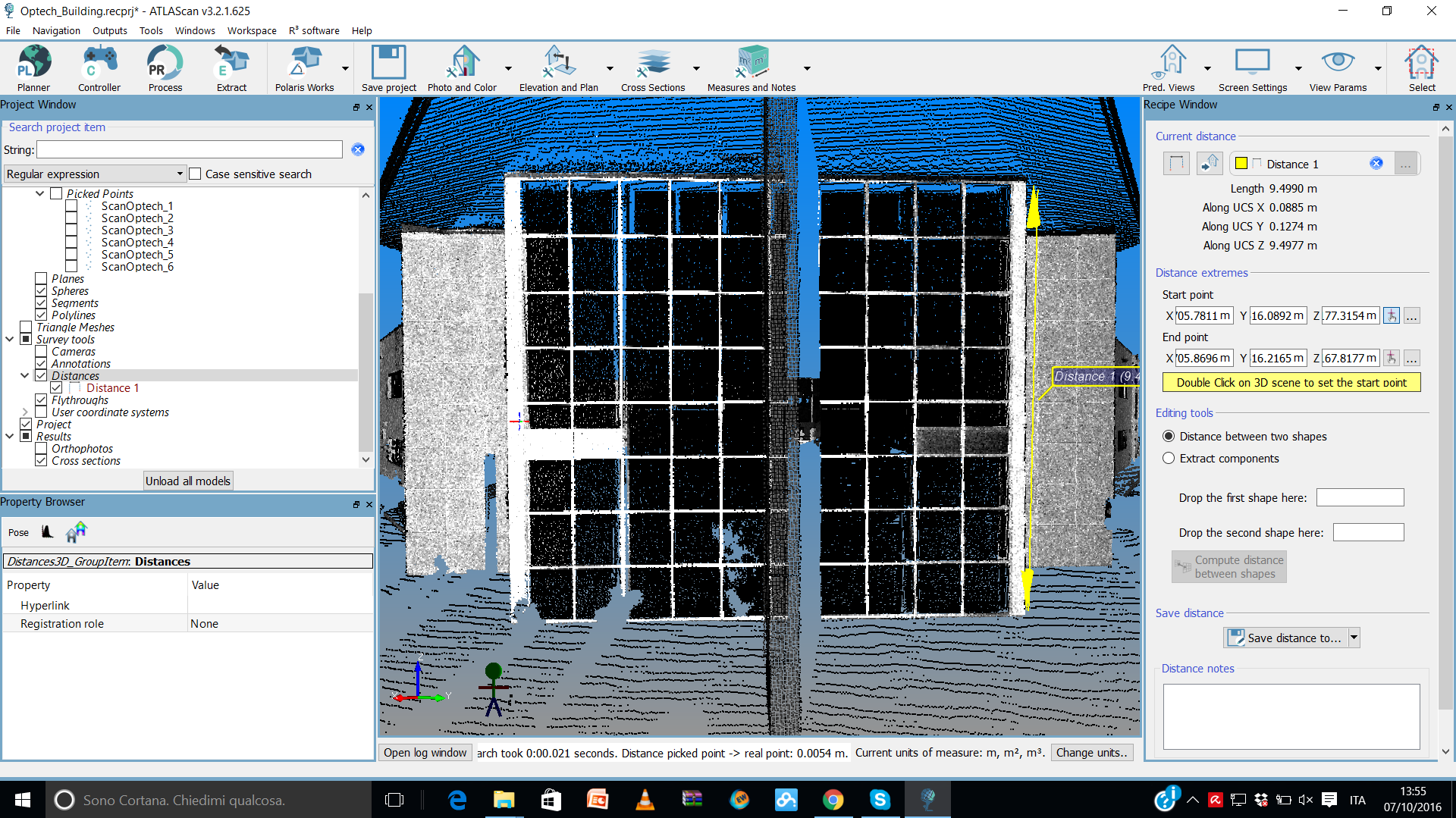
Polaris ATLAScan is a comprehensive software for the evaluation of scan data in 3D laser scanning. ATLAScan can do more than just align scan data very well and georeference point clouds. Bundled in one software solution, users can process point clouds directly and evaluate them into 3D meshes and DTMs. Among other things, users have powerful tools for tunnel construction, point cloud segmentation and monitoring at their disposal.
Results can be exported in the most common formats for point clouds, meshes and CAD objects.
ATLAScan software packages:
- Works – Basic package with every Polaris scanner. Includes project planning, remote control, point cloud processing, georeferencing and measurement tool
- WorksPro – Extends the analysis capabilities of Works and includes meshing and 3D modeling
- Photo – Extension to WorksPro. Use of images in conjunction with the point clouds
- Mobile – Supports the use of Polaris as a mobile system in conjunction with GNNS/INS system
TitleSoftware compatibility
ATLAScan can import several different formats and process them together in one project.
Format point cloud | Format mesh model |
|---|---|
*.pts | *.3ds |
*.las | *.txt |
*.txt | *.dae |
*.E57 | *.obj |
*.csv | *.dxf |
*.asc | *.ply |
*.scan | *.ifc |
*.ply | *.stl |
| *.wrl |
Better advice for users
Are you interested in our offer or would you like to find out more about the Polaris laser scanner? Then give us a call today and arrange a free, non-binding consultation. We will answer all your questions. As both a dealer and a user, we are ideally positioned to support you after your purchase.