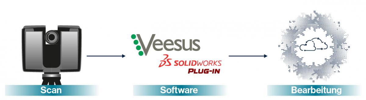
Plan efficiently in SolidWorks with point clouds and the Veesus plug-in

As part of its design work, the EAPL (European Active Projects Ltd.) team often needs to survey sites before creating designs. This was something Ben Ayling, CAD designer at EAPL, previously had to do by hand. For smaller projects, this wasn't a major problem, but for larger projects, manual surveying was both impractical and laborious.
Overcoming difficulties between 3D scanning and CAD
Although the team worked diligently and to a high standard, small errors could creep in when manually surveying large areas, requiring additional site visits to correct. Ben explains, "I particularly remember one property of approximately 2 hectares that was impossible to measure accurately by hand. Re-surveying areas where we had identified inconsistencies slowed down the project. It was clear that this type of surveying simply wasn't feasible on larger properties."
To solve the challenge, Ben and EAPL looked into 3D scanning technology to obtain accurate measurements of the properties. They invested in FARO scanners, but then faced another challenge: how to work with the point cloud files generated by the scanners in SolidWorks? For the first project, EAPL partner Solid Solutions converted the point clouds into mesh models, which Ben and the team could work with in SolidWorks.
"That was very helpful," says Ben, "but we wanted to go a step further. We wanted to be able to work with point clouds natively in SolidWorks. The meshes we used as a workaround often contained a lot of irrelevant data that we couldn't remove and simply weren't as versatile as point clouds."
Edit point clouds directly in SolidWorks with Veesus
Fortunately, Solid Solutions suggested a different approach – a SolidWorks plug-in from point cloud expert Veesus. The plug-in allows CAD designers to work with point clouds of any size natively in SolidWorks, without the need for meshing or other workarounds.
"We had looked at one or two other solutions, but none of them allowed us to work with point cloud data in SolidWorks – they all required converting point clouds into meshes first, so Veesus's offering was really exciting," explains Ben.
TitleFirst tests and results
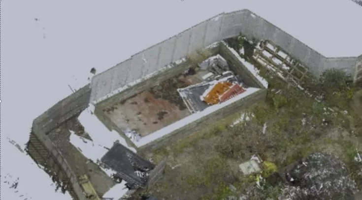
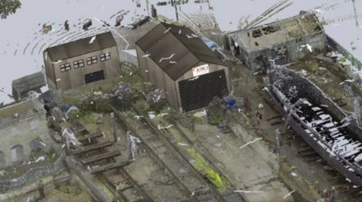
After learning about Veesus and being convinced of the solution, the team decided to test the beta version of the plug-in. The first attempt was impressive. To plan new buildings on the site, the team uploaded a 2-mile scan of Ramsgate Harbor and was immediately able to navigate the entire scan, including the dock, the ships in the harbor, and the surrounding buildings. The plug-in allows users to fully edit the point cloud, including the ability to hide parts—something Ben found particularly useful.
"The scanning captured a lot of data we didn't need—including hundreds of birds in the harbor. With Veesus, it was so easy to remove all that extraneous data and focus only on what we needed."
Faster & more accurate location measurements & a bright future for point clouds
The scan of Ramsgate Harbor enabled incredibly accurate surveying of the harbor and easy planning of the new buildings. Ben comments: "When you take measurements by hand up front, there's always the risk of forgetting something and having to go back to the site to fix it. With the point cloud, I can take every measurement I need from my desk – it saves a lot of time."
The point cloud data also helped EAPL obtain planning permission from the local council for their project. Working with the scan data in SolidWorks allowed Ben to demonstrate how the planned buildings would look next to the existing ones.
"Thanks to the detailed scan data, I was even able to design the building to fit the foundations of a previous building," he adds, "which is a useful thing to show the council."
Ben plans to use the Veesus plug-in on more projects in the future. In addition to the time-saving benefits and added accuracy that come with using point clouds, using 3D scan data will help EAPL increase safety when scanning sites. The team often surveys sites like quarries while they're still in operation, which poses a safety risk for surveyors.
"Now that we can easily work with point clouds, we can simply scan areas where surveying by hand would be dangerous, safely obtaining accurate data," Ben affirms. "This is just one of the many exciting opportunities the Veesus Point Clouds plug-in for SolidWorks has opened up for us—and I'm really excited to see where the partnership takes us in the future."
You can read the original article by Veesus here: Veesus Solidworks Plug-in