Fast construction documentation with orthoimages of the E6 in Norway

TitleModern measurement technology in road construction
Infrastructure construction presents many challenges. An example from Norway demonstrates how construction projects can be completed faster and more cost-efficiently thanks to modern methods: the extension of the E6 motorway.
TitleAim of the project
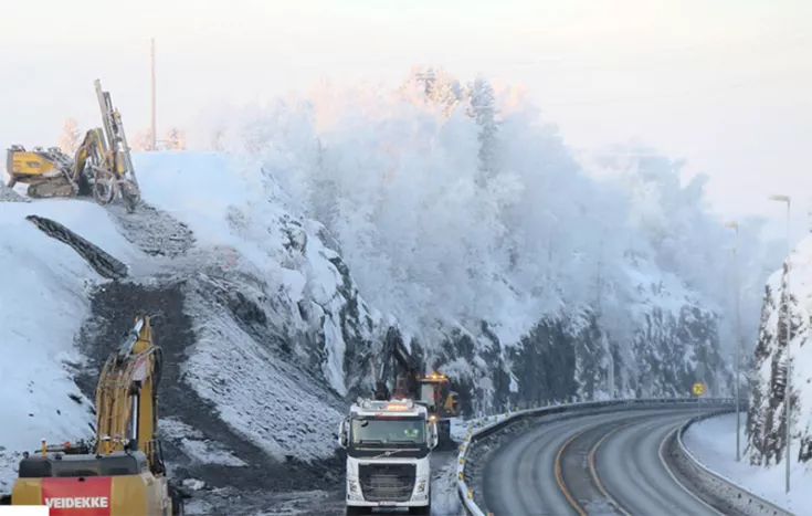
A new section of the E6 in Norway was built by the Norwegian engineering company Veidekke. This is the most important north-south connection through Norway and along the west coast of Sweden.
The construction progress on the four-lane European route was recorded through monthly drone flights. This regularly documented the current status of the entire project.
The goal of the project participants was to have fast, high-resolution access to the drone data in Infrakit.
TitleHow were the orthoimages used for construction monitoring?
The orthoimages from the drone footage were uploaded to Pointscene. The data could then be automatically transferred to BIM/design software such as Gemini Terrain or Infrakit and used as dynamic basemaps. This gave planners, project managers, and construction workers a constant overview of the progress of the entire project. All project stakeholders could access the latest data via the automated orthocompilation links from Pointscene.
TitleConclusion
The new section of the European route covers a length of 24 km; the project was scheduled to be completed in three years. Thanks to the use of drone technology in combination with the Pointscene software, the project was completed eight months ahead of schedule. The budget for the entire construction of the new road section was €250 million; 20% of the budget was saved here as well.
Consulting in infrastructure construction
If infrastructure projects are also of interest to you, please contact us. We would be happy to advise you on solutions that will help you implement your projects more efficiently.