3D Laser Scanning & Modeling in Infrastructure

Title3D scanning & modeling for infrastructure documentation
Surveying, scanning and modeling are central components in the acquisition of as-built data in infrastructure.
With the help of various methods, buildings, roads, bridges, supply and disposal facilities as well as leisure facilities can be captured in three dimensions in the shortest possible time and then modeled.
The generated point clouds provide a precise basis for planning and modeling software. This makes it easier to identify conflicts or problems in the planning process.
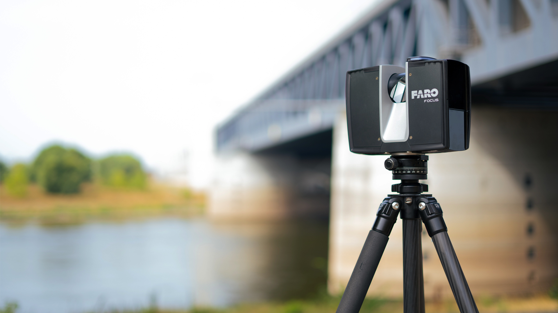
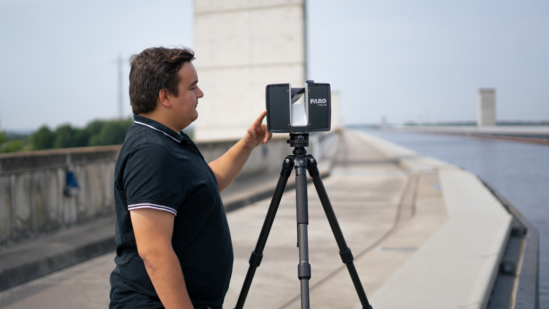
Title3D laser scanning for as-built surveys
3D laser scanning is considered to be the most advanced method of surveying. The conditions on site can be precisely captured and documented using a variety of measuring systems. The choice of the right system depends on factors such as the required accuracy, resolution, object size, local conditions and the desired data processing.
Various technologies, including mobile and terrestrial laser scanners, mobile mapping systems and drones, are used depending on the application. These systems generate point clouds, which can then be merged into a comprehensive overall point cloud using special software solutions. The data forms the basis for the creation of plans and 3D models.
TitleMobile mapping for rapid surveying of large areas
Mobile mapping has become increasingly important in the acquisition of infrastructure data. This method combines measurement and positioning sensors to enable highly efficient 3D data collection. The sensors can either be mounted on mobile platforms such as vehicles or trains or integrated into portable systems such as trolleys or backpacks.
Mobile mapping provides point clouds, mesh data, videos and/or geo-referenced images. A clear advantage of this technology is the fast data capture while continuing regular operations. With modern mobile mapping systems, large areas can be digitally captured in a very short time. Depending on the use of control points and areas, the accuracy currently reaches values of 1 to 3cm.
TitleAerial shots using UAV
The use of UAVs (unmanned aerial vehicles) in the infrastructure sector offers numerous advantages:
- Large areas can be surveyed quickly and efficiently.
- Complex, manual tasks such as inspections and structural monitoring can be replaced by UAVs.
- Work safety in dangerous or difficult-to-access areas, such as on highways or bridges, is increased as the devices are controlled from a safe distance.
The results of UAV missions often serve as a basis or supplement for 3D modeling. This technology has successfully established itself on the market, particularly through the generation of point clouds and high-resolution orthophotos.

TitleGreat benefits for the infrastructure sector
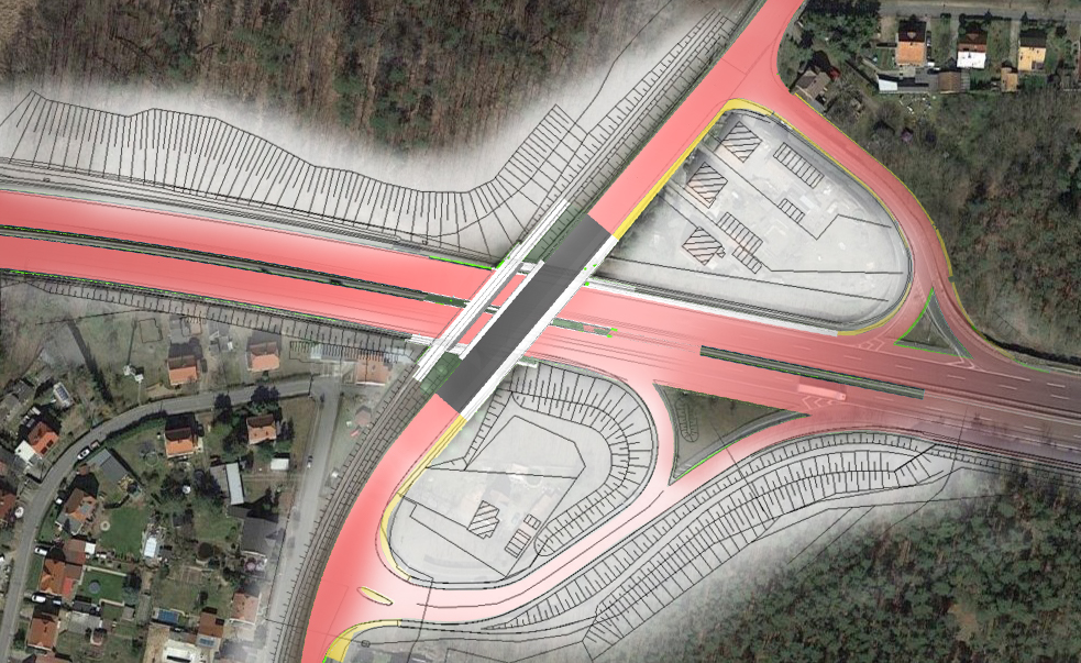
In the infrastructure sector, large-scale projects such as highways, railroad lines, tunnel construction or the renovation of hospitals are not uncommon. Such long-term projects require standardized and georeferenced as-built data. It is crucial that data capture is carried out efficiently, without interrupting operations and without risking people's safety.
With scanning technology, highly accurate measurement data can be captured in the shortest possible time, even in complex or difficult to access areas. This saves time, as the measurement is carried out much faster than with conventional methods, and at the same time reduces construction site interruptions or closures.
3D laser scanning impresses with its modern and fast recording method, which delivers an impressive amount of information in the shortest possible time. Thanks to the high information density and accuracy, the captured data is extremely precise, while the low error rate increases the reliability of the results.
TitleAdvantages of 3D laser scanning in infrastructure
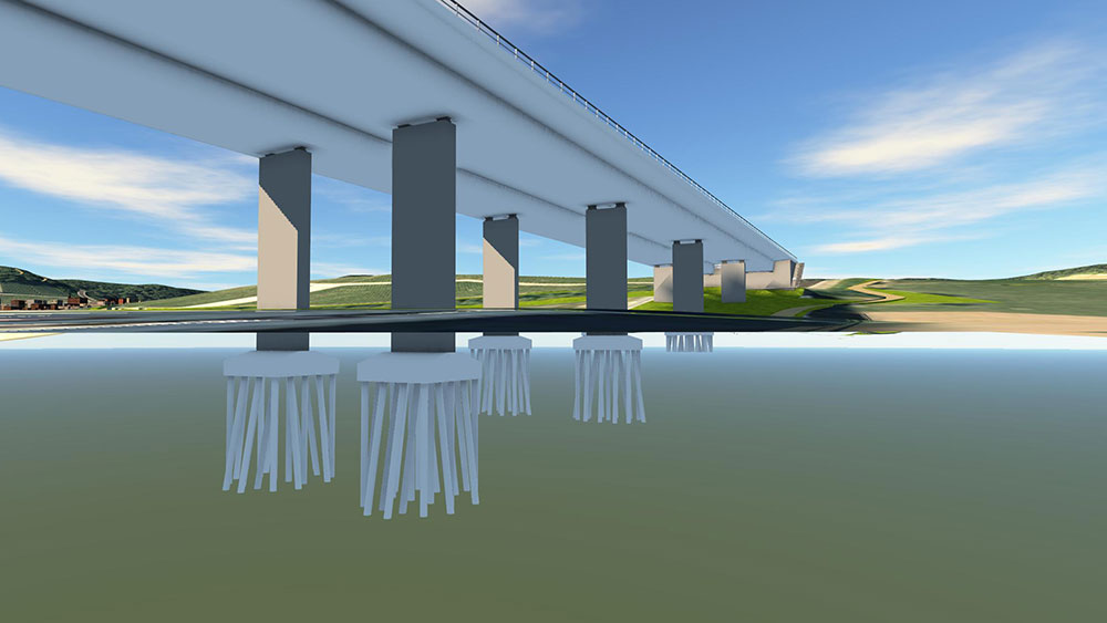
The technology enables deformation-true measurements and the realistic visualization of buildings and terrain. In combination with high-resolution 360° images, the results can be presented not only technically but also visually appealing – ideal for planners, engineers and stakeholders.
At the same time, the method helps to minimize planning errors and avoid costly rework by making deviations from construction plans visible at an early stage.
Sustainability also benefits: Precise data capture reduces material waste, and existing buildings can be refurbished or reused in a way that conserves resources. Finally, 3D laser scanning plays a central role in the long-term maintenance and inspection of buildings. Regular scans make it possible to continuously monitor the condition of safety-relevant infrastructure such as bridges and tunnels.
With these advantages, 3D laser scanning is becoming an indispensable technology for modern infrastructure projects.

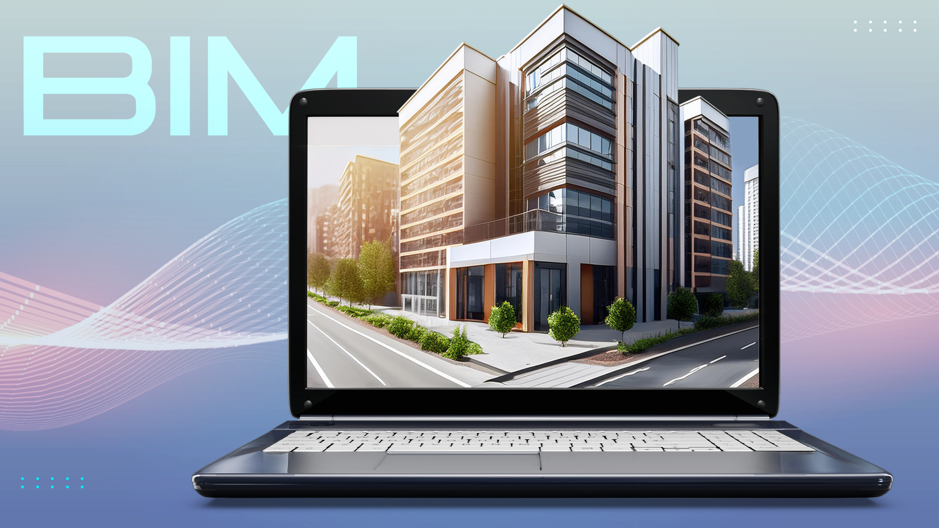
TitleUse of as-built models
The captured data is further processed by various specialist departments and user groups. Digital terrain models, video flights, virtual tours, environmental and evenness analyses and as-built models are among the tools used. As-built models (BIM models) are particularly frequently used as the basis for planning and refurbishment, but are also becoming increasingly important in operational management.
The benefits of as-built models are :
- Identification of open spaces, variant planning and conversion
- Spatial integration into the environment
- Simulation of processes, visualization, virtual tours
- Model-based quantity and cost calculation
- Creation of component lists
- Model-based collaboration and clash detection
- Simple data exchange via the IFC interface
- No loss of information through the assignment of attributes, parameters and features
- Model-based maintenance and servicing
- VR connection
- Replacement of old planning documents and old planning statuses
- Improved resource management
- Increased sustainability and adaptability
TitleWhy Building Information Modeling in infrastructure?
Improved planning & visualization
- BIM enables a realistic 3D representation of infrastructure projects, allowing planners to identify potential problems at an early stage.
- Visualizations make it easier to communicate project details to stakeholders in an understandable way.
Life cycle management
- BIM integrates data for the entire life cycle of a building - from planning to construction and maintenance.
- This enables more efficient maintenance and extends the service life of the infrastructure.
Cost reduction & error reduction
- Cost-intensive planning errors can be avoided by simulating various scenarios.
- Material and time schedules are optimized, which minimizes budget overruns.
Sustainability & resource efficiency
- BIM supports the analysis of a project's energy efficiency and environmental impact.
- Resource-saving use of materials is facilitated.
Efficient collaboration
- All project participants – from engineers to construction companies – can access a central, updated database.
- This reduces misunderstandings and promotes coordination between teams.
Legal certainty & standardization
- Many countries rely on BIM to make construction projects more transparent and compliant with legal requirements.
- It creates a standardized basis for tenders and documentation.
TitleInfrastructure projects - Count on a strong partner
In recent years, the BIM methodology (Building Information Modeling) has established itself on the market, and we at Laserscanning Europe have trained our employees accordingly and invested in modern hardware and software. This has shown that the requirements for 3D models vary depending on the project and client. Many infrastructure projects already require BIM, with clearly defined requirements and modeling frameworks.
Work on infrastructure projects, such as bridges, tunnels, hospitals and urban districts, demonstrates the benefits of BIM methodology, especially for large-scale projects involving many specialist groups and engineering firms. Different capture methods and workflows lead to consistent and comparable end results thanks to defined modeling standards. Not only point cloud data, but also analog as-built documents and tachymetric measurements are used.
Our close collaboration with specialist groups, universities and leading software manufacturers, as well as the continuous development of BIM tools and technologies, enables us to stay up to date and offer the best solutions for our clients.
Contact us at Laserscanning Europe to implement your infrastructure projects efficiently and successfully using the latest BIM technologies! Whether it's modeling your as-built data or commissioning surveying, we can support your project from start to finish.