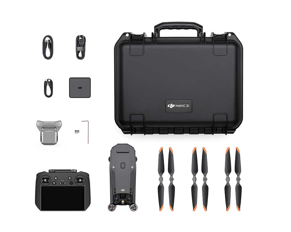
DJI Mavic 3E

TitleCompact UAV for surveying & inspection
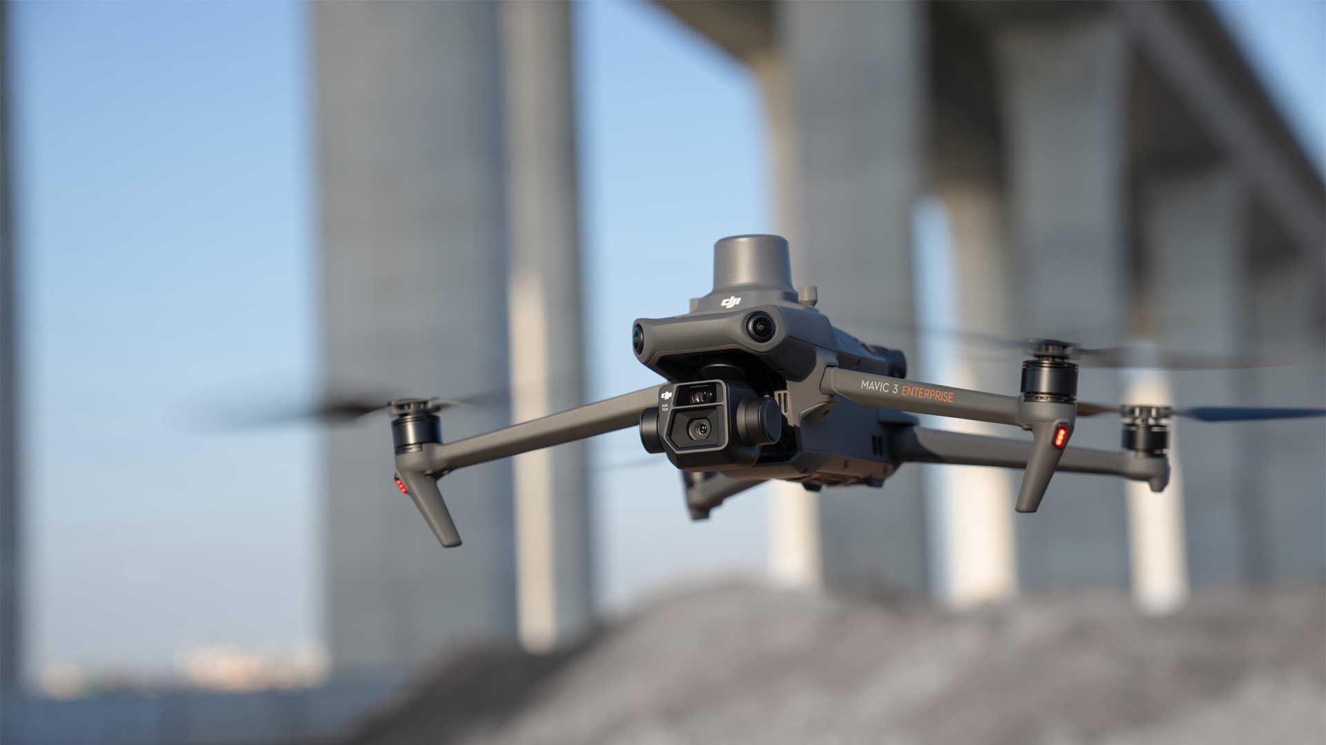
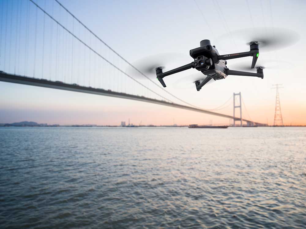
The DJI Mavic 3 Enterprise is a compact UAV designed specifically for commercial applications such as surveying, mapping and inspection. It features two powerful camera systems and supports precise GNSS positioning for accurate data capture. With a flight time of up to 45 minutes, it offers long flight units for missions.
The Mavic 3 Enterprise is also equipped with modular add-ons such as an RTK module for even greater precision. Its robust construction and ease of use make it ideal for professional use in a wide range of environments.
TitleDJI Mavic 3E in surveying
The DJI Mavic 3E can be used in surveying to quickly and accurately capture geodata from the air. It enables the creation of high-resolution maps and 3D models by efficiently covering large areas and providing accurate measurement data.
Possible applications:
- Orthomosaic creation for mapping projects
- Creation of 3D terrain models through photogrammetry
- Surveying construction sites, infrastructure and agricultural areas
- Acquisition of data for volume calculations and area analyses
Title4/3 CMOS camera
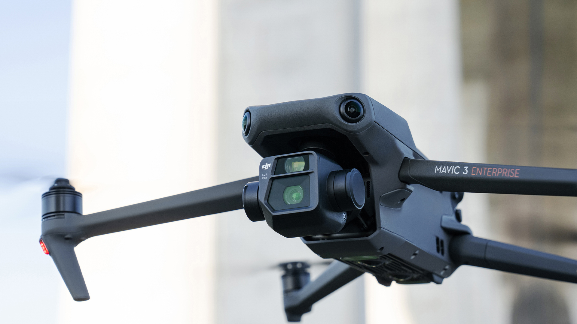
The DJI Mavic 3E is equipped with a 4/3 CMOS camera that offers high resolution and improved light sensitivity, ideal for detailed aerial shots. Thanks to the larger sensor, the UAV can deliver clear and sharp images even in difficult lighting conditions. This camera is ideal for precise surveying, mapping and inspections.
- Wide-angle camera: 20 megapixel resolution and 24 mm focal length
- Tele camera: 12 megapixel resolution and 162 mm focal length
TitleRTK module
The RTK module adds no additional load, allowing the drone to maintain its full 45-minute flight time while providing centimeter-accurate positioning data.
This combination ensures precise and efficient surveying and inspection tasks over extended periods of time.
Title45 minutes flight time
With a maximum flight time of up to 45 minutes, the DJI Mavic 3 Enterprise offers an impressively long flight time, which is particularly beneficial for surveying and inspection projects over large areas.
This reduces the need for frequent battery changes and enables longer, uninterrupted missions.
As a result, more data can be captured in less time, significantly increasing efficiency and productivity.
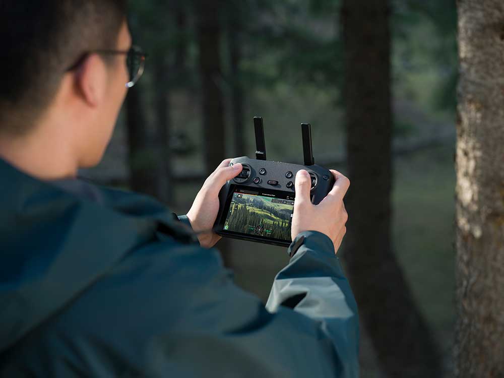
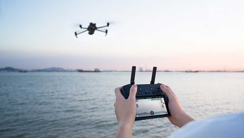
TitleDJI RC Pro Enterprise remote control
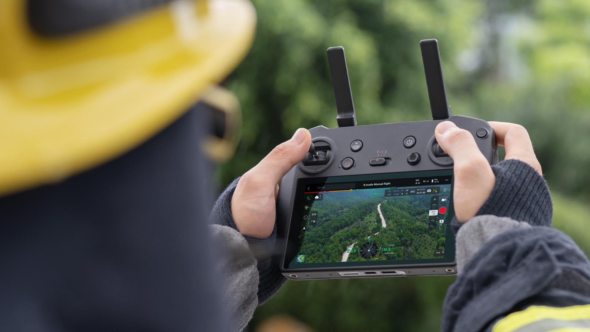
The DJI Mavic 3E comes with the DJI RC Pro Enterprise controller, which offers an enhanced user experience and robust control.
With its bright 5.5-inch display, the DJI RC Pro Enterprise enables clear visibility even in direct sunlight and supports a range of up to 15km.
The remote control also offers advanced features such as customized control options and seamless integration of third-party apps for professional operations.
TitleWorkflow with Mavic 3 Enterprise
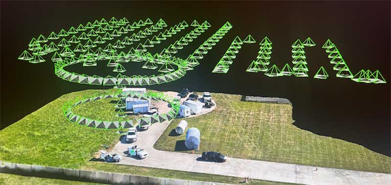
The workflow with the DJI Mavic 3E begins with planning, where you define flight routes and parameters for data acquisition in the DJI Pilot 2 app.
During the flight, the drone collects high-precision images and geodata, which are georeferenced with centimeter accuracy thanks to the RTK module.
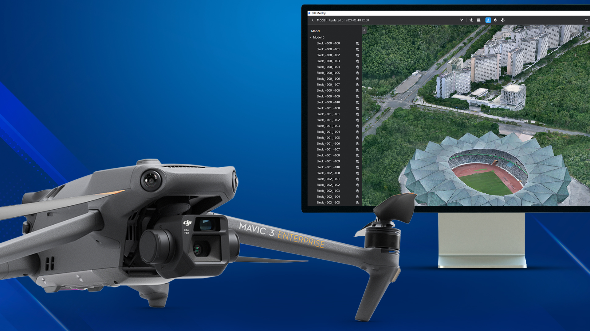
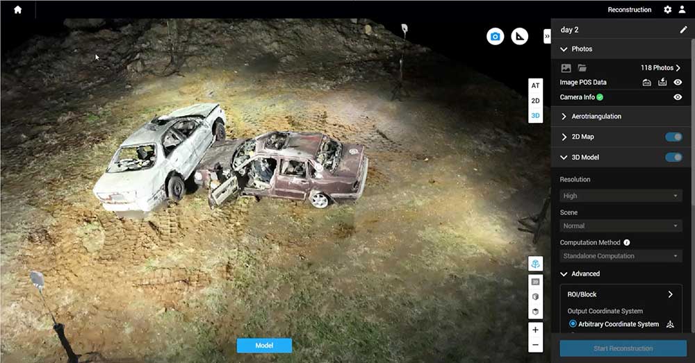
After the flight, the data is processed in software such as DJI Terra or other photogrammetric software to create maps, 3D models or survey results.
TitleFurther processing of the captured data
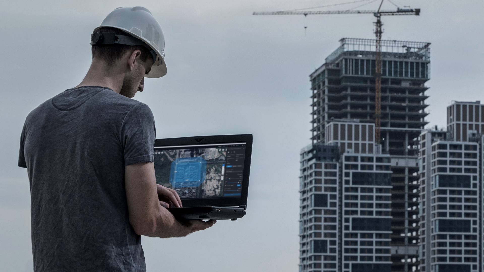
There are several post-processing software solutions from DJI for the DJI Mavic 3E, including
- DJI Terra: A comprehensive 2D and 3D data processing software that enables precise maps, 3D models and orthomosaics to be created from data captured by the Mavic 3E. It also supports functions such as volume measurements and terrain models.
- DJI FlightHub 2: A cloud-based drone fleet management solution that provides real-time data, flight planning and team coordination. Ideal for monitoring and managing drone operations, including data collected by the Mavic 3E.
Both software solutions are suitable for professional surveys and inspections and enable seamless integration of drone data into the work process.
TitlePrecision in every area of application
Discover the wide range of applications for the DJI Mavic 3E, the drone designed for professionals to capture, analyse and visualize accurate geospatial data. Thanks to state-of-the-art technology and innovative functions, the Mavic 3E is an indispensable tool in a wide range of industries.
TitleSurveying & mapping
The Mavic 3E is revolutionizing the surveying industry with its high-resolution 4/3 CMOS camera and centimetre-accurate RTK positioning.
It enables the rapid capture of large areas and the creation of precise 2D and 3D maps.
Ideal for construction and engineering projects, road planning and urban development.
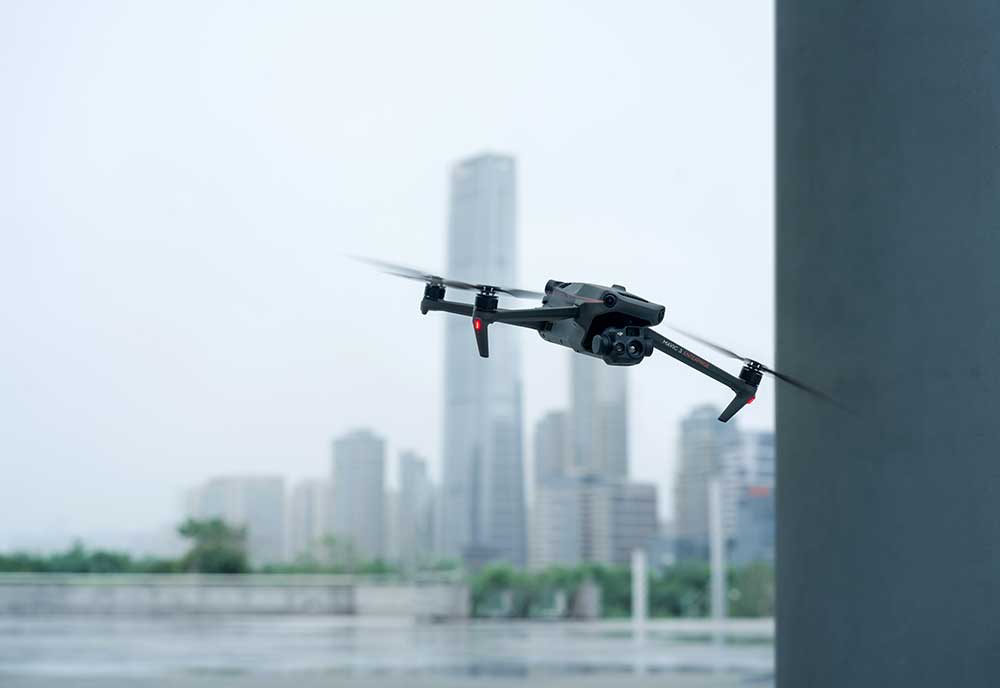
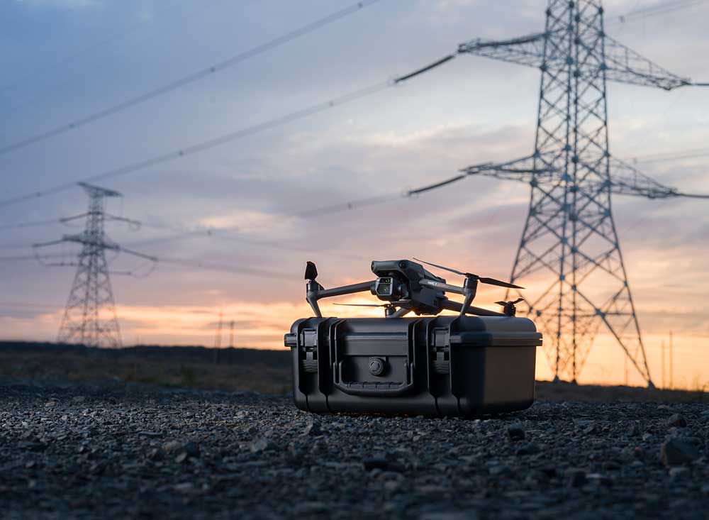
TitleConstruction & infrastructure monitoring
The Mavic 3E provides detailed aerial images and continuous monitoring for construction and inspection projects.
The drone helps to document construction progress, calculate material volumes and identify critical points on construction sites at an early stage.
Thanks to its multi-sensor capability and long flight time, it optimizes work processes and reduces costs.
TitleAgriculture & Forestry
In agriculture and forestry, the DJI Mavic 3E is a powerful tool for monitoring fields, crop health and forest areas.
With the ability to create precise aerial images and 3D models, it helps to analyze crop yields, plan irrigation strategies and detect pest infestations.
TitleInspections & safety work
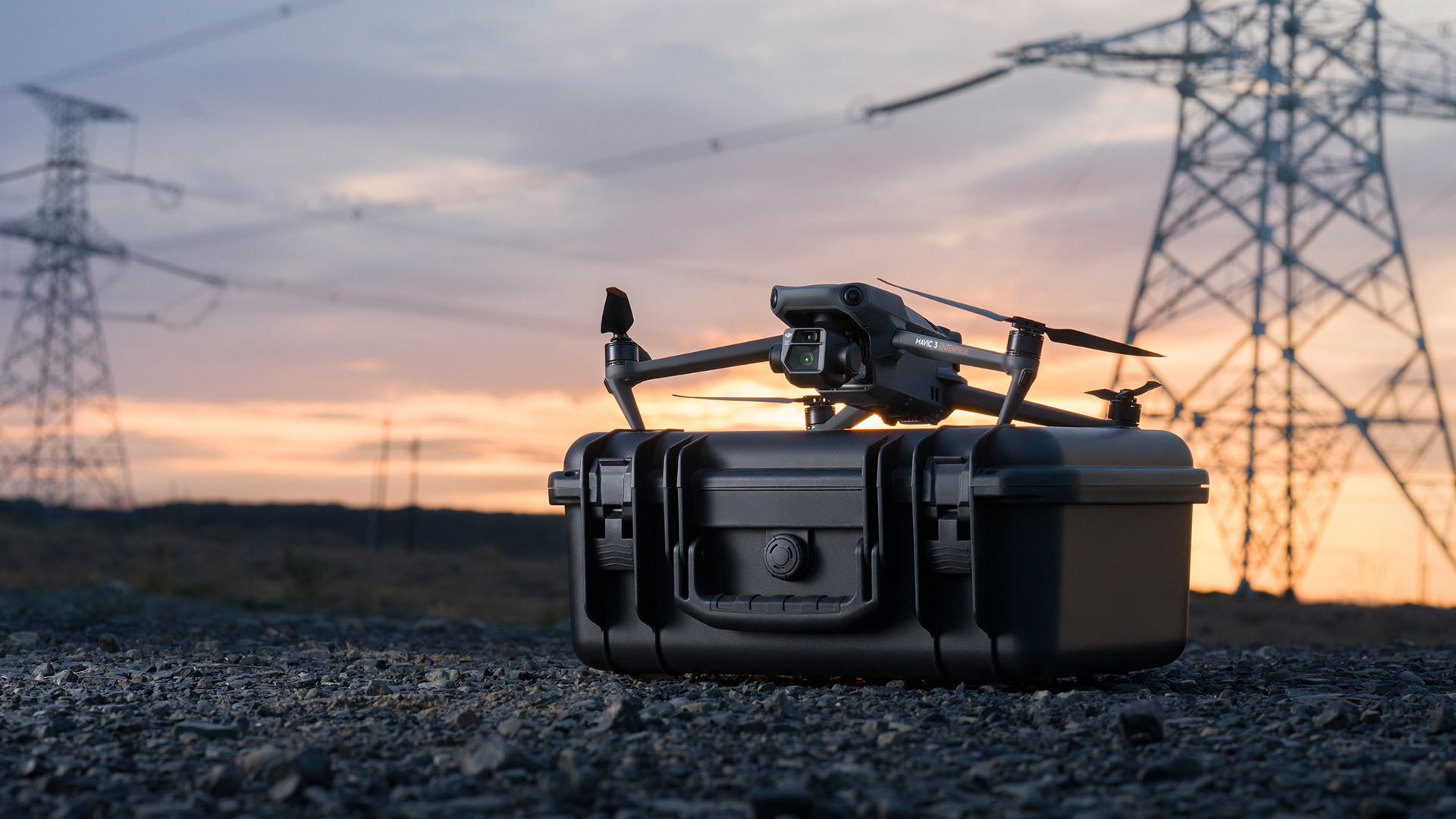
Thanks to its ability to capture high-resolution images and thermal images (with Mavic 3T), the Mavic 3E is perfect for inspection work on critical infrastructure such as power lines, wind turbines or solar fields.
With its long flight time and precise control, difficult or dangerous areas can be efficiently monitored and inspected.
TitleEmergency & rescue operations
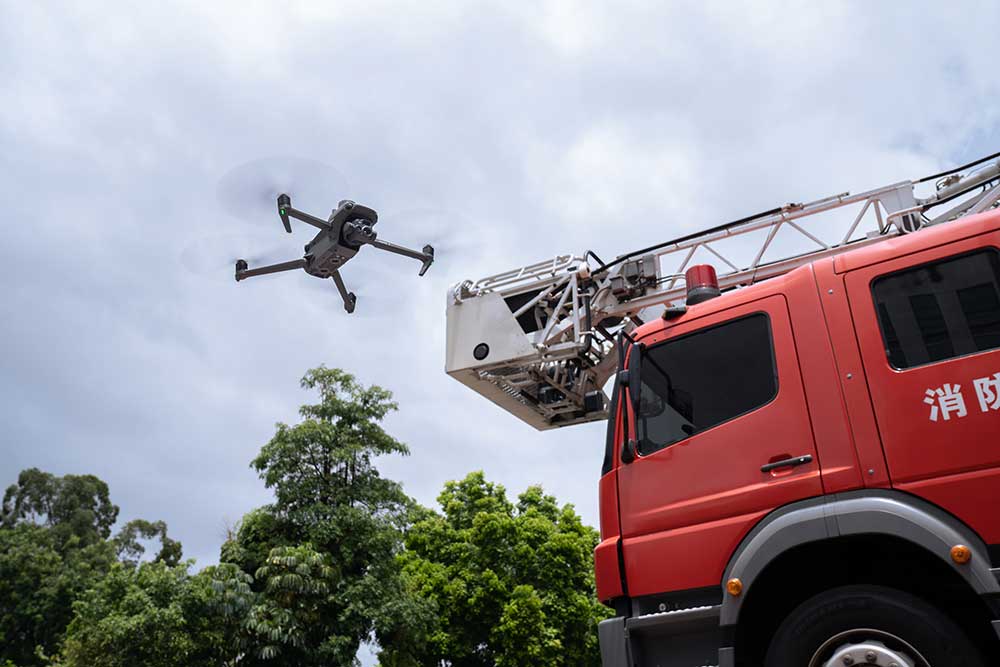
The DJI Mavic 3E can provide life-saving data in search and rescue missions.
Its powerful camera and thermal sensors make it possible to locate people in inaccessible terrain, day and night.
In this way, the drone helps rescue teams to act faster and more efficiently.

TitleWorkflow with DJI Mavic 3E
The workflow with the DJI Mavic 3E starts with the simple planning of a flight via the DJI Pilot 2 app, where missions are precisely defined.
After the automated flight, the recorded data is imported directly into software such as DJI Terra or third-party tools to create high-resolution maps, 3D models or point clouds.
TitlePlanning of the flight
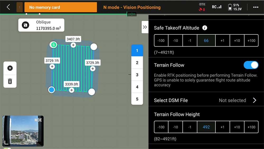
First, the area to be surveyed is defined using planning software such as DJI Terra or a third-party app.
Flight routes, flight altitude, image overlap and relevant parameters for the RTK module are defined to ensure complete and accurate coverage of the terrain.
TitlePreparing the drone
The Mavic 3E is equipped with the RTK module and calibrated to capture centimeter-accurate position data.
Batteries, memory and the DJI RC Pro Enterprise remote control are checked and prepared.
TitleCarrying out the flight
The drone is flown automatically along the pre-planned route.
Thanks to the RTK module, precise geo-referenced images are captured, while the 4/3 CMOS camera provides detailed and clear aerial images.
The flight time of up to 45 minutes makes it possible to cover large areas without frequent interruptions.
TitleData transfer & processing
After the flight, the collected image data is transferred to a computer and processed using surveying software such as DJI Terra or Pix4D.
The software creates an orthomosaic, 3D models or terrain maps that can be used for analysis and further processing.
TitleResults analysis & export
The processed data is checked for accuracy and then exported in the desired format, for example for CAD software or GIS systems, so that it can be used for further planning or documentation of the project.
TitleTechnical specifications of DJI Mavic 3 Enterprise
Aircraft
| Technical specifications | Values |
|---|---|
| Weight (with propellers, without accessories) | 915g |
| Max. starting weight | 1,050g |
| Dimensions | Folded (without propellers): 221 × 96.3 × 90.3 mm (L×W×H) Unfolded (without propellers): 347.5 × 283 × 107.7 mm (L×W×H) |
| Diagonal length | 380.1mm |
| Max. rate of climb | 6 m/s (normal mode) 8 m/s (sport mode) |
| Max. rate of descent | 6 m/s (normal mode) 6 m/s (sport mode) |
| Maximum speed (NHN, no wind) | 15 m/s (normal mode) Forward: 21 m/s, sideways: 20 m/s, backward: 19 m/s (sport mode) |
| Max. wind resistance | 12 m/s |
| Max. start altitude above NHN | 6,000 m (without payload) |
| Max. flight time (if there is no wind) | 45 min |
| Max. hover time (when there is no wind) | 38 min |
| Max. flight distance | 32km |
| Max. pitch angle | 30° (normal mode) 35° (sport mode) |
| Max. angular velocity | 200°/s |
| GNSS | GPS + Galileo + BeiDou + GLONASS (GLONASS is only supported if RTK module is enabled) |
| Hover accuracy | Vertical: ±0.1m (with vision sensors); ±0.5m (with GNSS); ±0.1m (with RTK) Horizontal: ±0.3m (with vision sensors); ±0.5m (with high-precision positioning system); ±0.1m (with RTK) |
| Operating temperature | -10 °C to 40 °C |
| Internal storage | - |
| Engine Model | 2008 |
| Propeller type | 9453F Enterprise Propeller |
| Signal light | Integrated into aircraft |
| Class | C2 (EU) |
Wide-angle camera
| Technical specifications | Values |
|---|---|
| Sensor | 4/3 CMOS; effective pixels: 20MP |
| Lens | Field of view: 84° Equivalent focal length: 24mm Aperture: f/2.8 to f/11 Focus: 1m to ∞ |
| ISO | 100 to 6400 |
| Shutter speed | Electronic shutter: 8 to 1/8000 s Mechanical shutter: 8 to 1/2000 s |
| Max. image size | 5280×3956 |
| Photo modes | Single shot: 20MP Interval: 20MP JPEG: 0.7/1/2/3/5/7/10/15/20/30/60s JPEG+RAW: 3/5/7/10/15/20/30/60s Smart photos in low light: 20 MP Panorama: 20MP (RAW) |
| Video resolution | H.264 4K: 3840×2160 bei 30 fps FHD: 1920×1080 bei 30 fps |
| Bitrate | 4K: 130 Mbps FHD: 70 Mbps |
| Supported file formats | exFAT |
| Photo formats | JPEG/DNG (RAW) |
| Video formats | MP4 (MPEG-4 AVC/H.264) |
Telecam
| Technical specifications | Values |
|---|---|
| Sensor | 1/2" CMOS, effective pixels: 12MP |
| Lens | Field of View: 15° Equivalent focal length: 162mm Aperture: f/4.4 Focus: 3m to ∞ |
| ISO | 100 bis 6400 |
| Shutter speed | Electronic shutter: 8 to 1/8000 s |
| Max. image size | 4000×3000 |
| Photo formats | JPEG |
| Video formats | MP4 (MPEG-4 AVC/H.264) |
| Photo modes | Single shot: 12MP Interval: 12MP JPEG: 0.7/1/2/3/5/7/10/15/20/30/60s Smart photos in low light: 12 MP |
| Video resolution | H.264 4K: 3840×2160 bei 30 fps FHD: 1920×1080 bei 30 fps |
| Bitrate | 4K: 130Mbps FHD: 70Mbps |
| Digital zoom | 8x (56x hybrid zoom) |
Gimbal
| Technical specifications | Values |
|---|---|
| Stabilization system | 3‑axis (tilt, roll, pan) |
| Mechanical area | Tilt: ‑135° to 100° Roll: ‑45° to 45° Pan: ‑27° to 27° |
| Controllable area | Tilt: ‑90° to 35° Pan: Uncontrollable |
| Max. steer speed (tilt) | 100°/s |
| Angular vibration range | ±0,007° |
Detection
| Technical specifications | Values |
|---|---|
| Detection system | Omnidirectional dual vision system, supplemented by an infrared sensor on the underside of the aircraft. |
| Front | Measurement range: 0.5 to 20m Detection range: 0.5 to 200m Effective detection speed: Airspeed ≤15 m/s Field of view: Horizontal: 90°, Vertical: 103° |
| Rear | Measurement range: 0.5 to 16m Effective detection speed: Airspeed ≤12 m/s Field of view: Horizontal: 90°, Vertical: 103° |
| Sideways | Measurement range: 0.5 to 25m Effective detection speed: Airspeed ≤15 m/s Field of view: Horizontal: 90°, Vertical: 85° |
| Top | Measurement range: 0.2 to 10m Effective detection speed: Airspeed ≤6 m/s Field of view: Front and rear 100°, left and right 90° |
| Bottom | Measurement range: 0.3 to 18m Effective detection speed: Airspeed ≤6 m/s Field of view: 130° front and rear, 160° left and right |
| Operational handling | Front, rear, left, right and top: Surfaces with clear contours and sufficient lighting (lux >15). Below: Surface with diffuse reflectance >20 % (e.g. walls, trees, people) and adequate lighting (lux >15). |
Video transmission
| Technical specifications | Values |
|---|---|
| Video transmission system | DJI O3 Enterprise broadcast |
| Live view quality | Remote control: 1080p/30fps |
| Operating frequency | 2.400 to 2.4835GHz 5.725 to 5.850GHz |
| Max. transmission range (without obstacles and interference) | FCC: 15m CE: 8km SRRC: 8km MIC: 8km |
| Max. transmission range (with obstacles) | Strong interference (e.g. dense development, residential areas): 1.5 to 3km (FCC/CE/SRRC/MIC). Medium interference (e.g. suburbs, city parks): 3–9km (FCC), 3–6km (CE/SRRC/MIC). Low interference (e.g. open space, remote area): 9–15km (FCC), 6–8km (CE/SRRC/MIC). |
| Max. download speed | 15MB/s (with DJI RC Pro Enterprise remote controller) |
| Latency (depending on environmental factors and mobile device used) | Approx. 200ms |
| Antennas | 4 antennas, 2 transmitters, 4 receivers |
| Radiated power (EIRP) | 2.4GHz: <33dBm (FCC), <20dBm (CE/SRRC/MIC) 5.8GHz: <33dBm (FCC), <30dBm (SRRC), <14dBm (CE) |
DJI RC Pro Enterprise
| Technical specifications | Values |
|---|---|
| Video transmission system | DJI O3 Enterprise transmission |
| Max. transmission range (without obstacles and interference) | FCC: 15m CE/SRRC/MIC: 8km |
| Operating frequency of the video transmission | 2.400 to 2.4835 GHz 5.725 to 5.850 GHz |
| Antennas | 4 antennas, 2 transmitters, 4 receivers |
| Radiated power (EIRP) of the video transmission | 2.4 GHz: <33dBm (FCC), <20dBm (CE/SRRC/MIC) 5.8 GHz: <33dBm (FCC), <14dBm (CE), <23dBm (SRRC) |
| Wi-Fi protocol | 802.11 a/b/g/n/ac/ax Supports 2×2 MIMO Wi-Fi |
| Wi-Fi operating frequency | 2.400 to 2.4835 GHz 5.150 to 5.250 GHz 5.725 to 5.850 GHz |
| Wi-Fi radiation line | 2.4 GHz: <26dBm (FCC), <20dBm (CE/SRRC/MIC) 5.1 GHz: <26dBm (FCC), <23dBm (CE/SRRC/MIC) 5.8 GHz: <26dBm (FCC/SRRC), <14dBm (CE) |
| Bluetooth protocol | Bluetooth 5.1 |
| Bluetooth operating frequency | 2.,400 to 2.4835 GHz |
| Bluetooth radiated power (EIRP) | <10dBm |
| Display resolution | 1920×1080 |
| Screen size | 5.5 inch |
| Screen frame rate | 60 fps |
| Display brightness | 1.000cd/m² |
| Touchscreen control | 10-point multi-touch |
| Battery | Li-Ion (5.000mAh at 7.2V) |
| Charging type | It is recommended to charge with the included DJI USB-C power supply (100W) or a 12V or 15V USB charger. |
| Nominal power | 12W |
| Memory capacity | Internal memory (ROM): 64GB Supports microSD card for capacity expansion |
| Charging time | Approx. 1 hour 30 minutes (with the supplied DJI USB-C power supply (100W) when charging the remote control only, or a 15V USB charger) Approx. 2 hours (with a 12V USB charger) Approx. 2 hours 50 minutes (with the supplied DJI USB-C power supply (100W) when charging the aircraft and the remote control at the same time) |
| Battery life | Approx. 3 hours |
| Video output | Mini-HDMI connection |
| Operating temperature | -10 °C to 40 °C |
| Storage temperature | <1 month: -30 °C to 60 °C1 to 3 months: -30 °C to 45 °C3 to 6 months: -30 °C to 35 °C>6 months: -30 °C to 25 °C |
| Charging temperature | 5 °C to 40 °C |
| Supported aircraft | DJI Mavic 3E DJI Mavic 3T |
| GNSS | GPS + Galileo + GLONASS |
| Dimensions | Antennas folded, control stick not mounted: 183.27 × 137.41 × 47.6mm (L×W×H) Antennas unfolded, control stick mounted: 183.27 × 203.35 × 59.84mm (L×W×H) |
| Weight | Approx. 680g |
| Model | RM510B |
Storage
| Technical specifications | Values |
|---|---|
| Compatible memory cards | Aircraft: U3/Class10/V30 or higher is required. A list of recommended microSD cards can be found below. |
| Recommended microSD memory cards | Remote control: SanDisk Extreme PRO 64GB V30 A2 microSDXC SanDisk High Endurance 64GB V30 microSDXC SanDisk Extreme 128GB V30 A2 microSDXC SanDisk Extreme 256GB V30 A2 microSDXC SanDisk Extreme 512GB V30 A2 microSDXC Lexar 667x 64GB V30 A2 microSDXC Lexar High-Endurance 64GB V30 microSDXC Lexar High-Endurance 128GB V30 microSDXC Lexar 667x 256GB V30 A2 microSDXC Lexar 512GB V30 A2 microSDXC Samsung EVO Plus 64GB V30 microSDXC Samsung EVO Plus 128GB V30 microSDXC Samsung EVO Plus 256GB V30 microSDXC Samsung EVO Plus 512GB V30 microSDXC Kingston Canvas Go! Plus 128GB V30 A2 microSDXC Kingston Canvas React Plus 128GB V90 A1 microSDXC Aircraft: SanDisk Extreme 32GB V30 A1 microSDHC SanDisk Extreme PRO 32GB V30 A1 microSDHC SanDisk Extreme 512GB V30 A2 microSDXC Lexar 1066x 64GB V30 A2 microSDXC Kingston Canvas Go! Plus 64GB V30 A2 microSDXC Kingston Canvas React Plus 64GB V90 A1 microSDXC Kingston Canvas Go! Plus 128GB V30 A2 microSDXC Kingston Canvas React Plus 128GB V90 A1 microSDXC Kingston Canvas React Plus 256GB V90 A2 microSDXC Samsung PRO Plus 256GB V30 A2 microSDXC |
Battery
| Technical specifications | Values |
|---|---|
| Memory capacity | 5,000mAh |
| Default voltage | 15.4V |
| Max. charging voltage | 17.6V |
| Battery type | LiPo 4S |
| Chemical composition | LiCoO2 |
| Energy | 77Wh |
| Weight | 335.5g |
| Charge temperature | 5 °C to 40 °C |
Charger
| Technical specifications | Values |
|---|---|
| Input | 100 to 240V AC, 50 to 60Hz, 2.5A |
| Output line | 100W |
| Output | Max. 100W (total) If both connections are used, the maximum output power is 82W each and the output power of both connections is dynamically distributed by the charger according to the current load. |
Battery charging unit
| Technical specifications | Values |
|---|---|
| Input | USB-C: 5 to 20V; 5.0A |
| Output | Battery slot: 12 to 17.6V; 8.0A |
| Nominal power | 100W |
| Charging type | Three batteries are charged in succession |
| Charging temperature | 5 °C to 40 °C |
RTK module
| Technical specifications | Values |
|---|---|
| Dimensions | 50.2 × 40.2 × 66.2mm (L×W×H) |
| Weight | 24±2g |
| Anschlüsse | USB-C |
| Performance | Approx. 1.2W |
| RTK positioning accuracy | RTK Fix: 1cm + 1ppm (horizontal), 1.5cm + 1ppm (vertical) |
Better advice for users
Are you interested in our offer or would you like to find out more about DJI Mavic 3 Enterprise UAV? Then give us a call today and arrange a free, non-binding consultation. We will answer all your questions. As both a dealer and a user, we are ideally positioned to support you after your purchase.