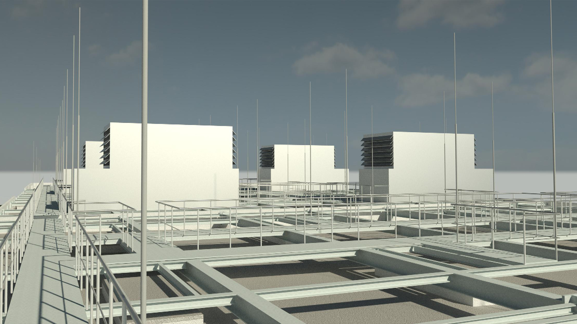
Roof survey - Comparison of different technologies for capturing inaccessible roof areas for inspection

TitleRoof inspection with 3D scans
For as-built documentation and inspection of inaccessible or impassable areas, a practical and efficient solution is increasingly required. Very often this depends on local conditions, so the approach to measurement must be very flexible.
Thanks to a wide range of measuring devices and accessories, we have the possibility to offer the most suitable method of roof survey for your project. Some variants of the roof survey are described and compared in this article.
TitleWhat is the purpose of roof survey?
The survey of roof surfaces is important from various aspects. However, the main concerns are conversions/extensions or inspections and checks of roof surfaces.
In order to minimize risks during a construction project on the roof of a building or during a roof inspection, work processes and installation efforts must be optimized. An exact measurement of the roof area enables precise planning and thus reduces the amount of work required on the roof.
At the same time, digital measurement is faster and more error-free than the conventional manual solution. The smallest deformations or discolorations can be documented and verified with high precision.
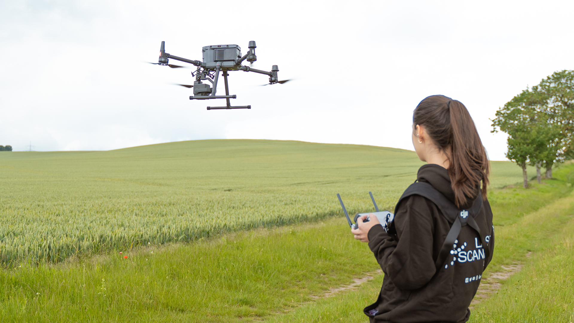
TitleRoof survey by UAV
UAV imaging enables the survey from the air. After previous planning, the survey can be carried out automatically from the air. The UAV can then be used to capture even the most complex roof shapes from the air in a short time.
For UAVs weighing 5kg or more, you need an ascent permit; in addition, a UAV operator's license is required in Germany. If you would like to carry out a roof survey using a UAV, you must also note that the object to be surveyed must be located at a certain distance from power plants, air-restricted areas and other areas prohibited for drone flight.

TitleRoof survey by photogrammetry – UAV in combination with measuring camera
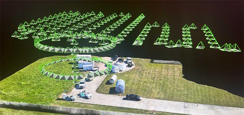
The highest quality solution for roof surveys or roof inspections is photogrammetric surveying using a high-resolution measuring camera, which is attached to a UAV suitable for this purpose. The necessary 3D information of the roof geometry is generated with a large number of individual images and complex computing processes. High accuracies can be achieved in the process. In addition, realistic and highly detailed RGB information is captured by the photos as raw data. The smallest discolorations can be detected. The calculation and analysis of the large amounts of data is more time-consuming and requires strong computing resources.
TitleScans from the roof using a UAV and mobile laser scanner
Instead of a measuring camera, a mobile laser scanner can also be mounted on the UAV. Using lidar sensors, the scanner captures the 3D information of the roof faster than the camera. By transmitting laser waves and detecting the reflection, the scanner measures the distance to the object and provides an image of the captured surface. Processing to the final point cloud also represents a much smaller time factor. High-precision sensor technology can be used to capture the roof surface even when it is in motion.
However, the final accuracy of the point cloud is lower than with photogrammetric surveying. RGB information is also rather unsuitable for detailed inspection. The combination of UAV and mobile laser scanner is therefore suitable for more affordable but coarser 3D planning.
The scanning method offers the advantage that the scans of the roof surfaces can be merged very effectively with scans from the interior of the building.
TitleRoof survey using terrestrial laser scanner on tripod
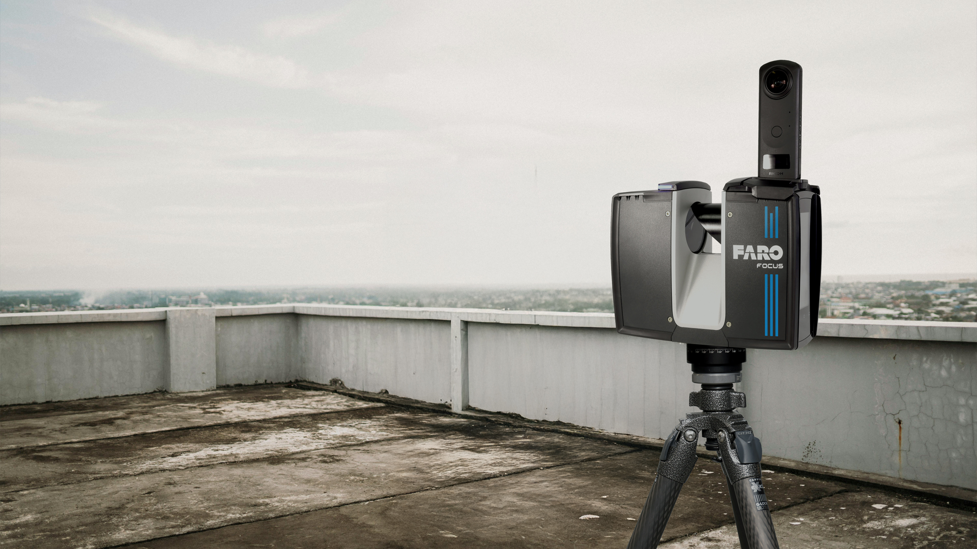
Another approach for generating highly accurate as-built data of roof surfaces is the use of terrestrial laser scanners. The measuring instrument is placed at several positions in order to capture the scan object from all directions. During each individual measurement, the position of the scanner is not changed, so that very accurate 3D information as well as RGB data can be created.
The advantage over surveying with a UAV is that no flight licenses or permits are required. Thus, virtually no preparation time is required for this procedure.
Title3D scans with a laser scanner on a high tripod
In order to avoid having to walk on roof surfaces, suitable accessories are available. With a high tripod, you can position the laser scanner at variable heights. This means that roofs can be scanned from the outside or through skylights. A point cloud covering the entire area can be generated via several scanner positions.
The planning of the positions makes the procedure somewhat more cumbersome than mobile surveying by drone. However, the subsequent processing times are significantly shorter with qualitatively similar results.

TitleSurvey using a laser scanner on a horizontal tripod
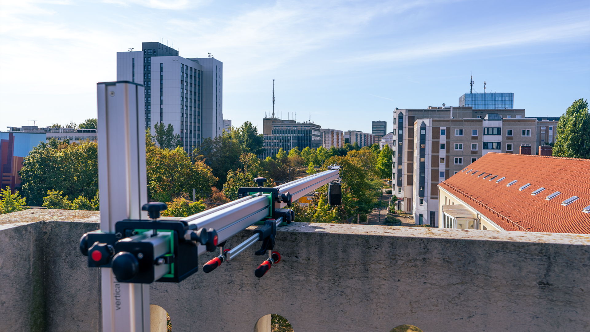
Using the same measurement principle, but with modified accessories, the method is carried out with the horizontal tripod. If there is a possibility to measure the roof surfaces from a higher position, this tripod comes into play.
The horizontal tripod allows the laser scanner to be placed from windows, for example. By mounting the scanner upright or upside down on the tripod's horizontal arm and positioning it outside the building, you can perform much of the roof survey, depending on the complexity of the roof and the tripod's capabilities.
A combination of high tripod and horizontal tripod is also an option. The data quality is comparable to the photogrammetry solution. On the other hand, the processing of the point clouds takes less time.