Laser Scanning for Military Applications

TitleTechnology for operational planning, security & military operations
Laser scanning has become a very important technology in the military. It plays a central role in the planning and execution of modern military operations.
It also provides a safe, accurate and fast way to capture sensitive locations, map terrain and provide detailed data for strategic decision-making, which minimizes the risk to soldiers during ground operations. Furthermore, this technology helps to control military and technical assets.
TitleApplications in defense
Laser scanning is used in the military in numerous scenarios, including
- Development of sensitive locations: Precise recording of terrain data in just a few minutes.
- Capturing critical infrastructure: To protect and monitor energy supply and transportation networks
- Crime scene & accident analysis: Detailed documentation for investigation.
- Tunnel mapping: Safe mapping of dangerous underground structures.
- Fire & explosion analysis: Capturing the situation to determine the cause.
- Mission planning: Creation of 3D maps for missions.
- Search & rescue operations: Efficient localization of victims.
- Route reconnaissance: Optimization of marching routes.
TitleTechnologies & Systems
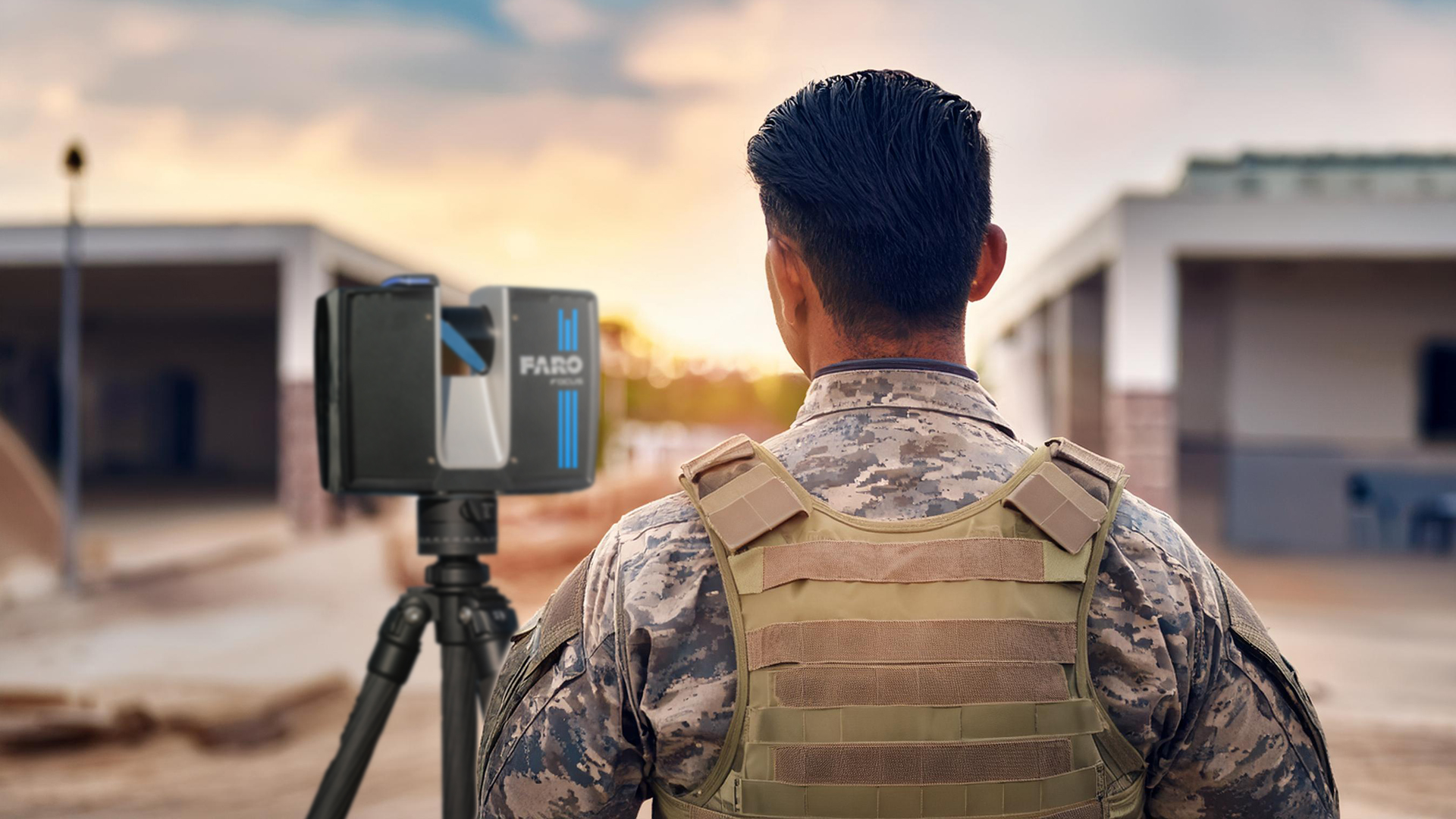
Terrestrial laser scanners
These stationary systems are based on LiDAR technology and capture detailed data. They are suitable for analyzing terrain, regardless of the environmental conditions. As the data is stored on SD cards, this ensures that the scanner is classified regardless of mission or use.
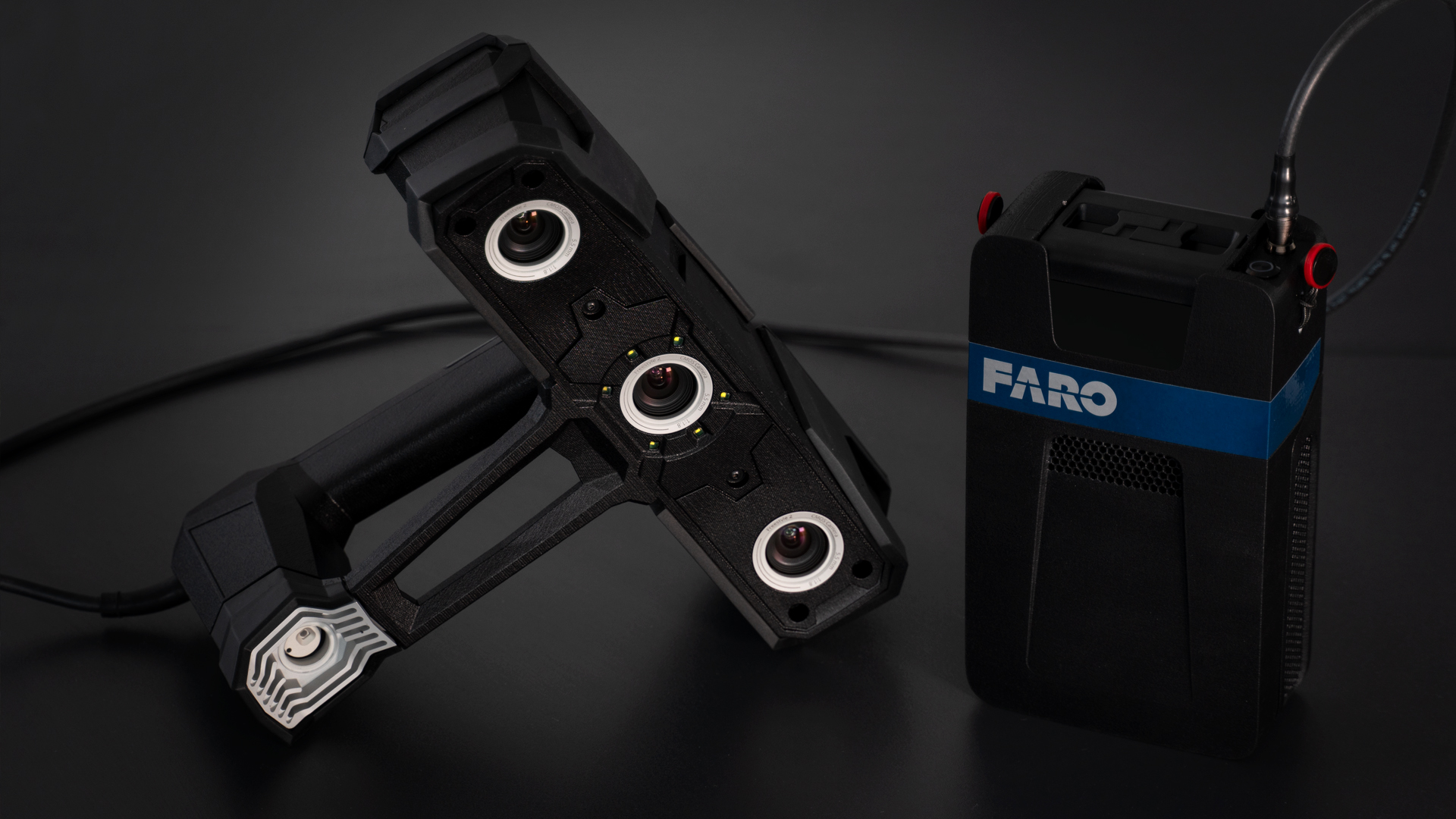
Handheld 3D scanners
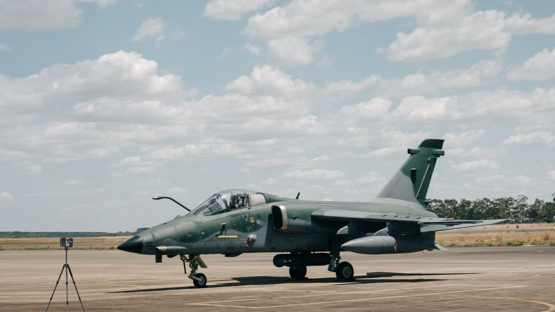
Handheld 3D scanners are used to precisely capture damaged equipment or vehicles, carry out forensic analyses after combat or customize individual protection and camouflage solutions. Their compact design allows them to be used directly in the field.
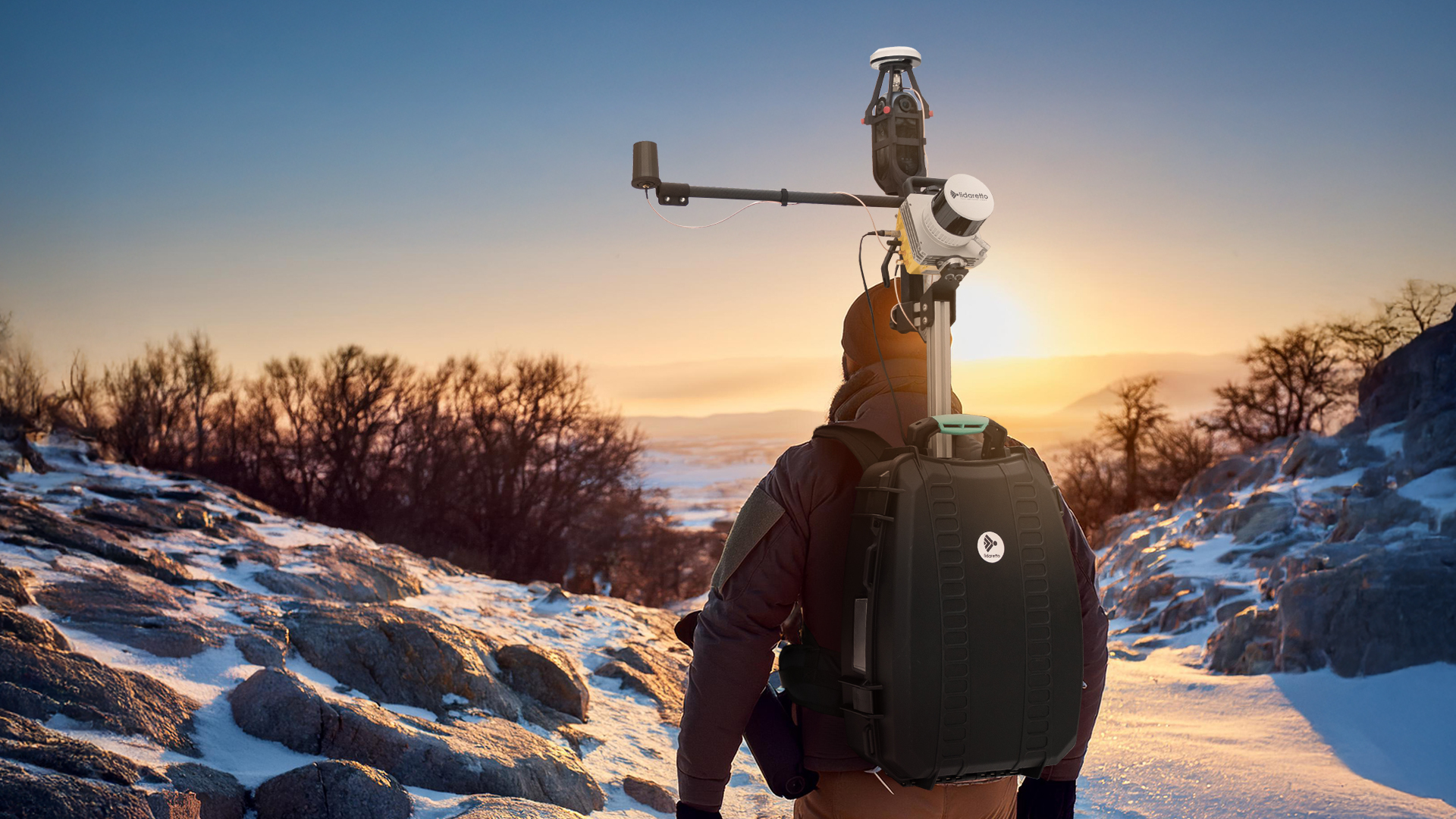
Mobile Mapping systems
Mobile mapping systems are ideal for military requirements as these systems offer maximum mobility and can be used in any terrain. They can be mounted on vehicles and backpacks and can be used both day and night without compromising the soldiers' operational readiness.
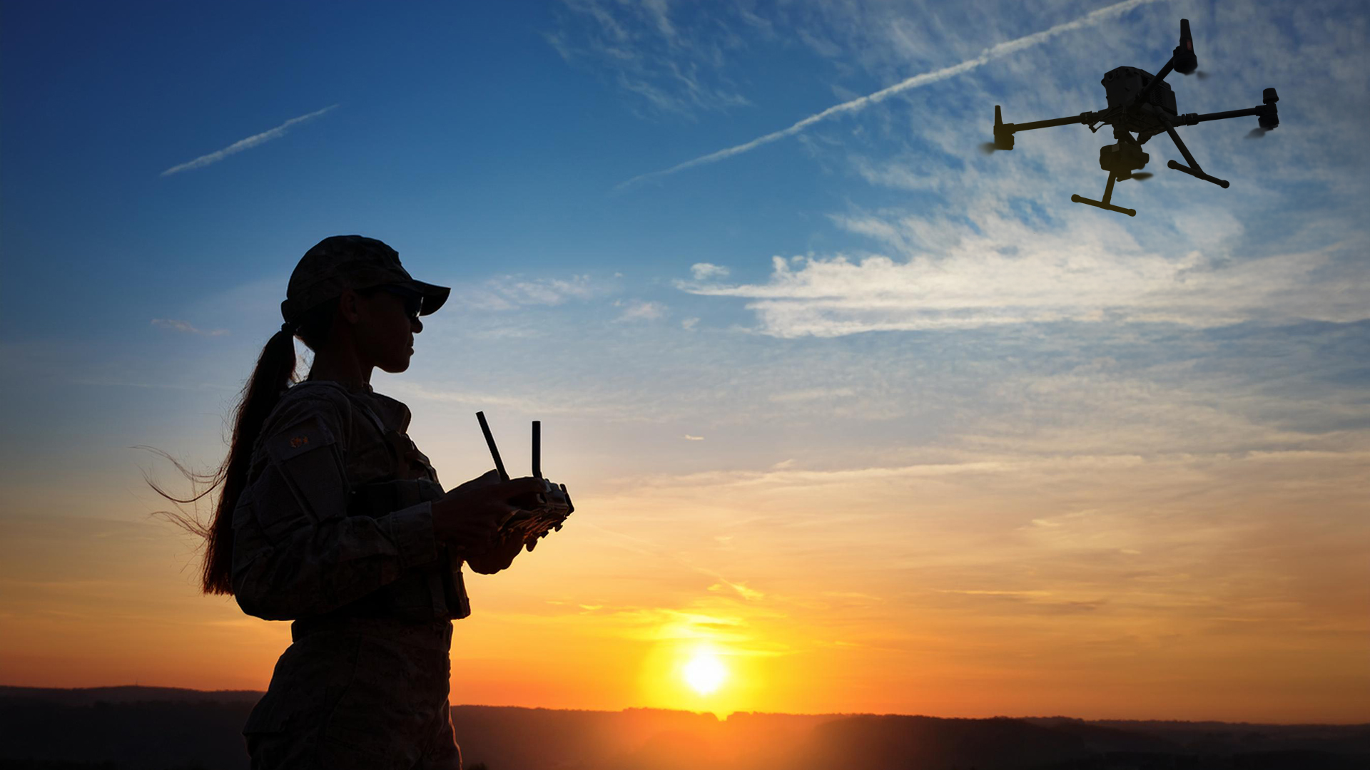
UAV
UAVs extend the scanning range and capture areas that are difficult to access, for example in the mountains, from the air. The combination of aerial and ground data enables comprehensive terrain analysis. Mobile mapping systems and photogrammetry are used with UAVs.

TitleNew perspectives thanks to laser scanning

Laser scanning is revolutionizing mission planning by providing a precise 3D representation of the environment. This technology allows drivers and operational teams to get a detailed picture of the area of operation – from the general overview to specific details such as access to buildings.
The captured data can be easily shared with other experts, improving coordination and increasing situational awareness for operational teams. It also enables the identification of potential threats, minimizing risky situations and increasing the success of missions.
TitleAreas of application

Sensitive locations
Laser scanning offers an effective solution for exploring sensitive locations. Within a few minutes, terrain can be captured in detail using scanners. This data serves analysts as a basis for subsequent, targeted analysis. Laser scanning is particularly valuable for covert operations, as it can also be used at night.
Information obtained in advance makes it possible to concentrate on the essential aspects during analysis. The data also provides a solid basis for making potential mission changes. Analysts benefit from the precise display, as they can view the operational area at their leisure and examine all relevant details. This optimizes planning and increases the chances of mission success.
Urban areas
Laser scanning helps to break away from conventional 2D terrain maps and open up a new dimension of mapping. Areas captured with this technology can be continuously updated, enabling the creation of interactive 3D city maps – an indispensable tool for modern operations.
Using a mobile mapping system, terrain can be mapped within minutes and comprehensive data can be generated to provide a holistic overview of the area. The use of drones equipped with these systems also allows data to be collected quickly and accurately. This data can later be analyzed in detail in order to make informed decisions and achieve operational benefits.


Tunnel mapping
Mapping tunnels is a challenging and often risky task, as information about the safety precautions or construction materials used is often lacking. Laser scanning offers a safe and precise method for analyzing these critical areas.
Tunnel mapping is particularly important with regard to the passability of military vehicles. It must be determined whether and how tunnels can be used as transportation routes. Robots equipped with laser scanners are used to overcome these challenges. These can navigate safely through the tunnel and collect comprehensive data.
The information obtained provides a detailed representation of the tunnel structure and thus contributes significantly to planning and operational safety. At the same time, the risk for soldiers is minimized as the exploration does not have to take place directly on site.
Scanning military technology & equipment
Another major advantage of laser scanning is the ability to capture and document equipment inventories. Systems are subject to constant development and renewal. Modernization requires 3D data in order to carry out precise maintenance and innovations. Laser scanning is also a great advantage in terms of maintenance. Changes, wear and tear on equipment and vehicles can be better recorded. This means that failures can be better prevented and technical defects can be detected early and more accurately, which has an impact on the usability of the equipment and may hinder mission processes.
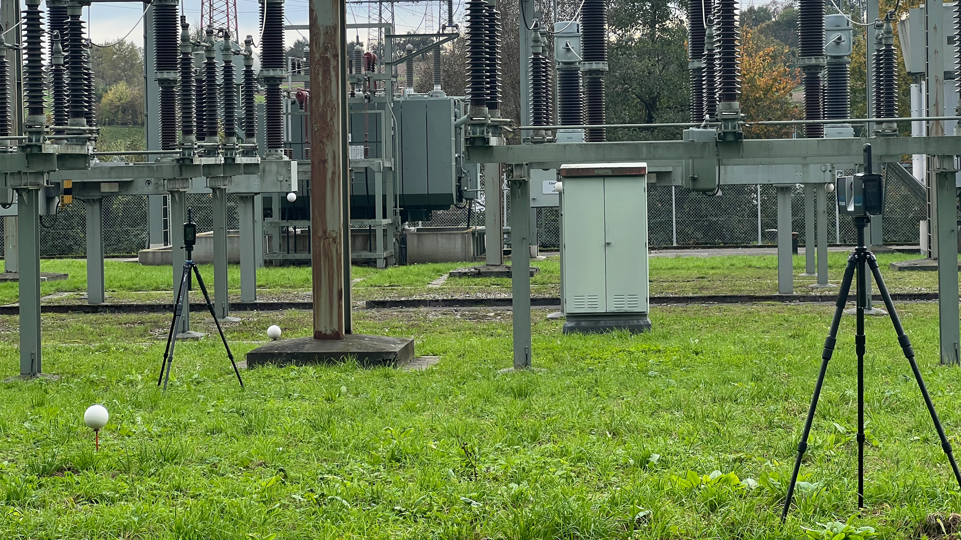
Protecting critical infrastructure
Military organizations use laser scanning specifically to monitor the condition of pipelines and detect leaks or tampering at an early stage. The precise 3D data enables potential weak points to be identified and countermeasures to be taken quickly. The technology also plays a crucial role in protecting substations: high-resolution 3D models help to plan and implement defensive measures such as the optimal placement of cameras, sensors or physical barriers. Laser scanning is also used to secure critical infrastructure along borders. The detailed capture of the environment makes it easier to prevent security breaches and efficiently design protective measures.
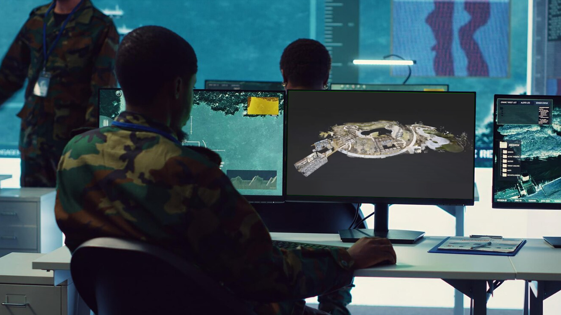
TitleScan data for strategic planning
Pre Planning / Base Design
The use of modern software solutions, such as FARO, is revolutionizing the planning of military operations. The integration of laser scan data with map material, such as Google Maps, or own aerial images, creates a comprehensive and up-to-date overview of the operational areas.
This software enables resources such as equipment and vehicles to be added directly to the maps and highlighted. This allows operational teams to be informed in a targeted manner and instructed more efficiently. The true-to-scale mapping offers decisive advantages, particularly for strategic planning:
- Precise route and length information makes navigation easier.
- Optimized mission objectives: Strategic decisions can be better informed.
- Improved collaboration: Teams receive clear instructions, which strengthens coordination.
These technologies make planning more precise and significantly increase the probability of mission success.
Combined air & terrestrial scans
By combining terrestrial scanners with UAV data, terrain can be displayed in even greater detail and more completely. UAVs have the advantage of capturing hard-to-reach or hidden areas that cannot be reached by ground scanners. This significantly improves the overall collection of data and provides a more comprehensive overview of the target area.
Terrestrial scanners make the UAV data measurable and precise by integrating it into a common, highly accurate database. This collaboration between aerial and ground scans optimizes mission planning and provides insights that would not be possible with individual methods alone.